مدينة
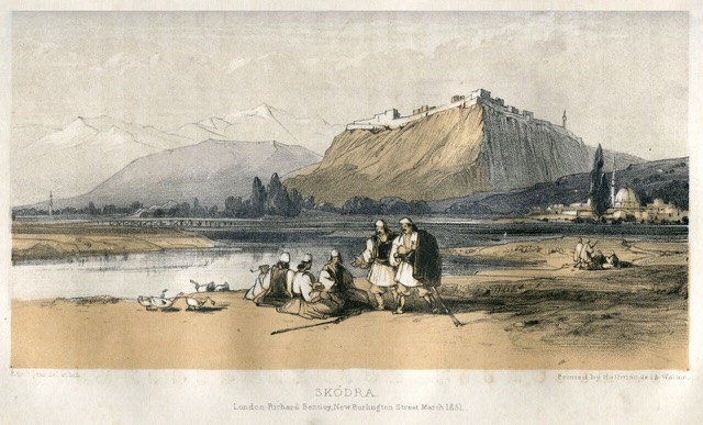
Shkodër
The cultural capital of the north: a lake, a fortress, a bicycle city and a Catholic heartland.
🧭 عرض إرشادي
هل أنت جديد على ألبانيا؟ تفتتح كل صفحة بشرح مبسّط يمكن قراءته لطفل في العاشرة من عمره، قبل أن تبدأ التفاصيل.
⚡ عرض للمتخصصين
أنت تعرف الأساسيات بالفعل. مباشرةً إلى الجوهر، مع إخفاء الشروح المبسّطة. هذا هو الوضع الافتراضي.
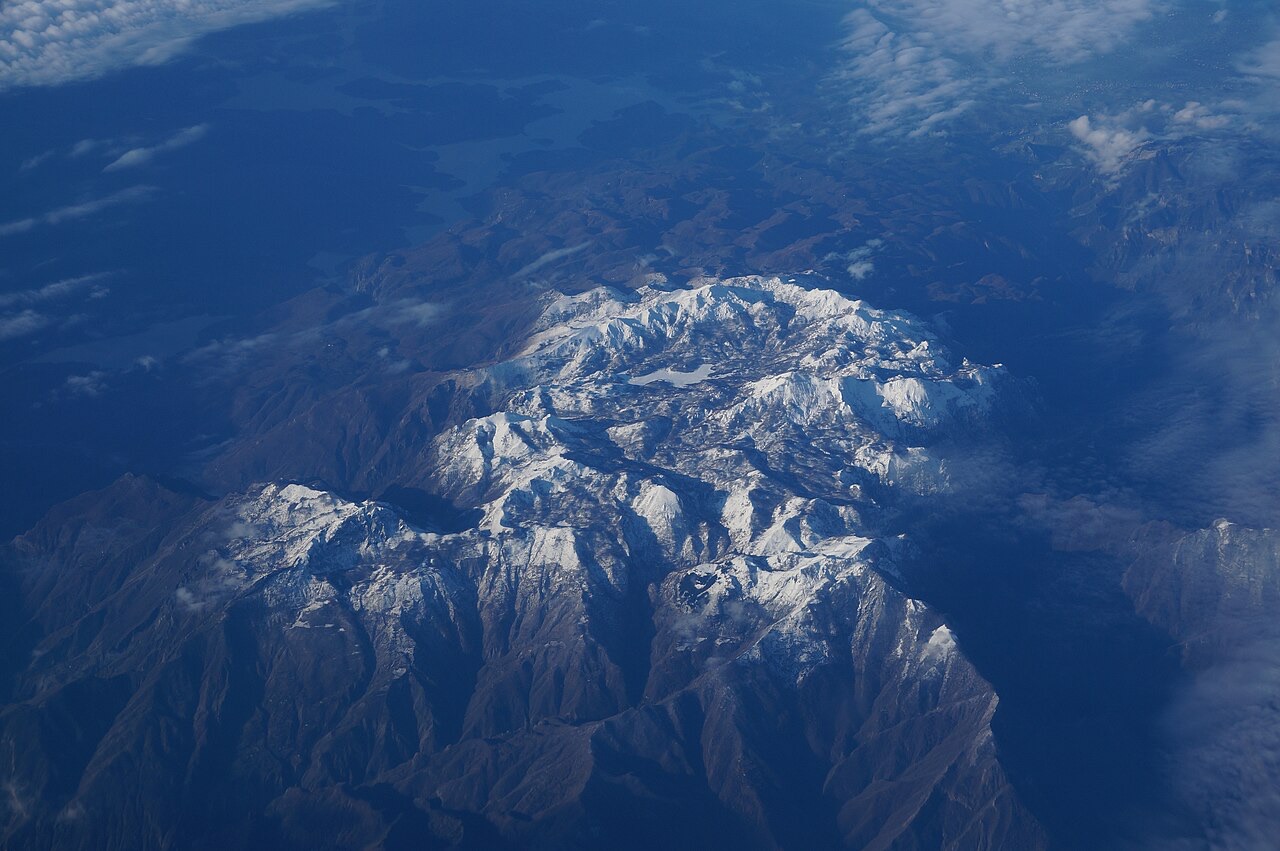
The Albanian Alps are the tall, sharp mountains in the north of the country. In Albanian they are called Bjeshkët e Nemuna, which means 'the cursed mountains', because they are so hard to cross. Villages like Theth and Valbonë sit in valleys between them.
The Albanian Alps are the tall, sharp mountains in the north of the country. In Albanian they are called Bjeshkët e Nemuna, which means 'the cursed mountains', because they are so hard to cross. Villages like Theth and Valbonë sit in valleys between them.
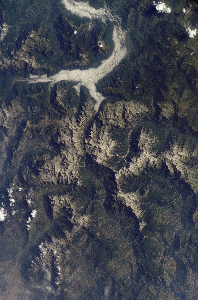
The Albanian Alps are a mountain region located primarily in northern Albania, forming the country's highest and most fragmented physiographic region. They cover an area of 2,240 km² (860 sq mi) within the broader Dinaric Alps system. The range is bounded by the Upper Shkodër plains to the southwest, the Drin river valley to the south, and the Tropojë basin to the east. Beyond Albania's state borders, the range connects with the High Karst of Montenegro to the north and with Bjeshkët e Namuna in Kosovo to the northeast.
At their greatest extent, the Alps reach a maximum length of approximately 64 km (40 mi), running from Maja e Zhihovës in the north to Megulla e Gjerkajve in the south. Their maximum width approaches 60 km (37 mi), stretching from Morinë Pass in the east to the village of Jeran in the Kastrat area to the west. This combination of length, width, and cross-border continuity makes the Albanian Alps the defining highland zone of the country's north.
The Albanian Alps encompass three main tectonic zones: the Gashi Highlands, the Alps of the same name, and the Krastë-Cukal zone. The rocks are predominantly carbonate in nature, including Mesozoic limestone, alongside terrigenous rocks such as Paleozoic shale and volcanic rocks associated with Cretaceous-Paleogene flysch deposits. This varied lithology reflects a long and complex geological history involving both marine sedimentation and tectonic deformation.
The physical structure of the range has been shaped by recent tectonic movements that produced blocks, scales, anticlines, synclines, and monoclines. These structural forms have directly influenced the creation of alpine landscapes characterized by pronounced ridges and cliffs. Overlaid on this tectonic framework, environmental processes including glaciation, river erosion, karst activity, frost action, snow loading, and human activity have further reshaped the terrain. Fluvial, glacial, and karst features are widespread across the region as a result.
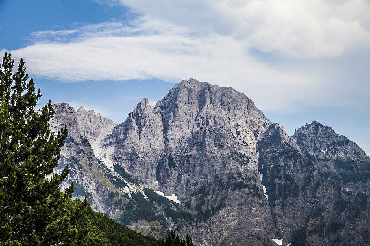
The hypsometric curve of the Alps records an average altitude of 1,140 m (3,740 ft), which is approximately 1.5 times higher than Albania's national average elevation. The most significant uplift is concentrated in the central portion — the Jezercë massif and the Accursed Mountains — which together account for 7% of the total surface area and carry elevations exceeding 2,000 m (6,600 ft). The peripheral zones decline gradually to between 50 and 300 m (160–980 ft), giving the range an overall dome-like profile with pronounced vertical and radial divisions.
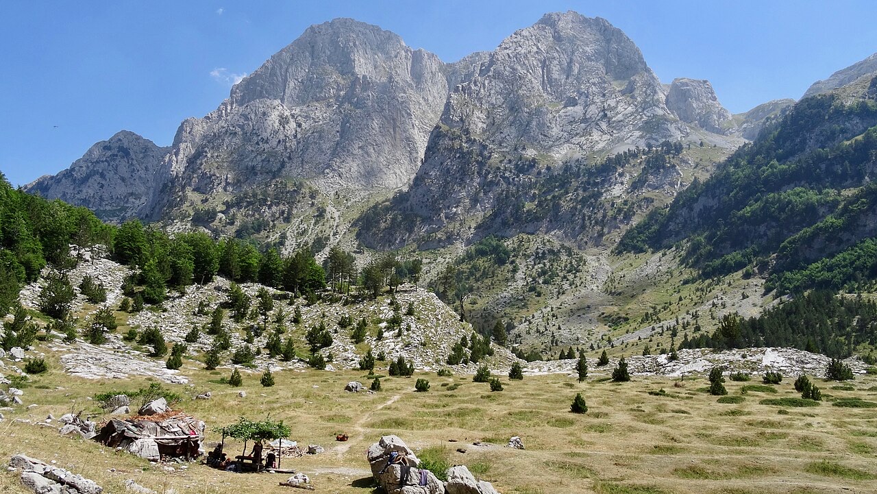
At least 13 peaks within the Albanian Alps exceed 2,500 m (8,200 ft) in elevation. These high summits are distributed across the distinct blocks of Jezercë, Grykat e Hapëta, Kollata, Radohina, Zhaborret, and Mali i Hekurave. The distribution of these peaks across separate blocks reflects the fragmented physiographic character that distinguishes the Albanian Alps from more continuous high-altitude ranges.
The high peaks are separated by numerous intermountain troughs and river valleys. Connectivity between these sub-regions is provided by the passes of Tërthore, Leqet e Hotit, Valbonë, Agri, and Kolç. These passes have historically served as the primary routes of movement through terrain that is otherwise defined by steep cliffs and deep river incisions.
The Albanian Alps experience a typical alpine climate marked by harsh, wet winters with frost and snow, and relatively short, cool summers. Average annual temperatures across the range span from 7.2°C at Vermosh to 10.7°C at Dragobi. January averages fall between 2.8°C (Vermosh) and −0.2°C (Theth), while July averages range from 15.9°C to 20.4°C at those same stations respectively.
Precipitation levels are exceptionally high. The area around Bogë records average annual rainfall of approximately 3,033 mm (119.4 in), which gives the Albanian Alps the distinction of receiving the highest precipitation of any region in Albania. This level of rainfall also places the range among the wettest regions in the Balkans and in Europe more broadly, though the article does not specify the exact ranking.
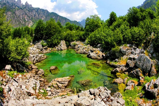
The Albanian Alps contain substantial water resources. The principal rivers — Valbonë, Shala, Cem, and Kir — all follow a nival hydrological pattern, meaning their flow is strongly influenced by snowmelt. Numerous alpine lakes, springs, and other freshwater sources are also present throughout the range.
These water resources are exploited for two main purposes: energy production through the construction of hydropower plants, and agricultural irrigation. The article states that irrigation from these sources covers 75% of the arable land within the region.
Vegetation across the Albanian Alps is described as rich and diverse, predominantly of the Central European, or boreal, type. The distribution of plant communities follows clear altitudinal bands. Deciduous forests dominated by oak and beech occupy elevations between 800 and 1,100 m (2,600–3,600 ft). Between 1,200 and 1,800 m (3,900–5,900 ft), heather and coniferous forests prevail. Above 2,000 m (6,600 ft), the vegetation transitions to alpine pastures.
Endemic plant species present in the range include the alpine star (Aster alpinus) and the mountain pine (Pinus mugo). Soil types correspond to these vegetation zones: brown mountain soils are found on the mountain ranges proper, brown forest soils characterise the heather and coniferous forest belt, and mountain meadow soils cover the alpine pastures.
The Albanian Alps contain deposits of several commercially significant minerals, including bauxite, polymetal ore, quartz, and fluorite. The range also supports extensive forested areas, with named forest zones at Vermosh, Lepushë, Skrobotushë, Budaç, Shosh, and Valbonë.
The article identifies the region as having significant potential for alpine tourism, mountaineering, and game hunting, attributed to its forests and high-altitude terrain. No specific development or visitor data are provided in the source.
The Western Alps (Albanian: Alpet Perëndimore) form the western section of the Albanian Alps. Their boundaries run from the Shalë River valley and the Runica depression in the east, to the Upper Shkodër Plain in the southwest, the Drin Valley in the south, and the border regions of Kosovo and Montenegro in the north and northwest. Geographically, the Western Alps largely correspond to the historic region known as Malësia.
The geology of the Western Alps consists mainly of Jurassic and Cretaceous carbonate rocks, flanked by Paleozoic schist and Cretaceous–Paleogene flysch deposits. Tectonically, the subregion is dominated by northeast–southwest-oriented thrust sheets — including those of Marlulë, Vilë, Gjarpri i Vuklit, and Bishkaz–Biga e Gimajve — alongside block-faulted structures in the Accursed Mountains and the Biga e Gimajve–Troshan area. The Cukal anticline is identified as the principal folding structure of the Western Alps.
The Western Alps are divided into a set of named geographical subregions: the Shalë Valley; the range between the Shalë and Kir valleys; Cukal; the range between the Kir Valley and Përroi i Thatë; the Kir Valley; the Rrjoll Valley; the Accursed Mountains and Veleçik–Bridash Plateau; the Cem Valley; the range between Cemi i Selcës and the Vermosh Valley; the Vermosh Valley; and the Marlulë–Maja e Bojës range.
هذه علاقات حقيقية في الأطلس — أماكن قريبة من هذا الموقع وموضوعات تنتمي إليها فعلاً. لا شيء هنا توصية عامة.
The cultural capital of the north: a lake, a fortress, a bicycle city and a Catholic heartland.
A glacial valley village in the Albanian Alps: a lock-in tower, a waterfall, and one end of the country's best-known…
A town rebuilt above a reservoir in the 1970s, and the northern end of the Nation's Road.
A wide white riverbed under 2,500 m peaks; the eastern end of the Theth trek.
The cultural capital of the north: a lake, a fortress, a bicycle city and a Catholic heartland.
A broad U-shaped glacial valley of white gravel and beech forest under the Alps' highest peaks.
The glacial valley park at the heart of the Albanian Alps, merged into a wider protected complex in 2022.
At 2,764 m the highest point in both Albania and North Macedonia, on the border ridge.
At 2,694 m the highest peak entirely inside the Dinaric Alps, deep in the Albanian Alps.
The seat of Dibër County, known for thermal springs and the high pastures below Mount Korab.
A glacial valley village in the Albanian Alps: a lock-in tower, a waterfall, and one end of the country's best-known…
The Alps, the Koman ferry and the Shkodër lake country — the part of Albania least like the coast.
كُتبت الأقسام المُصنَّفة "تعمق بحثي" أعلاه لهذا الأطلس استناداً إلى مقالة المصدر المذكورة أدناه، التي قُرئت كاملةً (5,518 حرف). وهي بحث بمساعدة الذكاء الاصطناعي على ذلك المستند، مُدقَّق في مواجهة الحقائق المنتقاة في هذه الصفحة. تحقق من أي معلومة ذات أهمية بالرجوع إلى مصدر أصلي.
ثمة خطأ في هذه الصفحة؟ نرحب بالتصويبات وتُراجَع في مواجهة سجل المصدر. أخبرنا بما هو خاطئ، وإن أمكن، بالمكان الذي يأتي منه الرقم الصحيح.
![Title: A chief of Thethi, Tribe of Shale [i.e. Shala], Albania Abstract/medium: 1 photographic print.](/static/img/thumbs/theth-4.jpg)