村庄
![Title: A chief of Thethi, Tribe of Shale [i.e. Shala], Albania Abstract/medium: 1 photographic print.](/static/img/thumbs/theth-4.jpg)
Theth
A glacial valley village in the Albanian Alps: a lock-in tower, a waterfall, and one end of the country's best-known…
🧭 引导视图
初次了解阿尔巴尼亚?每个页面均以通俗易懂的说明开篇——即便是十岁的孩子也能读懂——随后再展开详细内容。
⚡ 专业视图
您已掌握基础知识。直接进入正题,简明解释默认隐藏。此为默认模式。
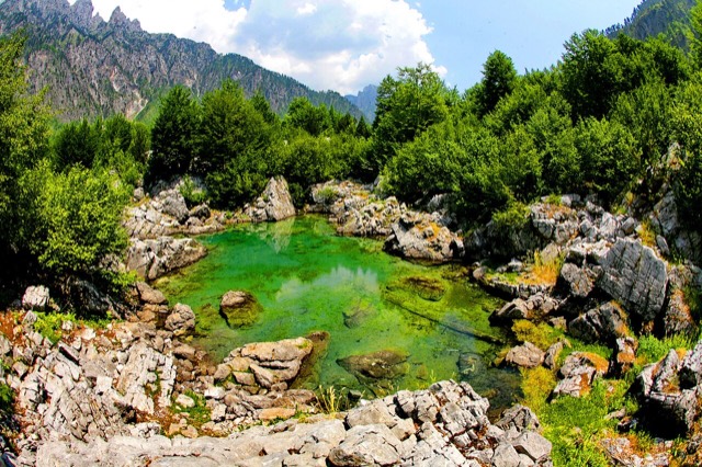
Theth National Park protects a deep valley in the northern mountains, with a waterfall, a blue pool called the Blue Eye of Theth, and old stone houses.
Theth National Park protects a deep valley in the northern mountains, with a waterfall, a blue pool called the Blue Eye of Theth, and old stone houses.
Theth National Park (Albanian: Parku Kombëtar i Thethit) was established in 1966, covering 2,630 ha (26.3 km²) around the larger portion of Shala Valley in northern Albania. It was one of the earliest formally protected areas in the Albanian Alps and remained a distinct administrative unit for more than five decades.
In 2022, Theth National Park was merged with Valbona Valley National Park and Gashi Nature Reserve to form the Alps of Albania National Park (Albanian: Parku Kombëtar Alpet e Shqipërisë), now the largest national park in Albania at 8,844.65 ha (88.4465 km²). The consolidation was undertaken to protect the ecosystems, biodiversity, and cultural and historical heritage of the region as a unified whole. Separately, in 2017, Theth village was declared a Protected Historic Center.
The Alps of Albania National Park borders Montenegro to the north and the Nikaj-Mërtur Regional Nature Park to the south. The region has also been identified as an important Bird and Plant Area.
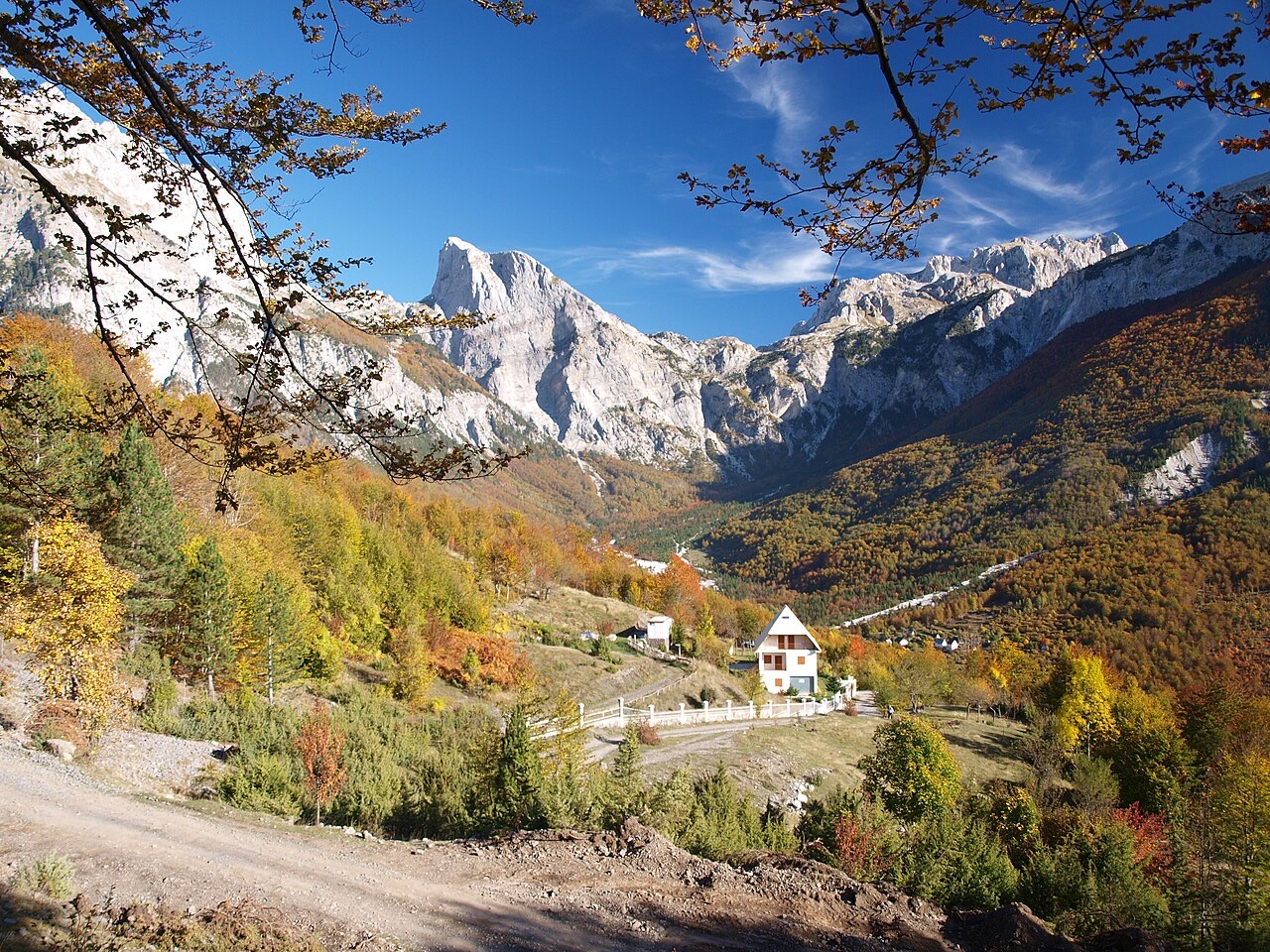
The Theth area occupies the upper Shala Valley and is enclosed on four sides by peaks exceeding 2,000 m: Radohima lies to the west, Arapi and Poplluka to the north, and Jezerca to the east. This topographic enclosure gives the valley its strongly defined character.
The Valbona Pass, standing at 1,795 m (5,889 ft), carries a mountain path on the western side and marks the boundary separating the former Theth National Park from the Valbona Valley National Park to the west. The pass remains the principal high-altitude connection between the two valleys.
Like most of the Albanian Alps, the Theth area is dominated by limestone and dolomite rocks. These lithologies produce pronounced karst features across the landscape. Notable examples include the Grunas Canyon and the southern wall of Arapi, the latter of which is considered the highest rock face in the Balkans.
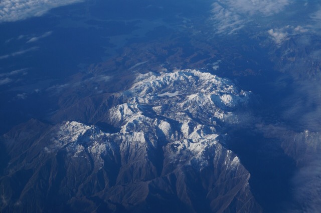
The broader Albanian Alps, which are also called the Accursed Mountains and serve as the namesake of the national park, contain most of Albania's peaks above 2,000 m. This range includes Maja e Jezercës, the highest peak of the Dinarides. The geological formation is generally characterised by high terrain with glaciers, valleys, rivers, waterfalls, dense forests, and several rock formations.
Three distinct forest types are found within the park, each corresponding to an altitudinal belt. The oak floor extends from approximately 600 m to 800 m and is dominated by Austrian oak, oriental hornbeam, hophornbeam, cornel, and flowering ash.
The beech floor occupies the band between 900 m and 1,900 m and is mainly covered by common beech, silver fir, and sycamore. Above this, from 1,900 m to 2,300 m, the alpine floor is characterised by herbaceous plants and shrubs, most notably juniper and willow. Key plant species at this elevation include alpine bluegrass, alpine aster, trefoil, and common bird's-foot trefoil.
Biogeographically, the park falls within the Dinaric Mountains mixed forests terrestrial ecoregion, itself part of the Palearctic temperate broadleaf and mixed forest biome.
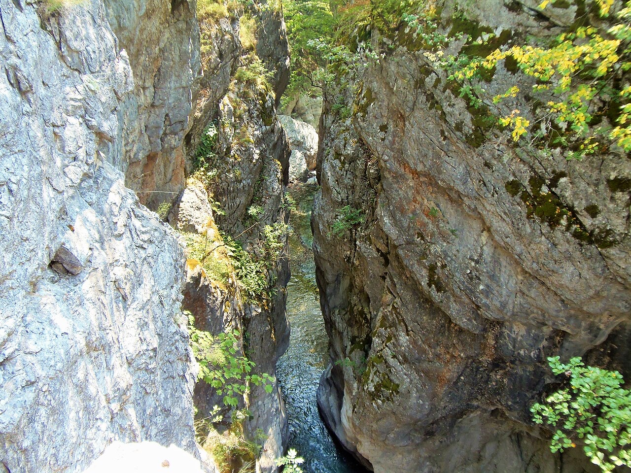
Despite the limited area of the former Theth National Park at 2,630 ha, the flora is described as highly diverse. Estimates of the total number of plant species vary between 1,500 and 1,650, reflecting some uncertainty in botanical surveys of the area. Of these, 70 species are recorded as endangered.
The park is considered part of a large, primarily untouched preserved ecosystem. This relatively undisturbed condition is cited as a factor in sustaining the density and variety of plant life recorded there.
Only 20 species of mammals have been recorded within the park's land area. Large mammals present include brown bear, roe deer, and chamois. Rare or endangered species recorded in the park include the gray wolf, lynx, and wild goat.
The presence of apex predators such as the wolf and lynx alongside prey species like chamois and roe deer reflects the relatively undisturbed state of the ecosystem. The park's remote character is considered a key factor in maintaining habitat for these species.
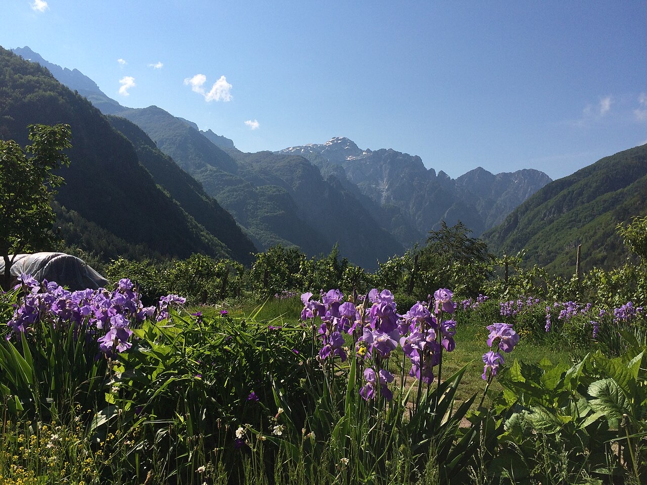
Fifty species of birds have been observed in the park. Raptors represented include the golden eagle and the lesser kestrel. Other recorded species include the nuthatch, robin, blackbird, red-backed shrike, western capercaillie, and rock partridge. The region's designation as an important Bird and Plant Area reflects this avian richness.
The park supports comparatively few reptile and amphibian species, a fact attributed to the harsh winters of the Albanian Alps. A total of 10 reptile species and 8 amphibian species have been recorded. Confirmed species include the alpine salamander, common frog, alpine newt, and brown trout.
The national park designation, first applied to the Theth area in 1966 and subsequently absorbed into the larger Alps of Albania National Park in 2022, was established explicitly to protect ecosystems, biodiversity, and the cultural and historical heritage of the region. The 2017 declaration of Theth as a Protected Historic Center added a separate layer of heritage protection to the village itself.
The park's very remote areas are described as containing a large preserved ecosystem that is primarily untouched. The region's identification as an important Bird and Plant Area underlines its international significance for conservation beyond Albania's national framework. The amalgamation into the Alps of Albania National Park in 2022 made it the country's largest protected area by land area.
三十年气候平均值,地点: Theth National Park, 由本 Atlas 依据 1994—2023 年 ERA5 逐日再分析数据计算得出。以上为长期平均值,并非预报;任何单一年份均可能存在较大偏差。
最热月份为 August (日最高气温均值 26°C), 最冷月份为 January (日最低气温均值 -2°C), 降水最多的月份为 December (272 mm). 年均降雨总量为 1,946 mm.
| 月份 | 最高气温 | 最低气温 | 降雨量 | 降雨天数 | 日照时长 |
|---|---|---|---|---|---|
| January | 5°C | -2°C | 211 mm | 14 | 6.0 h |
| February | 6°C | -1°C | 190 mm | 13 | 7.0 h |
| March | 9°C | 1°C | 184 mm | 13 | 8.6 h |
| April | 14°C | 5°C | 156 mm | 16 | 9.7 h |
| May | 19°C | 10°C | 138 mm | 18 | 11.3 h |
| June | 23°C | 14°C | 92 mm | 16 | 13.0 h |
| July | 26°C | 16°C | 80 mm | 12 | 13.4 h |
| August | 26°C | 17°C | 66 mm | 12 | 12.5 h |
| September | 21°C | 13°C | 141 mm | 12 | 10.0 h |
| October | 17°C | 8°C | 156 mm | 11 | 8.4 h |
| November | 12°C | 4°C | 260 mm | 13 | 6.2 h |
| December | 6°C | -0°C | 272 mm | 14 | 5.6 h |
数据来源: ERA5 reanalysis via Open-Meteo, 1994–2023 · "最高气温"与"最低气温"分别为日最高和日最低气温均值。"降雨天数"统计降水量不低于 1 毫米的天数。 获取 JSON 数据
以下均为本 Atlas 中真实存在的关联关系——与本地点邻近的地点,以及本条目实际所属的主题类别。本栏目不包含任何通用推荐内容。
A glacial valley village in the Albanian Alps: a lock-in tower, a waterfall, and one end of the country's best-known…
A wide white riverbed under 2,500 m peaks; the eastern end of the Theth trek.
A 25–30 m fall in the Theth valley, and a declared natural monument.
The limestone wall of the far north — locally the Accursed Mountains — shared with Montenegro and Kosovo.
Albania's best-known walk: roughly 17 km over a 1,795 m pass, six to eight hours, June to October.
上文标注"深度解析"的章节,系本 Atlas 依据以下来源文章全文阅读后撰写而成 (3,970 字符). 以上内容为基于该文献的 AI 辅助研究成果,并已与本页精选事实核对。如涉及重要事项,请务必核对原始来源。
本页内容有误? 欢迎提交更正意见,所有意见均会与原始记录核对。请告知错误所在,如能提供正确数据的出处,请一并注明。