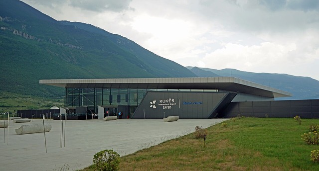
Аэропорт · Kukës
Kukës International Airport
A small northern airport that opened to commercial flights in 2021, mainly serving the diaspora.
Каждый округ, каждый берег, каждый век
Режим с пояснениями
Впервые об Албании? Каждая страница начинается с доступного объяснения, понятного даже десятилетнему ребёнку, и лишь затем переходит к подробностям.
Режим эксперта
Основы вам уже известны. Сразу к существу вопроса, без простых пояснений. Это режим по умолчанию.
Городок · Kukës County
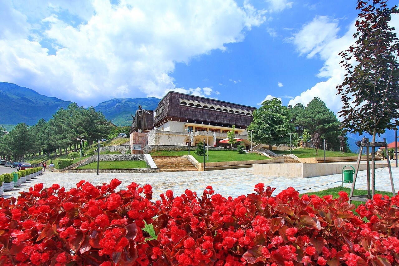
The road head for the Valbona valley, named after a guerrilla leader of the 1920s.
Сохранить
Bajram Curri is a small town in the far north-east mountains. Most people pass through it on the way to hike in the Valbona valley.
Bajram Curri is a small town in the far north-east mountains. Most people pass through it on the way to hike in the Valbona valley.
Bajram Curri was born on 16 January 1862, though more recent sources based on a subsequently discovered passport give 1866 as his birth year. He was born in the village of Krushë e Madhe while his family was being transported under Ottoman guard from Gjakova to Prizren. His family originated in Krasniqi, a district that today falls within Tropojë in northeastern Albania, in the region historically known as the Highlands of Gjakova.
His father, Shaqir Aga Curri, had led a rebellion in Krasniq against the Ottomans, motivated by heavy taxation and forced military recruitment. As a result, the family was being interned at the time of Bajram's birth. Shaqir Aga had previously served as a trusted associate of Abdullah Pasha Dreni of Gjakova, assisting in tax collection and punitive expeditions. He aided Pasha Dreni during the attack against Mehmed Ali Pasha and was killed in that skirmish by forces of the League of Prizren.
Between 1885 and 1886, Curri entered a feud with Riza Bey Gjakova that lasted approximately a decade. It was resolved only when Sultan Abdulhamid II dispatched an envoy who conferred a military rank and command on each man; Curri was made a captain of the gendarmerie in Pristina. This outcome reflected the sultan's broader method of governance: using patronage networks to award privileges and official positions to local leaders as a means of co-opting them into the Ottoman administrative structure.
Despite this incorporation, Curri remained active in Albanian resistance networks. In 1893, he participated in a revolt in Kosovo led by Haxhi Zeka, which was quickly suppressed by the Ottoman army. In 1899, he became a founding member of Zeka's League of Peja. By 1906, he had become one of the founders of the Gjakovë branch of the Secret Committee for the Liberation of Albania, known as the Bashkimi Society, and was regarded as an influential member of that organisation.
During the Young Turk Revolution, Galib Bey succeeded in bringing Curri together with Albanian leaders Nexhip Draga and Ferhat Draga to a meeting at Firzovik (present-day Ferizaj). There, they used their influence over the assembled crowd, raising fears of foreign intervention, to build support for the restoration of constitutional government. During the subsequent 31 March Incident in Istanbul, Curri, alongside Çerçiz Topulli, mobilised 8,000 Albanians as part of the approximately 15,000 volunteers who assisted the larger Ottoman army in suppressing the revolt.
The repressive conduct and broken promises of the Young Turk government led Curri back to militant opposition. On 20 May 1912, at a meeting in Junik attended by Curri and other Albanian leaders, a besa — a formal pledge — was given to wage war against the Young Turk government. He played an active role in the Albanian Revolt of 1912, fighting alongside Hasan Prishtina, Isa Boletini, Themistokli Gërmenji, and others. During the uprising, Curri and other leaders ordered their forces to advance on Üsküb (modern Skopje), which was captured between 12 and 15 August. On 18 August, Prishtina's moderate faction persuaded Curri and conservative leaders including Idriz Seferi, Riza Bey Gjakova, and Isa Boletini to accept an agreement with the Ottomans covering Albanian sociopolitical and cultural rights.
Curri was also one of the leaders in the Battle of Lumë against the Serbian military. According to the article, this engagement delayed Serbian expansion into Albania and contributed to securing Albanian independence.
During World War I, Curri organised a guerrilla unit as part of the Kachak movement, operating through the Committee for the National Defence of Kosovo, of which he was a member. On 20 October 1914, a force of 1,000 Albanians led by Curri and Isa Boletini, together with Bulgarian komitadjis and Austro-Hungarian officers, attacked a Montenegrin base near Gjakova, seizing two hill artillery pieces in the process. The Montenegrin army subsequently surrounded and defeated this force, pushing the survivors back into Albanian territory.
In 1915, Curri became a founding member of the Committee for the National Defence of Kosovo, a formal organisation that later established relations with the Comintern, which supported the principle of national self-determination. In December 1921, Curri told the Soviet minister in Vienna that the Albanian people awaited the determination of their borders not on the basis of what he called brutal historical considerations, but on the actual situation as it then existed, and expressed confidence that Soviet Russia would address Balkan boundaries justly.
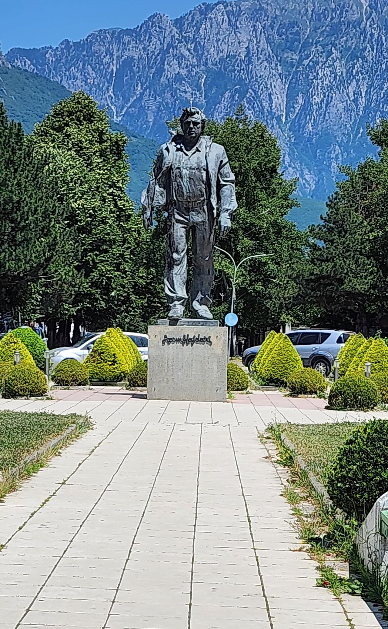
Following the Congress of Lushnja in 1920, Curri entered Albanian government as a minister without portfolio in the cabinet. He aligned politically with the left-wing forces of Fan Noli against Ahmet Zogu. In December 1921, he became Minister of War in the unstable government of Hasan Prishtina, replacing Zogu in that post.
Within days of that appointment, Zogu assembled his fellow Mati tribesmen and overthrew the government, compelling Prishtina, Curri, and others to flee northwards. In March 1922, Curri and Prishtina launched a revolt against Zogu, which failed. It was crushed on 8 March 1922 by Captain Prenk Pervizi, a result facilitated by the efforts of the British ambassador to Albania, Harry Eyres, who persuaded one of the rebel commanders to surrender.
Having spent approximately two years in the mountains to evade Zogist forces following the failed 1922 revolt, Curri issued the call to arms that initiated the Bourgeois-Democratic Revolution of June 1924 against Zogu. The revolution ultimately failed, but Curri continued his opposition to Zogu's regime rather than capitulating.
On 29 March 1925, Zogist troops surrounded him while he was hiding in a cave near Dragobia. According to the article, he was killed by his own companions so that their lives might be spared by the Zogist forces.
Like other educated Albanians of nationalist sentiment in his era, Curri supported the unity of Albanians across religious lines under the banner of Skanderbeg. He favoured governmental reforms that would benefit Albanians. Following the 1913 Treaty of London, which did not incorporate Kosovo into Albania, he devoted particular effort to the cause of Kosovo's union with the Albanian state.
His December 1921 statement to the Soviet minister in Vienna illustrates the internationalist dimension of his later politics. He framed Albanian territorial claims explicitly in terms of existing demographic realities rather than historical precedent, and expressed the hope that Soviet Russia would intervene to achieve just boundaries in the Balkans. He was a member of the Committee for the National Defence of Kosovo, an organisation that sought support from the Comintern on the basis of the right to national self-determination.
Bajram Curri was posthumously awarded the title Hero of Albania. The town formerly known as Kolgecaj was renamed Bajram Curri in his honour in 1952, twenty-seven years after his death.
The renaming reflected his standing as a significant figure in Albanian nationalist history, spanning resistance to Ottoman authority, opposition to Serbian military expansion, participation in the establishment of the Albanian state, and sustained armed opposition to the Zogu government until his death in 1925.
Аэропорт · Kukës
A small northern airport that opened to commercial flights in 2021, mainly serving the diaspora.
Охраняемая территория · Kukës
A broad U-shaped glacial valley of white gravel and beech forest under the Alps' highest peaks.
Энергетический объект · Kukës
The uppermost and largest of the Drin dams, creating a reservoir shared with Kosovo.
Деревня · Kukës
A wide white riverbed under 2,500 m peaks; the eastern end of the Theth trek.
Городок · Kukës
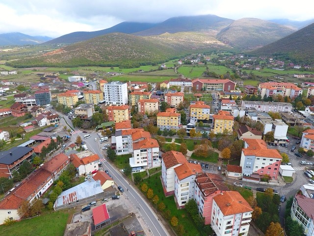
A town rebuilt above a reservoir in the 1970s, and the northern end of the Nation's Road.
Паромный маршрут · Shkodër
A working transport link through a gorge that has become one of Albania's best-known journeys.
Руководство
Albania's best-known walk: roughly 17 km over a 1,795 m pass, six to eight hours, June to October.
Нашли ошибку на этой странице? Исправления приветствуются и проверяются по исходной записи. Сообщите нам, что именно неверно, и по возможности укажите, откуда взята правильная цифра.