Airport · Kukës
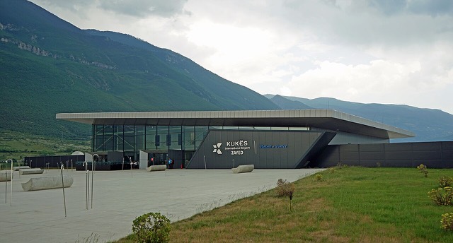
Kukës International Airport
A small northern airport that opened to commercial flights in 2021, mainly serving the diaspora.
Every county, coast and century
Guided view
New to Albania? Every page opens with a plain-language explanation you could read to a ten-year-old, before the detail begins.
Expert view
You already know the basics. Straight to the substance, with the simple explanations hidden. This is the default.
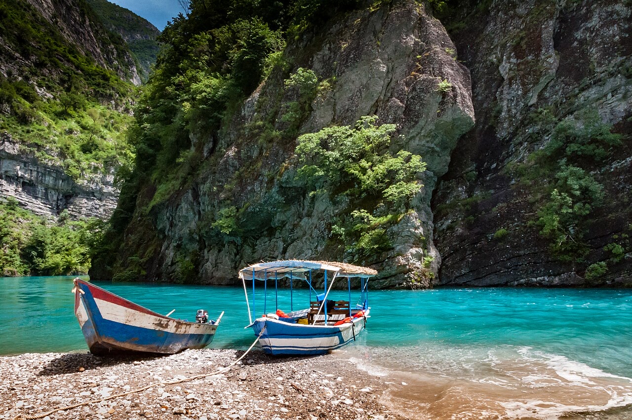
County
The north-eastern highlands on the Kosovo border, the gateway to the Valbona valley.
Save
Kukës County is in the far north-east, next to Kosovo. It is very mountainous. The Valbona valley, where many people go hiking, is here, and so is the big reservoir at Fierza.
Kukës County is in the far north-east, next to Kosovo. It is very mountainous. The Valbona valley, where many people go hiking, is here, and so is the big reservoir at Fierza.
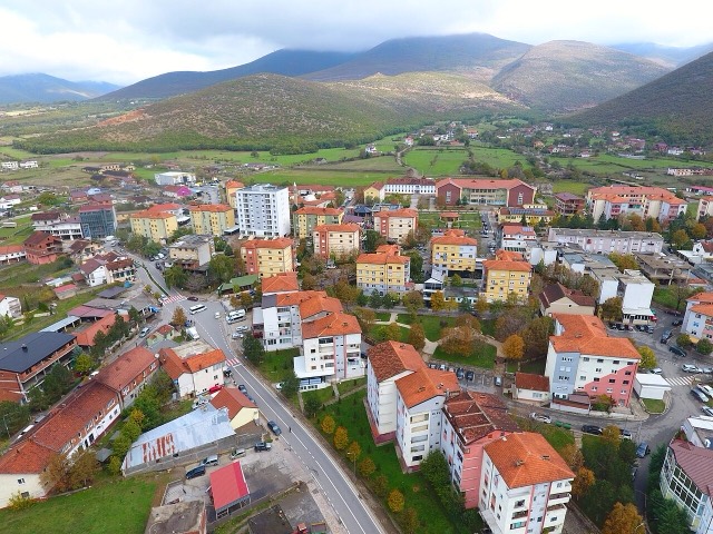
Kukës is a city in northeastern Albania, situated on the Luma Plain along the southern shores of Lake Fierza. It lies between the hills of the northernmost Korab Mountains to the east and the westernmost Sharr Mountains, within the broader Albanian Alps. The city covers 8.2 km² (3.2 sq mi). The confluence of the Black Drin and White Drin rivers occurs close to the city's territory, making it the point at which the Drin River originates.
The current city sits on a plateau approximately 320 metres above sea level and lies roughly 3 kilometres southeast of the original town's location. From above, the new settlement resembles a peninsula, surrounded on multiple sides by the artificial Fierza lake and connected to the rest of the country by three bridges. To the east, the snow-covered peak of Gjallica rises to 2,468 metres (8,097 ft).
The Kukës region has a recorded human presence stretching back over a thousand years, with roots in ancient Illyrian settlement. The area was inhabited by several Illyrian tribes, most predominantly the Dardani, and during antiquity formed part of the Kingdom of Dardania. Illyrian tombs have been identified at the sites of Këneta and Kolsh, both in the vicinity of the modern city.
In the Roman period, the settlement served as a stopping point on a branch road leading to the Via Egnatia, the major Roman highway that connected Dyrrachium on the Adriatic Sea in the west with Constantinople on the Sea of Marmara in the east. This transit function gave the locality an economic and logistical importance disproportionate to its size.
During the Ottoman period, Kukës functioned as a minor market centre and trading post on the road leading to southern Kosovo. Its position on a significant overland route maintained the town's role as a commercial waypoint.
In 1912, at the mountain pass of Qafa e Kolosjanit near Kukës, Albanian resistance forces confronted the retreating Serbian army. This episode is recorded in the context of the broader military and political upheaval of the Balkan Wars period.
The original town of Kukës occupied the confluence of the White Drin and Black Drin rivers. In 1976, the site was submerged beneath the Fierza Reservoir, created by the construction of a dam as part of a hydroelectric scheme. The entire town was consequently relocated.
The replacement settlement, known as Kukësi i Ri (New Kukës), was constructed in the 1970s on a nearby plateau 320 metres above sea level. The new town's position between the artificial lake and surrounding terrain gives it the appearance from the air of a peninsula. Three bridges link it to the broader road network.
Kukës gained international prominence during the Kosovo War when approximately 500,000 Kosovo Albanian refugees crossed the frontier from Kosovo and were housed in camps in and around the city. The city's proximity to the Kosovo border made it the primary point of entry and shelter for the displaced population.
The scale of the response — Kosovo Albanian refugees finding accommodation in both organised camps and private Albanian households — brought sustained international media and humanitarian attention to the city. The episode remains the defining event in Kukës's modern international profile.
In recognition of the hospitality extended to refugees during the Kosovo War, Kukës was nominated for the Nobel Peace Prize for the year 2000. According to the article, this was the first occasion on which a town had been nominated for the prize.
In 2017, the city submitted an application for the 2018 European Green Capital Award. The article does not record the outcome of that application.
Kukës has a humid subtropical climate classified under the Köppen system as Cfa, described as similar to that of northern Italy. Its inland location, combined with distance from the Mediterranean, produces strongly continental conditions in practice: cold and snowy winters and predominantly hot summers.
Spring months of April and May are mild; June through August are hot; September and October are frequently rainy and windy; December through March are very cold, often with snow and frost. The article records that the mean monthly temperature ranges between −25 °C (−13 °F) in winter and 25 °C (77 °F) in summer. Mean annual precipitation varies widely, between 900 mm (35 in) and 3,000 mm (120 in), depending on longitude and latitude.
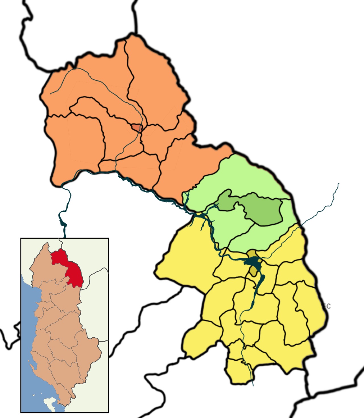
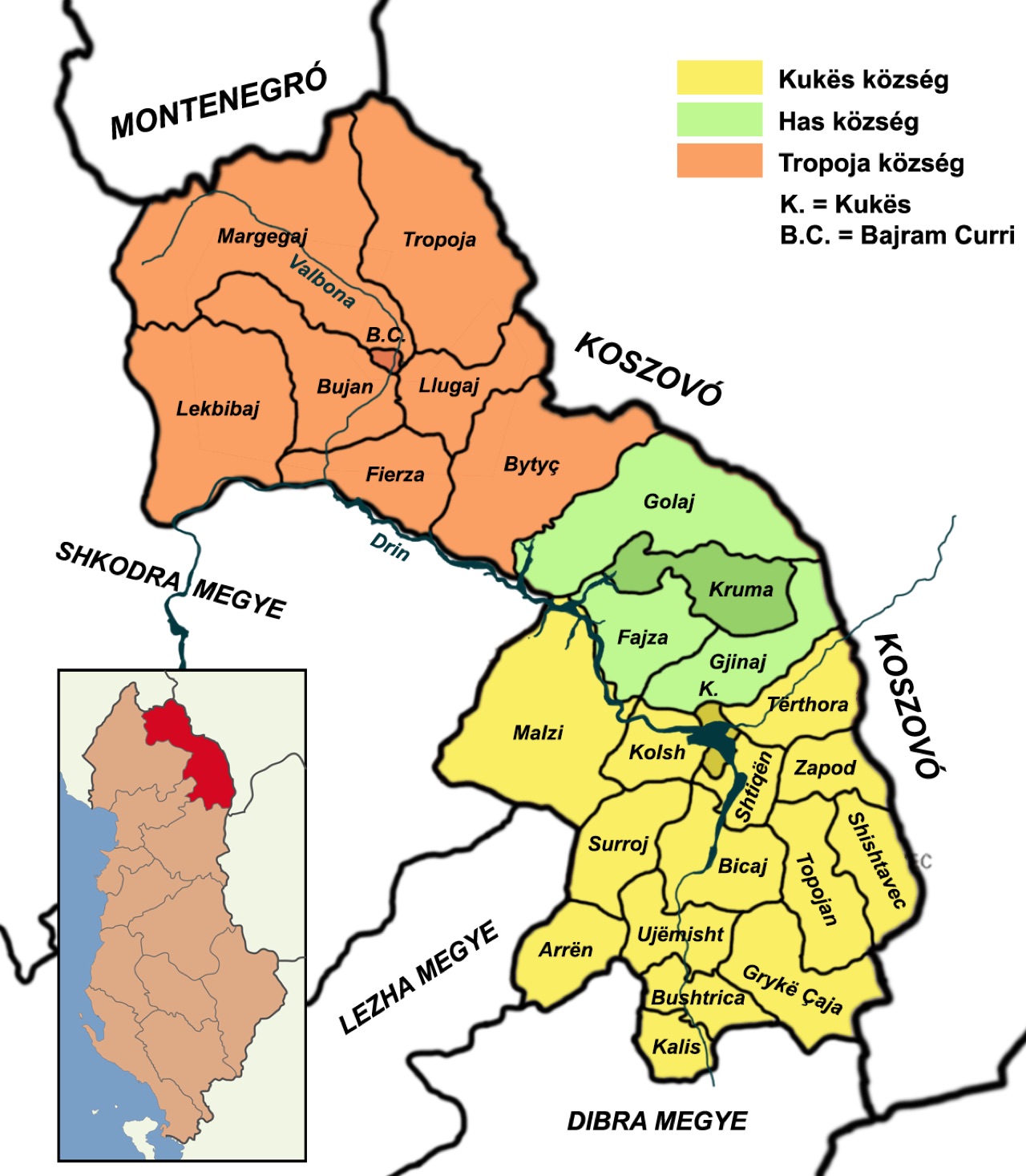
The Kukës municipality was formed in 1923 through the merger of fifteen former municipalities: Arrën, Bicaj, Bushtricë, Grykë-Çajë, Kalis, Kolsh, Kukës, Malzi, Shishtavec, Shtiqën, Surroj, Tërthore, Topojan, Ujëmisht, and Zapod. Each of these became a municipal unit within the new entity.
The municipality covers an area of 934.80 km² (360.93 sq mi) and recorded a total population of 36,125 as of 2023. The city of Kukës itself, which serves as the capital of both the municipality and Kukës County, had a population of 15,643 as of the same census. Kukës County is one of Albania's 12 constituent counties.
After the end of communist rule in Albania, the newly available freedom of movement led a significant portion of Kukës's population to relocate internally or emigrate abroad in search of better economic conditions. This demographic shift has shaped the city's subsequent economic profile.
Agriculture is noted as a developed sector in the region. Industrial facilities recorded in the article include a carpet factory producing goods for both domestic use and trade, and a copper processing factory that works with local raw materials. The A1 highway passes through Kukës, providing a principal road connection. The city also serves as a base for fishing in the surrounding lakes and walking in the surrounding mountains. The article notes the presence of a mosque and a closed alpine-style hotel, the latter described as part of an attempt to develop a tourism sector. The OSCE maintained a villa in the city.
Airport · Kukës
A small northern airport that opened to commercial flights in 2021, mainly serving the diaspora.
Protected area · Kukës
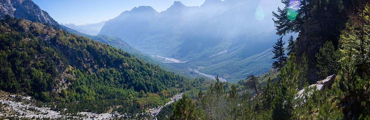
A broad U-shaped glacial valley of white gravel and beech forest under the Alps' highest peaks.
Energy site · Kukës
The uppermost and largest of the Drin dams, creating a reservoir shared with Kosovo.
Road · Kukës
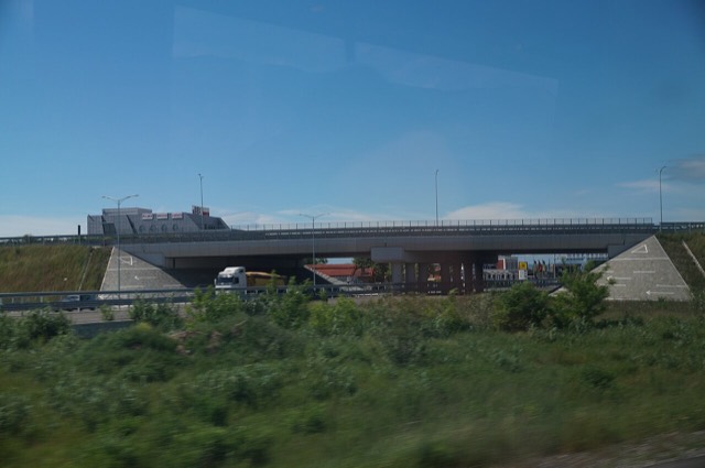
The Durrës–Kukës–Morina motorway, including the 5.6 km Kalimash tunnel, linking Albania to Kosovo.
Town · Kukës
The road head for the Valbona valley, named after a guerrilla leader of the 1920s.
Village · Kukës
A wide white riverbed under 2,500 m peaks; the eastern end of the Theth trek.
Town · Kukës
A town rebuilt above a reservoir in the 1970s, and the northern end of the Nation's Road.
Something wrong on this page? Corrections are welcome and are checked against the source record. Tell us what is wrong and, if you can, where the right figure comes from.