
Plaats · Kukës
Bajram Curri
The road head for the Valbona valley, named after a guerrilla leader of the 1920s.
Elke provincie, elke kust, elke eeuw
Begeleidende weergave
Nieuw in Albanië? Elke pagina begint met een uitleg in eenvoudige taal die u aan een tienjarige zou kunnen voorlezen, voordat de details beginnen.
Expertweergave
U kent de basis al. Meteen naar de kern, met de eenvoudige uitleg verborgen. Dit is de standaardinstelling.
Beschermd gebied · Kukës County
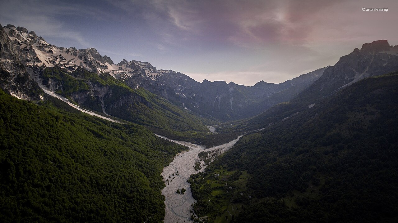
A broad U-shaped glacial valley of white gravel and beech forest under the Alps' highest peaks.
Opslaan
Valbona Valley National Park protects a wide mountain valley in the north-east. The river bed is very broad and white with stones, and in summer much of the water runs underground.
Valbona Valley National Park protects a wide mountain valley in the north-east. The river bed is very broad and white with stones, and in summer much of the water runs underground.
The Albanian Alps form the southernmost continuation of the Dinaric Alps and constitute the highest section of that range. The mountains sit within the Alpine-Himalayan orogenic belt, which extends from the Atlantic Ocean to the Himalaya Mountains, and their formation resulted from the episodic collision of the African and Eurasian tectonic plates. The range is strongly karstified: rain and snow seep rapidly into an underlying karst system, and the Albanian Alps are described as the most glaciated mountains in Europe located south of the Scandinavian ice sheet, with nowhere else in the Balkans showing as much glacial erosion evidence.
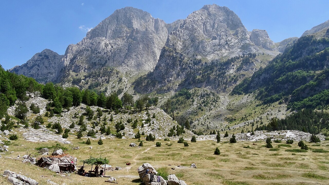
The Valbona Valley occupies a U-shaped corridor in the eastern Albanian Alps, situated entirely within Kukës County, lying mostly between latitudes 42° and 27° N and longitudes 19° and 53° E. The valley extends between four peaks: Maja Jezercë to the west, Maja e Kollatës, Maja Boshit, and Maja e Hekurave. Maja Jezercë, at 2,694 m (8,839 ft), is the highest mountain in the entire Dinaric Alps. Geological formations within the park are composed of limestone, limestone-siliceous rock, clay shale, and conglomerate, with carbonatite rocks dominant throughout the region and schist exposures appearing only near the villages of Valbona and Dragobia.
Over the past few million years, glaciers periodically covered most of the area now constituting the park. During the Würm glacial period, the glacier occupying the Valbona Valley reached a total length of 9.5 kilometres. The legacy of this glaciation is visible throughout the landscape: steep slopes, high ridges, cirques, and deep river valleys characterise the relief, and the park contains glacial lakes and springs fed by glacial melt.
Two very small active glaciers persist today near the northeastern edge of Maja Jezercë. These represent a sharply reduced remnant of the extensive Pleistocene ice cover and remain among the few active glaciers found in the mountains of the western Balkans.
The Valbona Valley and its surrounding mountains were designated Valbona Valley National Park in 1996, under Decision of the Council of Ministers number 102, dated 15 January 1996. The stated purpose was to preserve natural ecosystems and landscapes together with their vegetation, biodiversity communities, and habitats. The park covered an area of 80 km² (31 sq mi).
In 2022, Valbona Valley National Park was amalgamated with Theth National Park to form the larger Alps of Albania National Park. Prior to that merger, the park bordered Prokletije National Park to the north, Gashi Nature Reserve to the east, Nikaj-Mërtur Regional Nature Park to the south, and Theth National Park to the west. The park is described as a transboundary park shared between Albania and Montenegro.
The park holds several international conservation designations. The Gashi River, located within the park, is included in the UNESCO Primeval Beech Forests of the Carpathians and Other Regions of Europe. The park is also part of the European Green Belt, the Emerald Network under the Bern Convention, and has applied to join the EUROPARC Federation. Plantlife has recognised both the park and the broader Albanian Alps as an Important Plant Area of international importance.
The park's climate is characterised by cold winters and hot, dry summers, modified at higher elevations where conditions remain cooler even in the warmest months. Its proximity to the Mediterranean Sea means the climate is influenced by both Mediterranean and Continental climate patterns. The coldest period runs from December to February and the hottest from July to August.
Recorded minimum temperatures range between −23.4 °C (−10.1 °F) and −16.1 °C (3.0 °F) in winter, while maximum temperatures range between 36.4 °C (97.5 °F) and 39.9 °C (103.8 °F) in summer. Annual precipitation averages between 2,700 mm (110 in) and 3,000 mm (120 in), with the highest amounts at altitude. By season, at least 38% falls in winter, 32.3% in autumn, 22% in spring, and 8.7% in summer. At higher elevations, snow begins accumulating in October or November and persists until March or April, reaching depths of 1.5–5 m and lasting between 60 and 160 days.
The Valbona River is the longest river within the Albanian Alps, at 50.6 km (31.4 mi). It originates from several karst springs on the southern slopes of Maja Jezercë and along the eastern section of Valbona Pass, and drains the entire eastern portion of the Albanian Alps range. Shortly after its source, the river collides with rocks to produce a waterfall 50 metres high, before disappearing into the ground near Rrogami for approximately 5 km and re-emerging at the village of Valbona. The river flows through a narrow U-shaped valley before reaching Fierza, where it eventually becomes a tributary of the Drini River, which drains to the Adriatic Sea. Frequent rainfall renders the river unnavigable.
At Shoshan's canyon, the river narrows sharply. The Shoshani Source, located at the entry of the Valbona Valley, is described as one of the largest water sources on the Balkan Peninsula. It supplies potable water for the entire Tropoja District, and its flow is reported to equal half the volume of the Valbona River itself.
The Xhemas Lake is a natural basin fed by water rising from within the rock. It reaches up to 3 m depth in winter, covers an area of approximately 500 m², and sits at an altitude of 770 m above sea level. The lake has cold, clear water and is surrounded by beech trees on limestone cliffs. A road connecting Dragobia to Valbona passes close to it.
Forest covers 89% of the park's total surface area. The park falls within the Dinaric Mountains mixed forests terrestrial ecoregion of the Palearctic temperate broadleaf and mixed forest zone. The forests grow on limestone and dolomite and consist of a mixture of deciduous and coniferous species. Dominant tree types include beech, pine, and oak.
Pine species present include Austrian, Balkan, Bosnian, and Scots pine. The area around the village of Valbona is characterised by European beech. The park is considered the only area in Albania where a significant number of Norway spruce forest formations can be found. The upper part of the valley supports a mixed forest of silver fir, common beech, Norway spruce, and Scots pine.
Riparian vegetation along the banks of the Valbona River consists mainly of grey alder, olive willow, and goat willow. The steep slopes and ravines support communities of largeleaf linden, sycamore, ash, and wych elm in cool and humid locations. Boglands in wet, low-lying areas contain narthecium, carex, and sphagnum. The park also contains communities of narthecium, carex and sphagnum in waterlogged areas.
The park is described as one of the last areas in Europe where large numbers of brown bears and grey wolves persist. Other primary mammals include lynx — specifically the critically endangered Balkan lynx — chamois, roe deer, wild boar, and wild goat. Chamois are found at higher altitudes away from human activity.
The park records 145 bird species. Birds of prey of conservation significance include the golden eagle, booted eagle, Egyptian vulture, sparrowhawk, goshawk, lanner falcon, saker falcon, peregrine falcon, and honey buzzard. Seven owl species are present: barn owl, scops owl, eagle owl, little owl, tawny owl, long-eared owl, and short-eared owl. Other recorded species include the western capercaillie, alpine swift, alpine accentor, great cormorant, grey heron, rock partridge, and Eurasian golden oriole.
Aquatic habitats — glacial lakes, streams, and upper river courses — support marble trout and river trout. These bodies of water also provide habitat for water insects and amphibians. The limited range of fish species reflects the predominantly cold, fast-flowing, and high-altitude character of the available water bodies.
The valley has been inhabited since classical antiquity. Four villages lie within the park — Dragobi, Valbonë, Cerem, and Rragam — recording 852 inhabitants at the time of the article. The population is associated with the Krasniqi and Gashi tribes. During 1995–2002, villages such as Çerem and Rragam experienced population declines of 63% and 57% respectively, driven by unfavourable economic conditions. The total population in these villages was recorded at 920 in 2008 and had fallen to 817 subsequently.
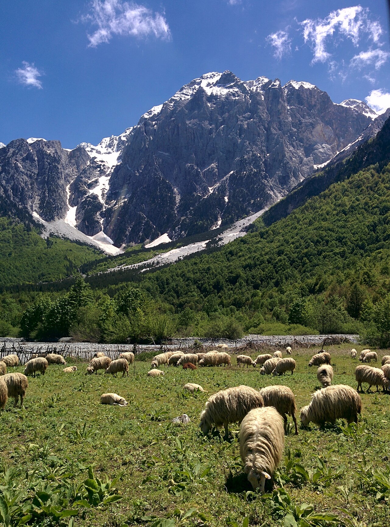
The local economy depends primarily on agriculture and livestock. Cultivated crops include corn, potato, rye, beans, vegetables, and fodder. Livestock kept includes cattle, sheep, goats, horses, and poultry, with beekeeping also practised. Agricultural land is scarce, generally situated on slopes and in small valley pockets. A water-bottling factory, trading under the name Valbona, represents the area's only notable industrial activity. Forestry is precluded by the park's protected status. Tourism — including alpinism, rural, cultural, gastronomic, and adventure forms — is developing, supported in part by a government-backed tourism complex planned to accommodate approximately 500 people on a surface of 4,200 m².
In January 2016, residents learned of plans to construct up to 14 hydroelectric power plants along 30 km of the Valbona River, with 8 of those plants located wholly within the national park. Issuing permits for such construction within a protected area is stated to be illegal under Albanian law, but the government cited the cost of legal proceedings against developers as grounds for not revoking the licences already granted. Local activists organised campaigns under the name 'Don't Touch My Valbona' (Mos ma prek Valbonen) to pressure authorities to halt construction, which was already under way along a section of the river at the time of reporting.
De warmste maand is August (gemiddeld dagelijks maximum 25°C), de koudste is January (gemiddeld dagelijks minimum -3°C), en de natste is December (233 mm). De gemiddelde jaarlijkse neerslag bedraagt 1,910 mm.
| Maand | Maximum | Minimum | Neerslag | Natte dagen | Zon/dag |
|---|---|---|---|---|---|
| January | 3°C | -3°C | 187 mm | 13 | 6.2 h |
| February | 4°C | -2°C | 168 mm | 12 | 7.2 h |
| March | 7°C | 0°C | 163 mm | 14 | 8.9 h |
| April | 12°C | 4°C | 141 mm | 16 | 10.0 h |
| May | 18°C | 9°C | 148 mm | 18 | 11.4 h |
| June | 22°C | 13°C | 126 mm | 17 | 13.1 h |
| July | 24°C | 15°C | 118 mm | 15 | 13.4 h |
| August | 25°C | 15°C | 106 mm | 14 | 12.5 h |
| September | 20°C | 11°C | 155 mm | 14 | 10.1 h |
| October | 15°C | 7°C | 146 mm | 11 | 8.5 h |
| November | 10°C | 3°C | 219 mm | 13 | 6.5 h |
| December | 5°C | -1°C | 233 mm | 14 | 5.7 h |
Bron: ERA5 reanalysis via Open-Meteo, 1994–2023 · "Maximum" en "Minimum" zijn het gemiddelde dagelijkse maximum en minimum van de luchttemperatuur. "Natte dagen" telt dagen met ten minste 1 mm neerslag.
Plaats · Kukës
The road head for the Valbona valley, named after a guerrilla leader of the 1920s.
Dorp · Shkodër
A glacial valley village in the Albanian Alps: a lock-in tower, a waterfall, and one end of the country's best-known trek.
Bergketen · Shkodër
The limestone wall of the far north — locally the Accursed Mountains — shared with Montenegro and Kosovo.
Gids
Albania's best-known walk: roughly 17 km over a 1,795 m pass, six to eight hours, June to October.
Iets onjuist op deze pagina? Correcties zijn welkom en worden gecontroleerd aan de hand van de bronregistratie. Laat ons weten wat onjuist is en, indien mogelijk, waar het juiste cijfer vandaan komt.



