村 · Shkodër
Theth
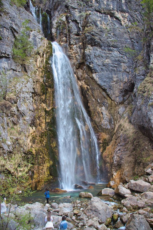
A glacial valley village in the Albanian Alps: a lock-in tower, a waterfall, and one end of the country's best-known trek.
すべての県、すべての海岸、すべての世紀
ガイドビュー
アルバニアを初めて知る方へ。各ページは、詳細に入る前に、10歳の子どもにも読み聞かせられる平易な説明から始まります。
エキスパートビュー
基本知識はすでにお持ちの方向け。平易な説明を非表示にし、内容を直接表示します。これがデフォルトです。
保護区域 · Shkodër County
The glacial valley park at the heart of the Albanian Alps, merged into a wider protected complex in 2022.
保存
Theth National Park protects a deep valley in the northern mountains, with a waterfall, a blue pool called the Blue Eye of Theth, and old stone houses.
Theth National Park protects a deep valley in the northern mountains, with a waterfall, a blue pool called the Blue Eye of Theth, and old stone houses.
Theth National Park (Albanian: Parku Kombëtar i Thethit) was established in 1966, covering 2,630 ha (26.3 km²) around the larger portion of Shala Valley in northern Albania. It was one of the earliest formally protected areas in the Albanian Alps and remained a distinct administrative unit for more than five decades.
In 2022, Theth National Park was merged with Valbona Valley National Park and Gashi Nature Reserve to form the Alps of Albania National Park (Albanian: Parku Kombëtar Alpet e Shqipërisë), now the largest national park in Albania at 8,844.65 ha (88.4465 km²). The consolidation was undertaken to protect the ecosystems, biodiversity, and cultural and historical heritage of the region as a unified whole. Separately, in 2017, Theth village was declared a Protected Historic Center.
The Alps of Albania National Park borders Montenegro to the north and the Nikaj-Mërtur Regional Nature Park to the south. The region has also been identified as an important Bird and Plant Area.
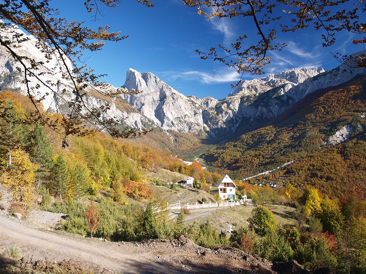
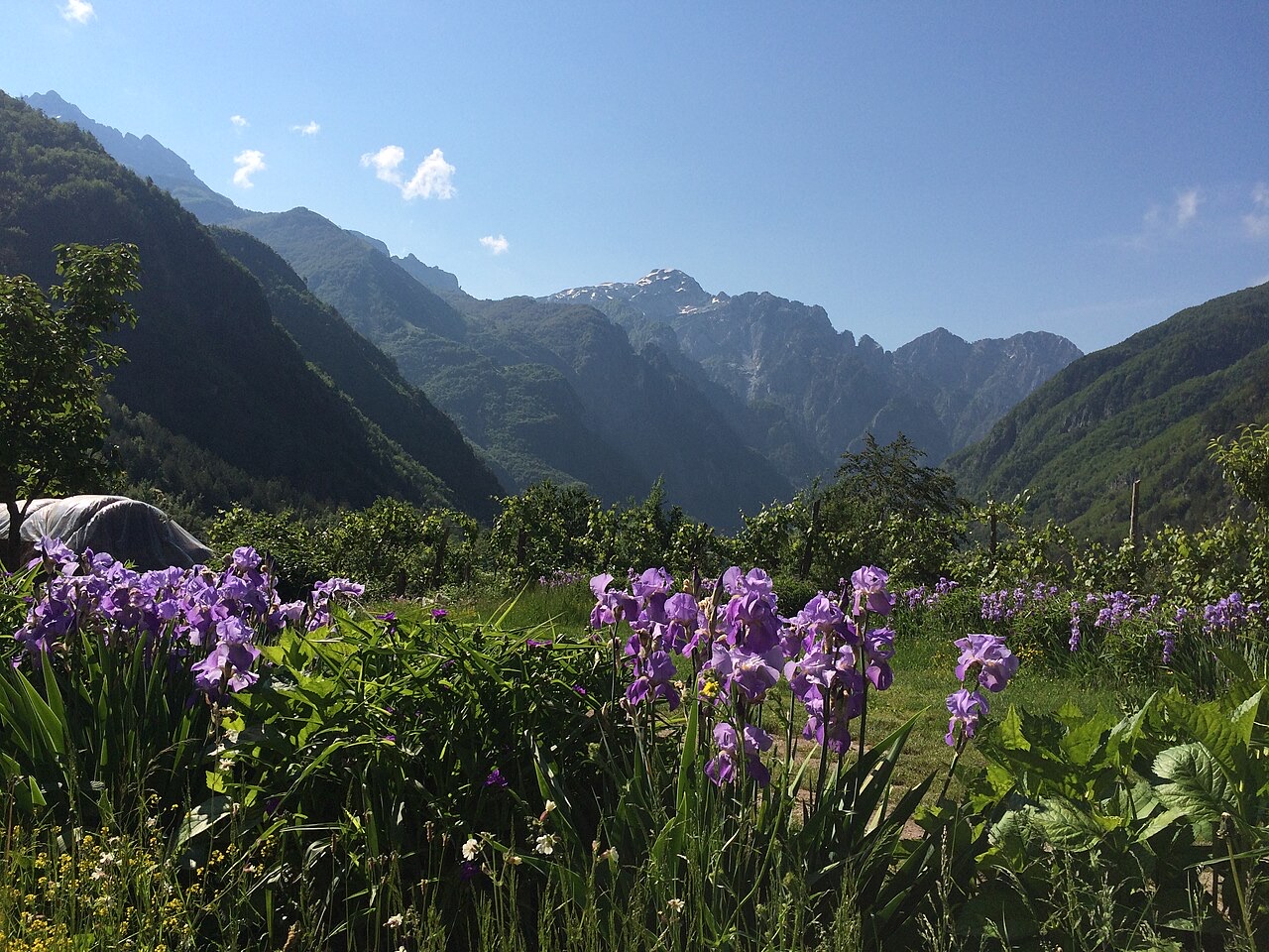
The Theth area occupies the upper Shala Valley and is enclosed on four sides by peaks exceeding 2,000 m: Radohima lies to the west, Arapi and Poplluka to the north, and Jezerca to the east. This topographic enclosure gives the valley its strongly defined character.
The Valbona Pass, standing at 1,795 m (5,889 ft), carries a mountain path on the western side and marks the boundary separating the former Theth National Park from the Valbona Valley National Park to the west. The pass remains the principal high-altitude connection between the two valleys.
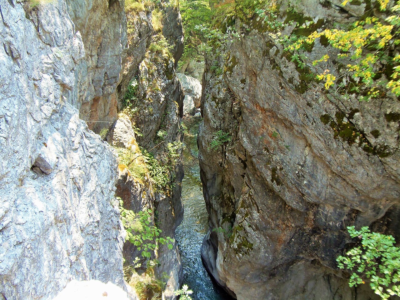
Like most of the Albanian Alps, the Theth area is dominated by limestone and dolomite rocks. These lithologies produce pronounced karst features across the landscape. Notable examples include the Grunas Canyon and the southern wall of Arapi, the latter of which is considered the highest rock face in the Balkans.
The broader Albanian Alps, which are also called the Accursed Mountains and serve as the namesake of the national park, contain most of Albania's peaks above 2,000 m. This range includes Maja e Jezercës, the highest peak of the Dinarides. The geological formation is generally characterised by high terrain with glaciers, valleys, rivers, waterfalls, dense forests, and several rock formations.
Three distinct forest types are found within the park, each corresponding to an altitudinal belt. The oak floor extends from approximately 600 m to 800 m and is dominated by Austrian oak, oriental hornbeam, hophornbeam, cornel, and flowering ash.
The beech floor occupies the band between 900 m and 1,900 m and is mainly covered by common beech, silver fir, and sycamore. Above this, from 1,900 m to 2,300 m, the alpine floor is characterised by herbaceous plants and shrubs, most notably juniper and willow. Key plant species at this elevation include alpine bluegrass, alpine aster, trefoil, and common bird's-foot trefoil.
Biogeographically, the park falls within the Dinaric Mountains mixed forests terrestrial ecoregion, itself part of the Palearctic temperate broadleaf and mixed forest biome.
Despite the limited area of the former Theth National Park at 2,630 ha, the flora is described as highly diverse. Estimates of the total number of plant species vary between 1,500 and 1,650, reflecting some uncertainty in botanical surveys of the area. Of these, 70 species are recorded as endangered.
The park is considered part of a large, primarily untouched preserved ecosystem. This relatively undisturbed condition is cited as a factor in sustaining the density and variety of plant life recorded there.
Only 20 species of mammals have been recorded within the park's land area. Large mammals present include brown bear, roe deer, and chamois. Rare or endangered species recorded in the park include the gray wolf, lynx, and wild goat.
The presence of apex predators such as the wolf and lynx alongside prey species like chamois and roe deer reflects the relatively undisturbed state of the ecosystem. The park's remote character is considered a key factor in maintaining habitat for these species.
Fifty species of birds have been observed in the park. Raptors represented include the golden eagle and the lesser kestrel. Other recorded species include the nuthatch, robin, blackbird, red-backed shrike, western capercaillie, and rock partridge. The region's designation as an important Bird and Plant Area reflects this avian richness.
The park supports comparatively few reptile and amphibian species, a fact attributed to the harsh winters of the Albanian Alps. A total of 10 reptile species and 8 amphibian species have been recorded. Confirmed species include the alpine salamander, common frog, alpine newt, and brown trout.
The national park designation, first applied to the Theth area in 1966 and subsequently absorbed into the larger Alps of Albania National Park in 2022, was established explicitly to protect ecosystems, biodiversity, and the cultural and historical heritage of the region. The 2017 declaration of Theth as a Protected Historic Center added a separate layer of heritage protection to the village itself.
The park's very remote areas are described as containing a large preserved ecosystem that is primarily untouched. The region's identification as an important Bird and Plant Area underlines its international significance for conservation beyond Albania's national framework. The amalgamation into the Alps of Albania National Park in 2022 made it the country's largest protected area by land area.
最も暖かい月は August (日中の平均最高気温 26°C), 最も寒い月は January (夜間の平均最低気温 -2°C), 最も雨が多い月は December (272 mm). 年間総降水量の平均は 1,946 mm.
| 月 | 最高気温 | 最低気温 | 降水量 | 降水日数 | 日照時間/日 |
|---|---|---|---|---|---|
| January | 5°C | -2°C | 211 mm | 14 | 6.0 h |
| February | 6°C | -1°C | 190 mm | 13 | 7.0 h |
| March | 9°C | 1°C | 184 mm | 13 | 8.6 h |
| April | 14°C | 5°C | 156 mm | 16 | 9.7 h |
| May | 19°C | 10°C | 138 mm | 18 | 11.3 h |
| June | 23°C | 14°C | 92 mm | 16 | 13.0 h |
| July | 26°C | 16°C | 80 mm | 12 | 13.4 h |
| August | 26°C | 17°C | 66 mm | 12 | 12.5 h |
| September | 21°C | 13°C | 141 mm | 12 | 10.0 h |
| October | 17°C | 8°C | 156 mm | 11 | 8.4 h |
| November | 12°C | 4°C | 260 mm | 13 | 6.2 h |
| December | 6°C | -0°C | 272 mm | 14 | 5.6 h |
出典: ERA5 reanalysis via Open-Meteo, 1994–2023 · 「最高気温」および「最低気温」は日平均最高・最低気温です。「降水日数」は降水量が1mm以上の日数を計上しています。
村 · Shkodër
A glacial valley village in the Albanian Alps: a lock-in tower, a waterfall, and one end of the country's best-known trek.
山脈 · Shkodër
The limestone wall of the far north — locally the Accursed Mountains — shared with Montenegro and Kosovo.
ガイド
Albania's best-known walk: roughly 17 km over a 1,795 m pass, six to eight hours, June to October.
このページに誤りがありますか? 修正は歓迎しており、原典記録と照合して確認します。何が誤っているか、また可能であれば正しい数値の出典をお知らせください。