Cidade · Vlorë
Vlorë
Where the Adriatic meets the Ionian, and where Albanian independence was declared in 1912.
Cada condado, cada costa, cada século
Vista guiada
Novo na Albânia? Cada página começa com uma explicação em linguagem simples, acessível a uma criança de dez anos, antes de entrar em pormenor.
Vista para especialistas
Já conhece o essencial. Direto ao conteúdo, com as explicações simples ocultadas. Esta é a vista predefinida.
Área protegida · Vlorë County
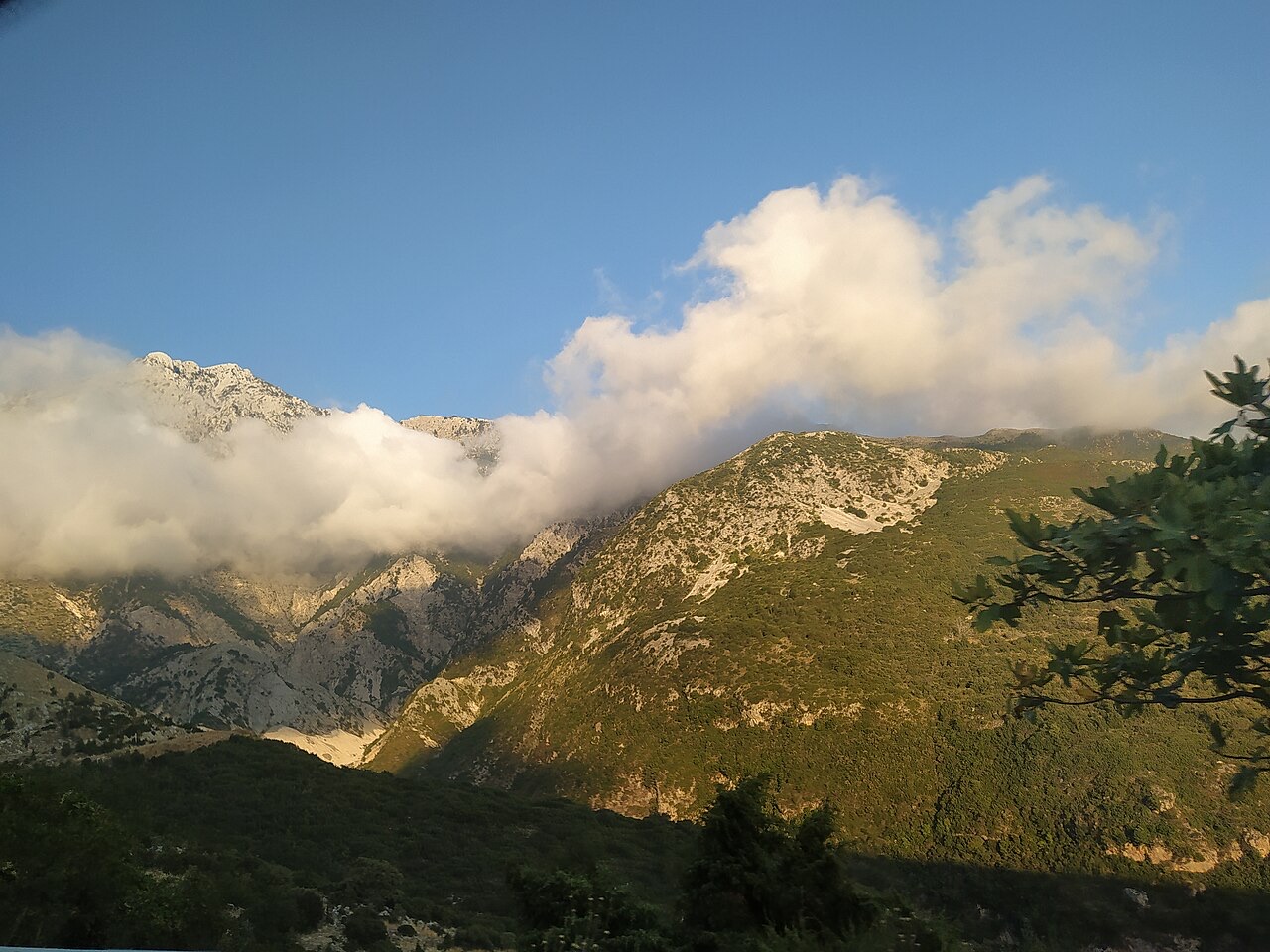
A pine-forested pass at 1,027 m where the road drops from mountain forest to the Ionian in a few kilometres.
Guardar
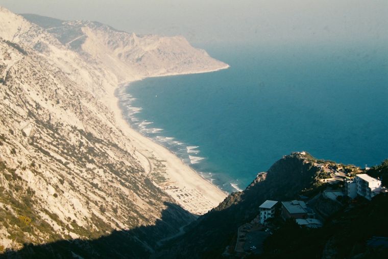
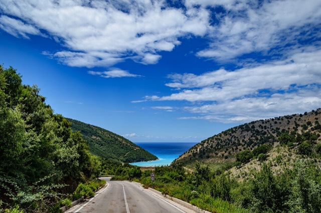
Llogara is a mountain pass covered in pine trees. The road climbs to the top and then drops steeply to the Riviera. From the pass you look straight down at the sea.
Llogara is a mountain pass covered in pine trees. The road climbs to the top and then drops steeply to the Riviera. From the pass you look straight down at the sea.
Llogara National Park was established in 1966 with the purpose of protecting several ecosystems and biodiversity of national importance in southwestern Albania. It covers a surface area of 1,769 hectares (17.69 km²), of which 1,010 hectares (10.1 km²) fall within Vlorë County. The International Union for Conservation of Nature (IUCN) has classified the park under Category II, the designation applied to national parks managed primarily for ecosystem protection and recreation.
The region has been recognised as an Important Bird and Plant Area, a status reflecting the significant number of species the park supports. Its position within the Ceraunian Mountains, combined with a wide elevation range and proximity to the Mediterranean Sea, produces the ecological conditions that justify this recognition.
The park is centred on the Ceraunian Mountains in southwestern Albania, southeast of the town of Orikum, lying mostly between latitudes 40° and 12° N and longitudes 19° and 34° E. Its elevation ranges from 200 metres (660 ft) at its lowest to 2,020 metres (6,630 ft) above the Adriatic. The Ionian Sea coast lies close to the southern boundary of the park.
The Ceraunian Mountains reach their highest points at Maja e Çikës, standing at 2,045 metres (6,709 ft), and Maja e Qorres at 2,018 metres (6,621 ft), both descending toward the Llogara Pass. The western portion of the mountain chain, known as Reza e Kanalit or the Akroceraunian Mountains, encompasses the Karaburun Peninsula and is approximately 24 kilometres (15 mi) long and 4–7 kilometres (2.5–4.3 mi) wide.
Geologically, like most mountains in the region, Llogara is composed of carbonic and flysch deposits from the Mesozoic and Paleozoic periods. Carbonate rocks occupy most of the area, with the mountains built primarily from limestones and dolomites.
The Llogara Pass rises to an elevation of 1,027 metres (3,369 ft) between Maja e Çikës and Maja e Gjipalit. It functions as the watershed between the Adriatic Sea to the north and the Ionian Sea to the south, and leads the Dukat Valley to the southern end of Vlora Bay close to Orikum.
The pass sits on a tectonic uplift line separating two tectonic zones: the Sazan zone to the southwest and the Jonike zone to the northeast. It also divides the Ceraunian mountain chain into two distinct chains. To the south, the terrain is rugged and steep, falling more than 1,000 metres (3,300 ft) to an Ionian Sea coast only three kilometres away.
Caesar's Pass, a named point nearby, takes its name from Julius Caesar, who is recorded as having marched through the area in pursuit of Pompey. The pass is located close to the Llogara Pass.
The park experiences a Mediterranean climate with subtropical influences, characterised by moderate rainy and dry winters and warm to hot summers. Mean monthly temperatures range between 12 °C (54 °F) in January and 32 °C (90 °F) in July. Mean annual precipitation ranges between 1,000 millimetres (39 inches) and 1,200 millimetres (47 inches), varying by geographic location and prevailing climate type within the park.
Despite the generally Mediterranean character of the region, an alpine climate prevails at Maja e Çikës due to its altitude. The proximity of the Mediterranean Sea exerts a significant moderating effect on the climate across most of the park. Snow covers the alpine peaks of the Ceraunian Mountains in winter, while the Albanian Ionian Sea coast remains sunny in summer.
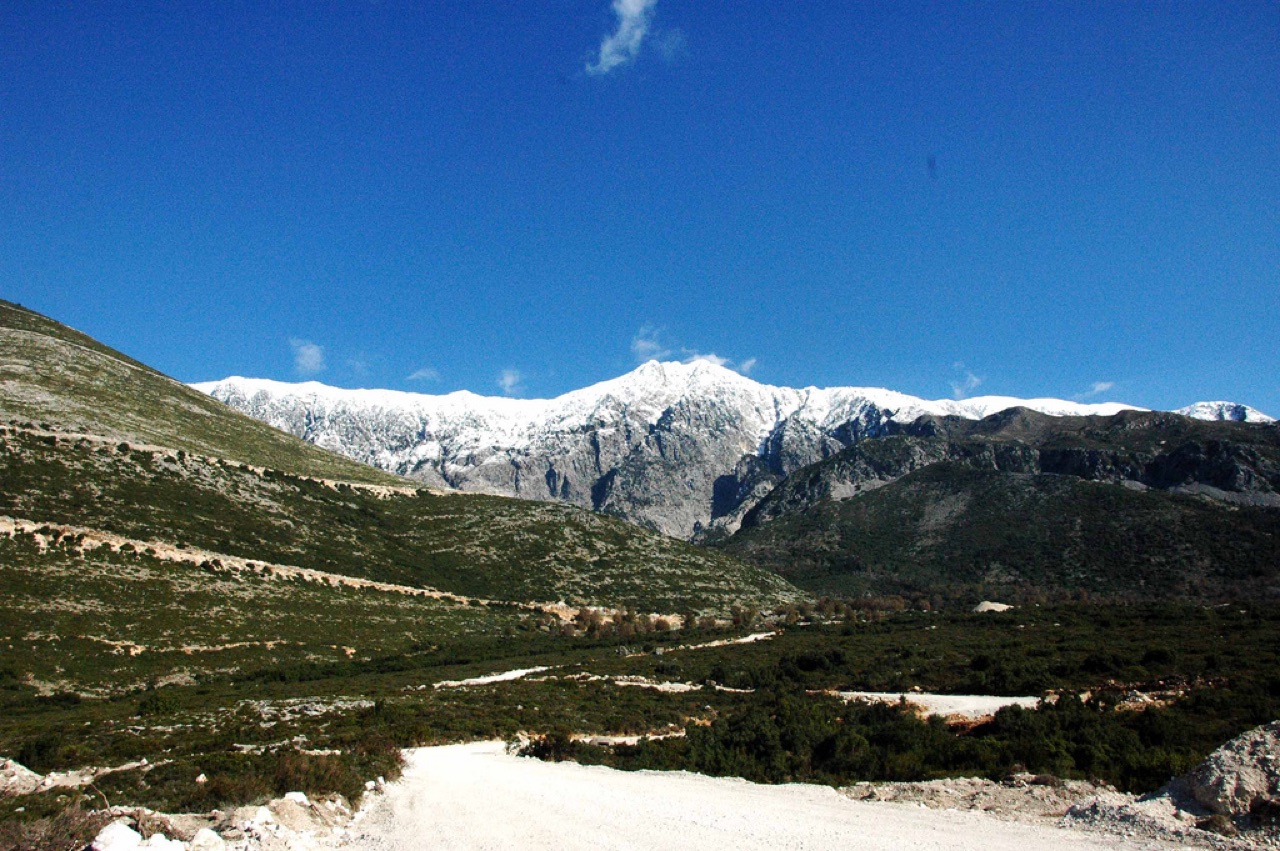
Phytogeographically, the park falls within the Illyrian deciduous forests terrestrial ecoregion, itself part of the Palearctic Mediterranean forests, woodlands, and scrub biome. Most of the park's area is covered by forest. The park is heavily forested mainly with pine, oak and fir trees growing on limestone and dolomite.
The forest composition includes both deciduous and coniferous species: Bosnian pine, black pine, Bulgarian fir, silver fir, ash trees, and kermes oak are among those recorded. Flora diversity is characterised by high endemism, attributed to the combination of the park's southern geographic latitude and its wide altitude variation.
Air currents moving through the area have caused individual trees to grow in bent and irregular forms. One noted example is the Pisha e Flamurit, a tree shaped by persistent local winds.
The vertebrate fauna of Llogara National Park includes a wide range of species. Those identified as having the highest conservation value are the griffon vulture, golden eagle, rock partridge, fallow deer, roe deer, European wildcat, chamois, red squirrel, otter, wolf, and red fox.
The park's position along the Albanian Adriatic and Ionian coast places it within one of the most ecologically significant zones in the country, a status attributed to both its climatic conditions and the topographic complexity of the area.
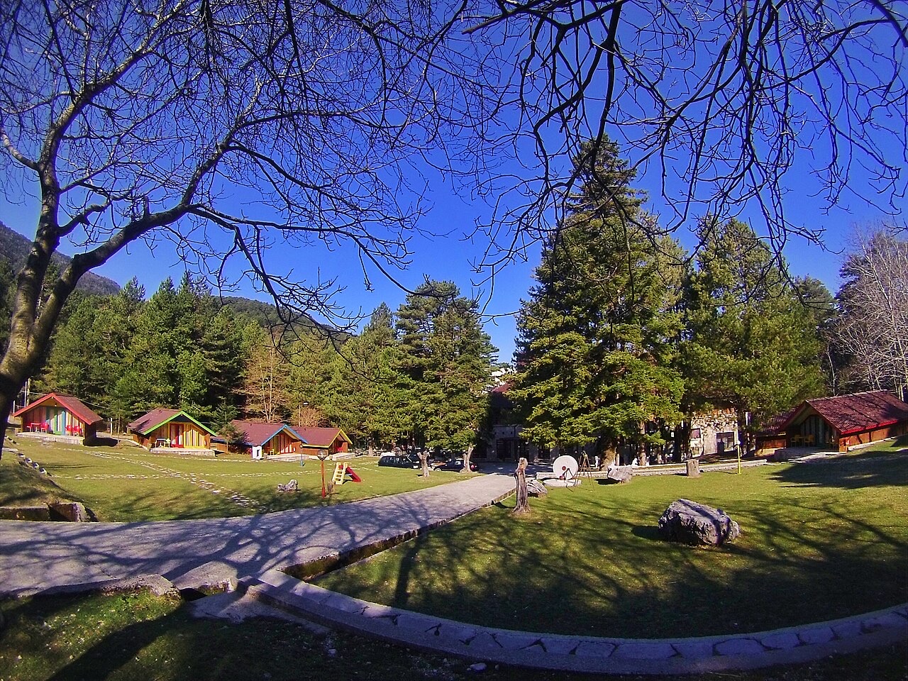
Tourism is identified as the most important sector within the park and is considered to have the largest potential as a source of sustainable income. Along National Road 8, there are several restaurants, hotels, and a small wooden cabin complex. Local vendors selling honey and mountain tea operate at various points along the road through the park.
The park and surrounding mountains are used primarily for hiking and tracking tours. A paragliding site located south of the park serves annually as the venue for the 9th FAI World Paragliding Accuracy Championship.
The park's terrain encompasses large alpine meadows, vertical rock faces, precipices, and dense forests. The landscape shifts from snow-covered alpine peaks in winter to the coast of the Albanian Ionian Sea in summer, a contrast produced by the park's elevation range of 200 metres to over 2,000 metres.
To the south of the Llogara Pass, views extend over the Albanian Riviera and several islands in the sea. The southern slopes are particularly steep, descending more than 1,000 metres over a horizontal distance of only three kilometres to the sea coast.
O mês mais quente é August (temperatura máxima média diária 26°C), o mais frio é January (temperatura mínima média diária 1°C), e o mais chuvoso é November (235 mm). A precipitação total anual média é 1,546 mm. A temperatura do mar atinge o máximo em agosto, com cerca de 26°C.
| Mês | Máx. | Mín. | Chuva | Dias com chuva | Sol/dia | Mar |
|---|---|---|---|---|---|---|
| January | 7°C | 1°C | 172 mm | 13 | 7.1 h | 17°C |
| February | 8°C | 1°C | 153 mm | 13 | 8.0 h | 15°C |
| March | 10°C | 3°C | 145 mm | 13 | 9.6 h | 15°C |
| April | 14°C | 6°C | 114 mm | 14 | 10.9 h | 16°C |
| May | 18°C | 10°C | 88 mm | 12 | 12.1 h | 18°C |
| June | 23°C | 14°C | 56 mm | 8 | 13.6 h | 23°C |
| July | 26°C | 17°C | 29 mm | 5 | 13.8 h | 25°C |
| August | 26°C | 17°C | 37 mm | 6 | 12.9 h | 26°C |
| September | 21°C | 14°C | 132 mm | 11 | 10.7 h | 26°C |
| October | 17°C | 10°C | 167 mm | 10 | 9.2 h | 25°C |
| November | 12°C | 6°C | 235 mm | 14 | 7.2 h | 21°C |
| December | 8°C | 3°C | 220 mm | 14 | 6.6 h | 18°C |
Fonte: ERA5 reanalysis via Open-Meteo, 1994–2023 · "Máx." e "Mín." são as temperaturas do ar máxima e mínima médias diárias. "Dias com chuva" conta os dias com pelo menos 1 mm de precipitação.
Cidade · Vlorë
Where the Adriatic meets the Ionian, and where Albanian independence was declared in 1912.
Cordilheira · Vlorë
The coastal ridge that makes the Riviera: 2,000 m peaks rising directly out of the Ionian.
Praia · Vlorë
A long white pebble shore under the Ceraunian ridge, and the Riviera's main nightlife strip.
Assunto · Vlorë
The 120 km of Ionian coast between the Llogara pass and Sarandë, where the Ceraunian mountains fall straight into the sea.
Praia · Vlorë
The first Riviera beach south of the Llogara pass, below the road's most dramatic descent.
Aldeia · Vlorë
An old white village on the slope above one of the Riviera's longest pebble beaches.
Estrada · Vlorë
The single road along the Albanian Riviera, over the Llogara pass and down the Ionian coast.
Vila · Vlorë
The centre of the Riviera coast: a Greek-speaking historical community, an old hill village and a string of coves.
Guia
One road, roughly 120 km, and about twenty places to stop. What each of them is actually like.
Algo errado nesta página? As correções são bem-vindas e verificadas em confronto com o registo de origem. Indique o que está errado e, se possível, de onde provém o valor correto.