
गाँव · Shkodër
Theth
A glacial valley village in the Albanian Alps: a lock-in tower, a waterfall, and one end of the country's best-known trek.
हर काउंटी, हर तट, हर सदी
निर्देशित दृश्य
Albania में नए हैं? हर पृष्ठ एक सरल-भाषा स्पष्टीकरण के साथ खुलता है जिसे आप किसी दस वर्षीय बच्चे को पढ़ कर सुना सकते हैं, इससे पहले कि विस्तृत जानकारी शुरू हो।
विशेषज्ञ दृश्य
आप मूल बातें पहले से जानते हैं। सीधे मूल विषय पर, सरल स्पष्टीकरण छिपे हुए। यह डिफ़ॉल्ट है।
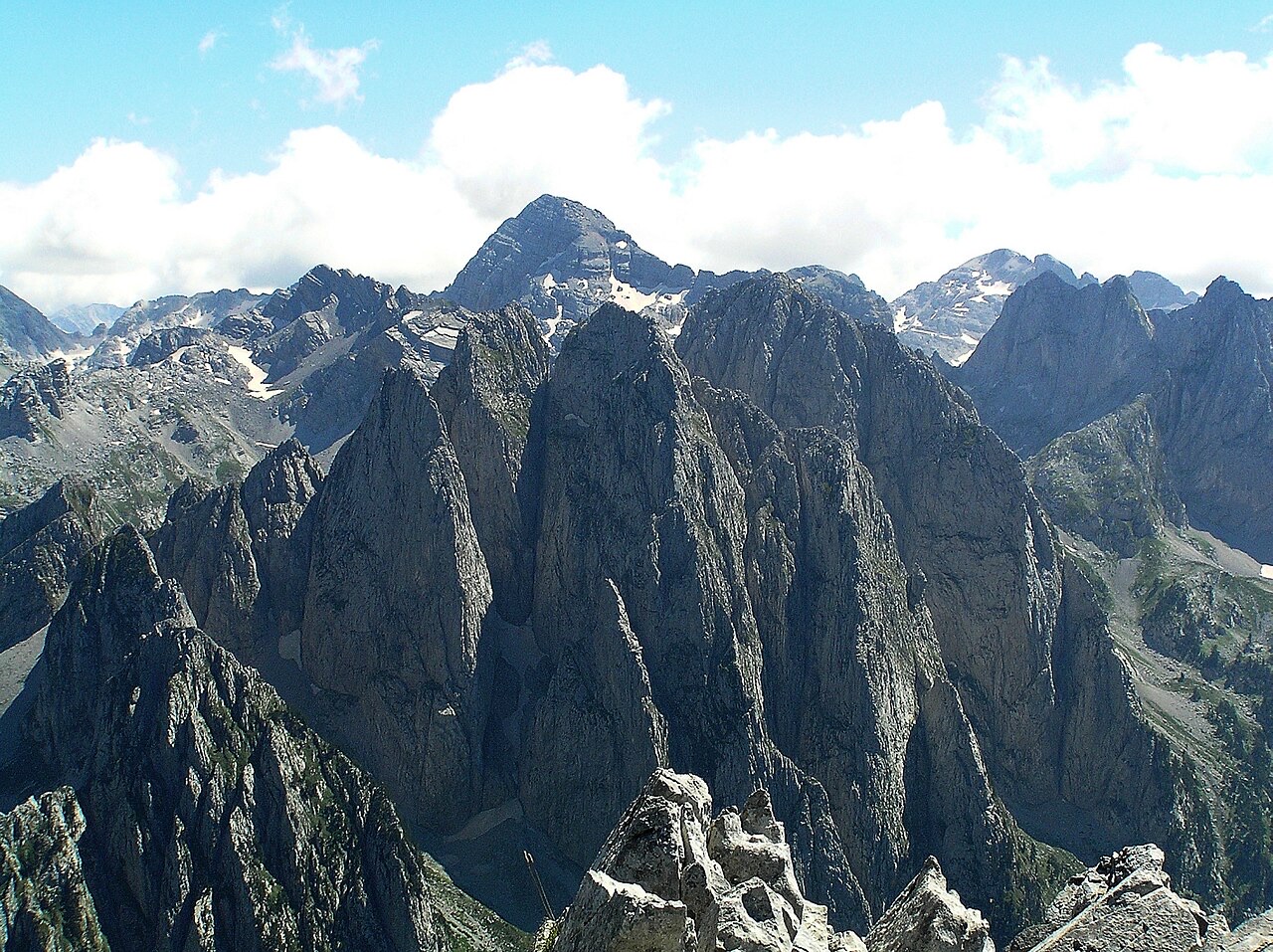
पर्वत · Shkodër County
At 2,694 m the highest peak entirely inside the Dinaric Alps, deep in the Albanian Alps.
सहेजें
Jezercë is the tallest mountain in the Albanian Alps, and the highest peak that lies completely inside the Dinaric mountain chain. It is a hard climb reached from Valbonë or Theth.
Jezercë is the tallest mountain in the Albanian Alps, and the highest peak that lies completely inside the Dinaric mountain chain. It is a hard climb reached from Valbonë or Theth.
Maja Jezercë (Albanian definite form: Jezerca) stands at 2,694 metres (8,839 ft) above sea level, making it the highest peak in the entire Dinaric Alps. Within Albania it ranks second highest, and across Southeast Europe it is the sixth highest summit. On a continental scale it is the 28th most prominent mountain peak in Europe.
The mountain is regarded as one of the toughest and most dangerous climbs in the Accursed Mountains. Its prominence and difficulty place it in a distinct category among Balkan peaks, drawing climbers who approach primarily from Gusinje in Montenegro or from the Albanian village of Theth.
The name Jezercë derives from the South Slavic word jezero, meaning 'lake'. The reference is to the cirque lakes located in the lower portion of the Buni i Jezercës on the northern side of the mountain, which were evidently a sufficiently distinctive local landmark to give the entire peak its name.
During Albania's communist period, the mountain was officially renamed Maja e Rinisë, literally 'Mountain of Youth'. The replacement name never achieved popular acceptance and did not displace the older toponym in common use.
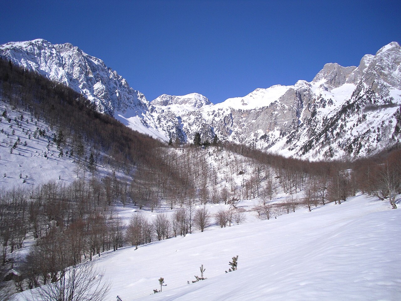
Jezercë lies within the Accursed Mountains range and its summit sits 5 kilometres (3.1 mi) from the border with Montenegro. Geographically it stands between two major valley systems: the valley of Valbonë to the east and the valley of Shala to the west.
The broader terrain unit formed by the floors of the Valbonë, Shala, and Ropojana valleys, bounded by Maja e Roshit at 2,522 metres (8,274 ft), is collectively referred to as the Jezercë Block. The surrounding ridge includes a series of neighbouring peaks: Maja e Popllukës (2,569 m / 8,428 ft) and Maja e Alies (2,471 m / 8,107 ft) to the west; Maja a Rragamit (2,478 m / 8,130 ft) to the east; Maja Kolaj (2,498 m / 8,196 ft), Maja e Malësores (2,490 m / 8,170 ft), and Maja e Bojës (2,461 m / 8,074 ft) to the northwest; and Maja e Kokërdhakut (2,508 m / 8,228 ft) and Maja e Etheve (2,393 m / 7,851 ft) to the north.
The mountain is a large rocky peak composed of dolomitic limestone. Vegetation is almost entirely absent from the upper elevations. The north, east, and west faces of the summit are enclosed within a large cirque formed during glacial periods when ice masses were more extensive than they are today.
The northern cirque, now known as the Buni i Jezercës, sits at elevations of approximately 1,980 metres (6,500 ft) to 2,100 metres (6,900 ft), with a depth of around 400 metres (1,300 ft). The cirque contains lakes whose presence gave the mountain its name. The Accursed Mountains range as a whole is noted for several small glaciers that are among the southernmost glacial masses in Europe, ranking after Snezhnika glacier (at latitude 41°46′09″ N) and the Banski Suhodol Glacier in the Pirin mountain of Bulgaria.
Jezercë is situated in what is described as the wettest region of Europe. Rainfall equivalent on the western slopes is believed — the article notes this as an estimate — to reach approximately 6 metres (240 inches) annually. This exceptional precipitation drives snowfall of sufficient magnitude that even the less exposed sections of the mountain fail to melt away except in dry years.
The combination of a limestone substrate that retains little surface water, near-permanent snowfields, and extreme precipitation levels defines the high-altitude environment of the peak and contributes to both its glacial heritage and the difficulty of ascent.
The limestone massif of Jezercë falls, in most of its extent, within the Alps of Albania National Park. Certain areas north of the peak are excluded from this protected designation.
The mountain can be climbed from the north. The two principal starting points recorded in the source material are Gusinje, a town in Montenegro, and Theth, a village in northern Albania. No other access routes are described in the available sources.
Jezercë is listed among the non-Alpine European Ultras, a classification applied to mountain peaks meeting a defined threshold of topographic prominence outside the Alps. Its ranking as the 28th most prominent peak on the continent reflects not only its absolute elevation but the degree to which it rises independently above surrounding terrain.
As the highest point of the Dinaric Alps — the major mountain system running along the eastern Adriatic — Jezercë holds particular significance for the physical geography of the western Balkans. Its position near the tripoint of Albania, Montenegro, and the broader Dinaric system gives it both geological and geographic importance beyond its role as a climbing objective.
सबसे गर्म महीना है August (औसत दैनिक अधिकतम 14°C), सबसे ठंडा है January (औसत दैनिक न्यूनतम -13°C), और सबसे अधिक वर्षा वाला है December (262 mm). कुल वार्षिक वर्षा का औसत है 1,859 mm.
| माह | अधिकतम | न्यूनतम | वर्षा | वर्षा के दिन | धूप/दिन |
|---|---|---|---|---|---|
| January | -7°C | -13°C | 203 mm | 14 | 6.0 h |
| February | -6°C | -12°C | 183 mm | 13 | 7.0 h |
| March | -3°C | -10°C | 176 mm | 13 | 8.7 h |
| April | 1°C | -7°C | 152 mm | 15 | 9.7 h |
| May | 7°C | -2°C | 130 mm | 17 | 11.3 h |
| June | 11°C | 2°C | 88 mm | 15 | 13.0 h |
| July | 14°C | 5°C | 77 mm | 12 | 13.4 h |
| August | 14°C | 5°C | 65 mm | 12 | 12.5 h |
| September | 9°C | 1°C | 131 mm | 12 | 10.0 h |
| October | 5°C | -3°C | 148 mm | 11 | 8.4 h |
| November | -0°C | -7°C | 244 mm | 13 | 6.2 h |
| December | -6°C | -12°C | 262 mm | 14 | 5.6 h |
स्रोत: ERA5 reanalysis via Open-Meteo, 1994–2023 · "अधिकतम" और "न्यूनतम" क्रमशः औसत दैनिक अधिकतम और न्यूनतम वायु तापमान हैं। "वर्षा के दिन" उन दिनों की गणना करता है जिनमें कम से कम 1 मिमी वर्षण हुई हो।
गाँव · Shkodër
A glacial valley village in the Albanian Alps: a lock-in tower, a waterfall, and one end of the country's best-known trek.
पर्वत श्रृंखला · Shkodër
The limestone wall of the far north — locally the Accursed Mountains — shared with Montenegro and Kosovo.
इस पृष्ठ पर कुछ गलत है? सुधार स्वागतयोग्य हैं और स्रोत अभिलेख के विरुद्ध जाँचे जाते हैं। हमें बताएँ क्या गलत है और, यदि संभव हो, तो सही आँकड़ा कहाँ से आता है।

