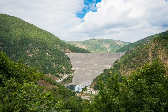
Localidad · Kukës
Bajram Curri
The road head for the Valbona valley, named after a guerrilla leader of the 1920s.
Cada condado, cada costa, cada siglo
Vista guiada
¿Nuevo en Albania? Cada página comienza con una explicación en lenguaje sencillo que cualquiera podría entender, antes de entrar en los detalles.
Vista experta
Ya conoces los fundamentos. Directo al contenido, con las explicaciones básicas ocultas. Esta es la vista predeterminada.
Instalación energética · Kukës County
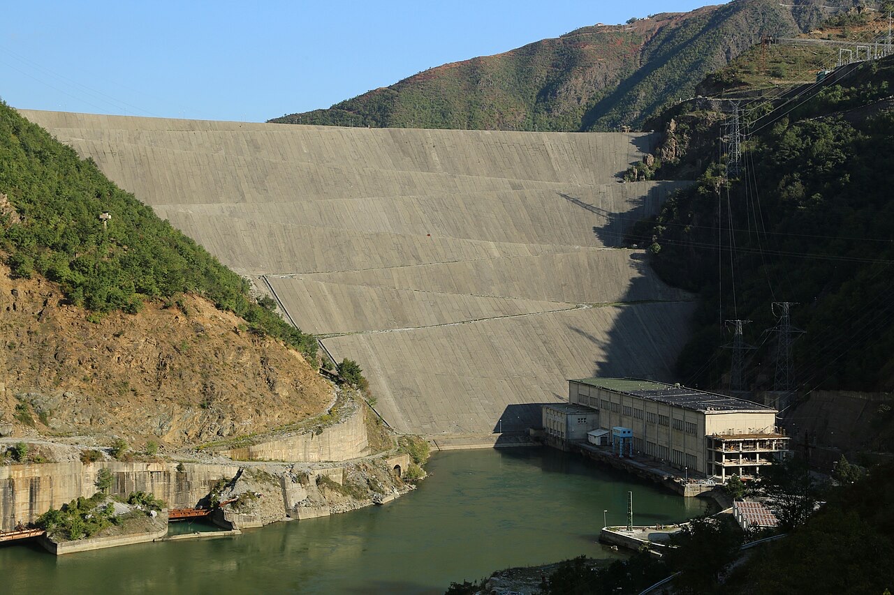
The uppermost and largest of the Drin dams, creating a reservoir shared with Kosovo.
Guardar
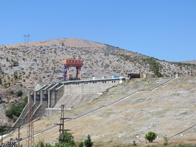
Fierza is the biggest dam on the Drin river. Its reservoir reaches back towards Kosovo, and it flooded the old town of Kukës.
Fierza is the biggest dam on the Drin river. Its reservoir reaches back towards Kosovo, and it flooded the old town of Kukës.
The Fierza Hydroelectric Power Station (Albanian: Hidrocentrali i Fierzës) sits on the Drin River in northern Albania as the uppermost of three hydroelectric plants in the Drin cascade. The two downstream stations, Koman and Vau i Dejës, follow it in sequence along the river.
Fierza's position at the head of the cascade, combined with its installed capacity and the volume of its reservoir, gives it a controlling role in the operation of the entire system. The reservoir regulates annual inflows into the cascade, increasing the efficient use of all three plants. Fierza's annual output averages 1,330 GWh, which represents approximately 33 percent of total Drin cascade production.
Preparatory work for the plant began in 1970, with dam construction starting in 1971. The project was completed over a decade of activity, with the first generating unit becoming operational in 1978 and the station reaching full operation in 1980. The reservoir was filled with water between 1978 and 1981.
Approximately 14,000 workers, engineers, and specialists were involved in building the plant. Equipment was sourced mostly from China, though the design concepts were developed by Albanian engineers.
The dam at Fierza is a rock-fill structure with a clay core. It stands 167 metres (548 ft) high and measures 380 metres (1,250 ft) in length along its crest. The dam has a total volume of 8 million cubic metres.
At the time of its construction, the Fierza dam was the second highest dam of its type in Europe. It is one of three hydroelectric dams on the Drin River.
The plant contains four generating units, each equipped with a Francis vertical turbine rated at 125 MW. This gives the station a total installed capacity of 500 MW.
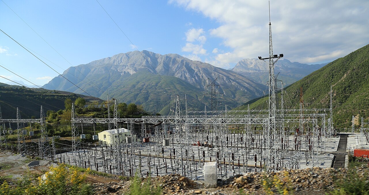
Each unit drives a three-phase synchronous generator operating at 13.8 kV. Step-up transformers raise the output voltage from 13.8 kV to 242 kV for connection to the transmission system substation.
With an average annual output of 1,330 GWh, Fierza accounts for roughly one third of the electricity produced by the full Drin cascade. This share reflects both the plant's own generating capacity and its influence over the flow of water available to the downstream stations at Koman and Vau i Dejës.
Beyond its direct generation, the large volume of the Fierza reservoir enables it to store and regulate the Drin's annual inflows. This regulatory function is considered central to the safe and efficient operation of the cascade as a whole.
Fierza is described as playing a key role in Albania's hydroelectric system by virtue of its installed power capacity, its location at the top of the cascade, and the volume of its reservoir. The plant was built with a combination of foreign equipment and domestic engineering expertise, reflecting the conditions of Albanian industrial development during the 1970s.
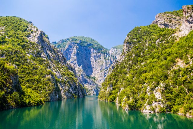
The Fierza reservoir also supports the Koman and Fierza Reservoirs Ferry service, which uses the lake formed by the dam as a transport route, though this function is separate from the plant's energy generation role.
El mes más cálido es August (máxima diaria media 29°C), el más frío es January (mínima diaria media -0°C), y el más lluvioso es December (229 mm). La precipitación anual total promedia 1,795 mm.
| Mes | Máx. | Mín. | Lluvia | Días de lluvia | Sol/día |
|---|---|---|---|---|---|
| January | 6°C | -0°C | 193 mm | 13 | 6.4 h |
| February | 8°C | 1°C | 173 mm | 12 | 7.4 h |
| March | 11°C | 4°C | 167 mm | 14 | 9.0 h |
| April | 16°C | 8°C | 144 mm | 14 | 10.1 h |
| May | 22°C | 13°C | 126 mm | 15 | 11.7 h |
| June | 26°C | 17°C | 94 mm | 12 | 13.3 h |
| July | 28°C | 19°C | 84 mm | 10 | 13.5 h |
| August | 29°C | 20°C | 72 mm | 10 | 12.6 h |
| September | 24°C | 15°C | 142 mm | 11 | 10.3 h |
| October | 19°C | 11°C | 153 mm | 10 | 8.7 h |
| November | 13°C | 6°C | 218 mm | 13 | 6.6 h |
| December | 8°C | 2°C | 229 mm | 14 | 5.9 h |
Fuente: ERA5 reanalysis via Open-Meteo, 1994–2023 · «Máx.» y «Mín.» son la temperatura del aire máxima y mínima diaria media. «Días de lluvia» cuenta los días con al menos 1 mm de precipitación.
Localidad · Kukës
The road head for the Valbona valley, named after a guerrilla leader of the 1920s.
Pueblo · Kukës
A wide white riverbed under 2,500 m peaks; the eastern end of the Theth trek.
Instalación energética · Shkodër
The middle station of the Drin cascade, and the dam that created Lake Koman.
Localidad · Kukës
A town rebuilt above a reservoir in the 1970s, and the northern end of the Nation's Road.
Lago · Shkodër
A 34 km reservoir in a gorge so narrow the ferry crossing is treated as a scenic journey in its own right.
Río · Shkodër
Albania's longest river and the backbone of its electricity system, dammed three times in the north.
Industria
Electricity almost entirely from hydropower — which makes supply depend on rainfall.
Empresa · Tiranë
The state generator that runs the Drin cascade and supplies most Albanian electricity.
¿Algo incorrecto en esta página? Las correcciones son bienvenidas y se contrastan con el registro fuente. Indíquenos qué es incorrecto y, si puede, de dónde procede el dato correcto.