城镇
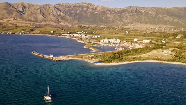
Orikum
A marina town at the foot of Llogara, beside the ancient harbour of Oricum.
🧭 引导视图
初次了解阿尔巴尼亚?每个页面均以通俗易懂的说明开篇——即便是十岁的孩子也能读懂——随后再展开详细内容。
⚡ 专业视图
您已掌握基础知识。直接进入正题,简明解释默认隐藏。此为默认模式。
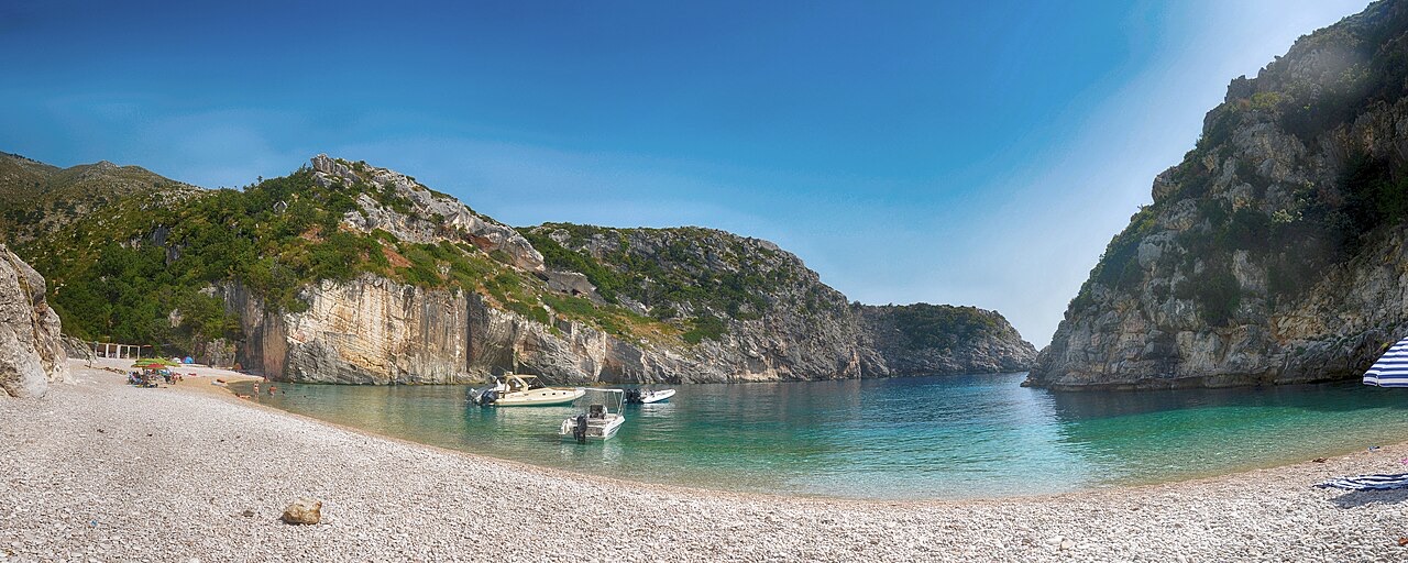
Grama Bay is on a wild peninsula with no roads. Sailors from ancient times carved their names into the rocks there, and you can still see the writing. You can only arrive by boat.
Grama Bay is on a wild peninsula with no roads. Sailors from ancient times carved their names into the rocks there, and you can still see the writing. You can only arrive by boat.
Grama Bay (Albanian: Gjiri i Gramës; pronounced [ˈɟiːɾi i ˈgraːməs]) lies on the Ionian Sea along the Albanian Riviera. It is one of several bays formed along the western face of the Ceraunian Mountains, a coastal range whose steep terrain shapes the character of the shoreline throughout this stretch of the Albanian coast.
The bay falls within the boundaries of the Karaburun-Sazan Marine Park. Its shore is dominated by coastal cliffs that slope vertically into the sea, alongside rocky and pebbled beaches. The site has been designated a natural monument on account of its landscape, which includes solutional caves and sea caves formed by coastal erosion.
The name Grama derives from the Greek word for 'letter', a direct reference to the carved inscriptions that cover the surrounding cliffs. The bay is also referred to as Grammata (or Grammata), the plural of Gramma, reflecting the accumulated body of inscribed texts found there.
These inscriptions were left by Greek, Roman and medieval sailors as expressions of thanksgiving to the Dioscuri — Castor and Pollux — and to other patron figures. The naming of the bay is therefore inseparable from its role as a site of votive inscription over many centuries.
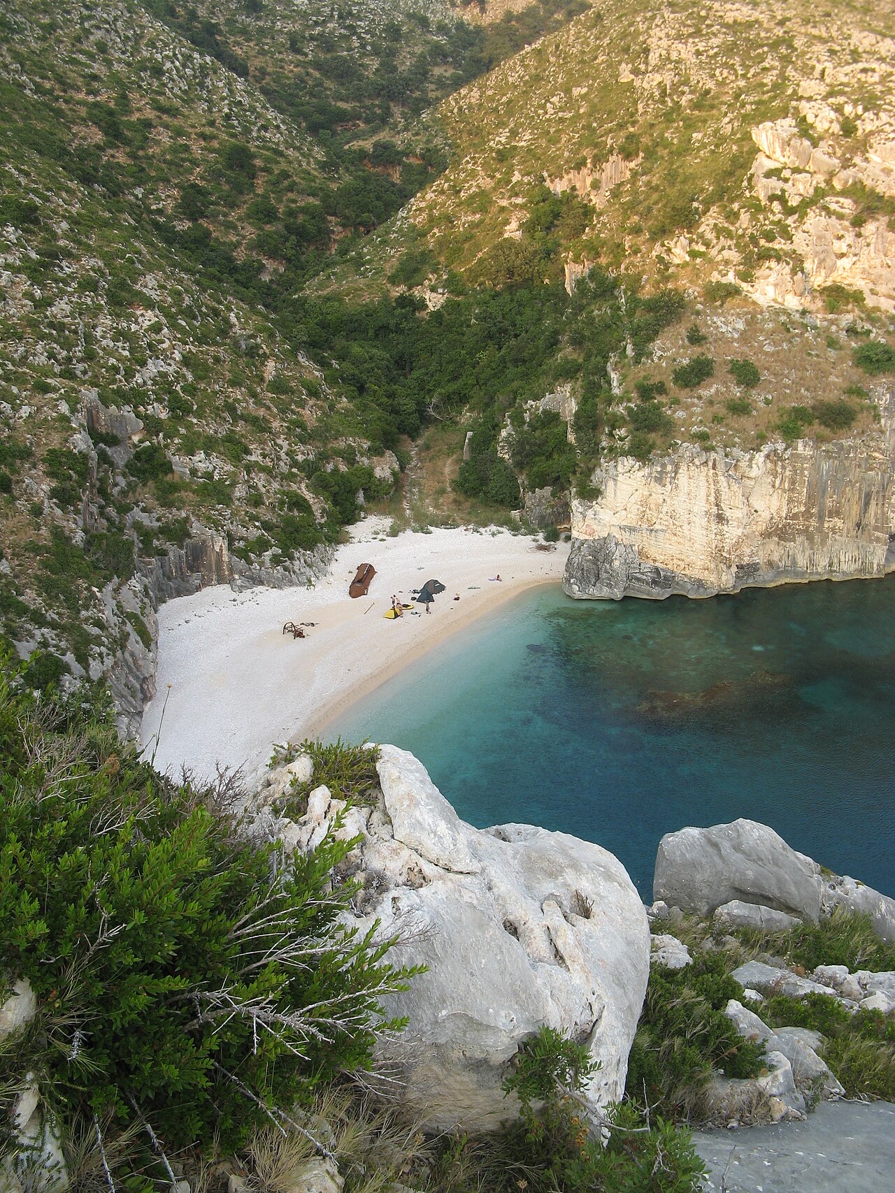
In antiquity, Grama Bay was a sheltered cove along the Chaonian coast, west of the Ceraunian Mountains. It served as a harbour and place of refuge for vessels sailing along this section of the coastline during classical antiquity.
On the vertical cliff faces and rocks, sailors carved inscriptions in Ancient Greek, Latin and Medieval Greek. This category of inscription was known in antiquity as euploia inscriptions (Greek: ευπλοϊα), a term associated with prayers or thanks for safe passage at sea. The presence of texts in three languages and across several historical periods indicates the bay was in continuous use as a waypoint over a long span of time.
A scholarly study of the inscriptions, authored by Arben Hajdari, Joany Reboton, Saïmir Shpuza and Pierre Cabanes, was published in the Revue des Études Grecques in 2007 under the title 'Les Inscriptions de Grammata (Albanie)'.
During World War II, Grama Bay was used as a base by the Special Operations Executive (SOE). The article provides no further detail on the nature or duration of SOE operations conducted from the bay.
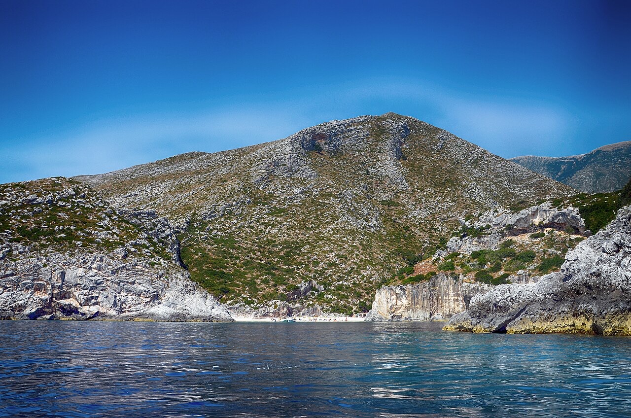
The sea caves of Grama Bay constitute a distinct ecosystem within the site. The article identifies them as providing important refuge for the Mediterranean monk seal, which it describes as the rarest seal species in the world.
The bay's landscapes are characterised in the article as being of global importance for their contribution to ecological balance and as habitat for species that are globally threatened or endangered. The sea caves are cited specifically in this context as an exceptional habitat type.
Grama Bay's designation as a natural monument relates to its landscape qualities, including the presence of solutional and sea caves, rather than solely to its archaeological or historical significance. It sits within the Karaburun-Sazan Marine Park, which provides a broader protected area framework for the surrounding coastal and marine environment.
The bay is described in the article as contributing to Albania's ecological balance. Its dual significance — as a site of archaeological and epigraphic importance and as a habitat for threatened marine species — underlies its protected status.
三十年气候平均值,地点: Grama Bay, 由本 Atlas 依据 1994—2023 年 ERA5 逐日再分析数据计算得出。以上为长期平均值,并非预报;任何单一年份均可能存在较大偏差。
最热月份为 August (日最高气温均值 31°C), 最冷月份为 January (日最低气温均值 7°C), 降水最多的月份为 November (206 mm). 年均降雨总量为 1,256 mm. 海水温度在八月达到峰值,约为 25°C.
| 月份 | 最高气温 | 最低气温 | 降雨量 | 降雨天数 | 日照时长 | 海水温度 |
|---|---|---|---|---|---|---|
| January | 12°C | 7°C | 146 mm | 13 | 7.4 h | 17°C |
| February | 13°C | 7°C | 126 mm | 12 | 8.3 h | 15°C |
| March | 15°C | 9°C | 118 mm | 12 | 9.9 h | 15°C |
| April | 18°C | 12°C | 86 mm | 12 | 11.0 h | 16°C |
| May | 23°C | 16°C | 61 mm | 9 | 12.3 h | 18°C |
| June | 28°C | 20°C | 33 mm | 6 | 13.7 h | 23°C |
| July | 31°C | 22°C | 17 mm | 4 | 13.8 h | 25°C |
| August | 31°C | 23°C | 27 mm | 4 | 12.9 h | 25°C |
| September | 26°C | 20°C | 103 mm | 9 | 10.8 h | 26°C |
| October | 22°C | 16°C | 143 mm | 10 | 9.3 h | 25°C |
| November | 18°C | 12°C | 206 mm | 14 | 7.4 h | 21°C |
| December | 14°C | 9°C | 190 mm | 14 | 6.8 h | 18°C |
数据来源: ERA5 reanalysis via Open-Meteo, 1994–2023 · "最高气温"与"最低气温"分别为日最高和日最低气温均值。"降雨天数"统计降水量不低于 1 毫米的天数。 获取 JSON 数据
以下均为本 Atlas 中真实存在的关联关系——与本地点邻近的地点,以及本条目实际所属的主题类别。本栏目不包含任何通用推荐内容。
A marina town at the foot of Llogara, beside the ancient harbour of Oricum.
Albania's largest uninhabited peninsula, closed to the public for most of the 20th century and now a marine park.
Albania's only marine national park: sea caves, wrecks and the country's clearest water.
Butrint, Apollonia, Byllis, Antigonea and Amantia — five sites that cover 2,500 years between them.
上文标注"深度解析"的章节,系本 Atlas 依据以下来源文章全文阅读后撰写而成 (2,293 字符). 以上内容为基于该文献的 AI 辅助研究成果,并已与本页精选事实核对。如涉及重要事项,请务必核对原始来源。
本页内容有误? 欢迎提交更正意见,所有意见均会与原始记录核对。请告知错误所在,如能提供正确数据的出处,请一并注明。