Sông · Gjirokastër
The Vjosa
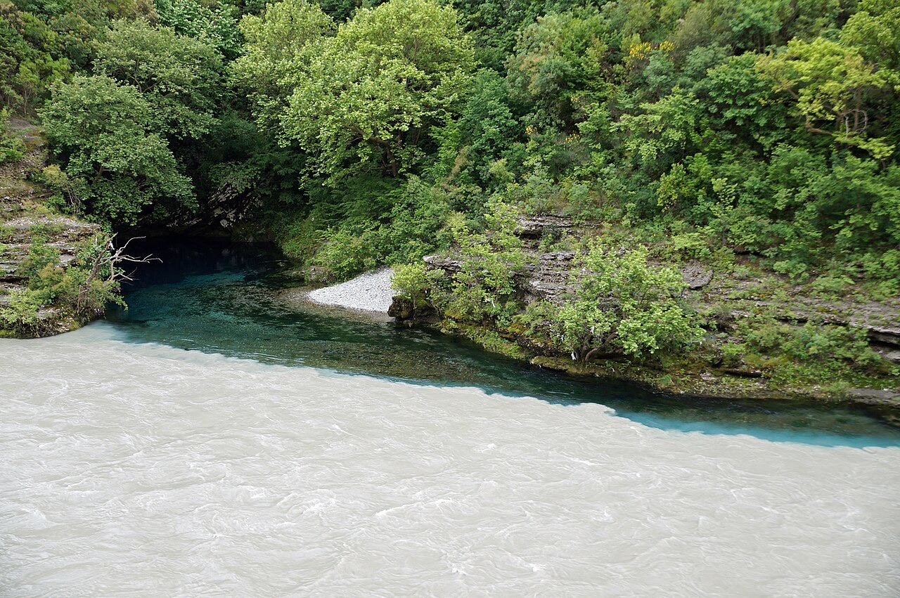
One of the last large free-flowing rivers in Europe, declared a Wild River National Park in March 2023.
Mọi hạt, mọi bờ biển, mọi thế kỷ
Chế độ hướng dẫn
Mới tìm hiểu về Albania? Mỗi trang mở đầu bằng một giải thích ngôn ngữ đơn giản mà bạn có thể đọc cho một đứa trẻ mười tuổi, trước khi đi vào chi tiết.
Chế độ chuyên gia
Bạn đã nắm được những điều cơ bản. Đi thẳng vào nội dung, với các giải thích đơn giản được ẩn đi. Đây là chế độ mặc định.
Thị trấn · Gjirokastër County
A town at the mouth of the Këlcyrë gorge on the Vjosa.
Lưu
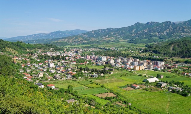
Këlcyrë sits where the Vjosa river comes out of a narrow gorge.
Këlcyrë sits where the Vjosa river comes out of a narrow gorge.
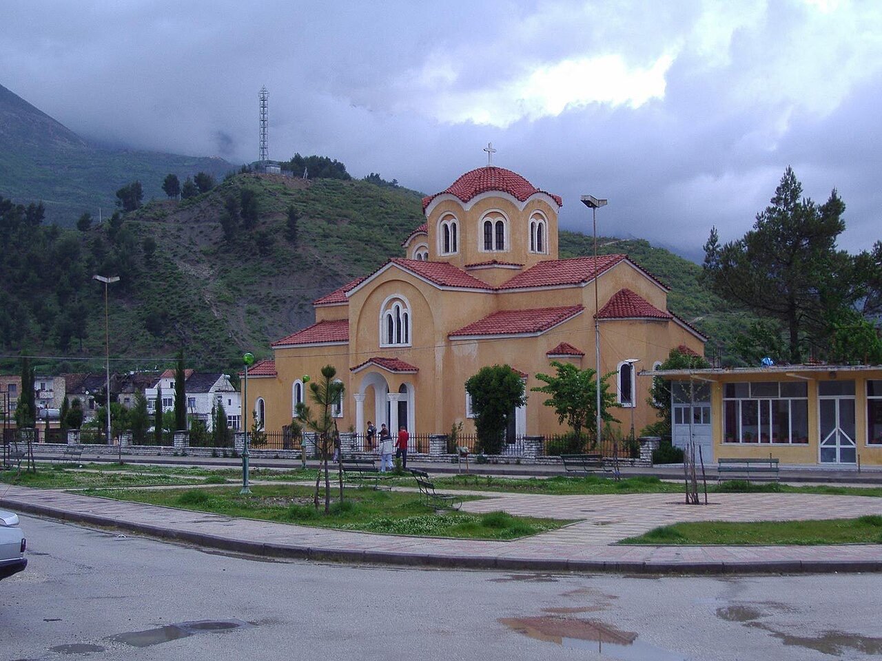
Këlcyrë is a town and municipality in southern Albania, situated on the bank of the river Vjosë. The Vjosë forms a canyon close to the town, known as the Këlcyrë Gorge, which has historically made the site a significant passage point through the mountains of southern Albania.
The municipality covers a total area of 304.86 square kilometres. The town itself serves as the seat of the wider municipal unit, which encompasses both the town and a collection of surrounding villages.
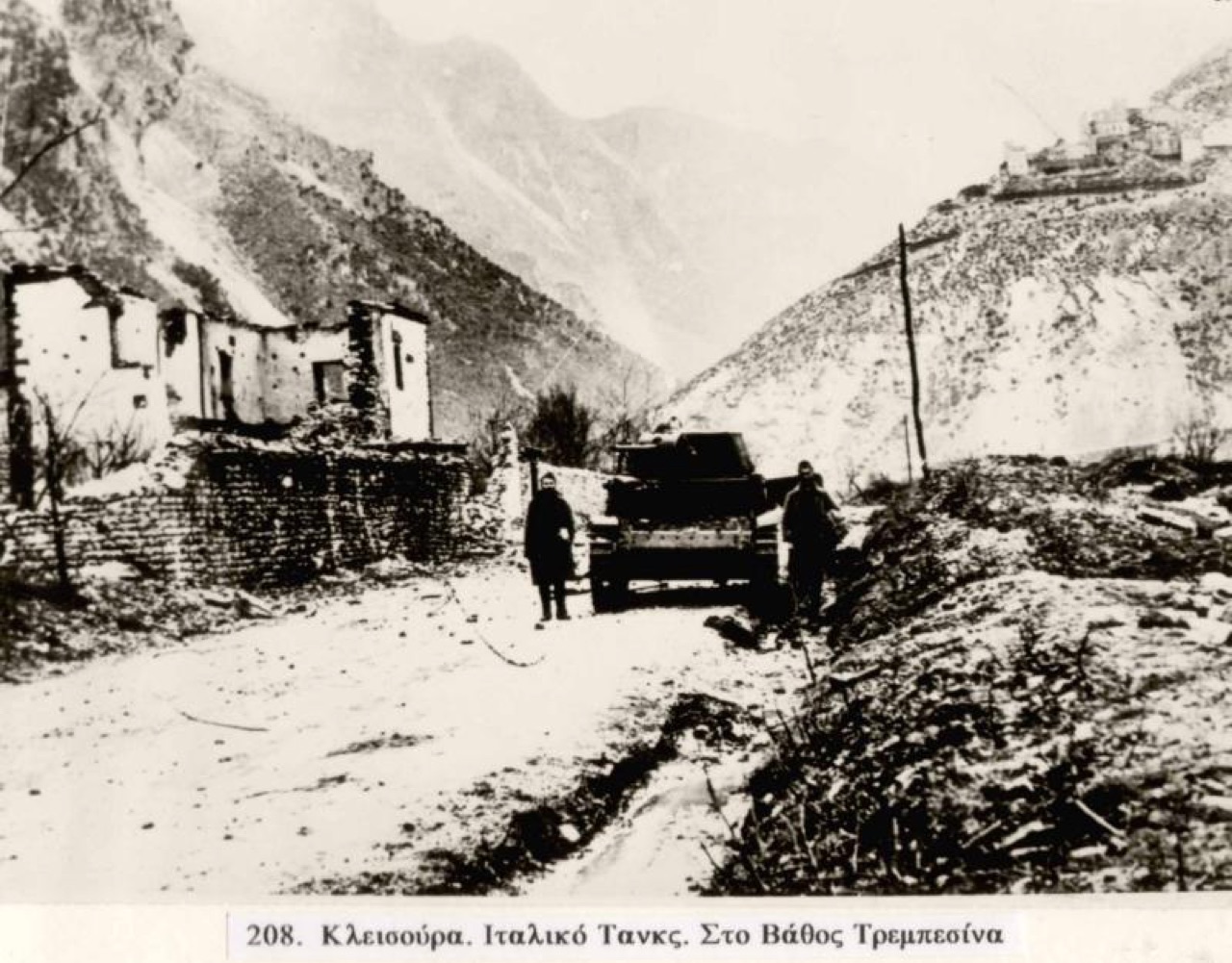
The name Këlcyrë derives from the Byzantine Greek word kleisoúra (κλεισοῦρα), itself a rendering of the Latin clausura, meaning a fortified pass or enclosed military route. The Latin term clausura is first recorded in an order issued by Emperor Theodosius II in 443. The Greek form appears in the Strategikon of Maurice and in the writings of Procopius in the early sixth century, and later in Theophylact Simocatta in the early seventh century.
The Byzantine Suda lexicon records that Romans applied the term Kleisoúrai to forts at mountain passes. By the late seventh century the term had been extended to describe larger frontier districts of Byzantium, distinct from the themata, though mountain passes continued to be called by the same word. The term was eventually borrowed across the Balkans, giving rise to place names such as Klisura in Bulgaria's Plovdiv and Blagoevgrad provinces, Klisura in North Macedonia's Demir Kapija Municipality, and Kleisoura in the Kastoria region of Greece.
Këlcyrë itself is recorded as Clausura in 1327 and as Qlisura in an Ottoman tax register of 1432, confirming the continuity of the name's Latin and Greek ancestry through the medieval period.
The current municipality of Këlcyrë was formed through Albania's 2015 local government reform, which merged four previously separate municipalities: Ballaban, Dishnicë, Këlcyrë, and Sukë. Each of these became a municipal unit within the enlarged municipality.
The municipal unit centred on the town of Këlcyrë includes the town itself and the villages of Fshat Këlcyrë, Sukë, Dishnicë, Mbrezhdan, Maleshovë, Limar, Toshkëz, Ballaban, Tolar, Çorrogunjë, Leskaj, and Kala. The village of Maleshovë is traditionally divided into three neighbourhoods: one Christian, one Muslim, and one comprising families of both religions.
According to the 2011 census, the total population of the merged municipality is 6,113, while the population of the former, pre-merger municipality of Këlcyrë alone was recorded at 2,651 in the same census.
During the Second Macedonian War, forces under Philip V of Macedon, commanded in the field by Athenagoras, used the gorge corresponding to modern Këlcyrë to block the advance of the Roman consul Titus Quinctius Flamininus in 198 BC. The Macedonians secured the passage and succeeded in halting the Roman column.
According to the ancient account, a shepherd guided Roman troops through the surrounding mountains, enabling them to attack the Macedonian position through the narrow gorge from two sides simultaneously. The Macedonians were decisively defeated. The Romans subsequently used the route through the gorge and established a small settlement there.
A castle was constructed at Këlcyrë in the thirteenth century to control the mountain passage. When the town was incorporated into the Kingdom of Albania in the late thirteenth century, it came under the authority of the Muzaka family. Correspondence between the Roman Curia and the Albanian nobility indicates that in 1319 the town was ruled by Count Mentul Muzaka.
After the town was captured by the Byzantine army, the Albanian population rose against Byzantine rule in 1335 and seized the town's fortress. In 1432, Albanian rebels again took the town, defeating and expelling Ottoman forces from the area.
During the nineteenth century, the Ottomans constructed a seraglio at Këlcyrë. The article describes this period as the town's peak as a trading centre, positioned along routes connecting Berat, Korçë, and Gjirokastër.
The gorge road remained the principal access route linking Këlcyrë to the wider region, continuing to function as a corridor between northern and southern parts of Albania and towards the Greek border.
The capture of the Klisura Pass, which took place between 6 and 11 January 1941, is described in the article as one of the most significant Greek Army victories during the Greek-Italian War. The pass at Këlcyrë, given its geography as a narrow gorge route, was a strategically important objective during the campaign fought on Albanian territory in the Second World War.
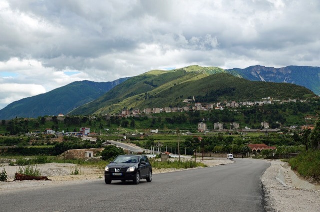
The main road through the Këlcyrë Gorge connects the town to Tepelenë to the north and other centres of Albania. To the south, the road continues toward Përmet and onward to Greece. The road leading north in the direction of Berat is paved for only a short distance, making long-distance travel in that direction difficult.
Several Eastern Orthodox churches of considerable age are located in the area around Këlcyrë. The Këlcyrë Castle is identified as a tourist attraction near the town.
Notable people associated with Këlcyrë include Ali Këlcyra, a politician; Sejfulla Malëshova, a writer and politician who founded the Albanian League of Writers and Artists in 1945; and Veli bej Këlcyra, who was a signatory of the Albanian Declaration of Independence.
Tháng nóng nhất là August (nhiệt độ cao trung bình ngày 32°C), tháng lạnh nhất là January (nhiệt độ thấp trung bình ngày 2°C), và tháng mưa nhiều nhất là November (167 mm). Tổng lượng mưa hàng năm trung bình 1,177 mm.
| Tháng | Cao | Thấp | Mưa | Ngày mưa | Nắng/ngày |
|---|---|---|---|---|---|
| January | 10°C | 2°C | 139 mm | 12 | 6.7 h |
| February | 12°C | 3°C | 120 mm | 11 | 7.6 h |
| March | 15°C | 5°C | 117 mm | 12 | 9.0 h |
| April | 19°C | 9°C | 94 mm | 13 | 10.5 h |
| May | 24°C | 13°C | 77 mm | 11 | 11.7 h |
| June | 28°C | 18°C | 49 mm | 8 | 13.5 h |
| July | 31°C | 20°C | 26 mm | 6 | 13.7 h |
| August | 32°C | 20°C | 26 mm | 5 | 12.8 h |
| September | 26°C | 16°C | 88 mm | 9 | 10.5 h |
| October | 22°C | 12°C | 117 mm | 9 | 8.9 h |
| November | 16°C | 8°C | 167 mm | 12 | 6.8 h |
| December | 12°C | 4°C | 158 mm | 12 | 6.1 h |
Nguồn: ERA5 reanalysis via Open-Meteo, 1994–2023 · "Cao" và "Thấp" là nhiệt độ không khí tối đa và tối thiểu trung bình ngày. "Ngày mưa" tính những ngày có lượng mưa ít nhất 1 mm.
Sông · Gjirokastër
One of the last large free-flowing rivers in Europe, declared a Wild River National Park in March 2023.
Thị trấn · Gjirokastër
A small Vjosa-side town known for its fruit preserves, thermal baths and polyphonic singing.
Thị trấn · Gjirokastër
Ali Pasha's birthplace, at the confluence of the Vjosa and the Drino.
Suối · Gjirokastër
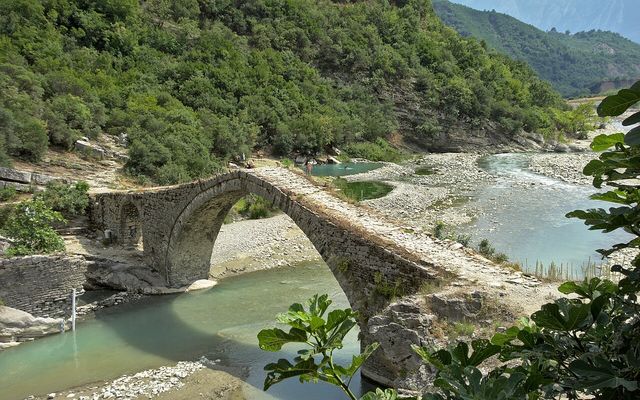
Sulphur pools beside the Ottoman Katiu bridge, at the mouth of the Lengarica canyon.
Có thông tin sai trên trang này? Chúng tôi hoan nghênh các đề nghị đính chính và sẽ đối chiếu với hồ sơ nguồn. Hãy cho chúng tôi biết điều gì sai và, nếu có thể, nguồn số liệu chính xác là ở đâu.