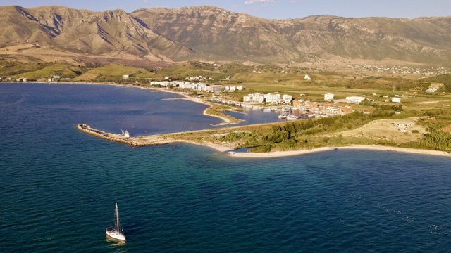
Ciudad · Vlorë
Vlorë
Where the Adriatic meets the Ionian, and where Albanian independence was declared in 1912.
Cada condado, cada costa, cada siglo
Vista guiada
¿Nuevo en Albania? Cada página comienza con una explicación en lenguaje sencillo que cualquiera podría entender, antes de entrar en los detalles.
Vista experta
Ya conoces los fundamentos. Directo al contenido, con las explicaciones básicas ocultas. Esta es la vista predeterminada.
Asunto · Vlorë County
Albania's largest island: a former Italian and then Soviet-era military base at the mouth of the Bay of Vlorë.
Guardar
Sazan is the biggest island in Albania. It has no ordinary residents — it was a military base for a long time, first Italian, then Albanian. Day trips from Vlorë now visit part of it.
Sazan is the biggest island in Albania. It has no ordinary residents — it was a military base for a long time, first Italian, then Albanian. Day trips from Vlorë now visit part of it.
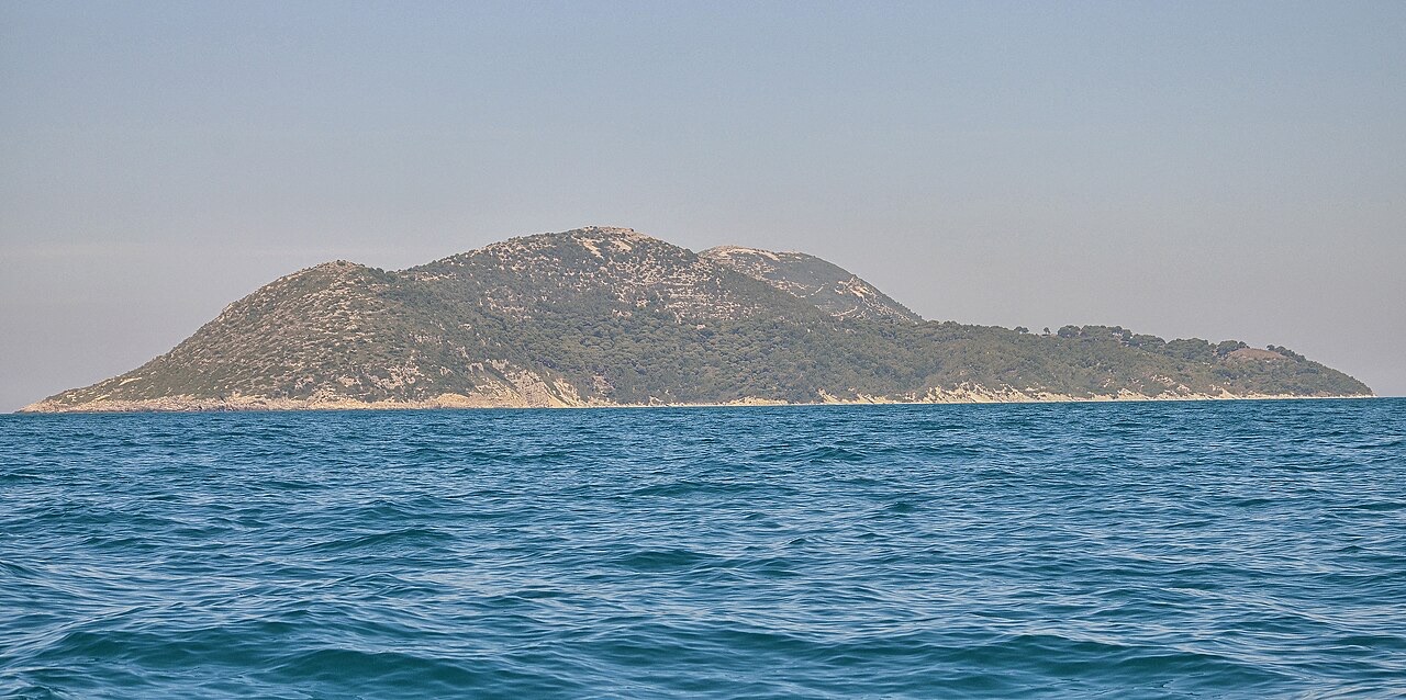
Sazan is the largest island in Albania and the country's westernmost point. It lies in the Adriatic Sea at the entrance to the Bay of Vlorë, positioned in the eastern Strait of Otranto, the passage separating Albania from Italy. International scientific bodies place the informal boundary between the Adriatic Sea and the Ionian Sea just to the south of the island, making Sazan's position a geographical threshold between the two seas.
The island has a surface area of 5.7 km², measuring 4.8 km in length and 2 km in width. Its coastline runs approximately 15 km, characterised by sandy beaches, capes, rocky cliffs, and underwater fauna. Along the western shore, cliffs descend up to 40 m below the waterline. In clear weather, the island is sometimes visible from the coast of Salento in southern Italy to the west.
Sazan is composed primarily of limestone formed during the Cretaceous period, with the eastern part partially composed of terrigenous and clastic deposits. It has four peaks: the highest at 344 m above sea level, two central peaks at 331 m and 307 m, and a southern peak at 228 m. Named features along the coast include the Bay of Paradise, the Bay of St. Nicholas, Cape of Shënkoll, Cape of Kallam, Cape of Jug, Cape of Pëllumba, and Cape of Pulbardha.
The ancient Greeks knew the island as Sason (Σάσων) and the Romans called it Saso. The Periplus of Pseudo-Scylax includes a mention of it, establishing the island's documented presence in ancient geographical literature.
The historian Polybius recorded that Philip V of Macedon used Sazan as a staging point during naval operations off Illyria. Philip anchored his fleet there while waiting for intelligence on Roman movements. Upon receiving false reports of a strong Roman naval force, he withdrew his entire fleet, forgoing the opportunity to strike at Apollonia and potentially seize control of Illyria while Rome was occupied with Hannibal's campaign. The island subsequently formed part of the Roman Empire and later passed under Byzantine rule.
In 1264, the island was the site of a naval clash between the Republic of Genoa and the Republic of Venice, known as the Battle of Sazan. In 1279, it was captured by the Kingdom of Albania, and during the 14th century it was held by Albanian lords, generally under Venetian protection.
Following the seizure of Vlorë by the Balsha noble family in 1371–1372, many inhabitants of the surrounding area fled to Sazan and placed themselves under Venetian protection. Venice effectively exercised practical control over the island even though the Balshas retained authority over the mainland territories of Vlorë and Kaninë. By the late 1380s, Comita Muzaka, widow of Balsha II, formally acknowledged Venetian dominion by committing to an annual tribute of rowers for the Venetian fleet. By 1393, Venetian control of Sazan was securely established.
A document dated 18 September 1372 from Ragusa records a maritime incident connected to the island. A sailor named Jurça appeared before the rector Ser Johannes de Grede to report that Potrentinus, his brother Miralia, and Goico Stanče of Vlorë—then residing on Sazan—had the previous June captured him along with two of his ships, seizing fifteen gold ducats, two swords, three shields, a bow with its string, a barrel of wine, and two sacks of cloth. He and his sailors were also detained for a full month. The event is preserved in the 'Lamento de foris 1370–1373.'
Following Comita's death, her daughter Rugjina Balsha's husband Mrkša Žarković ruled the Principality of Vlorë from 1396 to 1414, after which Rugjina Balsha herself ruled from 1414 to 1417. By 1418 the advancing Ottomans had captured the region, bringing Vlorë, the surrounding bay, and Sazan under Ottoman control. By 1696, the island had reverted to Venetian suzerainty.
Before the establishment of Ottoman control, Sazan served as both a religious site and a navigational landmark in the southern Adriatic. The island hosted a Marian shrine recorded in Italian sources as S. Maria della Suazi, later identified with a Greek Orthodox chapel dedicated to the Virgin Mary. By the late 15th century, a second chapel dedicated to Saint Nicholas was also recorded on the island. These shrines were part of a wider network of coastal sanctuaries along Adriatic maritime routes, including S. Maria de Casopoli in Corfu and S. Maria de le Scanfarie in the Strofades Islands.
The bays of Sazan provided sheltered anchorage along a stretch of the Adriatic where sailors faced dangerous currents, storms, and the risk of shipwreck. Monastic buildings on the island contributed to its reputation for holiness. Pilgrimage itineraries and liturgical sources, including a text known as the Sante Parole, mention Sazan, indicating its significance as a religious site for travelers during the Late Middle Ages.
By the late 15th century, the island had also become an important Ottoman naval base. A travel account by Arnold von Harff in 1497 described Sazan as a very fine harbour where the Ottomans regularly stationed ships, noting two small Greek Orthodox chapels and the use of the island by the Sultan for grazing valuable horses. The Ottoman expedition of 1480 across the Adriatic to Apulia and Calabria, which resulted in the capture of Otranto, was launched from Sazan. In 1521, the Ottoman admiral and cartographer Piri Reis, in his Kitab-ı Bahriye, described the island as a navigational landmark, noting the presence of drinking water and a landing place on its eastern side, ruins of a church, the need to anchor in ten fathoms of water to avoid a rocky seabed, and a submerged reef nearby.
After the Napoleonic Wars ended in 1815, Sazan came under British control together with the Ionian Islands under the Treaty of Paris. In 1864, Britain ceded the Ionian Islands, including Sazan, to Greece. Greece did not occupy the island, however, leaving it under de facto Ottoman control until 1912, when Greek forces landed to occupy it formally.
At the end of the First Balkan War in 1913, Italy took control of Sazan and established a military post there. This arrangement was later ratified by the secret Treaty of London on 26 April 1915. On 2 September 1920, Albania formally ceded the island to Italy under the Albano-Italian protocol. During the period of Italian administration, which lasted until after World War II, Sazan was administered as part of Lagosta in the province of Zara. Italian authorities constructed a lighthouse and naval fortifications, and relocated a small number of fishing families from Apulia to populate the island.
During World War II, Sazan served as a base for German and Italian submarines. The 1947 Paris Peace Treaty transferred sovereignty over the island to Albania.
During the Cold War, Albania's reliance on the Soviet Union led to a significant Soviet military build-up on and around Sazan. The Soviets constructed a base for Whiskey-class submarines and a chemical–biological weapons plant on the island and surrounding areas, and stationed approximately 3,000 military personnel there.
The Soviet-Albanian split in the early 1960s ended the Soviet naval presence on Sazan. After the fall of communism, four submarines were left at Pasha Limani port in the Bay of Vlorë. Soviet-era gas masks remain scattered around the island's valley. Albania also constructed approximately 3,600 nuclear bunkers on the island during the Cold War period. A villa on the island formerly belonged to the communist-era defence minister Beqir Balluku.
Sazan is designated a military exclusion zone and is currently uninhabited by civilians. A small joint Italian–Albanian naval base, reportedly staffed by two soldiers, operates on the island. Its stated functions include countering contraband between southern Italy and Albania, providing a training ground for the British Royal Navy, and offering shelter for boats in nearby Albanian waters. The island was opened to the public in July 2015.
In 2010, the Albanian government designated 2,721.87 hectares of the marine area surrounding Sazan and the adjacent Karaburun Peninsula as the Karaburun-Sazan Marine National Park. A small waterspout or tornado was observed along the coast moving inland in August 2002.
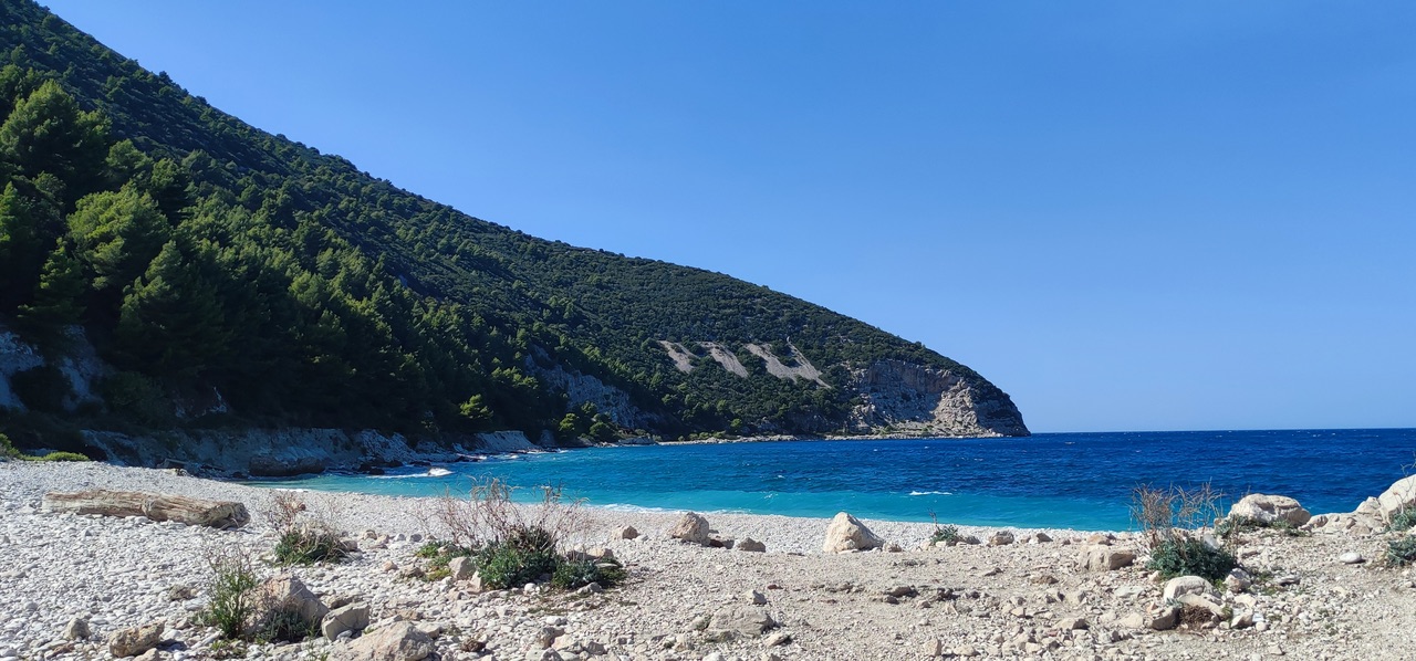
Biogeographically, Sazan falls within the Illyrian deciduous forests terrestrial ecoregion of the Palearctic Mediterranean forests, woodlands, and scrub biome. The island's position between the western and eastern Mediterranean, combined with variations in altitude, geology, and hydrology, has produced a distinctive flora. The island contains 435 species of vascular plants (419 of them indigenous), representing 8.2 percent of Albania's entire vascular flora. One species, Limonium anfractum, is endemic to the island; three further species are subendemic: Centaurea pawlowski, Scutellaria rupestris, and Verbascum guicciardii.
The rocky limestone cliffs and shores support numerous halophile species. The island's forests consist of shrubs, sclerophyll forest with holm oak, deciduous forest with hophornbeam, and forest with south European flowering ash. The fauna includes 15 species of mammals—among them 8 bat species, including the common pipistrelle and soprano pipistrelle—39 bird species, 8 reptile species, 1 amphibian species, and 122 species of invertebrates.
Among the bird species, those with high conservation value include 23 songbirds, 5 birds of prey, 3 pigeons, and 3 swifts. The sole recorded amphibian is the green toad. Reptiles present include the Mediterranean house gecko, Hermann's tortoise, Balkan pond turtle, sheltopusik, blue-throated keeled lizard, Balkan wall lizard, Montpellier snake, and Balkan whip snake. Of the 122 identified invertebrate species, 113 are insects; the article notes that the actual number of invertebrate species is estimated to be higher than the identified total. The insect count includes 40 beetles, 16 butterflies, 22 heteroptera, 20 orthoptera, 5 dragonflies, and 10 hymenoptera.
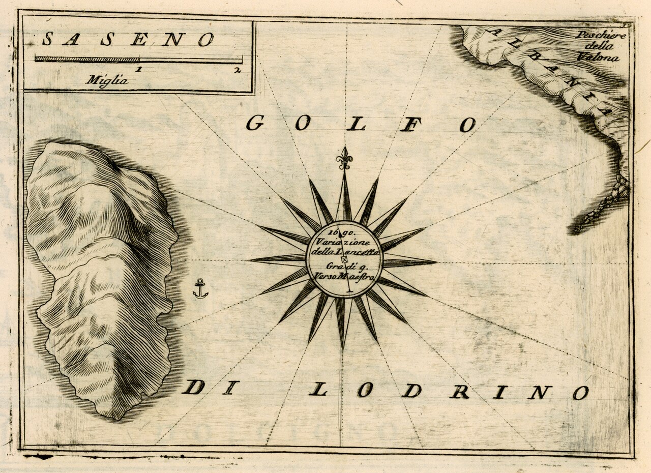
In 2024, Jared Kushner and his company Affinity Partners proposed the construction of a resort on Sazan Island and on several hundred hectares of the Vjosa-Narta protected landscape. The proposal followed a visit to the island by Kushner and Ivanka Trump.
In 2026, environmental protests known as the Flamingo Revolution erupted in Zvërnec, the mainland settlement facing the island, after the Albanian government approved the resort development. Opponents of the project allege that construction in the nearby Pishë Poro–Narta protected area causes damage to wetlands, dunes, and forested areas. Albanian authorities maintain that the works comply with permit and environmental regulations. The protests led to confrontations between demonstrators, private security personnel, and police.
El mes más cálido es August (máxima diaria media 31°C), el más frío es January (mínima diaria media 6°C), y el más lluvioso es November (142 mm). La precipitación anual total promedia 1,037 mm. La temperatura del mar alcanza su máximo en agosto, en torno a 25°C.
| Mes | Máx. | Mín. | Lluvia | Días de lluvia | Sol/día | Mar |
|---|---|---|---|---|---|---|
| January | 12°C | 6°C | 103 mm | 12 | 7.4 h | 17°C |
| February | 13°C | 6°C | 98 mm | 11 | 8.3 h | 15°C |
| March | 15°C | 8°C | 97 mm | 11 | 9.8 h | 15°C |
| April | 18°C | 11°C | 82 mm | 11 | 11.0 h | 16°C |
| May | 23°C | 15°C | 63 mm | 8 | 12.2 h | 18°C |
| June | 28°C | 19°C | 41 mm | 6 | 13.6 h | 22°C |
| July | 30°C | 21°C | 26 mm | 5 | 13.8 h | 25°C |
| August | 31°C | 22°C | 30 mm | 5 | 12.9 h | 25°C |
| September | 26°C | 18°C | 101 mm | 9 | 10.8 h | 25°C |
| October | 22°C | 14°C | 123 mm | 9 | 9.3 h | 24°C |
| November | 17°C | 11°C | 142 mm | 12 | 7.4 h | 20°C |
| December | 13°C | 7°C | 131 mm | 13 | 6.8 h | 18°C |
Fuente: ERA5 reanalysis via Open-Meteo, 1994–2023 · «Máx.» y «Mín.» son la temperatura del aire máxima y mínima diaria media. «Días de lluvia» cuenta los días con al menos 1 mm de precipitación.
Ciudad · Vlorë
Where the Adriatic meets the Ionian, and where Albanian independence was declared in 1912.
Área protegida · Vlorë
Albania's only marine national park: sea caves, wrecks and the country's clearest water.
Localidad · Vlorë
A marina town at the foot of Llogara, beside the ancient harbour of Oricum.
Asunto · Vlorë
Albania's largest uninhabited peninsula, closed to the public for most of the 20th century and now a marine park.
¿Algo incorrecto en esta página? Las correcciones son bienvenidas y se contrastan con el registro fuente. Indíquenos qué es incorrecto y, si puede, de dónde procede el dato correcto.