城市 · Vlorë
Sarandë
The Ionian resort town facing Corfu, and the arrival point for most visitors to southern Albania.
每个县、每段海岸、每个世纪
引导视图
初次了解阿尔巴尼亚?每个页面均以通俗易懂的说明开篇——即便是十岁的孩子也能读懂——随后再展开详细内容。
专业视图
您已掌握基础知识。直接进入正题,简明解释默认隐藏。此为默认模式。
主题 · Vlorë County
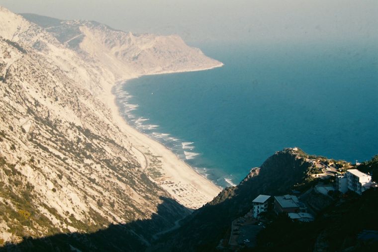
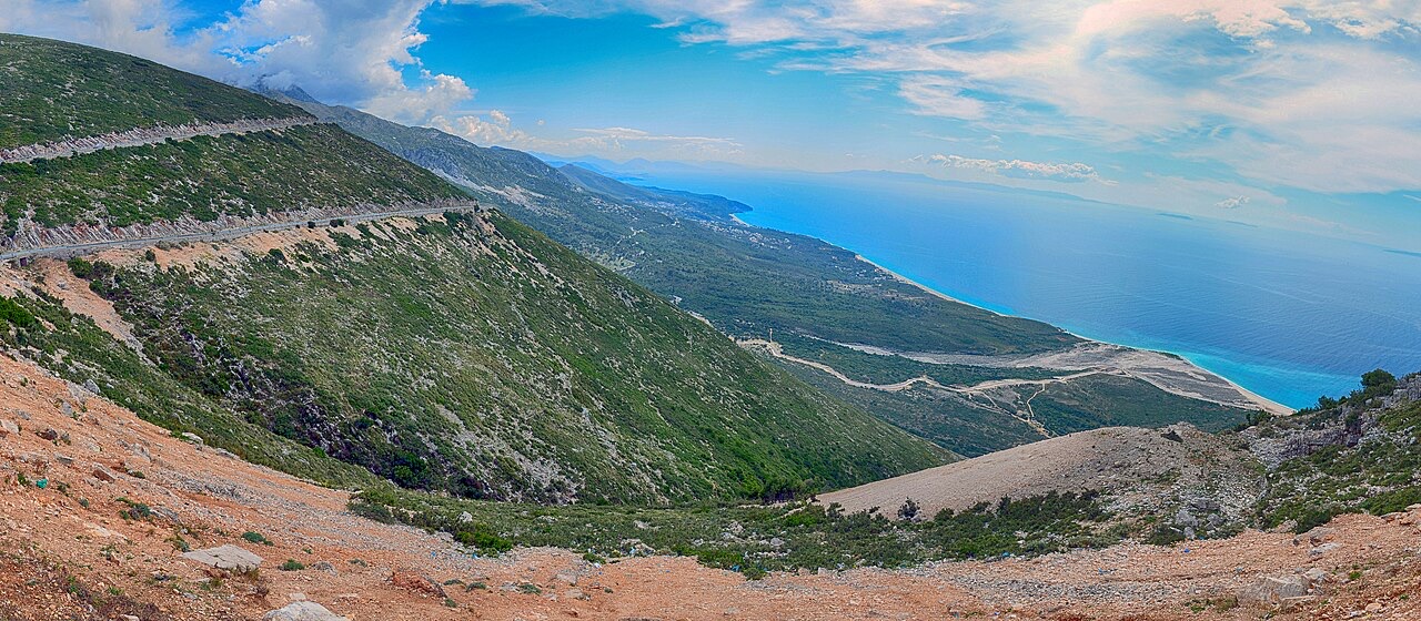
The 120 km of Ionian coast between the Llogara pass and Sarandë, where the Ceraunian mountains fall straight into the sea.
保存
The Albanian Riviera is the stretch of coast in the south where tall mountains come right down to a very blue sea. It has lots of small pebble beaches, old stone villages up on the slopes, and one main road that winds along above the water.
The Albanian Riviera is the stretch of coast in the south where tall mountains come right down to a very blue sea. It has lots of small pebble beaches, old stone villages up on the slopes, and one main road that winds along above the water.
The Albanian Riviera — known in Albanian as Riviera shqiptare and colloquially as Bregu — runs along the north-eastern Ionian Sea, a section of the Mediterranean, covering the districts of Sarandë and Vlorë in south-western Albania. It forms part of the broader Albanian Ionian Sea Coast and is distinct from the country's Adriatic Sea Coast to the north, which is mostly flat in character.
The Ceraunian Mountains form the inland boundary of the riviera, separating the coastal strip from the hinterland. The coastline is punctuated by the villages of Palasë, Kondraq, Dhërmi, Ilias, Vuno, Himara, Pilur, Kudhës, Qeparo, Borsh, Piqeras, Sasaj, Lukovë, Shën Vasil, and Nivicë-Bubari, among others. Physical features along the coast include bays, coves, seaside canyons, mountain passes, caves, rivers, and beaches alongside orange, lemon, and olive groves.
During the classical period, on 4 January 48 BCE, Julius Caesar landed at Palasë while pursuing his rival Pompey. He rested his legion there before continuing northward through the Llogara Pass, a point subsequently referred to in historical record as Caesar's Pass.
Palasë today remains a village in close proximity to the Llogara National Park and continues to receive foreign visitors. Its connection to Caesar's campaign represents one of the earliest documented episodes of military transit along what is now the Albanian Riviera.
The riviera gained wider international attention following the 2009 reconstruction of coastal road SH8. Subsequent events accelerated its profile: in 2010, DJ Tiësto made a tour stop in Dhërmi, and a Top Gear episode featuring a car pursuit along the winding coastal road brought the area to a broader television audience.
In 2012, Frommer's travel guide designated the Albanian Riviera as its Top Value Destination. Tourist numbers increased significantly from 2016 onward. Visitors have come increasingly from the United Kingdom, Germany, Italy, Sweden, France, Bosnia and Herzegovina, Poland, Ukraine, Moldova, North Macedonia, Serbia, and Croatia.
The Albanian Riviera has hosted several international music festivals, including the Kala Festival, Soundwave Albania, and Turtle Fest. Established nightlife venues include Havana Beach Club, located near Dhërmi, while Folie Marine opened more recently at Jalë beach.
Dhërmi itself is described as a nightlife destination, and Jalë is separately noted for its nightlife character. This clustering of festival and club activity has become a distinct component of the riviera's contemporary identity alongside its coastal and ecological features.
As part of a regional master plan, the World Bank and other institutions are financing local infrastructure projects along the riviera. Funded works include the renovation of roofs and facades of traditional houses overlooking the coast, the redesign of town squares, and the construction of water supply and treatment plants.
The coastal accommodation sector has expanded notably around Dhërmi, where a boom in construction has produced wooden villa complexes and modern boutique hotels. Dhërmi village itself sits on a slope of the Ceraunian Mountains at approximately 200 metres in altitude.
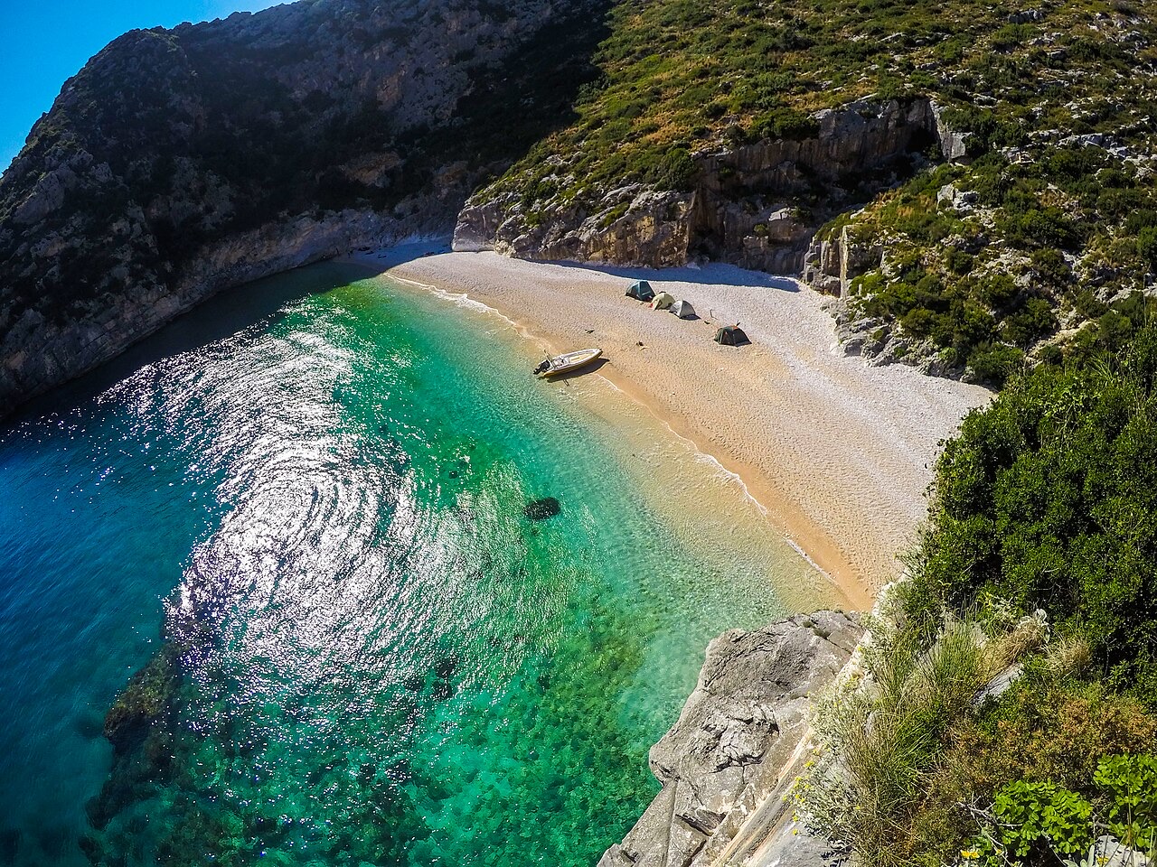
Sarandë is described as one of the most important tourist attractions on the riviera. Ksamil, a coastal resort near Sarandë, is among the most frequently visited by both domestic and foreign tourists; a small archipelago, the Ksamil Islands, lies just off the coast of the village. Lëkurësi Castle stands on a hill overlooking Sarandë's horseshoe bay, from which Ksamil, Corfu, and the Butrint Lagoon are visible.
Borsh holds the distinction of having the largest beach on the Albanian Ionian coast, stretching 7 kilometres. Tourism infrastructure there remains limited, consisting of a small number of hotels and guesthouses. Himara features long white sandy beaches; the hills near the sea are terraced and planted with olive and citrus trees, and above the modern town lies an old walled settlement containing a castle and fortified stone houses.
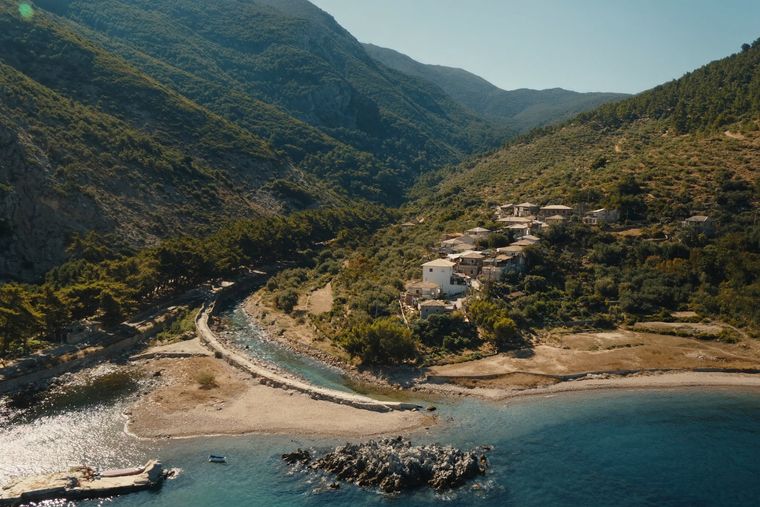
Qeparo is divided into two settlements. Old Qeparo occupies a hilltop above olive groves at approximately 450 metres (1,480 ft) above sea level on the western slope of Mount Gjivlash, while the newer settlement extends down the hillside toward the beach. Lukovë, in Vlorë County, is known for its beaches and terraced hillsides planted with olive groves.
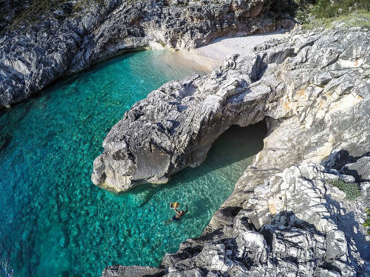
Llogara National Park lies adjacent to the riviera and is recorded as supporting over 100 types of wild animals and birds, including deer, wild cats, and foxes. Its elevation gives it a mountain-air character in proximity to the sea, and the park is noted as a site for ecotourism, picnicking, hiking, and air sports.
The Karaburun Peninsula is Albania's only national marine park. The peninsula is recorded as entirely undeveloped and supports wildlife including deer, foxes, wild boars, and wolves. A portion of the peninsula's mountains carries national park designation. The Canyon of Gjipe, located between Iljas and Vuno, is accessible only on foot via a hiking route from the Monastery of St. Theodore.
Porto Palermo Castle stands in the bay of Porto Palermo, a few kilometres south of Himara. Huffington Post ranked it first among 15 Undiscovered European Destinations for 2014. The structure popularly known as the Triangular Fortress — associated with this site — was built under Venetian dominion in the late 15th or early 16th century and served as a base for Venetian interests in fishing, grazing, olives, and timber around Butrint.
The Ali Pasha Castle takes its name from Ali Pasha of Tepelenë, who used it as a secondary residence until 1820. The current fortress was rebuilt in 1819 and features three towers. Borsh Castle is also known as the Castle of Sopot, after the hill on which it stands. Lëkurësi Castle occupies a strategic elevated position overlooking Sarandë bay.
Zvërnec Island, situated within the Narta Lagoon, contains the Zvërnec Monastery, a Byzantine foundation dated to the 13th century and described as well preserved.
Butrint, near Sarandë, was an ancient city and is a UNESCO World Heritage Site. The Venetian fortress referenced in the castles section was constructed specifically to exploit resources in and around Butrint, indicating the site's long-term strategic and economic significance.
Piqeras village is recorded as the birthplace of Vasil Laçi, described as an Albanian national hero who attempted to assassinate Victor Emmanuel III, King of Italy, and Shefqet Bej Vërlaci, Prime Minister of Albania, following the occupation of Albania by fascist Italy.
城市 · Vlorë
The Ionian resort town facing Corfu, and the arrival point for most visitors to southern Albania.
城镇 · Vlorë
The centre of the Riviera coast: a Greek-speaking historical community, an old hill village and a string of coves.
保护区 · Vlorë
A pine-forested pass at 1,027 m where the road drops from mountain forest to the Ionian in a few kilometres.
海滩 · Vlorë
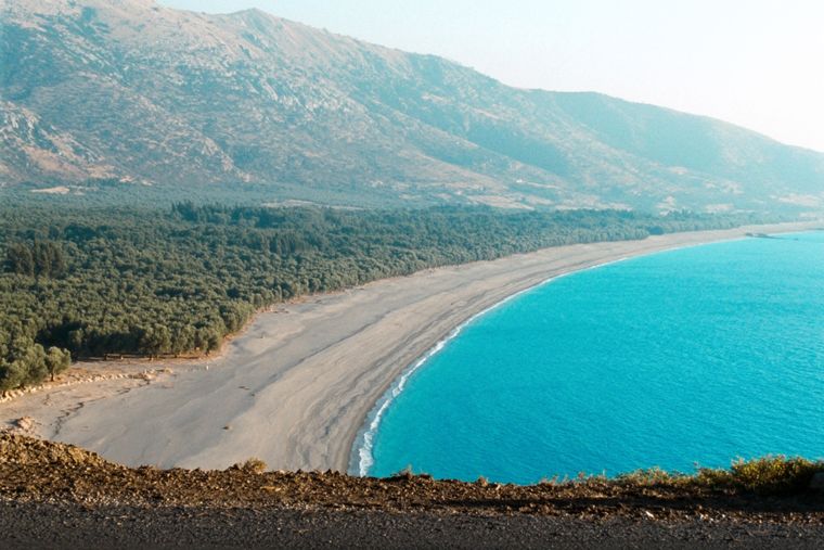
At roughly 7 km, the longest single beach on the Riviera, backed by one of Albania's largest olive groves.
村庄 · Vlorë
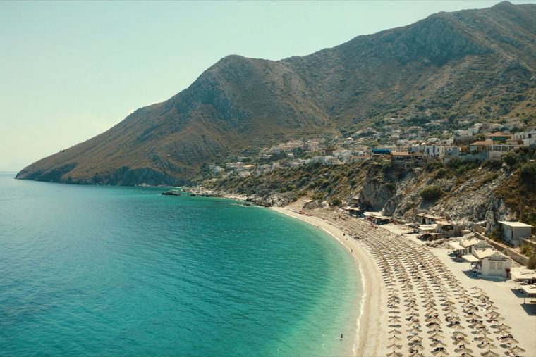
An old white village on the slope above one of the Riviera's longest pebble beaches.
国家
A mountainous country of about 2.4 million people on the Adriatic and Ionian seas, between Montenegro, Kosovo, North Macedonia…
城镇 · Vlorë
Four small islands and very clear shallow water; the most photographed and most crowded stretch of the Albanian coast.
山脉 · Vlorë
The coastal ridge that makes the Riviera: 2,000 m peaks rising directly out of the Ionian.
海滩 · Vlorë
A long white pebble shore under the Ceraunian ridge, and the Riviera's main nightlife strip.
海滩 · Vlorë
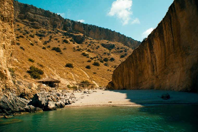
A pebble beach at the mouth of a limestone canyon, reachable only on foot or by boat.
海滩 · Vlorë
The first Riviera beach south of the Llogara pass, below the road's most dramatic descent.
工业
The fastest-growing part of the economy, concentrated on the southern coast and in a short summer season.
海滩 · Vlorë
A run of small coves — Bunec, Krorëz and Shpella — below the village of Lukovë.
本页内容有误? 欢迎提交更正意见,所有意见均会与原始记录核对。请告知错误所在,如能提供正确数据的出处,请一并注明。