- Type
- Archaeological city
- Period
- 4th century BC – 6th century AD
- Area
- About 30 ha inside the walls — the largest excavated Illyrian city
- Basilicas
- Five early Christian basilicas with mosaic pavements
In einfachen Worten
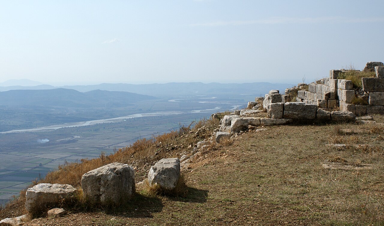
Byllis was a city built by the Illyrians on a flat hilltop with a big view over the valley. Later, Christians built five churches there with mosaic floors.
Einfache Erklärung
Byllis was a city built by the Illyrians on a flat hilltop with a big view over the valley. Later, Christians built five churches there with mosaic floors.
Auf dieser Seite
Identity and location of Byllis
Byllis (Albanian: Bylis; Greek: Βύλλις; Latin: Byllis), also recorded as Bullis or Boullis (Βουλλίς), was an ancient city and the chief settlement of the Illyrian tribe of the Bylliones. It was traditionally located in southern Illyria. In Hellenistic times the city was considered part either of Illyria or of Epirus, depending on the period; under Roman administration it fell within Epirus Nova, in the province of Macedonia.
The remains of Byllis lie north-east of Vlorë, 25 kilometres from the sea, in the district of Hekal, Fier County, Albania. The Albanian government designated the site as an archaeological park on 7 April 2003. The location on the northern edge of the Vjosa valley placed Byllis at the edge of the spheres of influence of Apollonia, Epidamnos, and Epirus, and the city's foundation in the 4th century BC is likely connected to the presence of bitumen mines near Selenica, on the opposite edge of the valley.
-
Antiquity
Attestation of the name in ancient sources
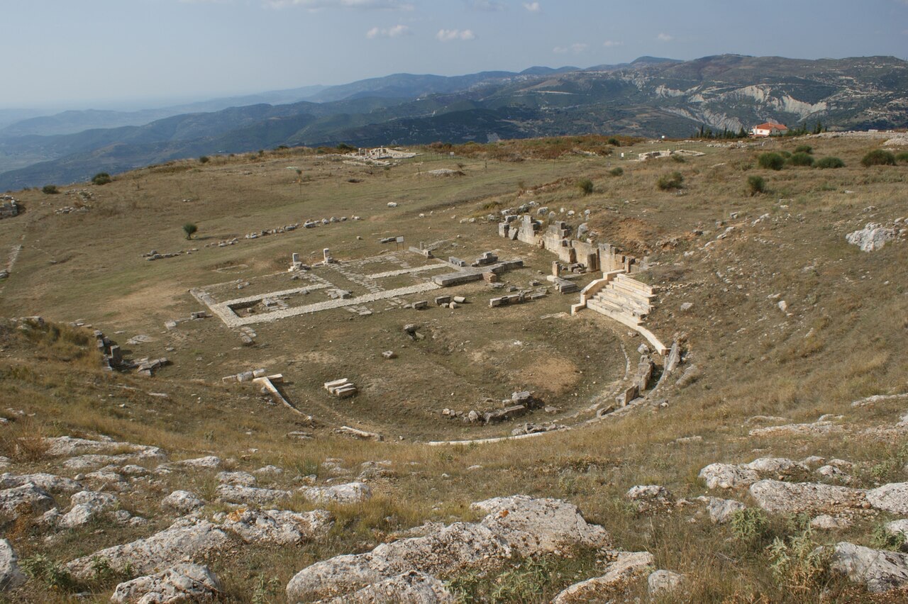
Byllis Theater. Byllis - Albania - Theater Albinfo · Public domain · Wikimedia Commons The toponym Βύλλις is attested on epigraphic material from the 3rd–2nd centuries BC, while Ptolemy records it as Βουλλίς (Boullis) in his Geography. The city's ethnic designation, Βυλλίων (Byllion), appears on a 4th-century BC inscription on a lead oracular tablet from Dodona and on Hellenistic-era coins of the 3rd–2nd centuries BC. Pseudo-Scymnus uses the form Βουλινός (Boulinos).
The only ancient source to attest the city explicitly as a polis is Stephanus of Byzantium, writing in the 6th century AD, who describes it as πόλις Ἰλλυρίδος — a city of Illyria — and gives its ethnicon as Βυλλιδεύς (Bullideus). Stephanus also records a foundation legend in which Myrmidons under Neoptolemus founded the city while returning from the Trojan War, a tradition reflected in Hellenistic-era numismatics but contradicted by archaeological research.
The relationship between the city's name and the name of the tribe has attracted scholarly debate. Both the legend ΒΥΛΛΙΣ (associated with the civic ethnic Βυλλιδεύς) and ΒΥΛΛΙΟΝΩΝ (associated with the tribe of the Bylliones) appear on coins issued by the koinon of the Bylliones. A recent analysis of the epigraphy and numismatics suggests an alternating use: one name for the ethnos and its territory, the other for the tribal polis that served as the capital of the ethnos and was internally organised through the decision-making bodies of the koinon.
-
Antiquity
Foundation and early Illyrian settlement, c. 450–350 BC
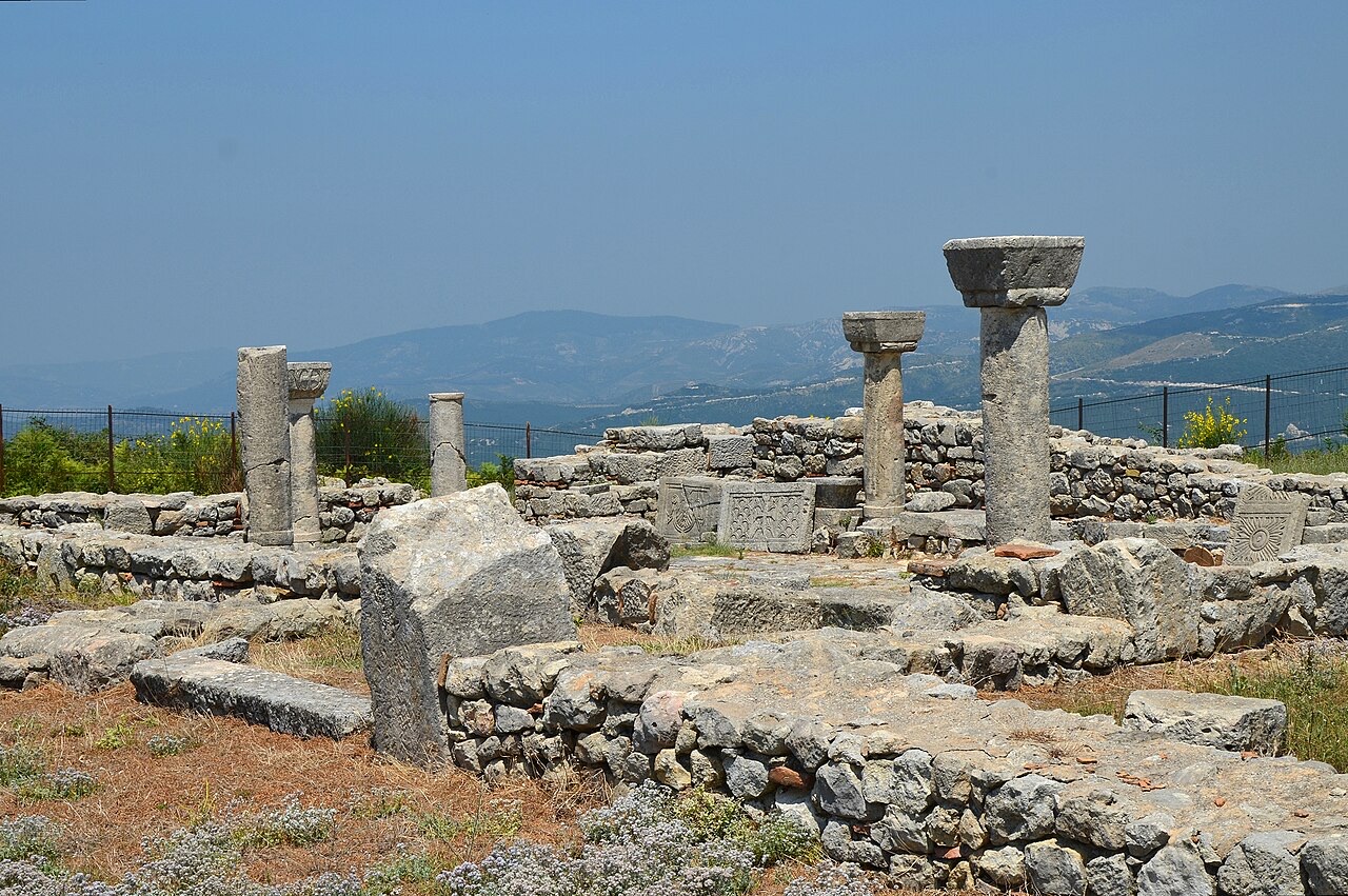
Basilica C, church of average dimensions built in 525-550 AD and paved with mosaics, it had three naves, a narthex covered by a gallery…. Basilica C, church of average dimensions built in 525-550 AD and paved with mosaics, it had three naves, a narthex covered by a gallery, preceded by a portico and several annexes, Byllis, Albania Carole Raddato from FRANKFURT, Germany · CC BY-SA 2.0 · Wikimedia Commons Byllis was founded around 350 BC on the territory of the Illyrian community of the Bylliones, on a site where a proto-urban Illyrian hilltop settlement had already existed during the previous century. The earliest known written reference to the Bylliones is a 4th-century BC inscription on a lead foil found at the sanctuary of Dodona, in which the Bylliones ask to which deity they should sacrifice to ensure the safety of their possessions.
At its inception, Byllis was one of several fortified Illyrian hilltops controlling the elevated terrain of the Mallakastër region. The fortification walls constructed around 350 BC used isodomic ashlar masonry; they ran 2.25 kilometres in length and were 3.5 metres wide, enclosing an area of 30 hectares around a steep hill. The city walls contained six gates, two of which received the road coming from Apollonia, which crossed the city on its way towards Macedonia via the gorges of the Vjosa river, or towards Epirus via Antigonia.
-
Antiquity
Hellenistic development and Macedonian and Epirote involvement
Byllis experienced substantial development during the Hellenistic period, serving as the chief settlement of the Illyrian koinon of the Bylliones, whose several hilltop centres are found in the lower valley of the Vjosa river. The creation of Hellenistic cities such as Byllis in the territory of southern Albania has been attributed to the successors of Alexander the Great and to Pyrrhus of Epirus.
In 314 BC the territorial community of Byllis was occupied by Cassander of Macedon. After two years, the Illyrian king Glaukias of the Taulantii expelled the Macedonians from the region. The area subsequently came under the control of Pyrrhus of Epirus and his son Alexander II of Epirus. In 270 BC the Illyrian king Mytilos established control over the hinterland of Apollonia, though the sources indicate that the life of Byllis continued without major disruption.
By the 3rd century BC, the city possessed a stadium, a theatre, an agora, two stoas, a cistern, and a peristyle temple. The Illyrian koinon of the Bylliones, partly Hellenised and bilingual, functioned after 232 BC as a coalition comprising Byllis and Nikaea; Byllis regarded Nikaea as one of its demes, as a 2nd-century BC inscription confirms. In 2011, during road reconstruction near the archaeological park, a statue of Hellenistic date was discovered that may depict an Illyrian soldier or a war deity.
Language, religion, and acculturation at Byllis
Local inscriptions at Byllis begin in the middle of the 4th century BC and point to a polis-like organisation. All surviving inscriptions are in Greek, as are the titles of officials and the institutional terminology of the settlement. These inscriptions reveal features characteristic of the north-western Greek dialect.
Archaeological exploration has not yet uncovered a sanctuary or temple within Byllis itself, but a series of inscriptions document the adoption of the Ancient Greek cults of Zeus, Hera, Dionysius, and Artemis. More specifically attested cults include those of Zeus Tropaios, Hera Teleia, Poseidon, and Parthenos. Ancient sources and epigraphic material also attest a fire sanctuary with an oracle, called Nymphaion in ancient Greek historiography, situated on the border with Apollonia near the bitumen mines. A fire symbol engraved on coins of Byllis minted in the 3rd–2nd century BC, and a relief found near the city depicting nymphs and a cloth wrapped around fire, suggest an admixture of local Illyrian cult traditions with practices brought by Greek colonists at Apollonia.
The personal names recorded in Hellenistic epigraphic material at Byllis belong predominantly to the northern Greek onomastic sphere — for example, Alexander, Andriscus, Archelaus, Nikanor, Philotas — while a smaller number are Illyrian, such as Preuratos, Triteutas, and Trasos. In the second half of the 20th century, Fanoula Papazoglu and N.G.L. Hammond argued that Byllis was an Ancient Greek foundation on Bylliones territory. Miltiades Hatzopoulos (1997) characterised it as the northernmost Greek city of non-colonial foundation in the region. By the 21st century, scholarly consensus has shifted toward viewing Byllis as an Illyrian city that progressively acquired the institutional and architectural forms of a Hellenistic town.
Because the southernmost Illyrian tribes, including the Bylliones, were inclined to become bilingual, Byllis was also a Greek-speaking city by the early 2nd century BC. During that period the city received theoroi — sacred envoys — from Delphi. The receipt of theoroi was restricted to cities considered Greek, indicating that by this time Byllis was regarded as a Greek city or that its inhabitants had become Greek-speaking. Scholars note that the time elapsed before Illyrian cities appeared on lists of theorodokoi shows that acculturation in southern Illyria was real but gradual.
The Roman-Illyrian war and sacking of Byllis, 169–168 BC
During the Roman-Illyrian war of 169/168 BC, the Bylliones initially sided with Rome against the Illyrian king Gentius. Subsequently, however, Byllis allied with the Molossians and Macedonians against the Romans, and as a consequence the Roman army sacked and destroyed the city.
This destruction marked the beginning of a long decline for Byllis. The name of the city appears in connection with the period of the Great Roman Civil War, but the city did not recover its former standing until the early 1st century BC.
Byllis as a Roman colony from 30 BC
After a prolonged decline, Byllis was refounded as a Roman colony in 30 BC. This status is confirmed by epigraphic evidence and by Pliny the Elder, who referred to it as Colonia Bullidensis. Strabo called its territory Bylliake (Βυλλιακή). The city was incorporated into the province of Epirus Nova under the Roman Empire.
The city walls at Byllis carry more than four inscriptions in Greek recording details of construction work ordered by Emperor Justinian I (483–565 AD) and carried out by an engineer named Victorinus. This late-antique building programme indicates that Byllis retained administrative significance into the Byzantine period, though the early Christian settlement was reduced in size compared with its Hellenistic and early Roman extent.
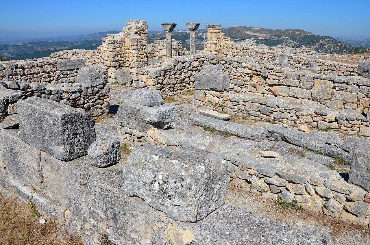
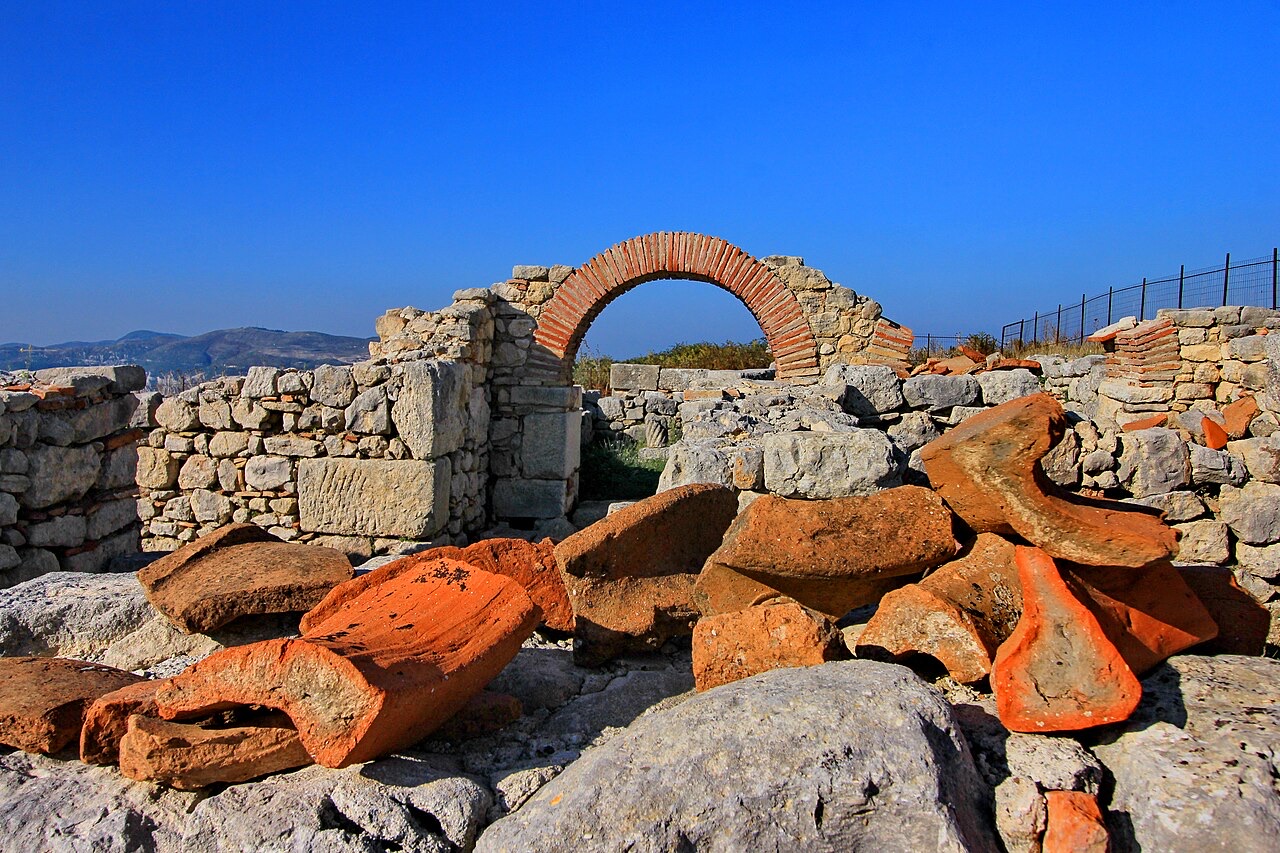
During the early Christian period a significant number of basilica churches were unearthed at Byllis, several of which contained mosaic floors and decorative carvings. Two of the basilicas may have had diaconicon chambers attached. A baptistery was established at the structure identified as basilica B.
Byllis as a bishopric and its ecclesiastical status
In late antiquity Byllis functioned as a bishopric. The ecclesiastical relationship between Byllis and the nearby see of Apollonia is, however, a matter of recorded uncertainty. One of the participants at the Council of Ephesus in 431 was a bishop named Felix, who signed on one occasion as Bishop of Apollonia and Byllis, and on another occasion simply as Bishop of Apollonia. Scholars have interpreted this in two ways: either that Apollonia and Byllis formed a single combined episcopal see, or that Felix held the see of Apollonia alone but was temporarily administering Byllis during a vacancy there.
At the Council of Chalcedon in 451, a bishop named Eusebius subscribed simply as Bishop of Apollonia, without reference to Byllis. In 458, in a letter from the bishops of Epirus Nova to the Byzantine Emperor Leo I, a bishop named Philocharis subscribed as Bishop of a place that manuscript editors believe should be read as Byllis, though the manuscripts themselves give the form 'Vallidus'. Whether Philocharis also held authority over Apollonia depends on how Felix's position in 431 is interpreted. The Annuario Pontificio lists Apollonia as a titular see, recognising it as a former residential diocese and a suffragan of the archbishopric of Dyrrachium; it does not extend the same recognition to Byllis.
Political organisation: the koinon of the Bylliones
Byllis served as the urban centre and political capital of the koinon of the Bylliones — a coalition whose several hilltop member communities were distributed across the lower valley of the Vjosa river. After 232 BC, the league is attested as comprising Byllis and Nikaea, with Byllis treating Nikaea as one of its demes. The koinon was internally organised with a political authority represented by its own decision-making bodies.
The dual nomenclature found on coinage — ΒΥΛΛΙΣ referring to the polis and ΒΥΛΛΙΟΝΩΝ referring to the broader tribe — reflects the distinction between the urban seat of the koinon and the wider ethnic community it governed. Both sets of legends appear on coins issued by the koinon itself, suggesting that the two designations were used in an alternating and complementary fashion rather than representing competing or separate authorities.
Archaeological remains and modern status
The archaeological remains at Byllis include the fortification walls built around 350 BC using isodomic ashlar masonry, which ran 2.25 kilometres and enclosed 30 hectares. Hellenistic-period remains include a theatre, a stadium, an agora, two stoas, a cistern, and a peristyle temple. Early Christian remains include multiple basilica churches with mosaic floors, carvings, diaconicon chambers, and a baptistery.
The Albanian government designated Byllis as an archaeological park on 7 April 2003. In 2011 a Hellenistic-period statue, possibly representing an Illyrian soldier or a war deity, was discovered during road reconstruction near the park. Systematic archaeological exploration has not yet located a sanctuary or temple within the city proper, leaving aspects of Byllis's religious topography unresolved.
Klima nach Monat
Der wärmste Monat ist August (mittleres tägliches Maximum 29°C), der kälteste ist January (mittleres tägliches Minimum 1°C), und der regenreichste ist November (150 mm). Der mittlere jährliche Gesamtniederschlag beträgt 1,191 mm.
| Monat | Maximum | Minimum | Niederschlag | Regentage | Sonne/Tag |
|---|---|---|---|---|---|
| January | 9°C | 1°C | 117 mm | 12 | 7.2 h |
| February | 10°C | 1°C | 105 mm | 11 | 8.1 h |
| March | 13°C | 3°C | 113 mm | 12 | 9.6 h |
| April | 17°C | 6°C | 100 mm | 13 | 10.8 h |
| May | 21°C | 11°C | 87 mm | 11 | 12.0 h |
| June | 26°C | 15°C | 62 mm | 9 | 13.6 h |
| July | 29°C | 18°C | 36 mm | 6 | 13.8 h |
| August | 29°C | 18°C | 40 mm | 7 | 12.8 h |
| September | 24°C | 14°C | 115 mm | 10 | 10.7 h |
| October | 20°C | 10°C | 126 mm | 10 | 9.2 h |
| November | 15°C | 6°C | 150 mm | 12 | 7.2 h |
| December | 10°C | 2°C | 141 mm | 12 | 6.6 h |
Quelle: ERA5 reanalysis via Open-Meteo, 1994–2023 · „Maximum" und „Minimum" sind das mittlere tägliche Temperaturmaximum bzw. -minimum. „Regentage" zählt Tage mit mindestens 1 mm Niederschlag.
Weitere Bilder
Verwandte Themen
In der Nähe

Fluss · Gjirokastër
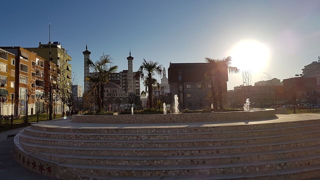
The Vjosa
One of the last large free-flowing rivers in Europe, declared a Wild River National Park in March 2023.
Kleinstadt · Fier
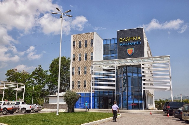
Ballsh
The seat of Mallakastër and the site of Albania's main oil refinery, near the ruins of Byllis.
Verwandte Themen
Historische Epoche
The Illyrians
The Indo-European tribes of the western Balkans, and the ancestors most Albanians claim.
Leitfaden
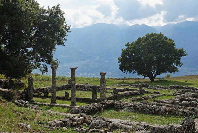
Archaeological Albania
Butrint, Apollonia, Byllis, Antigonea and Amantia: five sites that cover 2,500 years between them.
Quellen
- Wikipedia.
Byllis — English Wikipedia
· abgerufen 13 Oct 2026
Used to ground the deep-research section and as a discovery aid; not relied on alone for contested claims. - Wikidata.
Wikidata item Q1018544
· abgerufen 13 Oct 2026
Source of the population, area and elevation figures shown in Quick facts, each with its own observation year. - Open-Meteo / ECMWF.
Monthly climate normals, 1994–2023
· abgerufen 13 Oct 2026
Computed here from daily ERA5 reanalysis via Open-Meteo over 1994–2023. - Wikimedia Commons.
Photographs
· abgerufen 13 Oct 2026
Each photograph carries its own creator, licence and file link beneath it. Only public-domain, CC0, CC BY and CC BY-SA files are published.
Etwas falsch auf dieser Seite? Korrekturen sind willkommen und werden gegen den Quelldatensatz geprüft. Bitte mitteilen, was falsch ist und, wenn möglich, woher die richtige Angabe stammt.