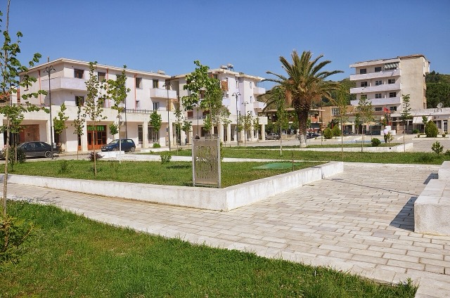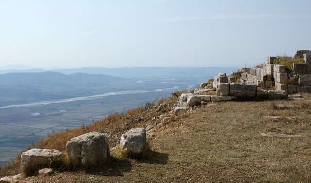
Site historique · Fier
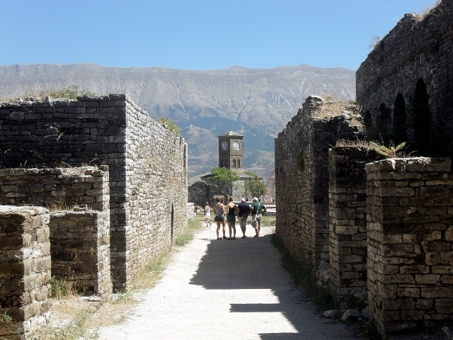
Byllis
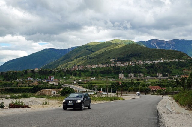
The largest Illyrian city yet excavated, on a plateau above the Vjosa with five early Christian basilicas.
Chaque comté, chaque côte, chaque siècle
Vue guidée
Nouveau en Albanie ? Chaque page s'ouvre sur une explication en langage clair, accessible à un enfant de dix ans, avant d'entrer dans le détail.
Vue expert
Vous connaissez déjà les bases. Directement à l'essentiel, les explications simples étant masquées. Il s'agit du réglage par défaut.
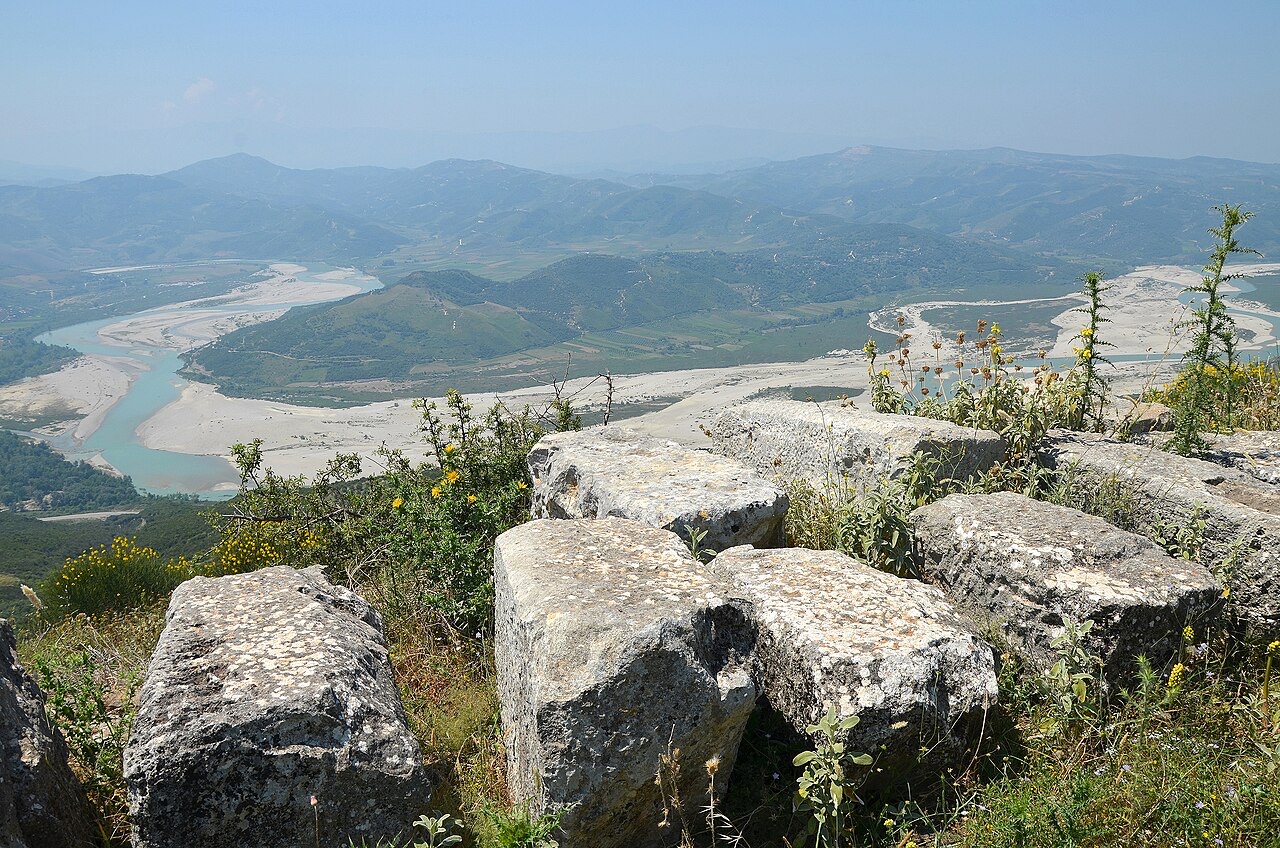
Fleuve/Rivière · Gjirokastër County
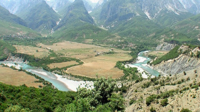
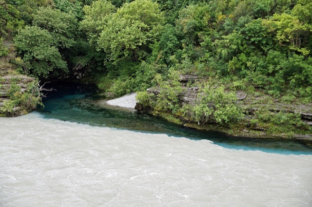
One of the last large free-flowing rivers in Europe, declared a Wild River National Park in March 2023.
Enregistrer
The Vjosa runs about 270 km from Greece to the Adriatic Sea without a single big dam on its main channel, which is very rare in Europe. In 2023 Albania made it a national park to keep it that way.
The Vjosa runs about 270 km from Greece to the Adriatic Sea without a single big dam on its main channel, which is very rare in Europe. In 2023 Albania made it a national park to keep it that way.
The Vjosa (indefinite Albanian form: Vjosë) rises in the Pindus mountains of Epirus, Greece, near the village of Vovousa, at an elevation where an artificial lake has been constructed at 1,350 metres (4,430 ft). A hydroelectric dam at that site has been in place since 1987. From its source the river flows generally northwest, passing through the canyons of the Vikos–Aoös National Park and then through the town of Konitsa, where it receives the Voidomatis tributary.
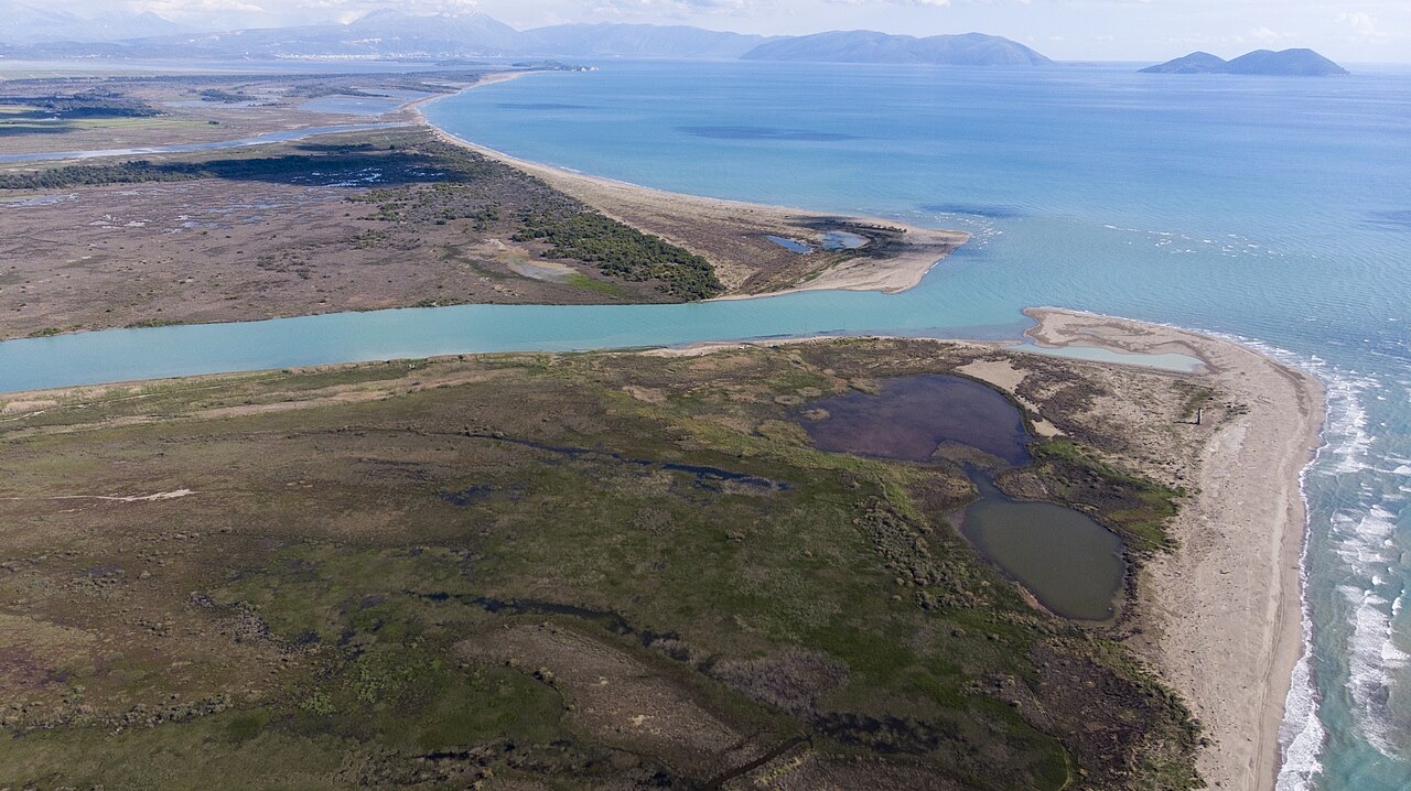
The river enters Albania near the villages of Vllaho-Psilloterë and Molyvdoskepastos, where the Sarantaporos joins it on the Greek–Albanian border. It continues northwest through Çarshovë, Përmet, Këlcyrë, and Tepelenë, where the Drino joins it, then on through Memaliaj, Selenicë and Novoselë before emptying into the Adriatic Sea just north of Vlorë. The river's mouth falls within the boundaries of the Vjosa-Narta Protected Landscape.
The total length of the Vjosa is approximately 272 kilometres (169 mi). Of this, the first 80 kilometres (50 mi) run through Greece and the remaining 192 kilometres (119 mi) through Albania. Its drainage basin covers 6,706 km² (2,589 sq mi) and its average discharge is 195 m³/s (6,900 cu ft/s). The four main tributaries are the Voidomatis, Sarantaporos, Drino, and Shushicë.
The river carries different names across its history and its two countries. In antiquity it was recorded as Aoös (Ἄωος, Ἀῶος, Ἀῷος) in Greek — appearing, for example, in Eratosthenes' Geography — and as Aous in Latin. The historian Hecataeus (550–476 BC) used the form Aias (Αἴας), Plutarch employed Anios (Ἄνιος) in his Caesar, while Polybius, Livy and Strabo all used Aoös. Stephanus of Byzantium recorded it as Avos (Αύος) in the sixth century AD.
In medieval Latin maps the river appeared as Viossa; in Greek it was also known as Voioussa (Βοϊούσα), especially in pre-20th-century texts, and as Vovousa (Βοβούσα) or Aias (Αίας). According to historian Ap. Vakalopoulos (1977), Voioussa is the common Greek name for the Aoos. In modern Albania and in the article's primary modern usage, the river is called Vjosë or Vjosa. In Greece today it is known by its ancient name, Αώος. Vjosa is also a common female Albanian given name.
The valley of the Vjosa provided one of the principal natural routes between the mountainous interior of Epirus and southern Illyria, and onward toward the Adriatic Sea. This corridor has been in continuous use from prehistoric times to the present. In ancient political geography, the upper course of the river lay in Epirus and the lower course in Illyria. Together with the Ceraunian Mountains, the stretch of the river up to approximately Tepelenë marked the boundary between the classical regions of Illyria and Epirus, and between the Roman provinces of Epirus Nova and Epirus Vetus.
The lower valley was inhabited by the Bylliones on the right shore and the Amantes on the left shore. From the mid-7th century BCE onward, proto-urban centres emerged in the southern Illyrian portion of the lower Aoos valley. Fortifications on the right shore included Kutë, Klos, Mashkjezë, Margëlliç and Strum; those on the left shore included Amantia, Mavrovë and Treport. The Thesprotian tribe of the Parauaioi took their name from the river, meaning those who lived beside it. Pausanias recorded the presence of 'sharks' (Greek: θηρία) in the river as it passed through Thesprotia.
Apollonia in Illyria was founded on the right bank near the river's mouth around 600 BC by Greek colonists from Corinth and possibly Corcyra. They established a trading settlement on a largely abandoned coastal site at the invitation of the local Illyrians. Apollonia developed into an independent polis and became one of the most important urban centres of the wider region throughout classical antiquity.
The river valley's role as a strategic corridor made it the site of several significant military engagements. In 274 BC, Pyrrhus of Epirus defeated Antigonus II Gonatas near the river's banks. In 198 BC, Philip V of Macedon and the Roman commander Titus Quinctius Flamininus clashed at the Battle of the Aous. In 170 BC, a plot to kidnap Aulus Hostilius Mancinus near the river was foiled, inadvertently, by Molossians.
The Vikos–Aoös National Park (Greek: Εθνικός Δρυμός Βίκου–Αώου) was created in 1973 and is also designated a UNESCO Geopark. It covers 126 square kilometres (31,135 acres) of mountainous terrain in Epirus, northwestern Greece, encompassing rivers, lakes, caves, canyons, and coniferous and deciduous forest.
The core of the 3,400-hectare park is the Vikos Gorge, carved by the Voidomatis River. The park's peripheral zone includes the Aoos Gorge, Mount Tymfi with its highest peak Gamila at 2,497 metres (8,192 ft), and a number of settlements. The Albanian portion of the Vjosa flows through generally wild and unpolluted terrain and is described in the article as largely free from industrial modification.
In February 2005, the Albanian government designated the Vjosë-Nartë wetlands near the river's mouth a protected area, legislation that followed Albania's ratification of the Kyoto Protocol in December 2004. Separately, the river contributes water to the Vjosë-Levan-Fier irrigation canal, built in the 1950s to irrigate the Myzeqe plain. In December 2020, the Albanian government designated the entire Albanian portion of the Vjosa a 'Managed Nature Reserve'.
Environmental groups received the 'Managed Nature Reserve' designation with scepticism. Under Albanian law, a national park designation would prohibit hydroelectric projects, airports, and other development, while a protected-area designation would not. The distinction was central to advocacy efforts that continued after December 2020.
A 2012 study assessing the hydromorphology of Balkan rivers, drawing on 35,000 kilometres of river data, found the region's rivers largely intact: 30 percent were deemed pristine and 50 percent slightly modified. By 2017, more than 2,000 dam projects had gained governmental approval across the Balkans, including on stretches of the Vjosa.
The Vjosa's hydropower potential has drawn multiple development proposals. A Turkish-Albanian venture called Ayen ALB advanced a plan, the immediate concern of scientists who submitted a petition to Albanian president Ilir Meta in April 2021, to construct a 50-metre-high hydroelectric dam on the river. Had it proceeded, the dam would have been the first infrastructure project to alter the course of Albania's approximately 200-kilometre section of the river. The structure would have flooded areas supporting 1,175 recorded animal and plant species, some of them endangered, as well as inundating farmland, destroying the river's fishery, and displacing thousands of residents.
Opposition came from European nature organisations including RiverWatch, EuroNatur and EcoAlbania. In February 2020, a campaign to create a Vjosa National Park gained the backing of 20 environmental groups under EcoAlbania's leadership. In September 2020, Prime Minister Edi Rama announced the creation of a protected area around the Vjosa, leading to the December 2020 Managed Nature Reserve designation. Activists argued that the government should instead focus on less damaging renewable energy sources.
Following sustained advocacy and negotiations — including contributions from individuals identified in the article as Besjana Guri and Olsi Nika — the Albanian government formally established the Vjosa Wild River National Park on 15 March 2023. The designation made the Vjosa the subject of what advocates described as Europe's first wild river national park.
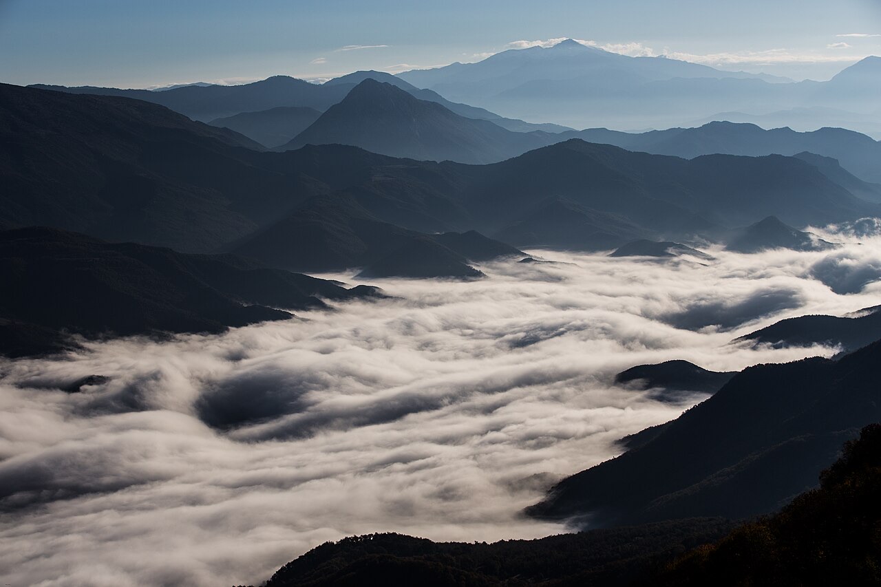
The campaign that produced the 2023 national park designation had been building since at least February 2020, when 20 environmental groups formally aligned behind the goal. A February 2021 proposal identified specific projects of concern along roughly 300 kilometres of rivers and streams within the watershed. The national park status, unlike the earlier 'Managed Nature Reserve' designation, carries legal provisions that restrict hydroelectric development and other large-scale infrastructure within its boundaries.
Le mois le plus chaud est August (maximum quotidien moyen 30°C), le plus froid est January (minimum quotidien moyen 5°C), et le plus pluvieux est November (127 mm). La pluviométrie annuelle totale est en moyenne de 921 mm.
| Mois | Max. | Min. | Pluie | Jours de pluie | Ensoleil./jour |
|---|---|---|---|---|---|
| January | 12°C | 5°C | 93 mm | 11 | 7.4 h |
| February | 13°C | 6°C | 86 mm | 10 | 8.3 h |
| March | 15°C | 7°C | 88 mm | 10 | 9.9 h |
| April | 18°C | 10°C | 70 mm | 10 | 11.0 h |
| May | 23°C | 15°C | 55 mm | 7 | 12.2 h |
| June | 27°C | 19°C | 37 mm | 5 | 13.6 h |
| July | 30°C | 21°C | 23 mm | 4 | 13.8 h |
| August | 30°C | 21°C | 29 mm | 5 | 12.9 h |
| September | 26°C | 18°C | 89 mm | 9 | 10.8 h |
| October | 22°C | 14°C | 106 mm | 9 | 9.3 h |
| November | 17°C | 11°C | 127 mm | 11 | 7.5 h |
| December | 13°C | 7°C | 118 mm | 12 | 6.8 h |
Source: ERA5 reanalysis via Open-Meteo, 1994–2023 · « Max. » et « Min. » sont les températures de l'air maximale et minimale quotidiennes moyennes. « Jours de pluie » comptabilise les jours avec au moins 1 mm de précipitations.
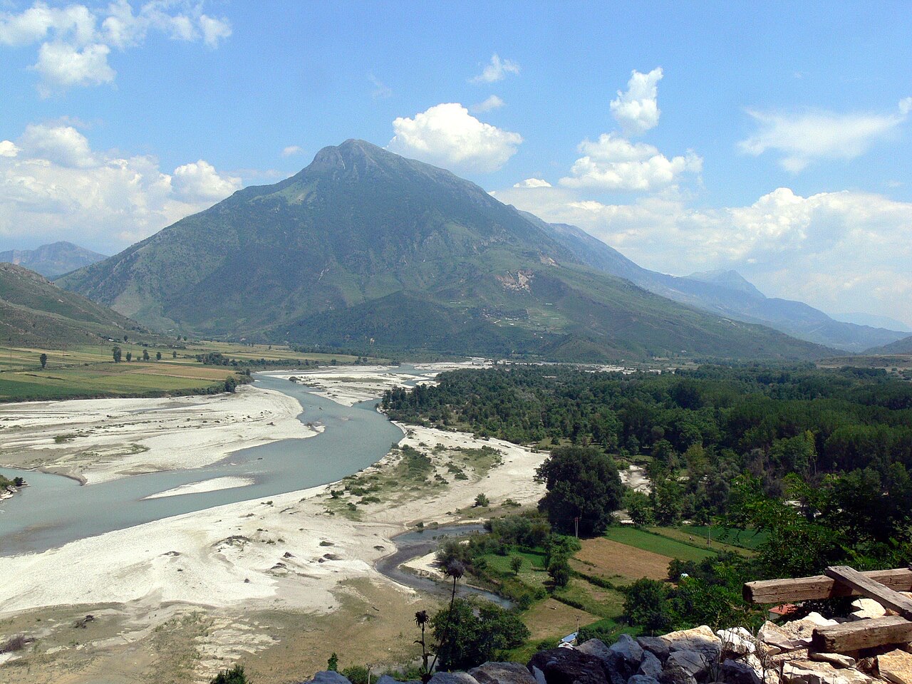
Site historique · Fier
The largest Illyrian city yet excavated, on a plateau above the Vjosa with five early Christian basilicas.
Ville · Gjirokastër
The 'stone city': slate-roofed tower houses on a steep slope beneath one of the Balkans' largest castles.
Espace protégé · Gjirokastër
Declared in March 2023, Europe's first national park built around a whole free-flowing river system.
Bourg · Gjirokastër
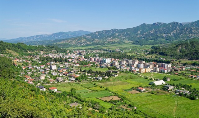
A small Vjosa-side town known for its fruit preserves, thermal baths and polyphonic singing.
Source · Gjirokastër
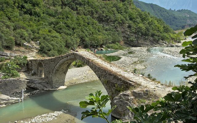
Sulphur pools beside the Ottoman Katiu bridge, at the mouth of the Lengarica canyon.
Industrie
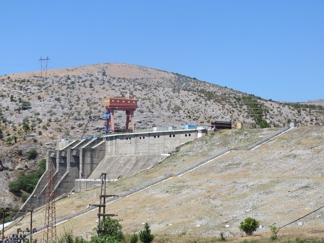
Electricity almost entirely from hydropower — which makes supply depend on rainfall.
Guide
Two stone cities, the country's best archaeology, a wild river, and the Riviera behind it.
Explicatif
Twenty-eight thousand square kilometres, seventy per cent of it hills and mountains, and a coast that changes character halfway…
Une erreur sur cette page ? Les corrections sont les bienvenues et sont vérifiées par rapport au document source. Indiquer ce qui est erroné et, si possible, d'où provient le chiffre correct.