都市
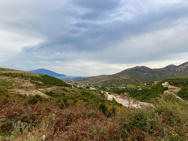
Vlorë
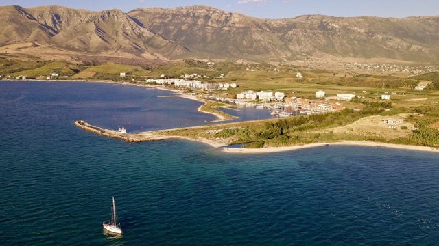
Where the Adriatic meets the Ionian, and where Albanian independence was declared in 1912.
🧭 ガイドビュー
アルバニアを初めて知る方へ。各ページは、詳細に入る前に、10歳の子どもにも読み聞かせられる平易な説明から始まります。
⚡ エキスパートビュー
基本知識はすでにお持ちの方向け。平易な説明を非表示にし、内容を直接表示します。これがデフォルトです。
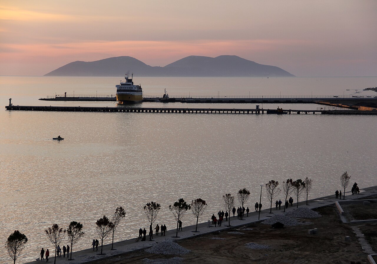
Vlorë has a port used by ferries to Italy and by fishing boats. The city has also been building a marina for yachts.
Vlorë has a port used by ferries to Italy and by fishing boats. The city has also been building a marina for yachts.
The Port of Vlorë (Albanian: Porti i Vlorës) is located in the city of Vlorë on Albania's Adriatic and Ionian coastline. By size it ranks as the second largest port in Albania, after the Port of Durrës.
The port complex is not a single facility but a grouping of distinct operational areas: a dry cargo port, a petroleum terminal known as Vlore 1, and a fishing harbour. Each component serves a different sector of the port's traffic.
The fishing harbour of Vlorë — formally the Vlora Fishing Harbor (Albanian: Porti i peshkimit Vlorë) — is situated in the city of Skel, close to Vlorë rather than within the city itself.
This fishing port has been assigned a transitional administrative function beyond its primary role: it is designated as the temporary location for the relocated passenger terminal and cargo area of the Port of Vlorë while construction of the Vlora Marina proceeds on the site of the existing passenger terminal.
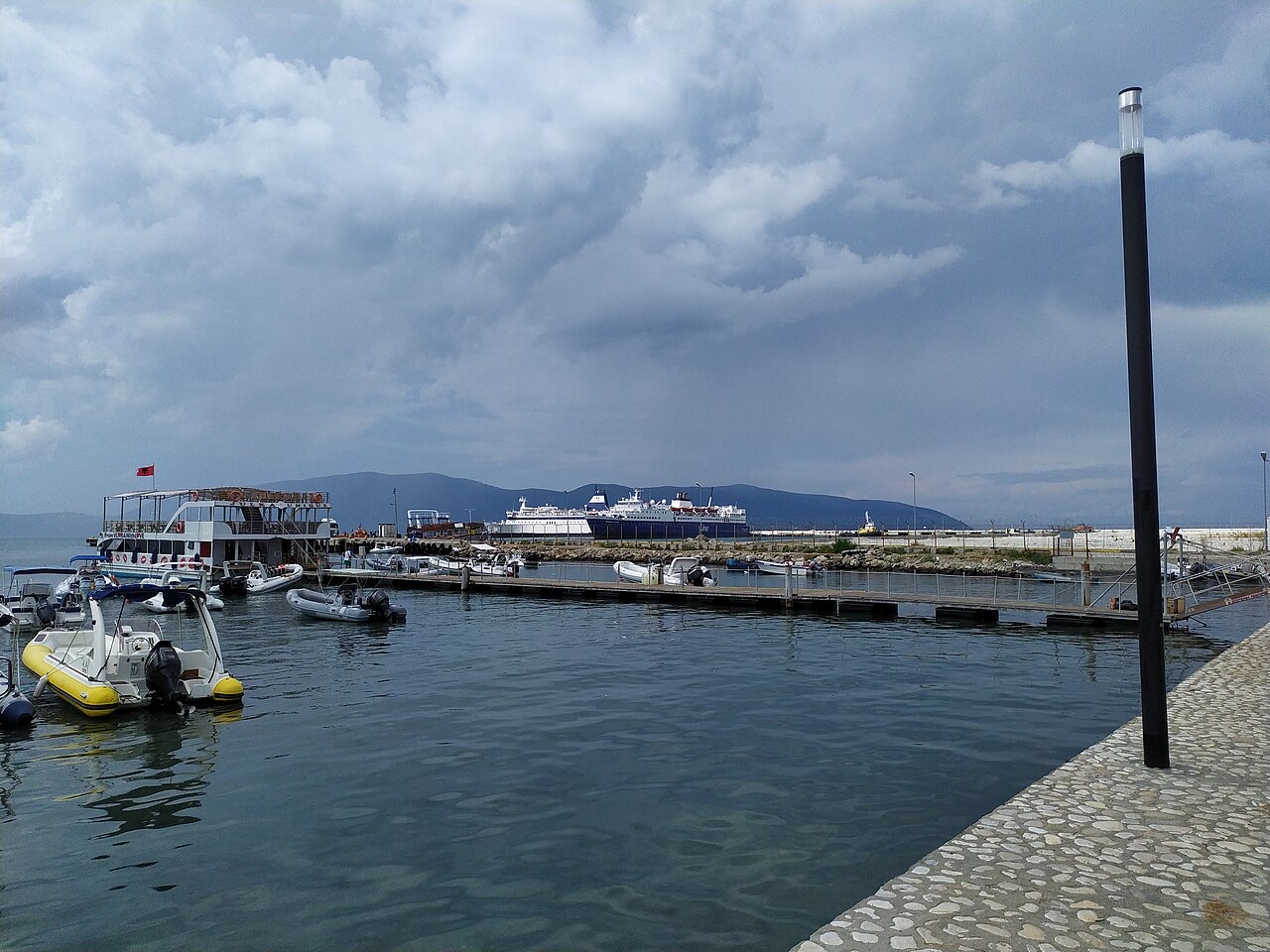
The Port of Vlorë is formally incorporated into a broader urban planning framework called the Lungomare Master Plan for Vlorë. The plan envisions a restructuring of the waterfront that integrates the port with public and commercial infrastructure across the city's seafront zone.
Among the components of the Master Plan is the construction of a yacht port. A road element — the Trans-Balkan Road, also referred to as the Cultural Corridor — has already been completed as one segment of the plan. A second segment of that road, extending from the existing road to the port, was planned to be added, though the article does not specify a completion date for this second segment.
In 2021, a joint venture company formed by UK and Albanian partners won a concession tender for the construction of the Vlora Marina. The concession covers the grounds currently occupied by the passenger terminal area of the Port of Vlorë.
The marina project, described in the source as a luxury development, comprises several distinct elements: docking areas for yachts, residential and hotel complex towers, and commercial areas including bars and restaurants. The article does not specify the financial value of the concession, the names of the joint venture partners, or a projected completion date.
The Port of Vlorë includes a dedicated petroleum terminal designated Vlore 1. It is listed as one of the three main operational components of the port alongside the dry cargo port and the fishing harbour.
The article does not provide throughput figures, storage capacity, or details about the origin or destination of petroleum shipments handled at Vlore 1, and those details should not be assumed from other sources.
Road access to the port is linked to the Trans-Balkan Road, which is also described in the source as the Cultural Corridor. The first segment of this road has been completed. A second segment, running from the existing road to the port itself, was identified as a planned addition under the Lungomare Master Plan framework.
The article does not provide the total length of either segment, the funding arrangement, or the authority responsible for construction. The relationship between the road and the marina concession suggests the infrastructure projects are coordinated, but the article does not state this explicitly.
30年平均値: Port of Vlorë, 1994〜2023年の日次ERA5再解析データからこのアトラス用に算出。これらは長期平均値であり、予測ではありません。個々の年は大幅に異なる場合があります。
最も暖かい月は August (日中の平均最高気温 32°C), 最も寒い月は January (夜間の平均最低気温 5°C), 最も雨が多い月は November (142 mm). 年間総降水量の平均は 1,037 mm. 海水温は8月にピークを迎え、約 25°C.
| 月 | 最高気温 | 最低気温 | 降水量 | 降水日数 | 日照時間/日 | 海水温 |
|---|---|---|---|---|---|---|
| January | 12°C | 5°C | 103 mm | 12 | 7.4 h | 16°C |
| February | 13°C | 6°C | 98 mm | 11 | 8.3 h | 15°C |
| March | 16°C | 7°C | 97 mm | 11 | 9.8 h | 15°C |
| April | 19°C | 10°C | 82 mm | 11 | 11.0 h | 16°C |
| May | 24°C | 15°C | 63 mm | 8 | 12.2 h | 19°C |
| June | 28°C | 19°C | 41 mm | 6 | 13.6 h | 22°C |
| July | 32°C | 22°C | 26 mm | 5 | 13.8 h | 24°C |
| August | 32°C | 22°C | 30 mm | 5 | 12.9 h | 25°C |
| September | 27°C | 18°C | 101 mm | 9 | 10.8 h | 25°C |
| October | 22°C | 14°C | 123 mm | 9 | 9.3 h | 24°C |
| November | 18°C | 11°C | 142 mm | 12 | 7.4 h | 20°C |
| December | 14°C | 7°C | 131 mm | 13 | 6.8 h | 18°C |
出典: ERA5 reanalysis via Open-Meteo, 1994–2023 · 「最高気温」および「最低気温」は日平均最高・最低気温です。「降水日数」は降水量が1mm以上の日数を計上しています。 JSONで取得
これらはアトラス内の実際の関係性です——この場所に近い地点と、実際に関連する項目です。汎用的な推薦は含まれていません。
Where the Adriatic meets the Ionian, and where Albanian independence was declared in 1912.
A marina town at the foot of Llogara, beside the ancient harbour of Oricum.
The shortest Albania–Italy crossing, but the least consistently operated.
Where the Adriatic meets the Ionian, and where Albanian independence was declared in 1912.
The shortest Albania–Italy crossing, but the least consistently operated.
上記の「詳細解説」のセクションは、以下に示す出典記事を全文精読したうえで、このアトラスのために執筆されました (1,376 文字). これらは当該文書に基づくAI支援による調査であり、このページの精選された事実と照合済みです。重要な事項については必ず一次情報源で確認してください。
このページに誤りがありますか? 修正は歓迎しており、原典記録と照合して確認します。何が誤っているか、また可能であれば正しい数値の出典をお知らせください。