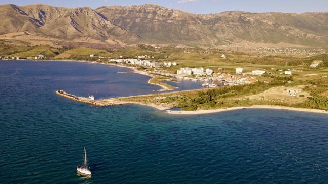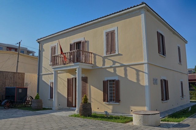
Stadt · Vlorë
Vlorë
Where the Adriatic meets the Ionian, and where Albanian independence was declared in 1912.
Jeder Kreis, jede Küste, jedes Jahrhundert
Geführte Ansicht
Neu in Albanien? Jede Seite beginnt mit einer einfachen Erklärung, die auch ein Zehnjähriger verstehen würde – bevor es ins Detail geht.
Expertenansicht
Sie kennen die Grundlagen bereits. Direkt zur Substanz, ohne die vereinfachten Erklärungen. Dies ist die Standardeinstellung.
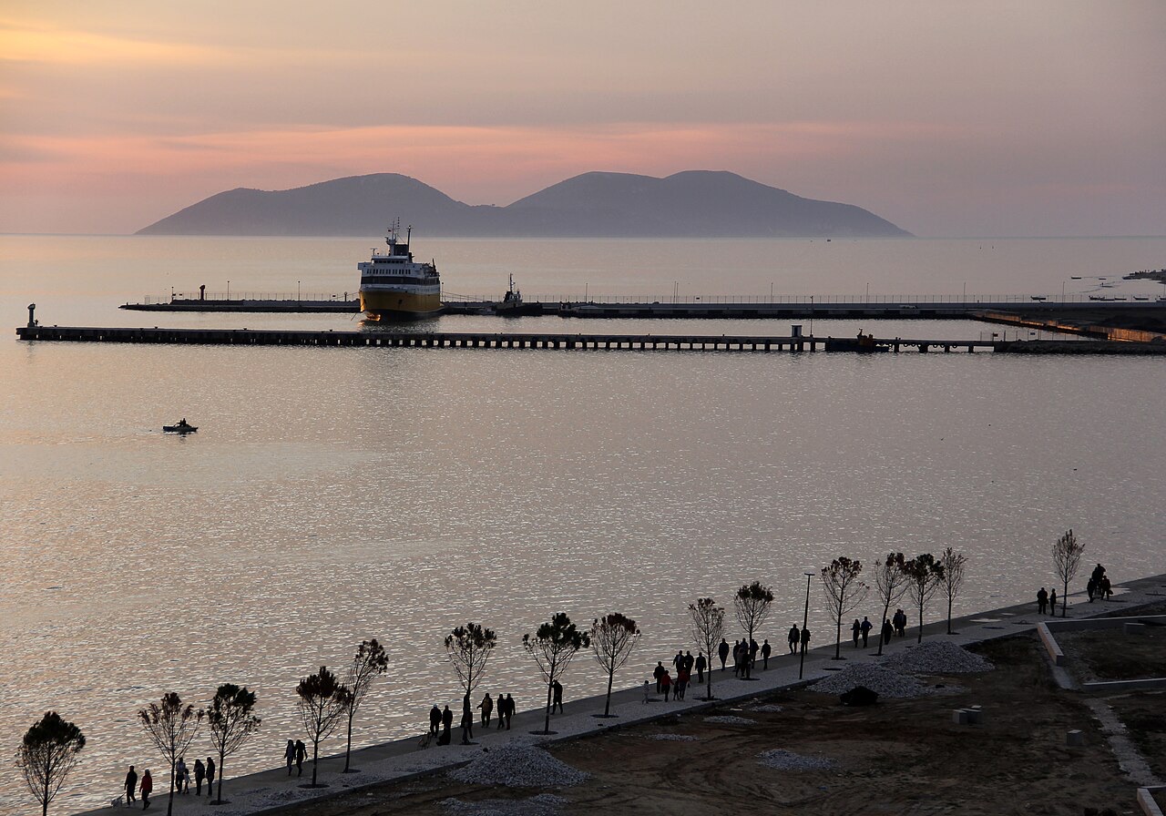
Hafen · Vlorë County
Albania's second passenger port, with a seasonal fast link to Brindisi.
Speichern
Vlorë has a port used by ferries to Italy and by fishing boats. The city has also been building a marina for yachts.
Vlorë has a port used by ferries to Italy and by fishing boats. The city has also been building a marina for yachts.
The Port of Vlorë (Albanian: Porti i Vlorës) is located in the city of Vlorë on Albania's Adriatic and Ionian coastline. By size it ranks as the second largest port in Albania, after the Port of Durrës.
The port complex is not a single facility but a grouping of distinct operational areas: a dry cargo port, a petroleum terminal known as Vlore 1, and a fishing harbour. Each component serves a different sector of the port's traffic.
The fishing harbour of Vlorë — formally the Vlora Fishing Harbor (Albanian: Porti i peshkimit Vlorë) — is situated in the city of Skel, close to Vlorë rather than within the city itself.
This fishing port has been assigned a transitional administrative function beyond its primary role: it is designated as the temporary location for the relocated passenger terminal and cargo area of the Port of Vlorë while construction of the Vlora Marina proceeds on the site of the existing passenger terminal.
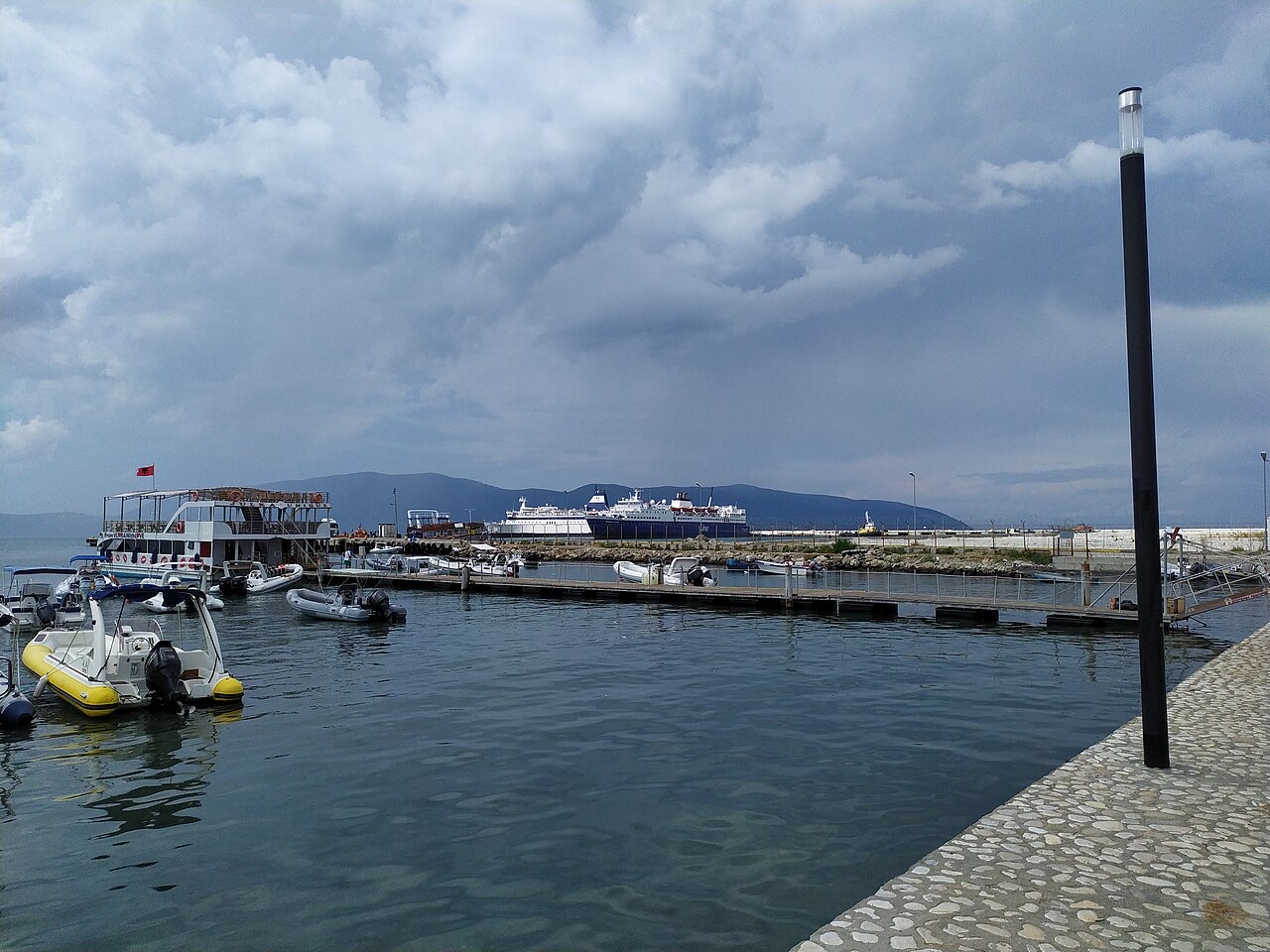
The Port of Vlorë is formally incorporated into a broader urban planning framework called the Lungomare Master Plan for Vlorë. The plan envisions a restructuring of the waterfront that integrates the port with public and commercial infrastructure across the city's seafront zone.
Among the components of the Master Plan is the construction of a yacht port. A road element — the Trans-Balkan Road, also referred to as the Cultural Corridor — has already been completed as one segment of the plan. A second segment of that road, extending from the existing road to the port, was planned to be added, though the article does not specify a completion date for this second segment.
In 2021, a joint venture company formed by UK and Albanian partners won a concession tender for the construction of the Vlora Marina. The concession covers the grounds currently occupied by the passenger terminal area of the Port of Vlorë.
The marina project, described in the source as a luxury development, comprises several distinct elements: docking areas for yachts, residential and hotel complex towers, and commercial areas including bars and restaurants. The article does not specify the financial value of the concession, the names of the joint venture partners, or a projected completion date.
The Port of Vlorë includes a dedicated petroleum terminal designated Vlore 1. It is listed as one of the three main operational components of the port alongside the dry cargo port and the fishing harbour.
The article does not provide throughput figures, storage capacity, or details about the origin or destination of petroleum shipments handled at Vlore 1, and those details should not be assumed from other sources.
Road access to the port is linked to the Trans-Balkan Road, which is also described in the source as the Cultural Corridor. The first segment of this road has been completed. A second segment, running from the existing road to the port itself, was identified as a planned addition under the Lungomare Master Plan framework.
The article does not provide the total length of either segment, the funding arrangement, or the authority responsible for construction. The relationship between the road and the marina concession suggests the infrastructure projects are coordinated, but the article does not state this explicitly.
Der wärmste Monat ist August (mittleres tägliches Maximum 32°C), der kälteste ist January (mittleres tägliches Minimum 5°C), und der regenreichste ist November (142 mm). Der mittlere jährliche Gesamtniederschlag beträgt 1,037 mm. Die Meerestemperatur erreicht im August einen Höchstwert von etwa 25°C.
| Monat | Maximum | Minimum | Niederschlag | Regentage | Sonne/Tag | Meer |
|---|---|---|---|---|---|---|
| January | 12°C | 5°C | 103 mm | 12 | 7.4 h | 16°C |
| February | 13°C | 6°C | 98 mm | 11 | 8.3 h | 15°C |
| March | 16°C | 7°C | 97 mm | 11 | 9.8 h | 15°C |
| April | 19°C | 10°C | 82 mm | 11 | 11.0 h | 16°C |
| May | 24°C | 15°C | 63 mm | 8 | 12.2 h | 19°C |
| June | 28°C | 19°C | 41 mm | 6 | 13.6 h | 22°C |
| July | 32°C | 22°C | 26 mm | 5 | 13.8 h | 24°C |
| August | 32°C | 22°C | 30 mm | 5 | 12.9 h | 25°C |
| September | 27°C | 18°C | 101 mm | 9 | 10.8 h | 25°C |
| October | 22°C | 14°C | 123 mm | 9 | 9.3 h | 24°C |
| November | 18°C | 11°C | 142 mm | 12 | 7.4 h | 20°C |
| December | 14°C | 7°C | 131 mm | 13 | 6.8 h | 18°C |
Quelle: ERA5 reanalysis via Open-Meteo, 1994–2023 · „Maximum" und „Minimum" sind das mittlere tägliche Temperaturmaximum bzw. -minimum. „Regentage" zählt Tage mit mindestens 1 mm Niederschlag.
Stadt · Vlorë
Where the Adriatic meets the Ionian, and where Albanian independence was declared in 1912.
Kleinstadt · Vlorë
A marina town at the foot of Llogara, beside the ancient harbour of Oricum.
Fährverbindung · Vlorë
The shortest Albania–Italy crossing, but the least consistently operated.
Etwas falsch auf dieser Seite? Korrekturen sind willkommen und werden gegen den Quelldatensatz geprüft. Bitte mitteilen, was falsch ist und, wenn möglich, woher die richtige Angabe stammt.