नदी · Gjirokastër
The Vjosa
One of the last large free-flowing rivers in Europe, declared a Wild River National Park in March 2023.
हर काउंटी, हर तट, हर सदी
निर्देशित दृश्य
Albania में नए हैं? हर पृष्ठ एक सरल-भाषा स्पष्टीकरण के साथ खुलता है जिसे आप किसी दस वर्षीय बच्चे को पढ़ कर सुना सकते हैं, इससे पहले कि विस्तृत जानकारी शुरू हो।
विशेषज्ञ दृश्य
आप मूल बातें पहले से जानते हैं। सीधे मूल विषय पर, सरल स्पष्टीकरण छिपे हुए। यह डिफ़ॉल्ट है।
संरक्षित क्षेत्र · Gjirokastër County
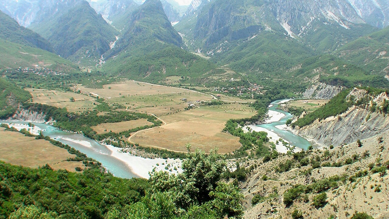
Declared in March 2023, Europe's first national park built around a whole free-flowing river system.
सहेजें
In 2023 Albania made the Vjosa river and its side rivers into a national park. It was the first park in Europe created to protect an entire wild river from its source to the sea.
In 2023 Albania made the Vjosa river and its side rivers into a national park. It was the first park in Europe created to protect an entire wild river from its source to the sea.
The Vjosa (indefinite Albanian form: Vjosë), known in Greek as the Aoös (Αώος), is a river running through southwestern Albania and northwestern Greece. Its total length is approximately 272 kilometres, of which the first 80 kilometres lie within Greece and the remaining 192 kilometres within Albania. The drainage basin covers 6,706 square kilometres, and average discharge is 195 cubic metres per second.
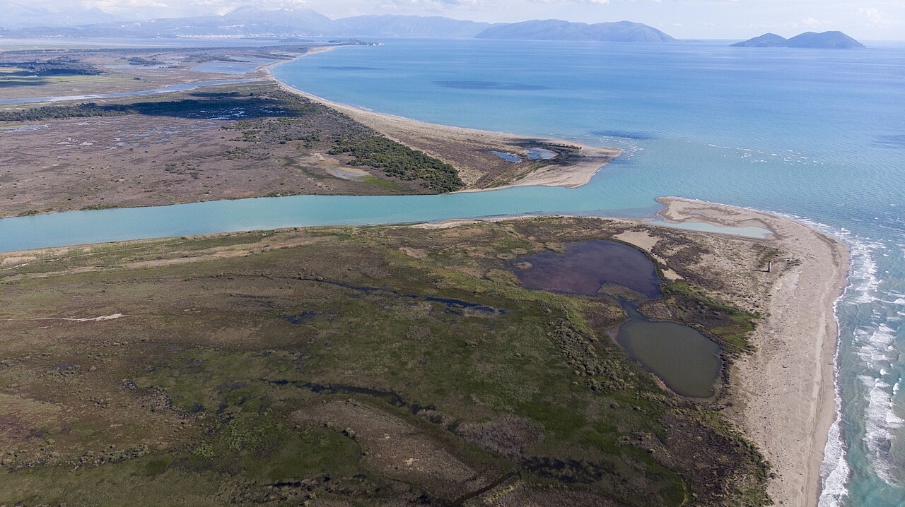
The river rises in the Pindus mountains of Epirus, Greece, near the village of Vovousa, and flows generally northwest. In Greece it passes through the canyons of the Vikos–Aoös National Park and through the town of Konitsa, where it receives the Voidomatis tributary. It enters Albania near the villages of Vllaho-Psilloterë and Molyvdoskepastos, where the Sarantaporos joins it at the Greek–Albanian border. Within Albania the river passes through Çarshovë, Përmet, Këlcyrë, and Tepelenë, where it receives the Drino, then continues through Memaliaj, Selenicë, and Novoselë before emptying into the Adriatic Sea northwest of Vlorë. The mouth lies within the boundaries of the Vjosa-Narta Protected Landscape.
The main tributaries are the Voidomatis, Sarantaporos, Drino, and Shushicë. A hydroelectric dam and artificial lake have been in place at an elevation of 1,350 metres in the Greek upper reaches since 1987. The Albanian section, at roughly 192 kilometres, is the portion that became the focus of national park designation efforts.
The river has been recorded under several names across different languages and periods. In antiquity it was called Aoös (variant spellings: Ἄωος, Ἀῶος, Ἀῷος) in Greek—used by sources including Eratosthenes' Geography, Polybius, Livy, and Strabo—and Aous in Latin. Hecataeus (c. 550–476 BC) refers to it as Aias (Αἴας), and Plutarch, in Caesar, uses the form Anios (Ἄνιος). Stephanus of Byzantium records it as Avos (Αύος) in the sixth century AD.
In medieval Latin maps the river appears as Viossa. Greek texts, particularly those predating the twentieth century, frequently use Βοϊούσα (Voioussa), and historian Ap. Vakalopoulos, writing in 1977, identified this as the common Greek name for the Aoos. It is also known in Greek as Vovousa (Βοβούσα). In modern Albania the river is called Vjosë or Vjosa, and Vjosa is additionally a common Albanian female given name.
The Vjosa valley has served as one of the principal natural routes connecting the mountainous interior of Epirus with southern Illyria and the Adriatic coast, a role maintained from prehistory to the present. In ancient geography the upper course of the river lay within Epirus and the lower course within Illyria. Together with the Ceraunian Mountains, the section up to around Tepelenë marked the boundary between the classical regions of Illyria and Epirus, and later between the Roman provinces of Epirus Nova and Epirus Vetus.
The lower valley was inhabited by the Bylliones on the right bank and the Amantes on the left. From the mid-seventh century BCE, proto-urban centres began appearing in the lower Aoos area: fortifications at Kutë, Klos, Mashkjezë, Margëlliç, and Strum on the right shore, and at Amantia, Mavrovë, and Treport on the left shore. Around 600 BC, Greek colonists from Corinth—and possibly Corcyra—founded Apollonia in Illyria on the right bank near the river's mouth, reportedly by invitation of local Illyrians. Apollonia grew into an independent polis and became one of the most important urban centres of the wider region during classical antiquity.
The Thesprotian tribe called the Parauaioi took their name from the river, the designation meaning those living beside it. Several significant military engagements occurred along the Vjosa: in 274 BC Pyrrhus of Epirus defeated Antigonus II Gonatas near its banks; in 198 BC the Battle of the Aous brought Philip V of Macedon into conflict with the Roman commander Titus Quinctius Flamininus; and in 170 BC a plot to kidnap Aulus Hostilius Mancinus was foiled, by accident, by Molossians.
The Greek portion of the river is protected by the Vikos–Aoös National Park (Greek: Εθνικός Δρυμός Βίκου–Αώου), established in 1973 and subsequently recognised as a UNESCO Geopark. The park encompasses 126 square kilometres of mountainous terrain incorporating rivers, lakes, caves, canyons, and coniferous and deciduous forest.
The core of the 3,400-hectare park is the Vikos Gorge, carved by the Voidomatis River. The park's scope also includes the Aoos Gorge and Mount Tymfi, whose highest peak, Gamila, reaches 2,497 metres. A number of settlements form the park's peripheral zone.
Albania's formal relationship with the Vjosa as a protected resource developed gradually. In February 2005, the Albanian government designated the Vjosë-Nartë wetlands near the river's mouth a protected area, a step that followed Albania's ratification of the Kyoto Protocol in December 2004.
The river also has an economic function: it contributes water to the Vjosë-Levan-Fier irrigation canal, a canal constructed in the 1950s to irrigate the Myzeqe plain. In December 2020, the Albanian government designated the Albanian portion of the Vjosa as a 'Managed Nature Reserve.' Environmental groups expressed scepticism about the level of protection this status actually provided, noting that a national park designation—unlike a managed nature reserve—would prohibit hydroelectric projects, airports, and other forms of large-scale development.
The Vjosa attracted developer interest because of its hydropower potential. By 2017, more than 2,000 dam projects had gained Albanian governmental approval on stretches of river across the Balkans, including the Vjosa's channel. European nature organisations including RiverWatch, EuroNatur, and EcoAlbania mounted opposition to these proposals.
A specific and immediate threat identified by scientists was a plan by a Turkish-Albanian joint venture, Ayen ALB, to construct a 50-metre-high hydroelectric dam on the Albanian section. This would have been the first project to alter the course of Albania's roughly 200-kilometre portion of the river. Scientists warned the dam would flood habitat supporting 1,175 recorded animal and plant species, some of them endangered, inundate farmland, destroy the river's fishery, and displace thousands of residents. In April 2021 a petition from Vjosa River scientists was delivered to Albanian president Ilir Meta calling for the project to be stopped.
A 2012 study of Balkan river hydromorphology, examining 35,000 kilometres of river channels, found that the region's rivers were largely intact: 30 percent were assessed as pristine and 50 percent as only slightly modified. The Vjosa's condition was central to arguments made by conservation advocates.
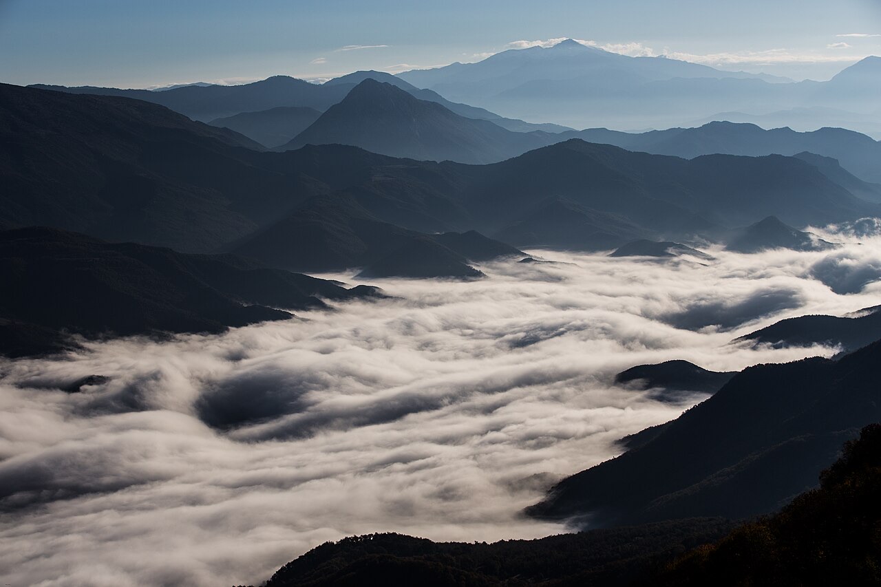
Organised advocacy for full national park status began formally in February 2020, when a campaign to create a Vjosa National Park gained backing from 20 environmental groups coordinated by EcoAlbania, with the stated goal of establishing what proponents described as Europe's first wild river national park. The effort aimed to protect approximately 300 kilometres of rivers and streams. In September 2020, Prime Minister Edi Rama announced publicly that a protected area would be created along the Vjosa.
A February 2021 proposal identified several specific dam and development projects that the campaign sought to prevent. Advocacy and negotiations continued over the following two years. Key individuals credited with advancing the campaign include Besjana Guri and Olsi Nika.
On 15 March 2023, the Albanian government formally established the Vjosa Wild River National Park, completing the transition from the 'Managed Nature Reserve' designation that had been in place since December 2020. The park protects the Albanian portion of the Vjosa, a section approximately 192 kilometres long.
The national park designation carries legal consequences that the earlier managed nature reserve status did not: it prohibits hydroelectric projects, airports, and comparable large-scale development along the river corridor. The park was the outcome of sustained advocacy spanning at least three years, involving environmental non-governmental organisations, scientists, and named individual negotiators. The river's mouth remains separately protected within the Vjosa-Narta Protected Landscape, while the Greek upper reaches are covered by the Vikos–Aoös National Park established in 1973.
सबसे गर्म महीना है August (औसत दैनिक अधिकतम 30°C), सबसे ठंडा है January (औसत दैनिक न्यूनतम 5°C), और सबसे अधिक वर्षा वाला है November (127 mm). कुल वार्षिक वर्षा का औसत है 921 mm.
| माह | अधिकतम | न्यूनतम | वर्षा | वर्षा के दिन | धूप/दिन |
|---|---|---|---|---|---|
| January | 12°C | 5°C | 93 mm | 11 | 7.4 h |
| February | 13°C | 6°C | 86 mm | 10 | 8.3 h |
| March | 15°C | 7°C | 88 mm | 10 | 9.9 h |
| April | 18°C | 10°C | 70 mm | 10 | 11.0 h |
| May | 23°C | 15°C | 55 mm | 7 | 12.2 h |
| June | 27°C | 19°C | 37 mm | 5 | 13.6 h |
| July | 30°C | 21°C | 23 mm | 4 | 13.8 h |
| August | 30°C | 21°C | 29 mm | 5 | 12.9 h |
| September | 26°C | 18°C | 89 mm | 9 | 10.8 h |
| October | 22°C | 14°C | 106 mm | 9 | 9.3 h |
| November | 17°C | 11°C | 127 mm | 11 | 7.5 h |
| December | 13°C | 7°C | 118 mm | 12 | 6.8 h |
स्रोत: ERA5 reanalysis via Open-Meteo, 1994–2023 · "अधिकतम" और "न्यूनतम" क्रमशः औसत दैनिक अधिकतम और न्यूनतम वायु तापमान हैं। "वर्षा के दिन" उन दिनों की गणना करता है जिनमें कम से कम 1 मिमी वर्षण हुई हो।
नदी · Gjirokastër
One of the last large free-flowing rivers in Europe, declared a Wild River National Park in March 2023.
कस्बा · Gjirokastër
A small Vjosa-side town known for its fruit preserves, thermal baths and polyphonic singing.
उद्योग
Electricity almost entirely from hydropower — which makes supply depend on rainfall.
इस पृष्ठ पर कुछ गलत है? सुधार स्वागतयोग्य हैं और स्रोत अभिलेख के विरुद्ध जाँचे जाते हैं। हमें बताएँ क्या गलत है और, यदि संभव हो, तो सही आँकड़ा कहाँ से आता है।