Thành phố · Vlorë
Vlorë
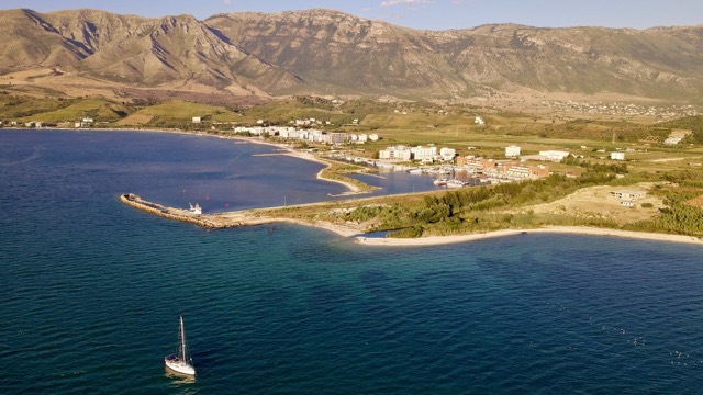
Where the Adriatic meets the Ionian, and where Albanian independence was declared in 1912.
Mọi hạt, mọi bờ biển, mọi thế kỷ
Chế độ hướng dẫn
Mới tìm hiểu về Albania? Mỗi trang mở đầu bằng một giải thích ngôn ngữ đơn giản mà bạn có thể đọc cho một đứa trẻ mười tuổi, trước khi đi vào chi tiết.
Chế độ chuyên gia
Bạn đã nắm được những điều cơ bản. Đi thẳng vào nội dung, với các giải thích đơn giản được ẩn đi. Đây là chế độ mặc định.
Khu vực được bảo vệ · Vlorë County
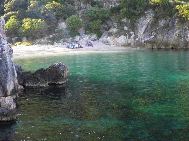
Albania's only marine national park: sea caves, wrecks and the country's clearest water.
Lưu
This is Albania's only national park in the sea. It covers the water around the Karaburun peninsula and Sazan island, with caves, shipwrecks and very clear water.
This is Albania's only national park in the sea. It covers the water around the Karaburun peninsula and Sazan island, with caves, shipwrecks and very clear water.
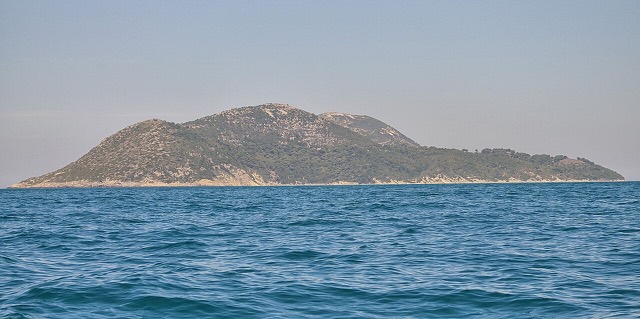
Karaburun-Sazan Marine Park (Albanian: Parku Detar Karaburun-Sazan) is a national marine park in Vlorë County, southwestern Albania. It covers 125.70 km² (48.53 sq mi) and encompasses the Karaburun Peninsula, including the sub-unit of Reza e Kanalit, and Sazan Island.
The Barcelona Convention has classified the park as a Specially Protected Area of Mediterranean Importance (SPAMI) on the grounds that it contains ecosystems and habitats specific to the Mediterranean Basin. It has also been identified as an Important Bird and Plant Area. The park is located near military bases; Albanian authorities may require visitors to obtain prior permission before entering certain zones, and access by road is described as inaccessible, with entry possible only by sea or on foot via full-day hiking routes.
The park lies on the eastern shore of the Strait of Otranto, primarily between latitudes 40° and 26° N and longitudes 19° and 18° E. The mountainous terrain of the Karaburun Peninsula extends approximately 24 km in length and between 4 and 7 km in width. The Mesokanali, a narrow natural channel, separates the peninsula from Sazan Island to the west.
The park as a whole experiences a Mediterranean climate, characterised by rainy winters and warm to hot, dry summers. Mean monthly temperatures range from 8–10 °C in January to 24–26 °C in July. Mean annual precipitation ranges between 1,000 mm and 1,200 mm depending on location and prevailing climate type.
Sazan Island is an exception to this pattern. Its climate is described not as Mediterranean but as subtropical, with warm winters and hot summers said to resemble conditions found in southern Crete, Tunisia and Egypt. This anomaly is identified as the most characteristic climatic feature of the island.
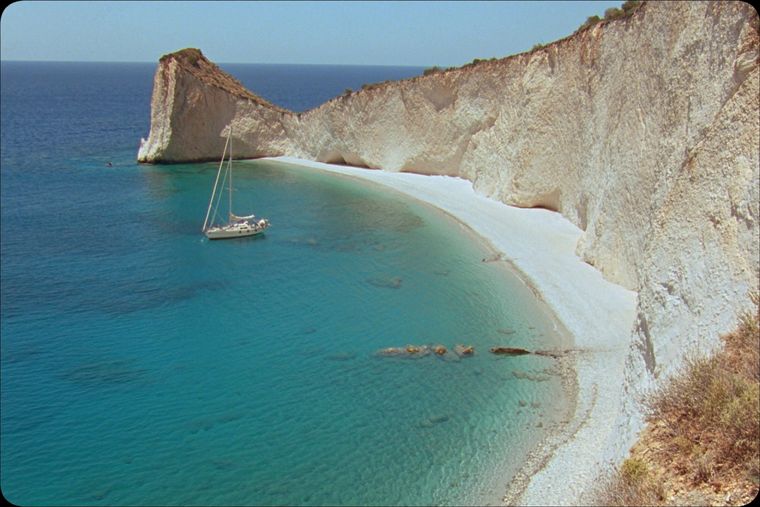
The Karaburun Peninsula is a geological continuation of the Ceraunian Mountains, a range that rises steeply along the Albanian Ionian Sea coast and runs toward the Llogara Pass, where it divides into two distinct mountain chains. The relief includes peaks rising to around 800 m above the Adriatic. Recorded high points include Maja e Shendelliut at 1,499.5 m, Maja Ali Hila at 1,318 m, Maja Çadëri at 839 m, Maja e Flamurit at 826 m and Maja e Ilqes at 733 m. The western face of the peninsula falls steeply into the Ionian Sea, producing a coastal landscape of calcareous limestone cliffs that descend vertically into the water.
The peninsula's composition reflects several geological periods. It is principally made up of carbonic limestone from the Mesozoic era, while its northwest is composed of terrigenous sediment. The south is chiefly composed of Pliocene rock formations and a variety of sediments. The peninsula reached its current form through the tectonic merging of Paleozoic schist formations, Mesozoic limestone and marble deposits.
Reza e Kanalit forms the southern portion of the Karaburun Peninsula. It is characterised by a narrow, steep platform extending from the peninsula toward the Dukat Valley near Orikum.
Sazan is the largest island in Albania, measuring 4.8 km in length and 2.7 km in width, with a surface area of 5.7 km². The Adriatic Sea borders the island to the north and the Ionian Sea to the south. The island is uninhabited.
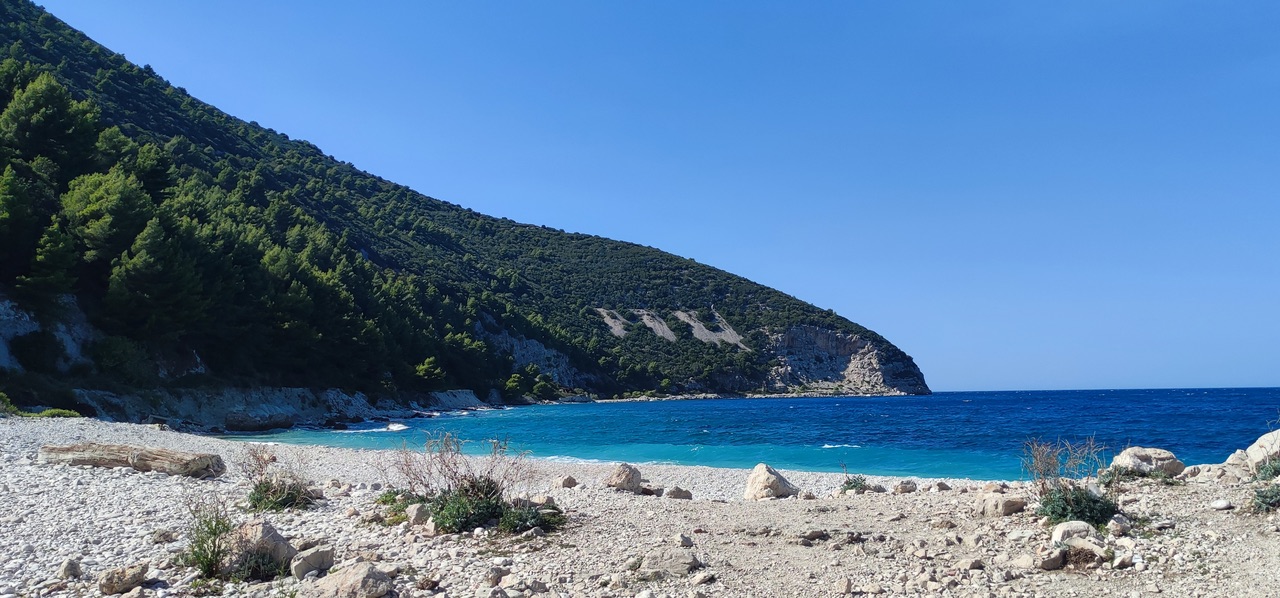
The rocks in the western part of Sazan are primarily Cretaceous in origin, while the eastern part is essentially composed of limestone formed during the Burdigalian age. The island is primarily made up of limestone rocks overall, with the bulk of its geological substrate dating to the Cretaceous period.
The park supports at least 70 species of mammals, 144 species of birds, 36 species of reptiles, 11 species of amphibia and 167 species of invertebrates. The Karaburun Peninsula alone accounts for approximately 55 mammal species, 105 bird species, 28 reptile species and 10 amphibian species. Sazan Island supports 15 mammal species, 39 bird species, 8 reptile species, 1 amphibian species and 122 invertebrate species.
Among the more common mammals are the golden jackal, wildcat, chamois, roe deer, wild boar, badger and otter. Smaller mammals include the red squirrel, hazel dormouse and pine vole. Eight bat species have been recorded on Sazan Island alone. The Kuhl's pipistrelle and Nathusius's pipistrelle are described as widespread and common, while the Mediterranean long-eared bat is characterised as relatively rare and restricted in distribution.
The coastal vegetation along both Karaburun and Sazan is classified within the Illyrian deciduous forests terrestrial ecoregion, part of the Palearctic Mediterranean forests, woodlands and scrub biome. Rocky limestone cliffs along both coastlines carry Mediterranean maquis dominated by lentisk, kermes oak and Phoenicean juniper. Sea fennel, statice and caper bush are typical of vertical cliff faces. Mediterranean tapeweed in the marine zone supports macrofauna including sponges, cnidarians, bryozoans and molluscs.
The article notes that the biodiversity of the local oceanic fauna is not well understood, and that the sufficient regularity of occurrence of several species remains unclear. Three sea turtle species have been recorded along park beaches: the loggerhead sea turtle, the green sea turtle and the leatherback sea turtle.
Dolphin species reported in park waters include the short-beaked common dolphin and the common bottlenose dolphin. The sperm whale, classified as endangered, has also been reported. The Mediterranean monk seal, described as one of the most endangered mammals in the world, is recorded as using the inaccessible caves and canyons of the park as refuge.
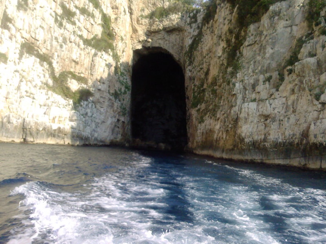
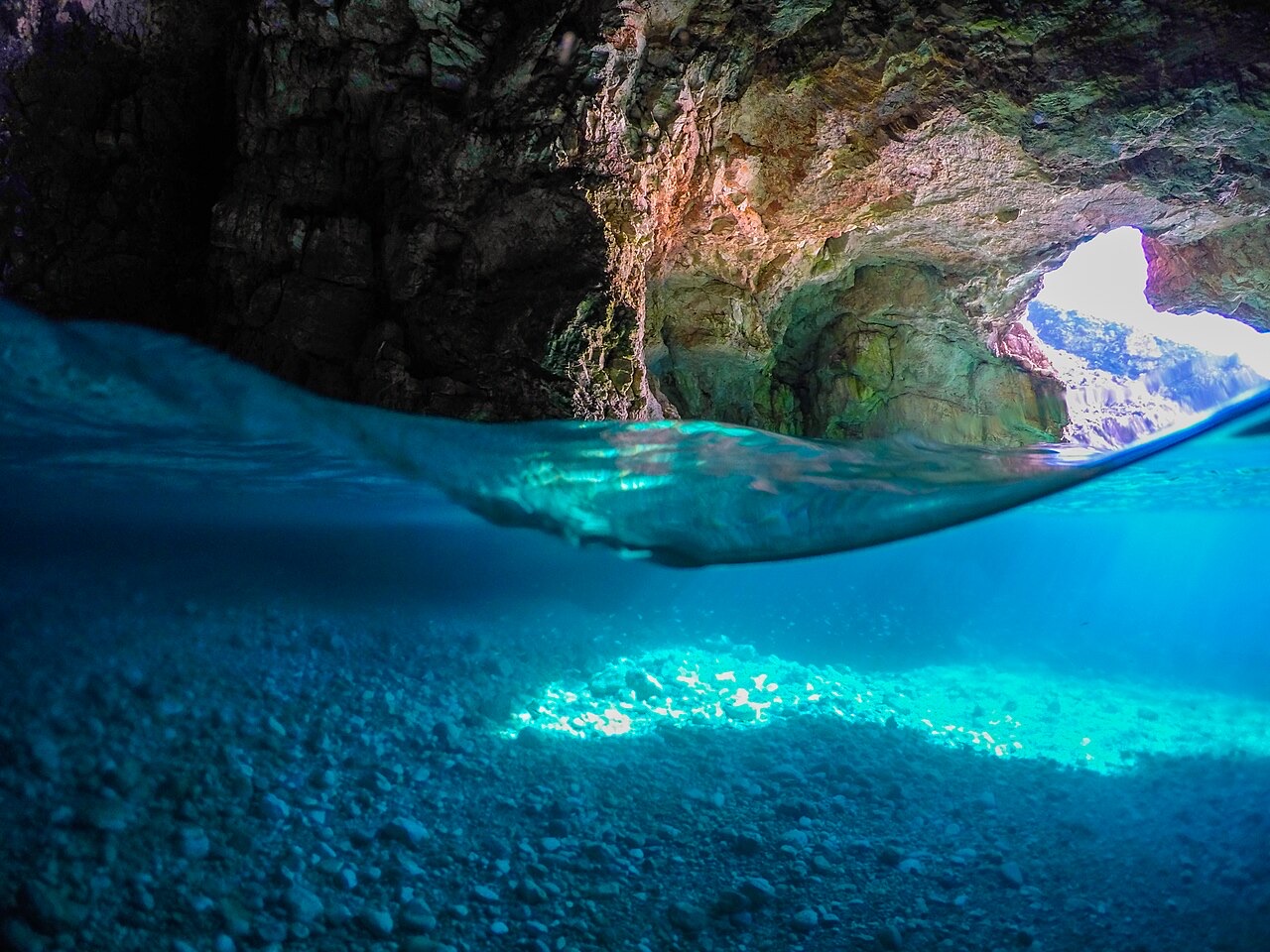
The park's underwater environment includes the ruins of sunken ancient Greek and Roman ships, as well as World War II wrecks. The western coastlines are incised by caves and canyons, with vertical cliffs continuing to considerable depths below the waterline.
The marine park contains physical evidence of long human engagement with the area. Ancient inscriptions made by sailors survive on shoreline rock faces. The park's waters hold the remains of sunken ancient Greek, Roman and World War II vessels, making the site of interest for maritime archaeology and technical diving.
The article notes that a professional local diver is recommended to serve as guide for underwater exploration of the park, given proximity to military installations and the demanding nature of the terrain and dive sites.
In 2025, the Albanian government approved an investment project by American businessman Jared Kushner, son-in-law of U.S. President Donald Trump, to develop a luxury tourist resort on Sazan Island and in the Vjosa–Narta Lagoon area. Albanian Prime Minister Edi Rama characterised the project as potentially transformational for the country as it pursues development of a high-end tourism sector and advances toward membership of the European Union.
The project drew strong criticism from environmental organisations and sections of the public over its potential impact on protected natural areas within and adjacent to the marine park. In 2026, large-scale protests were held in Tirana and in southern Albania. Demonstrators called for the project to be halted and for the government's decisions to be reconsidered.
Tháng nóng nhất là August (nhiệt độ cao trung bình ngày 27°C), tháng lạnh nhất là January (nhiệt độ thấp trung bình ngày 3°C), và tháng mưa nhiều nhất là November (156 mm). Tổng lượng mưa hàng năm trung bình 1,107 mm.
| Tháng | Cao | Thấp | Mưa | Ngày mưa | Nắng/ngày |
|---|---|---|---|---|---|
| January | 9°C | 3°C | 113 mm | 12 | 7.4 h |
| February | 10°C | 3°C | 103 mm | 11 | 8.3 h |
| March | 12°C | 5°C | 104 mm | 11 | 9.8 h |
| April | 15°C | 8°C | 86 mm | 12 | 11.0 h |
| May | 20°C | 12°C | 67 mm | 9 | 12.2 h |
| June | 24°C | 16°C | 42 mm | 6 | 13.6 h |
| July | 27°C | 18°C | 26 mm | 5 | 13.8 h |
| August | 27°C | 19°C | 32 mm | 6 | 12.9 h |
| September | 23°C | 16°C | 104 mm | 10 | 10.8 h |
| October | 18°C | 12°C | 127 mm | 10 | 9.3 h |
| November | 14°C | 8°C | 156 mm | 13 | 7.4 h |
| December | 10°C | 5°C | 146 mm | 13 | 6.8 h |
Nguồn: ERA5 reanalysis via Open-Meteo, 1994–2023 · "Cao" và "Thấp" là nhiệt độ không khí tối đa và tối thiểu trung bình ngày. "Ngày mưa" tính những ngày có lượng mưa ít nhất 1 mm.
Thành phố · Vlorë
Where the Adriatic meets the Ionian, and where Albanian independence was declared in 1912.
Chủ đề · Vlorë
Albania's largest island: a former Italian and then Soviet-era military base at the mouth of the Bay of Vlorë.
Chủ đề · Vlorë
Albania's largest uninhabited peninsula, closed to the public for most of the 20th century and now a marine park.
Bãi biển · Vlorë
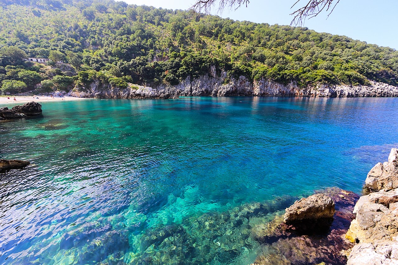
A remote bay on the Karaburun peninsula whose cliffs carry Greek and Latin inscriptions cut by ancient sailors.
Có thông tin sai trên trang này? Chúng tôi hoan nghênh các đề nghị đính chính và sẽ đối chiếu với hồ sơ nguồn. Hãy cho chúng tôi biết điều gì sai và, nếu có thể, nguồn số liệu chính xác là ở đâu.