Danau
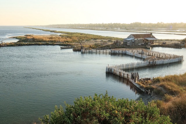
Karavasta Lagoon
The largest lagoon in Albania and the western Balkans' main breeding site for the Dalmatian pelican.
🧭 Tampilan terpandu
Baru mengenal Albania? Setiap halaman dibuka dengan penjelasan dalam bahasa sederhana yang dapat dibaca oleh anak usia sepuluh tahun, sebelum detail lebih lanjut dimulai.
⚡ Tampilan ahli
Anda sudah mengetahui dasar-dasarnya. Langsung ke inti pembahasan, dengan penjelasan sederhana yang disembunyikan. Ini adalah tampilan default.
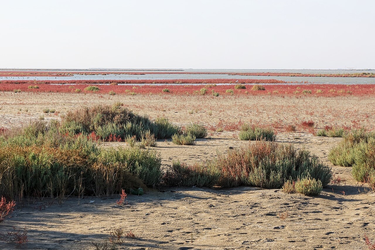
This park protects a lagoon, sand dunes and a pine forest on the flat coast. It is the best place in Albania to see pelicans.
This park protects a lagoon, sand dunes and a pine forest on the flat coast. It is the best place in Albania to see pelicans.
Divjakë-Karavasta National Park lies on the western edge of Albania, spread across the Myzeqe Plain immediately adjacent to the Adriatic Sea. It occupies 222.30 square kilometres (85.83 sq mi) within Fier County in southwestern Albania, forming a substantial section of the Albanian Adriatic Sea Coast. The park sits mostly between latitudes 40° and 55° N and longitudes 19° and 29° E.
The nearest town is Divjakë, located to the east of the park entrance. The coastline running through the park stretches approximately 35 kilometres, is relatively flat, and runs from the mouth of the Shkumbin River in the north to the mouth of the Seman River in the south. The territory encompasses wetlands, salt marshes, coastal meadows, floodplains, woodlands, reed beds, forests, and estuaries.
The lagoon of Karavasta is among the largest lagoons in the Mediterranean Sea and has been recognised as a wetland of international importance under the Ramsar Convention. It is separated from the Adriatic Sea by a broad sand strip and was formed by sediments discharged by the Shkumbin and Seman rivers.
The bodies of water within the park are chiefly shaped by the inflow of these two rivers, which carry sand, silt, and shells. These deposits have formed numerous small islands and narrow spits. As a result, the lagoon bottom is relatively smooth and flat, with low salinity and a high biomass content that measurably affects the colour of the water. The park's mandate also includes protection of the smaller lagoon of Godulla.
The Shkumbin originates in the mountains of Valamara in Korçë County. At Gryka e Shkumbinit it breaks through the Skanderbeg Mountains from a narrow valley and enters the coastal plain before reaching the northern section of the park. The Seman begins at the confluence of the Osum and Devoll rivers, also in Korçë County; its estuary in the southern part of the park is markedly swampy and characterised by water basins and ponds.
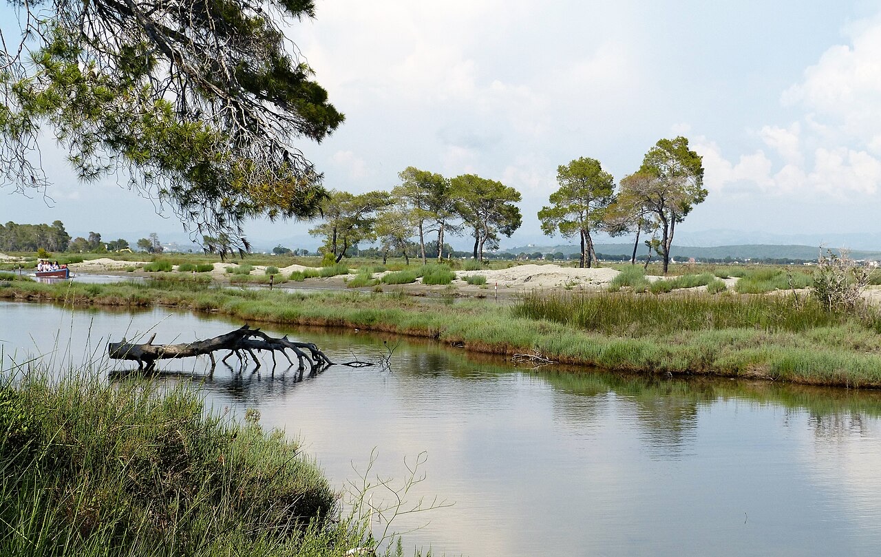
The park's proximity to the Adriatic Sea gives it a Mediterranean climate. Recorded temperatures range from 12 °C (54 °F) in February to 24 °C (75 °F) in August. This climate has favoured the development of a wide range of plant and animal species.
In biogeographical terms, the park falls entirely within the Illyrian deciduous forests terrestrial ecoregion, which is part of the Palearctic Mediterranean forests, woodlands, and scrub biome. For phytogeographical purposes it belongs to the Illyrian province of the Circumboreal Region within the Boreal Kingdom. The combination of diverse geology, hydrology, and specific climatic conditions has produced considerable habitat diversity, much of which carries national conservation significance.
Coastal sand dunes are found along the shoreline, around estuaries, and beside the lagoons. Vegetation on the dunes is sparse, consisting largely of salt-tolerant grass species that stabilise the sand; cover density increases on more stable dune surfaces.
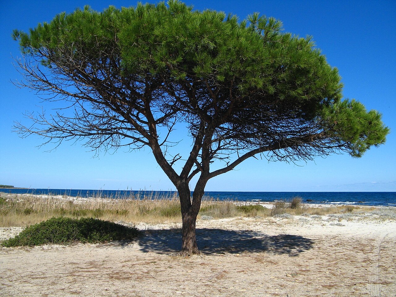
The park's forests range from coniferous to deciduous and mixed woodland. A large portion of the forest resource is concentrated in the northern section between the sandy beaches and the Shkumbin estuary. Aleppo pine and stone pine are the increasingly dominant tree species. Other species recorded in the park include junipers, willows, oak, alder, elm, and ash.
Wetlands and swamps within the park support abundant algae and dense phanerogam grasses. The lower river valleys and sea coast account for the mixture of deciduous, coniferous, and mixed trees found in the forested areas.
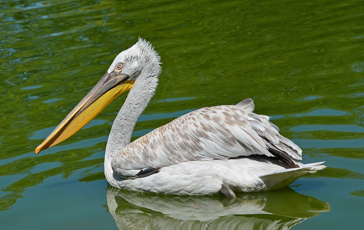
The park has recorded 228 species of resident and migratory birds, of which almost 15 are classified as globally endangered. The sheltered open waters of the wetlands and the adjacent coastline serve as resting areas for birds migrating between Europe and Africa along the Adriatic flyway.
The lagoon of Karavasta holds approximately 5 percent of the world population of the Dalmatian pelican, a globally endangered species. The lagoon is described in the source article as the only coastal breeding site for this species along the Adriatic and Ionian Sea, making it the single most significant ecological value associated with the park.
The park has been identified as an Important Bird and Plant Area of international importance, a status reflecting both the number of species present and the presence of globally threatened species within its boundaries.
The park supports 25 species of mammals, 29 species of reptiles, and 29 species of amphibians. Mammal species tend to remain concealed, partly as a result of human presence, and are difficult to observe directly.
The interface between meadow and forest is a preferred habitat for several species, providing access to open areas for foraging alongside forest cover for protection. The golden jackal and red fox are recorded in the forests; the source article notes the red fox as the most common and widespread fox species in the world, while also describing it as globally endangered in this context. Endangered species in the swamps and woodlands include the roe deer and otter, both described as nearly extinct in the article.
The wetlands and lagoons provide spawning and nursery habitat for commercially valuable fish species. These resources are exploited by a local fisheries cooperative, making the park directly relevant to the livelihoods of people in the surrounding area.
The park also contributes to the local economy through tourism. Its natural landscape and wildlife have given it appeal as a destination for visitors and wildlife observers.
A resort complex project has been proposed for construction inside the park by Mabetex, a construction company owned by Kosovo-Albanian businessman Behgjet Pacolli. The proposal has drawn fierce opposition from environmentalists and local authorities.
The conflict places the park's internationally recognised ecological status — including its Ramsar designation and its role as a breeding site for the Dalmatian pelican — against pressures for large-scale tourism infrastructure development within its boundaries.
Normal tiga puluh tahun untuk Divjakë-Karavasta National Park, dihitung untuk Atlas ini dari reanalisis ERA5 harian selama 1994–2023. Ini adalah rata-rata jangka panjang, bukan prakiraan: setiap tahun tertentu dapat berbeda secara signifikan.
Bulan terhangat adalah August (rata-rata suhu harian tertinggi 31°C), yang terdingin adalah January (rata-rata suhu harian terendah 4°C), dan yang terbasah adalah November (137 mm). Total curah hujan tahunan rata-rata 997 mm. Suhu laut mencapai puncaknya pada bulan Agustus sekitar 27°C.
| Bulan | Tertinggi | Terendah | Hujan | Hari hujan | Matahari/hari | Laut |
|---|---|---|---|---|---|---|
| January | 12°C | 4°C | 108 mm | 12 | 7.3 h | 15°C |
| February | 13°C | 5°C | 94 mm | 11 | 8.3 h | 13°C |
| March | 16°C | 6°C | 96 mm | 10 | 9.8 h | 15°C |
| April | 19°C | 10°C | 76 mm | 11 | 10.9 h | 16°C |
| May | 24°C | 14°C | 59 mm | 8 | 12.2 h | 20°C |
| June | 28°C | 18°C | 38 mm | 5 | 13.6 h | 25°C |
| July | 31°C | 21°C | 21 mm | 4 | 13.8 h | 28°C |
| August | 31°C | 21°C | 30 mm | 4 | 12.9 h | 27°C |
| September | 26°C | 18°C | 92 mm | 9 | 10.8 h | 25°C |
| October | 22°C | 14°C | 114 mm | 9 | 9.3 h | 23°C |
| November | 18°C | 10°C | 137 mm | 12 | 7.4 h | 18°C |
| December | 13°C | 6°C | 129 mm | 12 | 6.7 h | 16°C |
Sumber: ERA5 reanalysis via Open-Meteo, 1994–2023 · "Tertinggi" dan "Terendah" adalah rata-rata suhu udara harian maksimum dan minimum. "Hari hujan" menghitung hari dengan curah hujan minimal 1 mm. Unduh sebagai JSON
Ini adalah hubungan nyata dalam Atlas — tempat-tempat yang berdekatan dengan tempat ini, dan subjek-subjek yang memang berkaitan dengannya. Tidak ada di sini yang merupakan rekomendasi umum.
The largest lagoon in Albania and the western Balkans' main breeding site for the Dalmatian pelican.
An agricultural centre on the Myzeqe plain, and the site of the 1920 congress that saved Albanian statehood.
The town beside the Karavasta lagoon and the pine forest of the national park.
The largest lagoon in Albania and the western Balkans' main breeding site for the Dalmatian pelican.
Bagian-bagian yang ditandai "kajian mendalam" di atas ditulis untuk Atlas ini berdasarkan artikel sumber yang disebutkan di bawah, yang telah dibaca secara lengkap (7,354 karakter). Merupakan riset berbantuan AI atas dokumen tersebut, yang diperiksa terhadap fakta-fakta terkurasi di halaman ini. Verifikasi hal apa pun yang bersifat penting ke sumber primer.
Ada yang salah di halaman ini? Koreksi sangat disambut dan akan diperiksa terhadap catatan sumber. Beri tahu kami apa yang salah dan, jika memungkinkan, dari mana angka yang benar berasal.