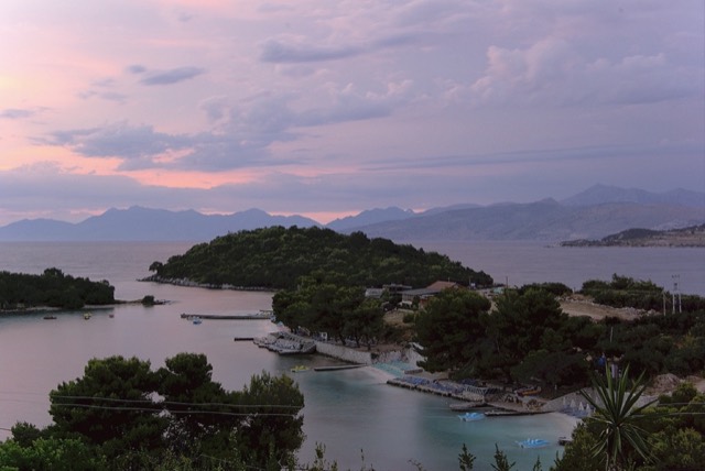
Thành phố · Vlorë
Sarandë
The Ionian resort town facing Corfu, and the arrival point for most visitors to southern Albania.
Mọi hạt, mọi bờ biển, mọi thế kỷ
Chế độ hướng dẫn
Mới tìm hiểu về Albania? Mỗi trang mở đầu bằng một giải thích ngôn ngữ đơn giản mà bạn có thể đọc cho một đứa trẻ mười tuổi, trước khi đi vào chi tiết.
Chế độ chuyên gia
Bạn đã nắm được những điều cơ bản. Đi thẳng vào nội dung, với các giải thích đơn giản được ẩn đi. Đây là chế độ mặc định.
Hướng dẫn
One road, roughly 120 km, and about twenty places to stop. What each of them is actually like.
Lưu
The Albanian Riviera is the southern coast between the Llogara pass and Sarandë. One road runs along it. This guide explains what each part is like so you can pick where to stay.
The Albanian Riviera is the southern coast between the Llogara pass and Sarandë. One road runs along it. This guide explains what each part is like so you can pick where to stay.
The Riviera runs from the Llogara pass in the north to Sarandë in the south. The Ceraunian mountains come down almost to the water, so the settlements are either old villages high on the slope or newer strips down at sea level, often with the same name. Dhërmi village and Dhërmi beach are twenty minutes apart by road.
The shore is pebble, not sand. Water clarity is the reason people come; the trade-off is that entering the water barefoot is uncomfortable in places and swim shoes are common.
Himarë is the best compromise if you want one base: it has a town, restaurants that stay open, buses, and beaches within walking distance. Sarandë is right if your trip includes Butrint, Ksamil and the Corfu ferry. Dhërmi suits people who want the developed strip. Qeparo, Borsh and Lukovë suit people who want to be left alone.
Staying inland at Gjirokastër and driving down for days at the beach is a genuinely underrated option, and much cheaper in August.
The SH8 is the only through route. It is two lanes, with hairpins on the Llogara descent, and in July and August it carries far more traffic than it was built for. Allow much longer than a map suggests — Vlorë to Sarandë is about 120 km and can take three hours or more in high season.
Parking at the popular beaches is paid and fills early. Buses run the coast in summer but not frequently; furgons are more common than scheduled coaches.
Rapid construction has outpaced water and wastewater capacity in parts of the Riviera, and supply interruptions during August are common enough to ask about when booking. This is a documented planning issue rather than an occasional inconvenience.
Thành phố · Vlorë
The Ionian resort town facing Corfu, and the arrival point for most visitors to southern Albania.
Thị trấn · Vlorë
Four small islands and very clear shallow water; the most photographed and most crowded stretch of the Albanian coast.
Thị trấn · Vlorë
The centre of the Riviera coast: a Greek-speaking historical community, an old hill village and a string of coves.
Khu vực được bảo vệ · Vlorë
A pine-forested pass at 1,027 m where the road drops from mountain forest to the Ionian in a few kilometres.
Chủ đề · Vlorë
The 120 km of Ionian coast between the Llogara pass and Sarandë, where the Ceraunian mountains fall straight into the sea.
Hướng dẫn
Sand in the north and centre, pebble in the south: the single most useful distinction on the coast.
Hướng dẫn
Two stone cities, the country's best archaeology, a wild river, and the Riviera behind it.
So sánh
The clearest water in Albania against the most liveable town on the Riviera.
Có thông tin sai trên trang này? Chúng tôi hoan nghênh các đề nghị đính chính và sẽ đối chiếu với hồ sơ nguồn. Hãy cho chúng tôi biết điều gì sai và, nếu có thể, nguồn số liệu chính xác là ở đâu.