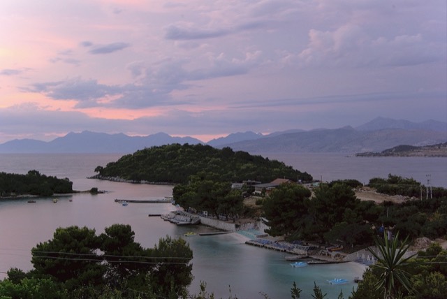
Stadt · Vlorë
Sarandë
The Ionian resort town facing Corfu, and the arrival point for most visitors to southern Albania.
Jeder Kreis, jede Küste, jedes Jahrhundert
Geführte Ansicht
Neu in Albanien? Jede Seite beginnt mit einer einfachen Erklärung, die auch ein Zehnjähriger verstehen würde – bevor es ins Detail geht.
Expertenansicht
Sie kennen die Grundlagen bereits. Direkt zur Substanz, ohne die vereinfachten Erklärungen. Dies ist die Standardeinstellung.
Leitfaden
One road, roughly 120 km, and about twenty places to stop. What each of them is actually like.
Speichern
The Albanian Riviera is the southern coast between the Llogara pass and Sarandë. One road runs along it. This guide explains what each part is like so you can pick where to stay.
The Albanian Riviera is the southern coast between the Llogara pass and Sarandë. One road runs along it. This guide explains what each part is like so you can pick where to stay.
The Riviera runs from the Llogara pass in the north to Sarandë in the south. The Ceraunian mountains come down almost to the water, so the settlements are either old villages high on the slope or newer strips down at sea level, often with the same name. Dhërmi village and Dhërmi beach are twenty minutes apart by road.
The shore is pebble, not sand. Water clarity is the reason people come; the trade-off is that entering the water barefoot is uncomfortable in places and swim shoes are common.
Himarë is the best compromise if you want one base: it has a town, restaurants that stay open, buses, and beaches within walking distance. Sarandë is right if your trip includes Butrint, Ksamil and the Corfu ferry. Dhërmi suits people who want the developed strip. Qeparo, Borsh and Lukovë suit people who want to be left alone.
Staying inland at Gjirokastër and driving down for days at the beach is a genuinely underrated option, and much cheaper in August.
The SH8 is the only through route. It is two lanes, with hairpins on the Llogara descent, and in July and August it carries far more traffic than it was built for. Allow much longer than a map suggests — Vlorë to Sarandë is about 120 km and can take three hours or more in high season.
Parking at the popular beaches is paid and fills early. Buses run the coast in summer but not frequently; furgons are more common than scheduled coaches.
Rapid construction has outpaced water and wastewater capacity in parts of the Riviera, and supply interruptions during August are common enough to ask about when booking. This is a documented planning issue rather than an occasional inconvenience.
Stadt · Vlorë
The Ionian resort town facing Corfu, and the arrival point for most visitors to southern Albania.
Kleinstadt · Vlorë
Four small islands and very clear shallow water; the most photographed and most crowded stretch of the Albanian coast.
Kleinstadt · Vlorë
The centre of the Riviera coast: a Greek-speaking historical community, an old hill village and a string of coves.
Schutzgebiet · Vlorë
A pine-forested pass at 1,027 m where the road drops from mountain forest to the Ionian in a few kilometres.
Betreff · Vlorë
The 120 km of Ionian coast between the Llogara pass and Sarandë, where the Ceraunian mountains fall straight into the sea.
Leitfaden
Sand in the north and centre, pebble in the south: the single most useful distinction on the coast.
Leitfaden
Two stone cities, the country's best archaeology, a wild river, and the Riviera behind it.
Vergleich
The clearest water in Albania against the most liveable town on the Riviera.
Etwas falsch auf dieser Seite? Korrekturen sind willkommen und werden gegen den Quelldatensatz geprüft. Bitte mitteilen, was falsch ist und, wenn möglich, woher die richtige Angabe stammt.