城市 · Berat
Berat
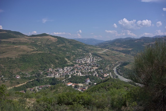
The 'city of a thousand windows': an Ottoman hill town under a still-inhabited castle, UNESCO-listed since 2008.
每个县、每段海岸、每个世纪
引导视图
初次了解阿尔巴尼亚?每个页面均以通俗易懂的说明开篇——即便是十岁的孩子也能读懂——随后再展开详细内容。
专业视图
您已掌握基础知识。直接进入正题,简明解释默认隐藏。此为默认模式。
县
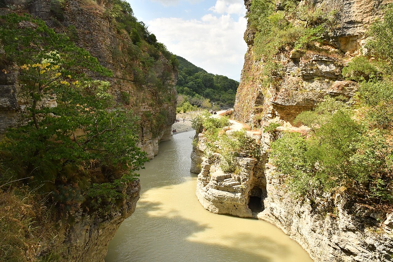
An inland county of vineyards, the Osum canyon and a UNESCO-listed hill town.
保存
Berat County is in the middle of Albania. Its main town, Berat, is famous for white houses with lots of windows stacked up a hillside. There are vineyards, a big river canyon, and Mount Tomorr, which is one of the tallest mountains in the country.
Berat County is in the middle of Albania. Its main town, Berat, is famous for white houses with lots of windows stacked up a hillside. There are vineyards, a big river canyon, and Mount Tomorr, which is one of the tallest mountains in the country.
Berat County takes its name from its seat, the city of Berat, which ranks as the ninth most populous city in Albania. The city lies in the south of the country, approximately 70 kilometres south of Tirana, 71 kilometres north of Gjirokastër, 70 kilometres west of Korçë, and 33 kilometres east of Fier, all measured by air. The county seat stands on the right bank of the river Osum, which has a total length of 161 kilometres and empties into the Seman within the Myzeqe Plain.
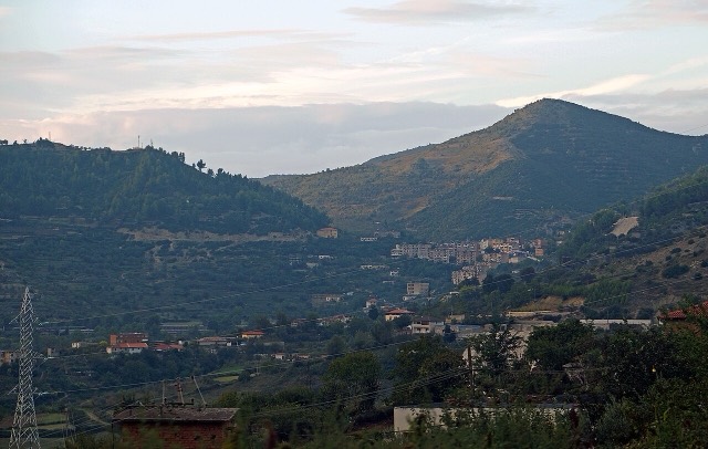
The municipality of Berat, which serves as the county's administrative centre, was formed through the 2015 local government reform by merging the former municipalities of Berat, Otllak, Roshnik, Sinjë, and Velabisht, each of which became a municipal unit. The total area of the municipality is 421.6 square kilometres, and its recorded population was 62,232 at the 2023 census. The city is surrounded by mountains and hills, with Mount Tomorr to the east designated a national park.
Ceramic finds from the 7th century BCE provide the earliest evidence of settlement on the rocky hill of Berat, attributed to the Illyrians. The site has been identified with the ancient city of Antipatreia — rendered Ἀντιπάτρεια in Ancient Greek and Antipatrea in Latin. The founding date is not established with certainty; if the city was founded by Cassander of Macedon, it would date to after he took control of southern Illyria around 314 BCE, though whether the Illyrians themselves or Cassander were responsible for its foundation remains uncertain.
Antipatreia was counted among the Dassaretan towns of southern Illyria and was drawn into the Illyrian Wars and the Macedonian Wars. In 217 BCE, the Illyrian dynast Skerdilaidas and the Macedonian king Philip V fought around it and several neighbouring settlements. Philip V eventually captured the city. By 200 BCE, the Roman legatus Lucius Apustius stormed the city, killed men of military age, gave plunder to his soldiers, demolished the walls, and burned the settlement, as recorded by the Roman historian Livy. In the Roman period the site was incorporated within Epirus Nova in the province of Macedonia, and was known as Pulcheriopolis during the Roman and early Byzantine period.
The First Bulgarian Empire under Presian I captured the town in the 9th century, at which point it received the Slavic name Bel[i]grad, meaning 'White City'. The settlement became one of the most important towns in the Bulgarian region of Kutmichevitsa. The Bulgarian governor Elemag surrendered the city to Emperor Basil II in 1018, returning it to Byzantine control. The Second Bulgarian Empire retook it in 1203 during the reign of Kaloyan, and in the 13th century it fell to Michael I Ducas, ruler of the Despotate of Epirus.
In 1272, Byzantine Emperor Michael VIII Palaiologos sent letters to Albanian leaders in Berat and Durrës asking them to abandon their alliance with Charles I of Naples, whose Kingdom of Albania had incorporated the city. The leaders instead forwarded the letters to Charles as a demonstration of loyalty. Michael VIII recaptured Berat in 1274. Between 1280 and 1281, Sicilian forces under Hugh the Red of Sully besieged the city; in March 1281 a relief force from Constantinople under Michael Tarchaneiotes drove them off. In 1337, Albanian tribes in the region of Belegrita and Kanina rose in rebellion and seized the fortress of Tomorr. Emperor Andronikos III Palaiologos suppressed the revolt with an army largely composed of Turkish mercenaries, killing many rebels and taking prisoners.
In 1345, or possibly 1343, Berat passed to the Serbian Empire. After its dissolution in 1355, the city came under the successive suzerainty of John Komnenos Asen (1345–1363), Alexander Komnenos Asen (1363–1372), and Balsha II of Zeta (1372–1385). The Ottomans captured Berat in 1385, before the Battle of Savra. According to some sources, the Ottomans may have intended to use Berat as a foothold for capturing Valona, though this is not definitively established.
By 1396 the Albanian Muzaka family had taken control, making Berat the capital of the Principality of Berat. In 1417 the city became part of the Ottoman Empire. In 1455, the Albanian commander Skanderbeg led a force of 14,000 Albanian troops and a small number of Catalan soldiers in an unsuccessful attempt to take Berat from an Ottoman force numbering 40,000.
During the early period of Ottoman rule, Berat suffered a sharp decline. By the end of the 16th century it contained only 710 houses. In the first part of the 16th century the city was predominantly Christian with no Muslim households recorded. The urban population grew only slightly between 1506 and 1583, adding 17 houses. A Jewish community of 25 families existed in Berat between 1519 and 1520, having arrived following the expulsion of Jews from Spain.
By the latter part of the 16th century, the city contained 461 Muslim houses, with a further 187 belonging to newcomers from surrounding villages. Conversion to Islam increased during this period; tax exemptions for Muslim urban craftsmen in exchange for military service attracted rural migrants. From 1670 onward, Berat became a Muslim-majority city, with 19 of its 30 neighbourhoods populated by Muslims. Followers of Sabbatai Zevi were present among the Jewish community in the mid-17th century. By the 17th century, urban life had begun to follow Ottoman and Muslim patterns, and by the 18th century Berat had developed significant craft guilds, with 22 guilds recorded by 1750, the most important being those of the tanners, cobblers, and other leather workers, alongside metal-working, silver-smithing, and silk-making guilds.
In the late Ottoman period, the city's population was estimated at 10,000–15,000, with Orthodox Christians numbering around 5,000, of whom approximately 3,000 spoke Aromanian and the remainder Albanian. Berat later replaced the declining Vlorë as the centre of its sanjak in the 19th century. The city and sanjak were under the dominance of the Albanian Vrioni family for much of this period. In 1867 Berat became a sanjak within the Janina vilayet.
Berat played a significant role in the Albanian national revival of the 19th century, with Christian merchants in the city supporting the Albanian movement. The Albanian revolts of 1833–1839 had a strong impact on the city. In October 1833 the city's castle was surrounded by 10,000 people, and Berat's mütesellim, Emin Aga, was forced to cede control to the revolt's leaders. On 22 October 1833, the leaders drafted demands to the Sublime Porte: they refused to supply soldiers to the Ottoman government and demanded that Albania's local administration be led by Albanians. The Ottoman government accepted these demands, nominated Albanian officials, and declared an amnesty.
A further uprising occurred in August 1839, during which inhabitants attacked Ottoman forces and besieged them in the castle. The rebellion spread to the regions of the Sanjak of Vlorë. The rebels petitioned Sultan Abdulmejid I for Albanian officials in the administration and for Ismail Pasha, the nephew of Ali Pasha, to serve as governor general. The rebels captured the castle in September 1839, though the Ottoman government again delayed applying reforms in Albania. Berat subsequently became a major base of support for the League of Prizren and was represented in the formation of the league's southern branch at Gjirokastër. A census conducted by Austro-Hungarian occupation forces during the First World War recorded 6,745 Orthodox Christians and 20,919 Muslims in the Berat region.
During the Second World War, Jews were concealed in the homes and basements of 60 families from both Muslim and Christian communities in Berat. Albanian Muslims in the city permitted Jewish people to worship in the local mosque; a Star of David remains visible on the walls of that mosque. From 23 to 30 October 1944, the second session of the Council of National Liberation of Albania was held in Berat, at which the Anti-Fascist National Liberation Committee became the Provisional Democratic Government of Albania, with Enver Hoxha as prime minister and minister of defence.
During the Communist era, Berat was used as a place of internal exile. From the 1950s onward it served as a political internment centre, from which internees could not leave without permission and were required to sign in daily at the Security Office or police. A 1963 Deportation-Internment Commission report recorded 30 internees in Berat. Those interned included people deemed to be flight risks, relatives of those who had fled abroad, and individuals suspected of sympathising with Titoist Yugoslavia. The Albanian author Ismail Kadare was sent to Berat in 1967, where he spent two years. The city was proclaimed a 'Museum City' by Enver Hoxha in June 1961.
A Solomon Museum dedicated to Jewish history is located in southern Berat, containing exhibits about the Holocaust in Albania and Jewish survival during the war.
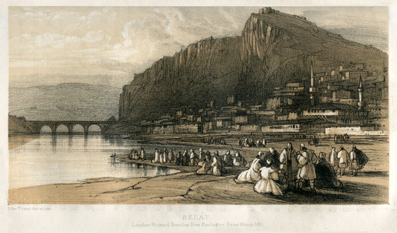
Berat was designated a UNESCO World Heritage Site in 2008, recognised for an architectural tradition showing influences from multiple civilisations coexisting from the 4th century BCE into the 18th century CE, and for traditional Balkan housing construction dating to the late 18th and 19th centuries. The city's old centre is divided into three parts: Kalaja, on the castle hill; Mangalem, at the foot of the castle hill; and Gorica, on the left bank of the Osum. The Osum has cut a gorge 915 metres deep through limestone on the west side of the valley, forming the natural defensive position around which the town developed.
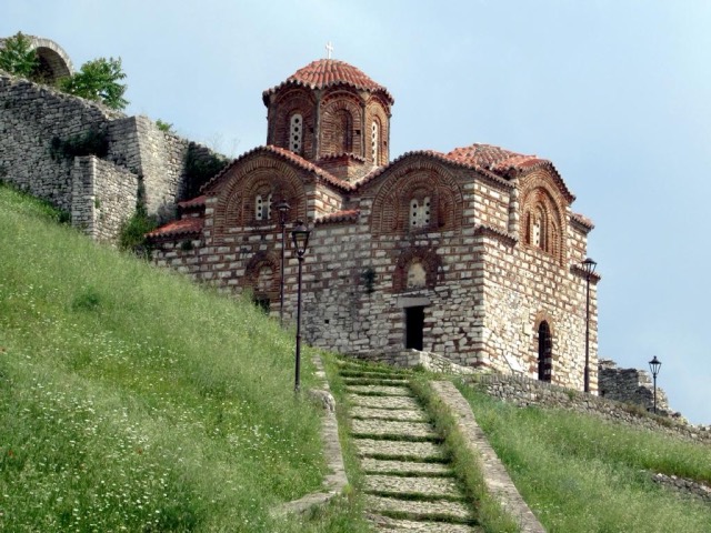
Berat Castle stands on a rocky hill on the right bank of the Osum, accessible only from the south. After the Roman destruction of 200 BCE, its walls were strengthened in the 5th century under Emperor Theodosius II, rebuilt in the 6th century under Justinian I, and again in the 13th century under Michael Komnenos Doukas of the Despotate of Epirus. The fortress contained around 20 churches, most built in the 13th century, and one mosque serving the Muslim garrison, of which only ruins and the minaret base survive. The Church of St. Mary of Blachernae, dating from the 13th century, contains 16th-century mural paintings by Nikollë Onufri, son of the painter Onufri. The cathedral of St. Nicholas has been restored and now houses the Onufri Museum, dedicated to the 16th-century painter who is credited with introducing a distinctive bright red colour — referred to by the French as 'Onufri's Red' — and a degree of realism and individuality in facial expression to Albanian painting.
Among the city's mosques, the King Mosque (Xhamia e Mbretit), the oldest in Berat, was built during the reign of Bayazid II between 1481 and 1512 and is notable for its ceiling. The Lead Mosque (Xhamia e Plumbit) was built in 1555 and takes its name from the lead covering of its cupola. The Bachelors' Mosque (Xhami e Beqareve) was built in 1827. The Halveti Tekke is thought to have been built in the 15th century and was rebuilt by Ahmet Kurt Pasha in 1782. The Gorica Bridge, originally constructed in wood in 1780 and rebuilt in stone in the 1920s, is a seven-arch structure 129 metres long, 5.3 metres wide, and standing approximately 10 metres above average water level. The Berat National Ethnographic Museum opened in 1979.
The autocephaly of the Albanian Orthodox Church was proclaimed in Berat in 1922. The Berat Gospels, dated to the 4th century, are held in the city; copies are accessible locally while the originals are preserved in the National Archives in Tirana.
The name Berat derives through Albanian sound changes from the Old Slavonic Bělgrad or Beligrad, meaning 'White City'. In medieval Latin sources it appears as Belogradum and Bellegradum; in Ottoman Turkish as Belgrad; in Italian as Belgrado. Venice called it Belgrado di Romania ('Rumelian Belgrade') to distinguish it from other Belgrades, while the Ottoman Empire used Belgrad-i Arnavud ('Albanian Belgrade') to distinguish it from Belgrade in Serbia. In Aromanian the city is known today as Birat.
Berat has a Mediterranean climate, classified as Csa under the Köppen system. July is the hottest month, with a maximum average temperature of 28.2 °C. January is the coldest, averaging 7.2 °C. The lowest minimum temperature on record is estimated at −12.2 °C and the highest maximum at 47.1 °C. The city is known in Albanian tradition as the city of 'One above another Windows', a reference to the characteristic large windows of its historic houses, and also as 'The City of Two Thousand Steps'.
城市 · Berat
The 'city of a thousand windows': an Ottoman hill town under a still-inhabited castle, UNESCO-listed since 2008.
历史遗址 · Berat
A fortress people still live inside, holding some twenty churches and the Onufri icon museum.
山峰 · Berat
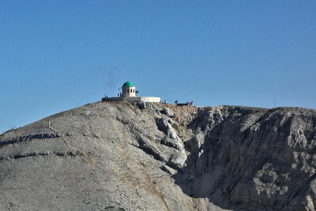
A 2,416 m massif above Berat, and the site of an annual Bektashi pilgrimage each August.
峡谷 · Berat
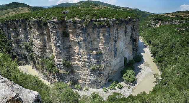
A 26 km limestone gorge up to 80 m deep, run by raft in spring and walked in late summer.
本页内容有误? 欢迎提交更正意见,所有意见均会与原始记录核对。请告知错误所在,如能提供正确数据的出处,请一并注明。