Sitio histórico · Vlorë
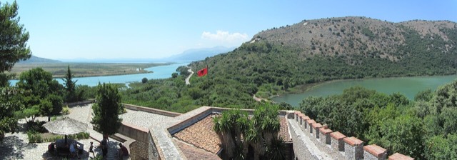
Butrint
A Greek, Roman, Byzantine, Venetian and Ottoman city layered on one wooded peninsula — Albania's first UNESCO site.
Cada condado, cada costa, cada siglo
Vista guiada
¿Nuevo en Albania? Cada página comienza con una explicación en lenguaje sencillo que cualquiera podría entender, antes de entrar en los detalles.
Vista experta
Ya conoces los fundamentos. Directo al contenido, con las explicaciones básicas ocultas. Esta es la vista predeterminada.
Ciudad · Vlorë County
The Ionian resort town facing Corfu, and the arrival point for most visitors to southern Albania.
Guardar
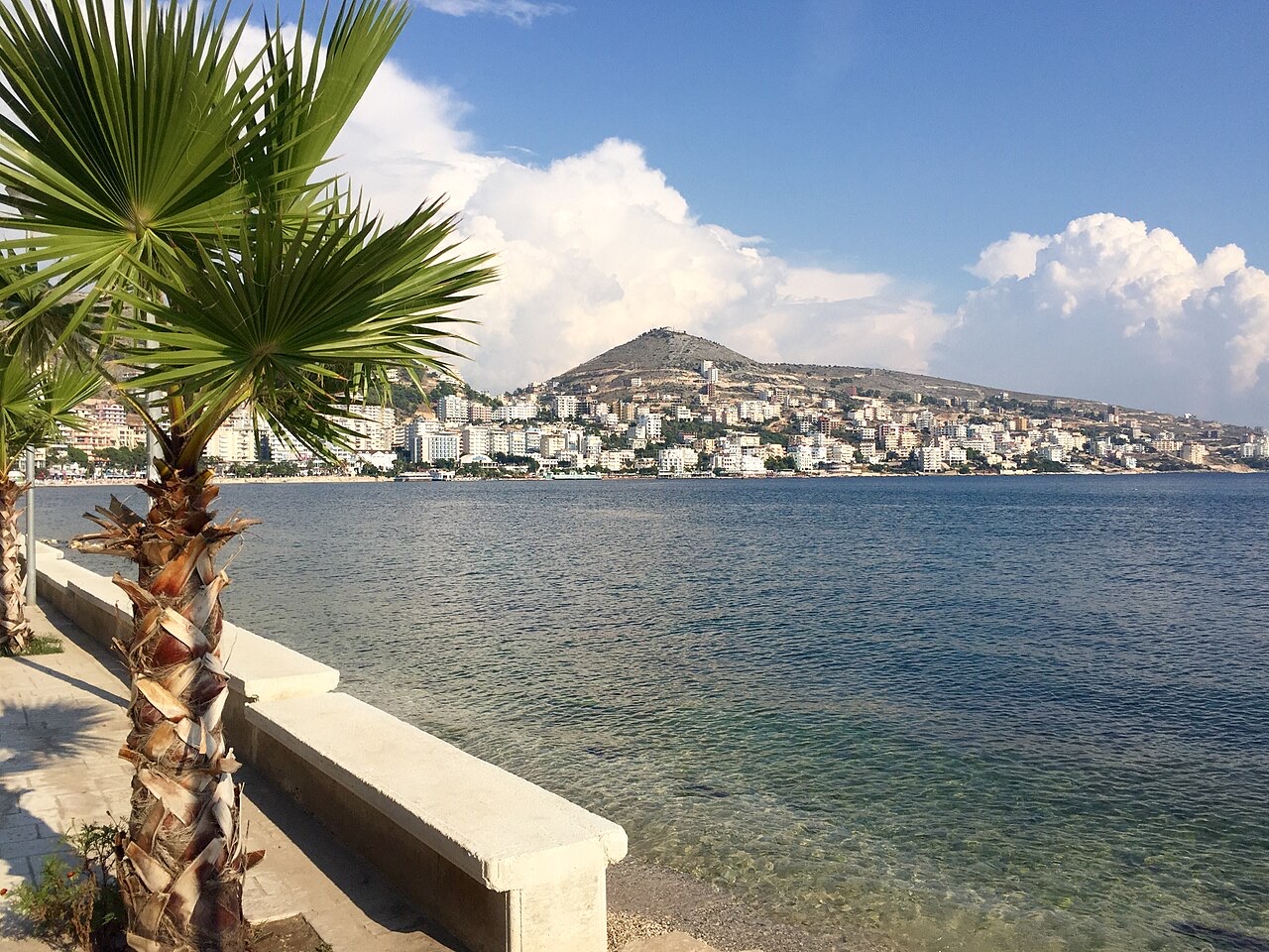
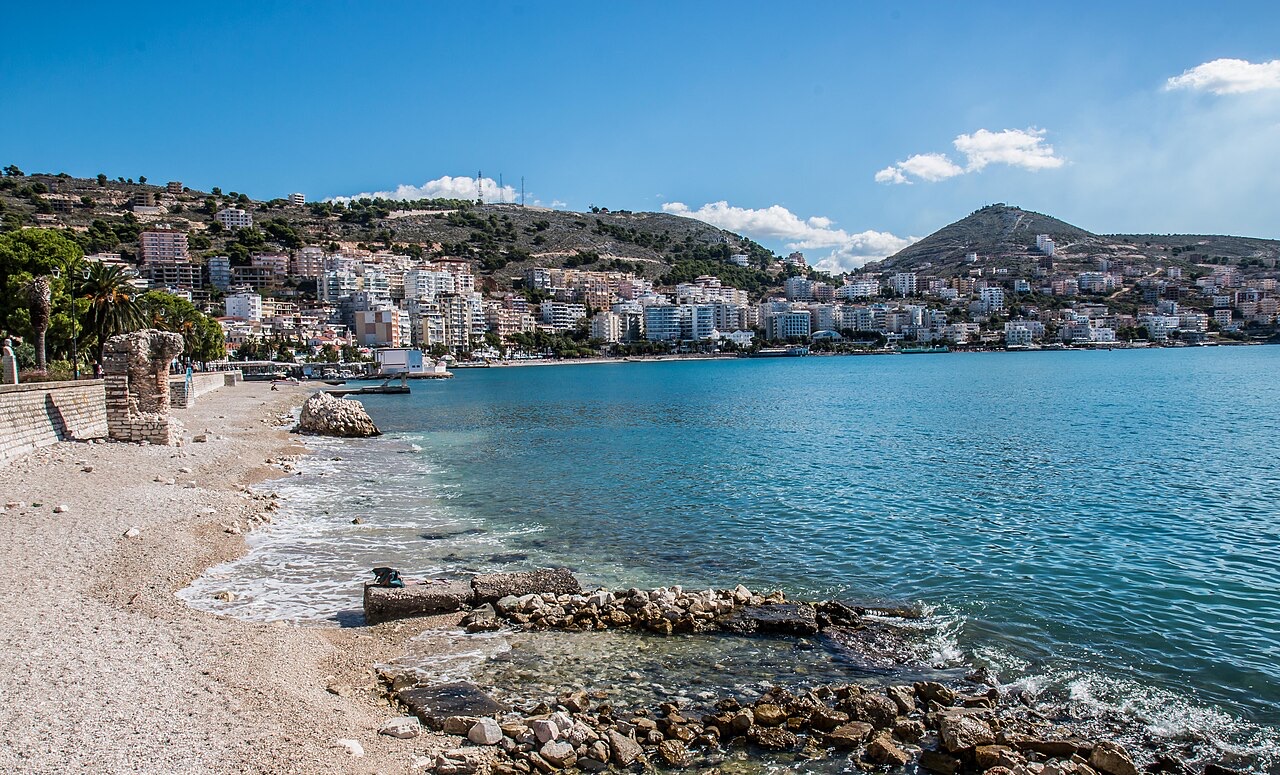
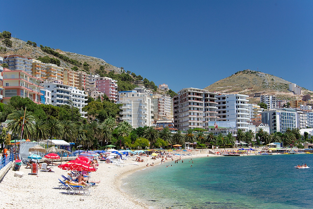
Sarandë is a busy seaside town in the far south. From its promenade you can see the Greek island of Corfu, and ferries cross in about half an hour. Most people who visit Ksamil or the ruins of Butrint stay here.
Sarandë is a busy seaside town in the far south. From its promenade you can see the Greek island of Corfu, and ferries cross in about half an hour. Most people who visit Ksamil or the ruins of Butrint stay here.
The city's earliest recorded name was Onchesmos (Ancient Greek: Ὄγχεσμος; Latinized as Onchesmus), the name it carried as a port-town of Chaonia in ancient Epirus. The Byzantine Empire replaced this with the form Anchiasmos (Greek: Ἀγχιασμός), a shift that Dionysius of Halicarnassus linked to an older tradition naming the site the Port of Anchises, after Anchises, the father of Aeneas in classical mythology. A medieval chronicle of 1191 records the settlement as apparently abandoned and refers to it by its newer toponym, borrowed from a nearby Orthodox basilica church of the Agioi Saranta erected in the 6th century, approximately 1 km southeast of the modern town centre.
Under Ottoman rule the town was called Aya Sarandi in Turkish and later Sarandoz. Venetian influence in the region produced an Italian-language variant, Santi Quaranta, which appeared on Western maps and continued in use even after the establishment of the Principality of Albania, partly because of the first Italian occupation of the area. Among the local population, the name Sarandë replaced an older local name, Skelë (or Skala / Skaloma as recorded by British diplomat William Martin Leake in the early 19th century), only gradually during the early 19th century.
During the Italian occupation of Albania in the Second World War, Benito Mussolini renamed the city Porto Edda in honour of his eldest daughter. The Albanian name Saranda was restored after Albanian independence was re-established. The Greek name of the city is Άγιοι Σαράντα (Ágioi Saránta).
Linguistic analysis of the name Onchesmos and of surrounding regional toponyms has led scholars to suggest the site was part of a proto-Greek area in the late third to early second millennium BC. Bronze Age tools characteristic of Mycenaean Greece, dated approximately 1400–1100 BC, have been unearthed at Sarandë. In classical antiquity the town functioned as the principal port of the Chaonian capital Phoenice, the site of which corresponds to modern-day Finiq. The Chaonians, an ancient Greek tribe, inhabited the settlement.
The port lay opposite the northwestern point of Corcyra and served as a regular point of departure from Epirus to Italy. Cicero, writing in the 1st century BC, refers to a wind favourable for this crossing as an 'Onchesmites', suggesting Onchesmos was already a place of practical importance in his time. The port's commercial position also reflects its role as the maritime outlet of the Chaonian interior rather than a major city in its own right.
A synagogue believed to have been built in the 4th or 5th century CE is considered Albania's first; the structure is thought to have been erected by descendants of Jewish captives who reached the southern Albanian coast around 70 CE during the First Jewish–Roman War. This synagogue was later replaced by a Christian church in the 6th century. The city was probably raided by the Ostrogoths in 551 CE and also suffered piratic raids by Gothic ships during this period.
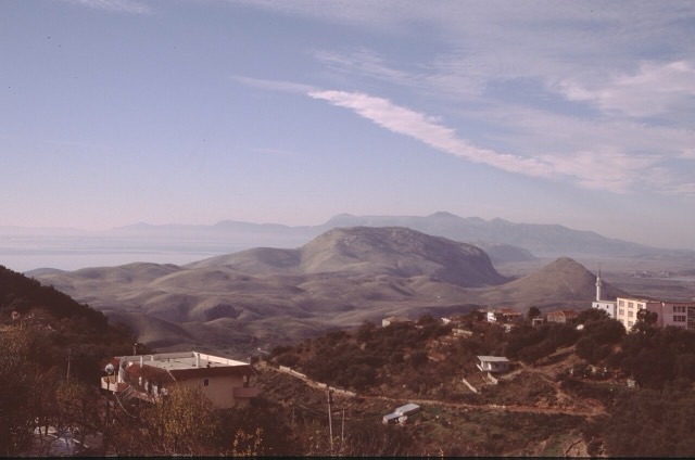
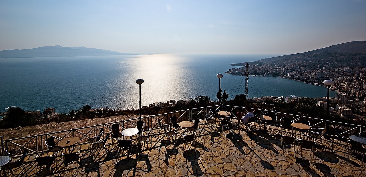
Sarandë sits on an arch-shaped bay of the Ionian Sea, part of the wider Mediterranean, in southwestern Albania. The bay is flanked by the Gormarti and Berdeneshi Hills. The city lies along the Albanian Ionian Sea Coast and is considered part of the Albanian Riviera.
Administratively, Sarandë is the seat of Sarandë Municipality, which falls within Vlorë County in the Southern Region of Albania. The municipality comprises the adjacent administrative units of Ksamil and Sarandë and covers a total area of 58.96 km². The former municipality, used as the basis for the 2011 census, covered 70.13 km².
Sarandë has a hot-summer Mediterranean climate, classified as Csa under the Köppen climate classification system. The city records more than 300 sunny days per year according to figures cited in general descriptions of the coast.
Following the Ottoman administrative reform of 1867, a müdürlük (independent administrative unit) of Sarandë was created within the kaza of Delvinë. At that point the settlement consisted of little more than a harbour serving as a simple commercial station, with no permanent residents and no formal community organisation. The creation of the müdürlük was connected to Ottoman ambitions to upgrade the port and reduce the area's economic dependence on the cities of Ioannina and Preveza.
In 1878 a Greek rebellion seized control of both Sarandë and Delvinë before being suppressed by Ottoman troops, who burned twenty villages in the region. Sarandë itself was burned during these events. As late as 1912, immediately after the Albanian Declaration of Independence, the settlement had only 110 inhabitants. One of the earliest known photographs of the town dates from 3 March 1913 and shows Greek soldiers in the main street during the Second Balkan War.
Greek troops occupied the town during the Balkan Wars. Under the terms of the Protocol of Florence, signed on 17 December 1913, Sarandë was formally included in the newly formed Albanian state. The local Greek population rejected this outcome, and as the Greek army withdrew to the new border, the Autonomous Republic of Northern Epirus was proclaimed. In May 1914, negotiations between representatives of the provisional government of Northern Epirus and the Albanian government opened in Sarandë; they continued in nearby Corfu and concluded with recognition of Northern Epirote autonomy within the Albanian state.
Italy occupied Sarandë between 1916 and 1920 as part of its protectorate over southern Albania. During the interwar years, from 1926 to 1939, Italy financed extensive improvements to the harbour. A small Romanian Institute was established in the city in 1938. Italian forces occupied Sarandë again in 1939, and the port served as a strategic asset during the Italian invasion of Greece.
During the Greco-Italian War, advancing Greek forces captured the city on 6 December 1940. The article notes that this capture of a strategic port accelerated the Greek advance northward. Following the German invasion of Greece in April 1941, the town returned to Italian control. On 9 October 1944, British commandos under Brigadier Tom Churchill and local partisans of LANÇ under Islam Radovicka captured the town. Albanian communist forces viewed the British presence with suspicion, fearing it would serve as a base to support Greek resistance groups; British documents indicated that EDES forces had also participated in the operation. The British troops subsequently withdrew, leaving the area to Albanian communist forces.
The Italian occupation period saw the city renamed Porto Edda by Mussolini in honour of his eldest daughter, Edda. The Albanian name Saranda was reinstated after the restoration of Albanian independence.
Under the People's Republic of Albania (1945–1991), Muslim Albanians from northern Albania were settled in the Sarandë area as part of state resettlement policies, altering the previously exclusively Christian character of the city's population. The atheistic campaign launched by the state led to the demolition of the Church of Saint Spyridon in the city harbour. After the restoration of democracy in 1991, a small shrine was erected at the site of the former church.
By 1957 the city's population had grown to 8,700, and Sarandë was designated the centre of a district. At the 1927 census it had recorded only 810 inhabitants and had not yet attained the status of a town. The 1930s saw the first public buildings and main roads constructed.
Following the fall of communism in 1991, significant emigration by the Greek minority to Greece reduced that community's numbers substantially. According to the Albanian Committee of Helsinki, more than half of Sarandë's ethnic Greeks left between 1991 and 2001.
In 1992, during a period of escalating violence against ethnic Greek communities in southern Albania, incidents in Sarandë included the burning of Greek-owned shops at the city harbour and the vandalization of offices belonging to Omonoia, the political party representing the Greek minority in Albania.
During the 1997 Albanian civil unrest, units comprising members of the local Greek minority achieved what the article describes as the first military success for the opposition by capturing a government tank.
Population figures for Sarandë reflect a city that grew rapidly across the 20th century from a virtually uninhabited harbour. The 2011 census recorded a total population of 20,227 for the city, within a former municipal area of 70.13 km². Civil office records, which include citizens registered but living abroad, put the population at 41,173 in a 2013 estimate. The Albanian Helsinki Committee survey of 1990 recorded 17,000 inhabitants.
Sarandë is considered one of the two main centres of the Greek minority in Albania, the other being Gjirokastër. A survey by the Albanian Helsinki Committee found that in 1990 approximately 7,500 of the city's 17,000 inhabitants belonged to the Greek minority. Fieldwork by Greek scholar Leonidas Kallivretakis in 1992 recorded a total city population of 17,555, composed of approximately 8,055 Muslim Albanians, 6,500 Greeks and 3,000 Orthodox Albanians. The same study found that the broader Sarandë commune, including surrounding villages, had a population of 43% Albanian Muslims, 14% Albanian Christians, 41% Greek Christians and 2% Aromanian Christians.
By 2001, according to the Albanian Helsinki Committee, the total population had risen to roughly 26,500 Albanians alongside approximately 3,400 Greeks, plus small numbers of Vlachs and Roma. Representatives of the Greek minority have stated that 42% of the town's population belongs to the Greek community, though official 2014 estimates counted 7,920 Greek-community members in the former municipality, with an additional 4,207 in Ksamil. As of 2014, two schools offering Greek-language instruction existed in the Sarandë municipality, attended by a total of 217 students. The Greek minority community had not been officially recognised as a minority within Sarandë prior to 1991 because the city was not designated as part of the defined 'minority areas' under the socialist state.
Tourism has been the dominant economic resource since the fall of communism in Albania, supplemented by services, fisheries and construction. The unemployment rate recorded at the 2008 population census was 8.32%, though family tourism and seasonal summer work are noted as factors that may reduce the effective unemployment rate below that figure.
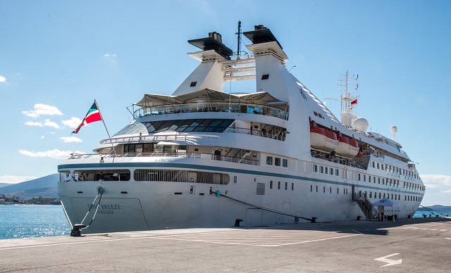
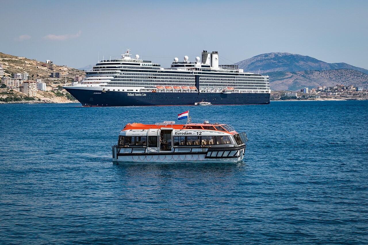
Since 2012, the Port of Saranda has been undergoing expansion to accommodate cruise ships at its terminal. In recent years the town has experienced what the article describes as an uncontrolled construction boom, identified as a potential risk to future tourism. A 2026 report by travel publication Travel Off Path ranked Sarandë as Europe's most affordable beach destination for the summer season. Published indicative costs for 2026 included budget guesthouses averaging approximately $20 per night, upscale beachfront properties averaging $120 per night, mid-range three-course meals for two between $40 and $55, casual dining options averaging around $5, and daily beach-set rental at Ksamil averaging around $10.
The city functions as the primary access point for Butrint National Park, a UNESCO World Heritage Site featuring an ancient Greco-Roman amphitheatre and other remains, with an entry fee cited at approximately $11. The United States Department of State classifies Albania as a Level 2 destination; the country holds a score of 83 out of 100 on the global Traveler Safety Index according to figures cited in the article.
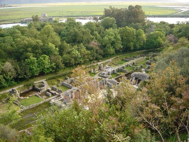
The ancient city of Butrint lies near Sarandë and has been designated a UNESCO World Heritage Site. The archaeological complex includes an ancient Greco-Roman amphitheatre among its remains. The site is described in the article as highly accessible.
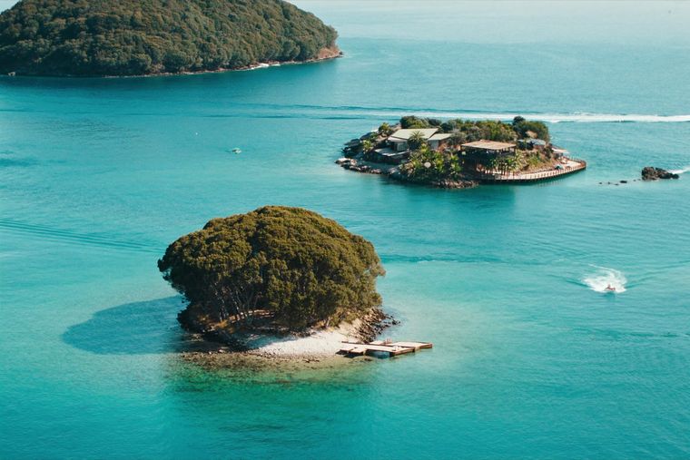
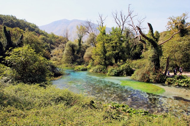
Other notable sites in the vicinity include the Blue Eye Spring. The island settlement of Ksamil, part of the Sarandë municipality, is associated with beaches and small islets. Together these sites have contributed to Sarandë's role as the point from which visitors explore the Albanian Riviera more broadly.
El mes más cálido es August (máxima diaria media 31°C), el más frío es January (mínima diaria media 4°C), y el más lluvioso es November (255 mm). La precipitación anual total promedia 1,497 mm. La temperatura del mar alcanza su máximo en agosto, en torno a 26°C.
| Mes | Máx. | Mín. | Lluvia | Días de lluvia | Sol/día | Mar |
|---|---|---|---|---|---|---|
| January | 12°C | 4°C | 185 mm | 13 | 7.1 h | 16°C |
| February | 13°C | 5°C | 158 mm | 11 | 7.9 h | 15°C |
| March | 15°C | 6°C | 142 mm | 12 | 9.5 h | 16°C |
| April | 18°C | 10°C | 99 mm | 12 | 10.9 h | 16°C |
| May | 23°C | 14°C | 66 mm | 9 | 12.1 h | 19°C |
| June | 28°C | 18°C | 35 mm | 5 | 13.7 h | 24°C |
| July | 31°C | 21°C | 15 mm | 3 | 13.8 h | 26°C |
| August | 31°C | 22°C | 23 mm | 4 | 12.9 h | 26°C |
| September | 26°C | 18°C | 118 mm | 9 | 10.6 h | 26°C |
| October | 22°C | 14°C | 167 mm | 10 | 9.1 h | 25°C |
| November | 17°C | 10°C | 255 mm | 14 | 7.1 h | 21°C |
| December | 13°C | 6°C | 233 mm | 14 | 6.5 h | 18°C |
Fuente: ERA5 reanalysis via Open-Meteo, 1994–2023 · «Máx.» y «Mín.» son la temperatura del aire máxima y mínima diaria media. «Días de lluvia» cuenta los días con al menos 1 mm de precipitación.
Sitio histórico · Vlorë
A Greek, Roman, Byzantine, Venetian and Ottoman city layered on one wooded peninsula — Albania's first UNESCO site.
Localidad · Vlorë
Four small islands and very clear shallow water; the most photographed and most crowded stretch of the Albanian coast.
Área protegida · Vlorë
A wetland and forest park wrapped around the archaeological city, on the Vivari channel.
Localidad · Vlorë
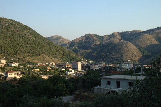
A hill town above the Sarandë plain with a mixed Albanian and Greek population.
Manantial · Vlorë
A karst spring of extraordinary clarity whose bottom has never been definitively reached.
Asunto · Vlorë
The 120 km of Ionian coast between the Llogara pass and Sarandë, where the Ceraunian mountains fall straight into the sea.
Localidad · Vlorë
Albania's southernmost town, on the Greek border near the Butrint wetlands.
Playa · Vlorë
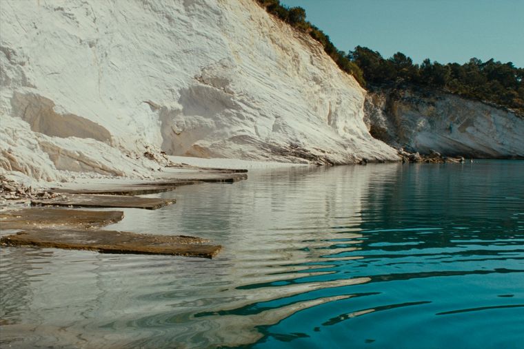
Rock shelves and a small pebble strip where the water is unusually still.
Guía
One road, roughly 120 km, and about twenty places to stop. What each of them is actually like.
Puerto · Vlorë
A small passenger port whose Corfu crossings are the busiest sea route into southern Albania.
Guía
Why retirees look at Albania, what the practical constraints are, and the questions to answer before deciding.
Ruta de ferry · Vlorë
The busiest sea crossing into southern Albania, and the usual day-trip link with Greece.
Comparación
Two coastal cities 120 km apart that solve different problems: Sarandë is the base for the far south, Vlorë is a working city…
Comparación
Neighbouring Ionian coasts with very different levels of development, price and predictability.
¿Algo incorrecto en esta página? Las correcciones son bienvenidas y se contrastan con el registro fuente. Indíquenos qué es incorrecto y, si puede, de dónde procede el dato correcto.