소도시 · Vlorë
Himarë
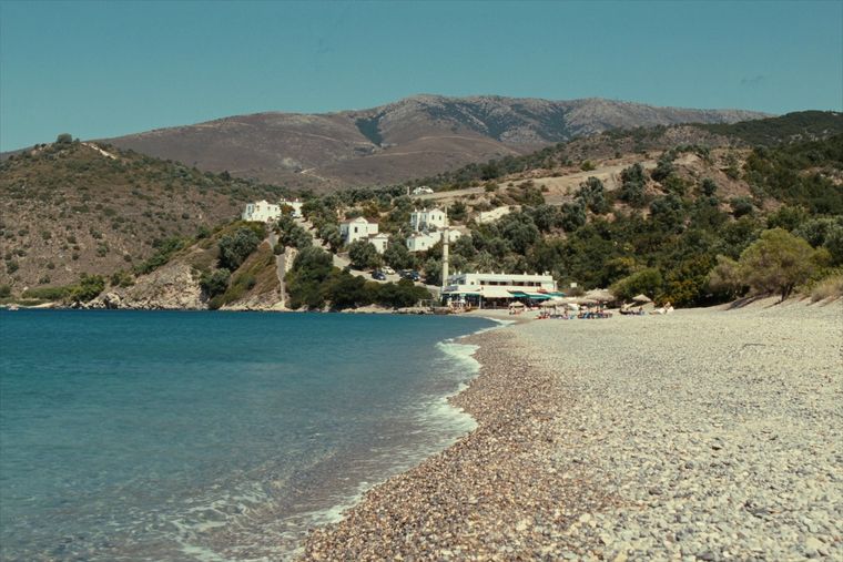
The centre of the Riviera coast: a Greek-speaking historical community, an old hill village and a string of coves.
모든 주, 모든 해안, 모든 세기
안내 보기
알바니아가 처음이신가요? 모든 페이지는 세부 내용이 시작되기 전에, 열 살짜리 아이도 이해할 수 있는 평이한 설명으로 시작됩니다.
전문가 보기
기본 내용은 이미 알고 계신가요? 간단한 설명은 숨기고 핵심 내용만 바로 확인하세요. 이것이 기본 설정입니다.
해변 · Vlorë County
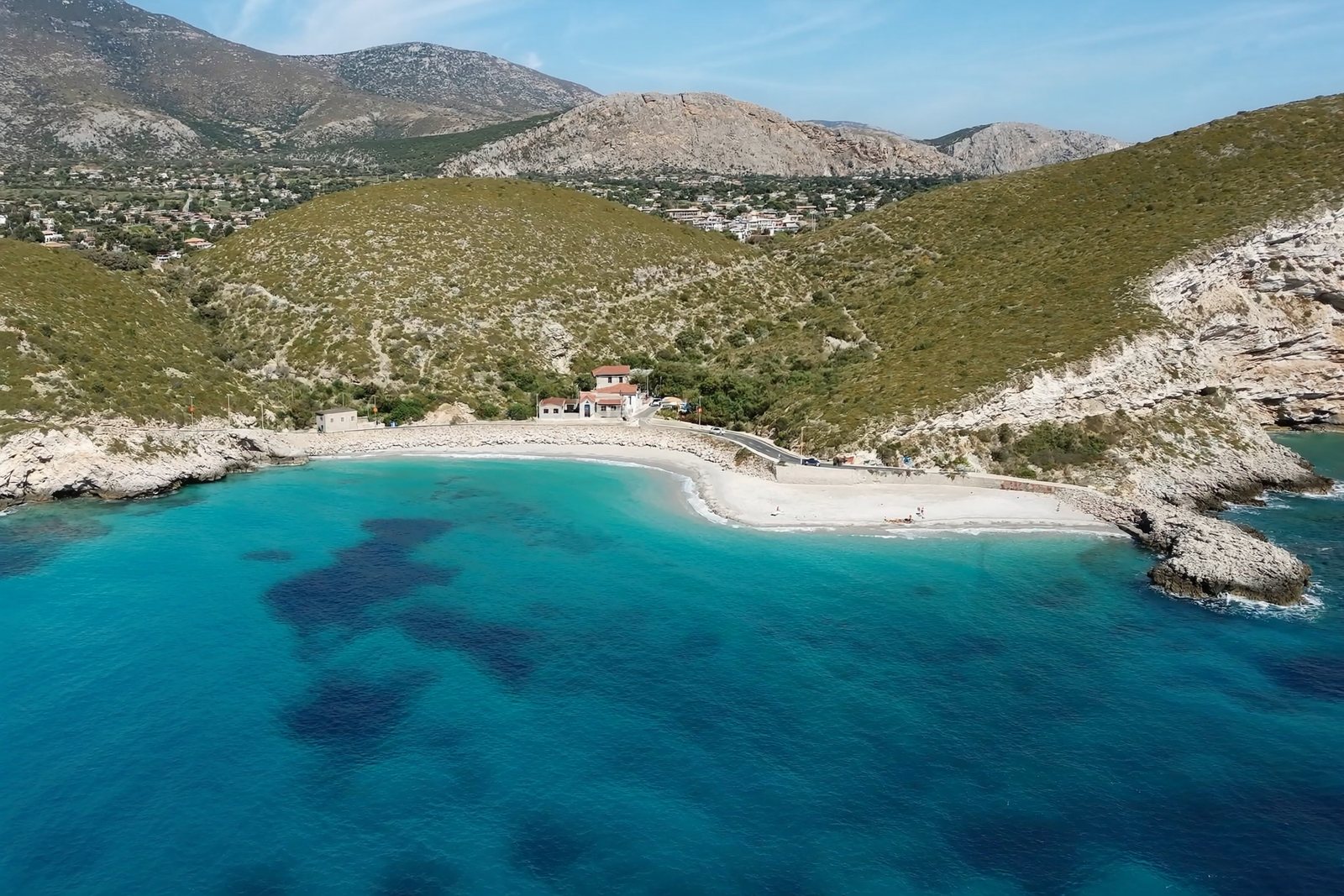
A compact bay just north of Himarë, backed by cliffs and olive slopes.
저장
Potami is a small beach right beside Himarë town, with clear water and rocks at each end.
Potami is a small beach right beside Himarë town, with clear water and rocks at each end.
Potami is one of several named parts of the town of Himarë, on the Albanian Ionian Sea coast in Vlorë County, southern Albania. The town of Himarë is divided into distinct localities: the old town known as Kastro, situated on and around the old castle; the coastal area of Spilea, which functions as the touristic and economic centre; and the further neighbourhoods of Potami, Livadhi, Zhamari, Michaili and Stefaneli.
Himarë municipality as a whole has a total area of 571.94 km², with the coastal strip of the historic Himarë region measuring approximately 20 km long by 5 km wide and covering 132.13 km². The municipality is bounded by the Ceraunian Mountains to the northeast and the Ionian Sea to the southwest.
The Himarë coastal strip lies between the Ceraunian Mountains, which reach approximately 2,000 metres in height, and the Ionian Sea. The coast features long pebbled beaches. The hills close to the sea are terraced and planted with olive and citrus trees.
North of the town of Himarë lie the villages of Vuno, Ilias, Dhërmi — whose coastal area is called Jaliskari — and Palasë. On the mountains to the inland lie Pilur and Kudhës, while Qeparo lies to the south of the town. Dhërmi contains a number of recently built beach resorts. The town's seaside promenade is among the features the area offers to visitors.
In 2015, the Albanian government merged the former municipalities of Himarë, Horë-Vranisht and Lukovë into a single municipality with its seat in the town of Himarë. The municipality comprises three administrative units corresponding to these former municipalities.
In the 2011 census, the three then-independent municipalities had a combined population of approximately 7,800 permanent residents: Lukovë recorded 2,916, Himarë 2,822 and Vranisht 2,080. The 2015 Albanian Civil Registry, which includes citizens living abroad, put the total municipal population at 27,049. The Himarë municipality has the second lowest population density in Albania, after Dropull. A large proportion of the population has emigrated to Greece or relocated to major Albanian cities.
From 1989 to 2011, approximately three-quarters of the population left the Himarë region.
The coastal region of Himarë is predominantly populated by an ethnic Greek community, and the local population is generally bilingual in Greek and Albanian. The town of Himarë and the villages of Dhërmi and Palasë, which account for the bulk of the region's population, are primarily inhabited by a Greek-speaking population. The villages of Iljas, Lukovë, Kudhës, Pilur and Vuno are inhabited by an Albanian population, while Qeparo is inhabited by both ethnic Albanians and Greeks.
In the 2011 census for the former municipality of Himarë, 60.38% declared themselves as Albanians, 24.56% as Greeks and 14.00% declined to declare any ethnicity. The census was disputed and was boycotted by part of the Greek minority, partly because article 20 of the census law imposed a fine of $1,000 for declaring an ethnicity different from what was recorded on a person's birth certificate.
The town of Himarë and the villages of Dhërmi and Palasë preserve a local Greek dialect with archaic features not found in standard Modern Greek. The surrounding settlements of Ilias, Vuno, Qeparo, Kudhës and Pilur mainly speak the Lab Albanian dialect, a subdialect of Tosk Albanian.
In antiquity the region was inhabited by the Chaonians, one of the three principal Greek-speaking tribes of Epirus. The town is believed to have been founded as Chimaira by the Chaonians as a trading outpost, though an alternative etymology derives the name from Greek cheimarros, meaning torrent. In the 2nd century BCE, Roman General Aemilius Paulus badly damaged settlements in the region when it was conquered by the Roman Republic.
Himarë became a nahiye of the Sanjak of Albania in 1431. The Ottoman Sultan Suleiman the Magnificent mounted a personal expedition in 1537 that destroyed or captured many surrounding villages but failed to subdue the area. The Ottomans subsequently granted the inhabitants a series of privileges: local self-government, the right to bear arms, exemption from taxes, the right to sail under their own flag into any Ottoman port, and the requirement to provide military service in wartime. Despite these concessions, the Himariots revolted repeatedly during subsequent conflicts. Ottoman reprisals eventually depopulated parts of the area and forced Islamisation, limiting the Christian population by the 18th century to the town and six villages.
In 1797, Ali Pasha, the Muslim Albanian ruler of the Pashalik of Yanina, led a raid on the town of Himarë in which more than 6,000 civilians were killed. The terms the Himariots had reached with Suleiman the Magnificent were inscribed on bronze tablets at the request of local leaders; these tablets are preserved in the Topkapi palace museum in Istanbul.
On 18 November 1912, during the First Balkan War, the town revolted under Spyros Spyromilios, a Greek Gendarmerie officer and native of Himarë, expelling Ottoman forces. In March 1914, the Protocol of Corfu established the Autonomous Republic of Northern Epirus, of which Himarë formed a part, though it formally remained within the Albanian state. In 1921 the region came under Albanian state control. Local uprisings against Albanisation measures followed in 1924, 1927 and 1932, all suppressed by the government of King Zog of Albania.
During the Greco-Italian War, the Greek Army's 3rd Infantry Division entered Himarë on 22 December 1940 after fighting Italian forces in the area. The town came under Greek control briefly until the German invasion in 1941. Himarë was subsequently incorporated into the Albanian communist state.
Ethnic tensions in the post-communist period have included arrests of Greek minority members in 1994, bomb attacks on the house of former mayor Vasil Bollano in 2004 and 2010, the killing of ethnic Greek shopkeeper Aristotelis Goumas in August 2010 after an altercation, and the demolition by Albanian authorities in August 2015 of the renovated Orthodox church of Saint Athanasius in Dhërmi. In the local elections of 15 May 2023, Greek minority candidate Dhionisios Alfred Beleri won by a narrow margin but was arrested two days earlier on charges of vote-buying, triggering diplomatic tensions between Albania and Greece. In March 2024, acting mayor Jorgo Goro was arrested on charges of corruption and abuse of office; Blerina Bala was subsequently elected caretaker mayor by the municipal council.
가장 더운 달은 August (일 최고 기온 평균 28°C), 가장 추운 달은 January (일 최저 기온 평균 6°C), 가장 강수량이 많은 달은 November (254 mm). 연평균 강수량은 1,618 mm. 해수 온도는 8월에 약 26°C.
| 월 | 최고 | 최저 | 강수량 | 강수일 | 일조 시간 | 해수 온도 |
|---|---|---|---|---|---|---|
| January | 11°C | 6°C | 185 mm | 13 | 7.0 h | 17°C |
| February | 12°C | 6°C | 161 mm | 12 | 7.9 h | 15°C |
| March | 14°C | 8°C | 152 mm | 13 | 9.5 h | 15°C |
| April | 17°C | 11°C | 114 mm | 13 | 10.8 h | 16°C |
| May | 21°C | 15°C | 93 mm | 11 | 12.1 h | 19°C |
| June | 25°C | 19°C | 56 mm | 8 | 13.6 h | 24°C |
| July | 28°C | 22°C | 28 mm | 5 | 13.8 h | 26°C |
| August | 28°C | 22°C | 37 mm | 6 | 12.9 h | 26°C |
| September | 24°C | 18°C | 134 mm | 11 | 10.6 h | 26°C |
| October | 20°C | 15°C | 165 mm | 10 | 9.1 h | 25°C |
| November | 16°C | 12°C | 254 mm | 14 | 7.1 h | 21°C |
| December | 12°C | 8°C | 238 mm | 14 | 6.5 h | 18°C |
출처: ERA5 reanalysis via Open-Meteo, 1994–2023 · "최고" 및 "최저"는 일 최고·최저 기온의 평균값입니다. "강수일"은 강수량이 1mm 이상인 날의 수입니다.
소도시 · Vlorë
The centre of the Riviera coast: a Greek-speaking historical community, an old hill village and a string of coves.
해변 · Vlorë
The broad bay immediately south of Himarë, the most developed beach on that stretch.
이 페이지에 오류가 있습니까? 수정 제안을 환영하며, 출처 기록과 대조하여 검토합니다. 잘못된 내용과 가능하다면 올바른 수치의 출처를 알려 주십시오.