Town · Vlorë
Himarë
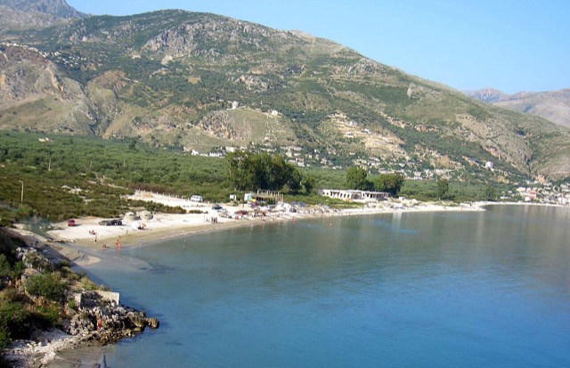
The centre of the Riviera coast: a Greek-speaking historical community, an old hill village and a string of coves.
Every county, coast and century
Guided view
New to Albania? Every page opens with a plain-language explanation you could read to a ten-year-old, before the detail begins.
Expert view
You already know the basics. Straight to the substance, with the simple explanations hidden. This is the default.
Beach · Vlorë County
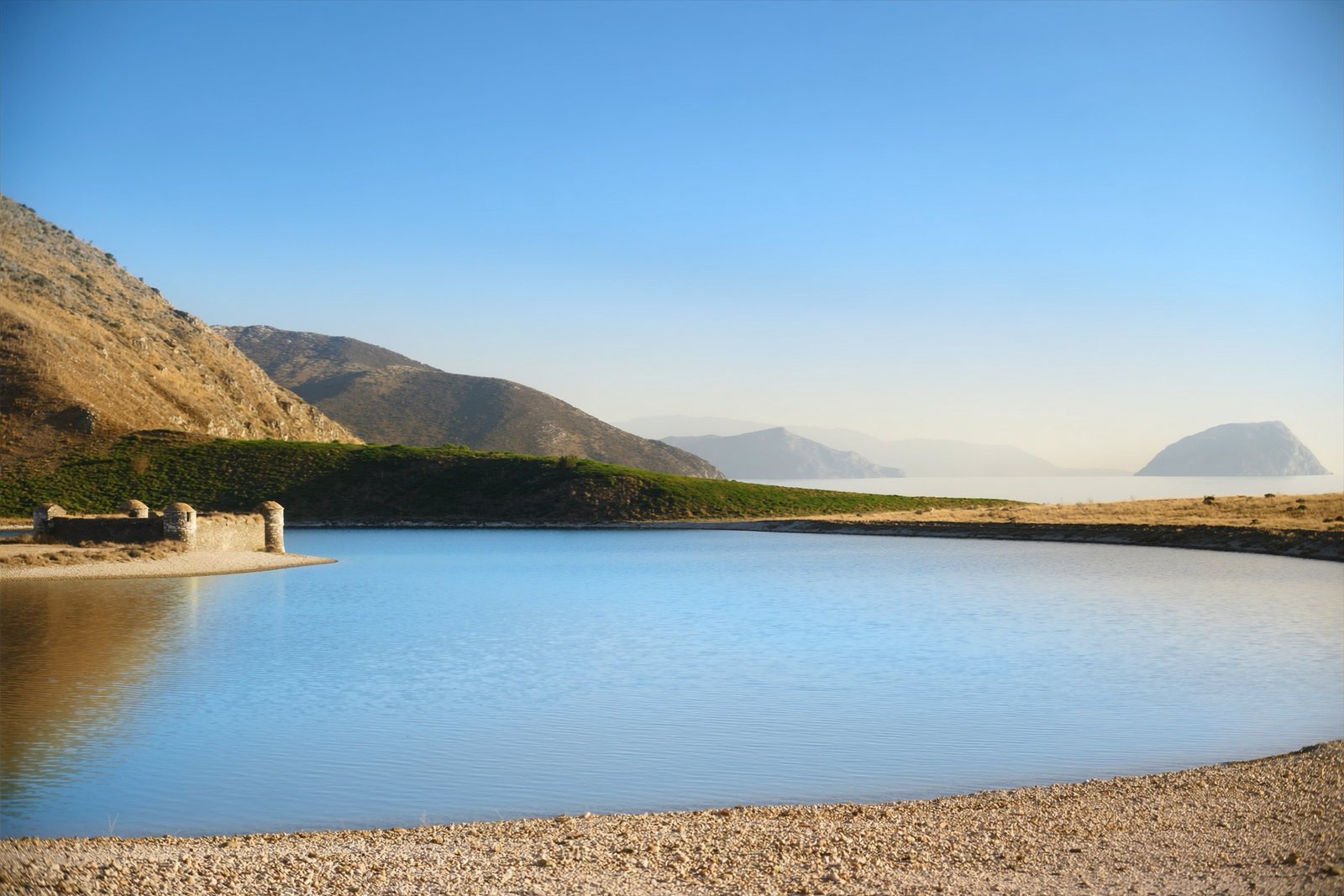
A near-enclosed bay wrapped around Ali Pasha's triangular fortress on its own peninsula.
Save
Porto Palermo is a bay shaped almost like a circle, with a small stone fortress on a peninsula in the middle. The water is very calm because the bay is so sheltered.
Porto Palermo is a bay shaped almost like a circle, with a small stone fortress on a peninsula in the middle. The water is very calm because the bay is so sheltered.
Porto Palermo Bay lies in southern Albania, a few kilometres south of Himarë along the Albanian Riviera, between the larger coastal towns of Vlorë to the north and Saranda to the south. The road connecting those two towns runs to the east of the bay. The area is associated with Llamani beach, and the Albanian Government has announced plans to grant the combined area the status of Protected Landscape.
The bay's shoreline has been used for defensive purposes from antiquity through to the Second World War, a consequence of its sheltered position on a coastline otherwise exposed to the Adriatic and Ionian seas.
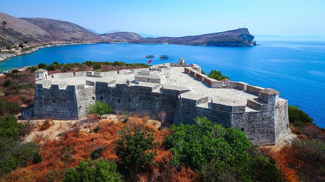
The castle standing in the bay today was built in the early nineteenth century by Ali Pasha of Tepelena. An inscription above the entrance records that it was constructed in 1804 by French engineers working for Ali Pasha. Researchers consider it unlikely that a Venetian or Ottoman fortification occupied the site before this structure was raised.
Ali Pasha's motivation was defensive: he was concerned about the exposed coastal flank of his pashalik, and Porto Palermo was one of several sea fortresses he ordered built along that stretch of coast. The castle is described as the most well-preserved garrison he erected in the region. Its construction was praised in verse by Ioannis Vilaras, a Greek poet who was a member of Ali Pasha's court.
In 1803, before the castle was complete or fully armed, Ali Pasha offered it and the port to the Royal Navy. At that time the fort held only four or five cannon, suggesting Ali Pasha himself did not regard the position as strategically critical to his own operations.
The site on which the castle stands was originally a small island in the bay. It was subsequently connected to the Albanian mainland by landfill work, creating the low narrow isthmus that links it to the shore. The castle therefore stands on what is effectively a man-made peninsula.
The French traveller François Pouqueville, writing in 1806, described the position precisely: 'The tower or fort stands on the southern point of the entrance, connected with the continent by a low narrow isthmus.' His account also notes warehouses, a custom-house, and a Greek church in the immediate vicinity.
Porto Palermo Castle is a three-sided fortress with three large gun bastions positioned at its corners and an open terrace facing south. At its centre is a hexagonal chamber with a domed ceiling supported by six large pillars; this chamber provides access to all the rooms and terraces within the structure.
Soldiers were quartered in rectangular rooms. The southern terrace is reached by a staircase. The castle also incorporates observation posts protected by walls, and a number of guard houses with stone roofs. The combination of bastions, observation posts, and a central circulation chamber reflects the functional requirements of a coastal garrison of the early nineteenth century.
Two near-contemporary observers left records of the castle shortly after its construction. The British military surveyor William Martin Leake visited the fort and noted that its garrison consisted of only ten men equipped with two four-pound cannon—a very modest complement for a coastal fortification.
Pouqueville, writing in 1806, was direct in his assessment of the castle's military limitations: 'It consists of a square with bastions, having a few guns, of no service either to command the entrance or to protect the shipping at anchor.' His description aligns with Leake's, suggesting the fort served more as a symbolic or administrative presence than as a serious defensive work in the years immediately following its completion.
Porto Palermo Castle is situated west of the Vlorë–Saranda road within the bay of Porto Palermo. The Albanian Government has indicated that the bay area, together with Llamani beach, will be proclaimed a Protected Landscape, though this status had not yet been formally granted at the time of the article.
The castle appears on the List of Castles in Albania and is referenced in the context of the Albanian Riviera and the broader geography and tourism framework of southern Albania. Its relatively intact condition, compared to other fortifications associated with Ali Pasha's rule, makes it a documented reference point for the early nineteenth-century Ottoman coastal defence network in the region.
The warmest month is August (mean daily high 29°C), the coldest is January (mean daily low 7°C), and the wettest is November (306 mm). Total annual rainfall averages 1,707 mm. Sea temperature peaks in August at about 26°C.
| Month | High | Low | Rain | Wet days | Sun/day | Sea |
|---|---|---|---|---|---|---|
| January | 12°C | 7°C | 222 mm | 14 | 7.2 h | 17°C |
| February | 13°C | 8°C | 189 mm | 12 | 8.1 h | 15°C |
| March | 15°C | 9°C | 160 mm | 12 | 9.7 h | 15°C |
| April | 18°C | 12°C | 97 mm | 10 | 11.0 h | 16°C |
| May | 22°C | 16°C | 67 mm | 7 | 12.2 h | 19°C |
| June | 26°C | 20°C | 33 mm | 4 | 13.7 h | 24°C |
| July | 29°C | 23°C | 12 mm | 2 | 13.8 h | 26°C |
| August | 29°C | 23°C | 23 mm | 3 | 12.9 h | 26°C |
| September | 25°C | 20°C | 131 mm | 8 | 10.7 h | 26°C |
| October | 22°C | 16°C | 183 mm | 10 | 9.2 h | 25°C |
| November | 17°C | 13°C | 306 mm | 15 | 7.2 h | 21°C |
| December | 14°C | 9°C | 283 mm | 15 | 6.6 h | 18°C |
Source: ERA5 reanalysis via Open-Meteo, 1994–2023 · “High” and “Low” are mean daily maximum and minimum air temperature. “Wet days” counts days with at least 1 mm of precipitation.
Town · Vlorë
The centre of the Riviera coast: a Greek-speaking historical community, an old hill village and a string of coves.
Historic site · Vlorë
A triangular fortress on a causeway peninsula, built for Ali Pasha of Tepelena.
Person
The 'Lion of Ioannina': an Ottoman governor who built his own state, courted Britain and France, and was finally killed for it.
Something wrong on this page? Corrections are welcome and are checked against the source record. Tell us what is wrong and, if you can, where the right figure comes from.