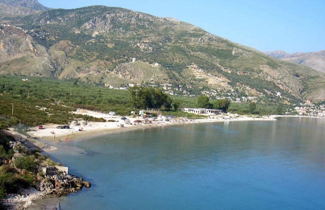
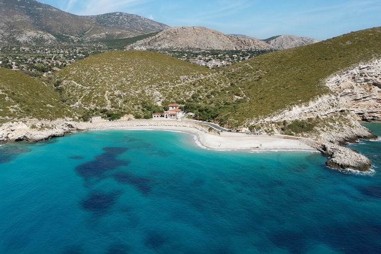
소도시 · Vlorë
Himarë
The centre of the Riviera coast: a Greek-speaking historical community, an old hill village and a string of coves.
모든 주, 모든 해안, 모든 세기
안내 보기
알바니아가 처음이신가요? 모든 페이지는 세부 내용이 시작되기 전에, 열 살짜리 아이도 이해할 수 있는 평이한 설명으로 시작됩니다.
전문가 보기
기본 내용은 이미 알고 계신가요? 간단한 설명은 숨기고 핵심 내용만 바로 확인하세요. 이것이 기본 설정입니다.
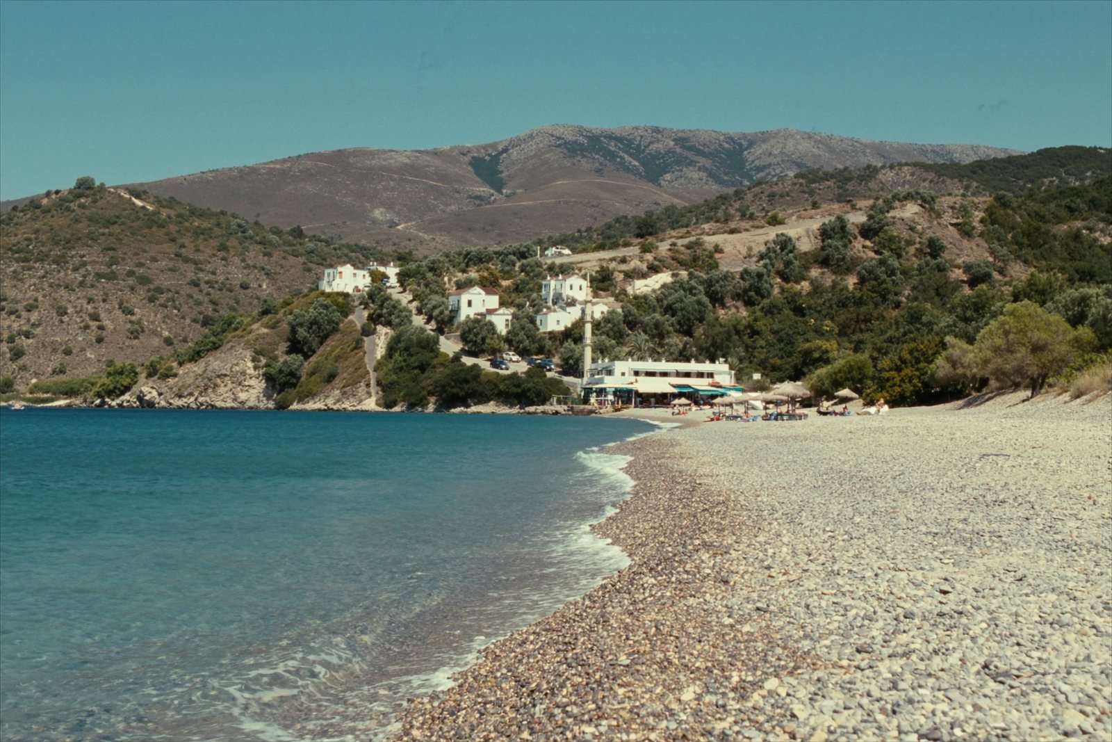
해변 · Vlorë County
The broad bay immediately south of Himarë, the most developed beach on that stretch.
저장
Livadhi is the big beach next to Himarë town. It has plenty of places to eat and stay, and the water gets deep quite quickly.
Livadhi is the big beach next to Himarë town. It has plenty of places to eat and stay, and the water gets deep quite quickly.
Livadhi is one of the coastal districts of the town of Himarë, situated on the Albanian Ionian Sea coast in Vlorë County, southern Albania. The town of Himarë is divided into several named parts: the old hilltop quarter known as Kastro, the touristic and economic centre of Spilea, and the further districts of Potami, Livadhi, Zhamari, Michaili, and Stefaneli. Livadhi therefore forms one component of a larger settlement rather than a standalone village.
The broader Himarë coastal strip runs approximately 20 kilometres long by 5 kilometres wide, bounded by the Ceraunian Mountains to the northeast and the Ionian Sea to the southwest. The article describes the coastline as having long pebbled beaches, with the few hills near the sea terraced and planted with olive and citrus trees. The Ceraunian Mountains reach approximately 2,000 metres in elevation.
Livadhi Beach lies within the municipality of Himarë, which covers a total area of 571.94 square kilometres. The municipality was formed in 2015 when the Albanian government merged the former municipalities of Himarë, Horë-Vranisht, and Lukovë. The seat of the municipality is the town of Himarë, within which Livadhi is located.
The municipality forms part of the Albanian Riviera and is positioned between the Ceraunian Mountains and the Albanian Ionian Sea Coast. The traditionally understood Himarë region, whose borders contracted during the Ottoman period, came to encompass the town of Himarë and the coastal villages of Palasë, Dhërmi, Pilur, Kudhës, Vuno, Iljas, and Qeparo.
The three former municipalities that now make up the Himarë municipality recorded a combined population of approximately 7,800 in the 2011 census. The former Himarë municipality, which includes the town containing Livadhi, recorded 2,822 residents. The 2015 Albanian Civil Registry, which includes citizens living abroad, placed the overall municipal population at 27,049. The Himarë municipality has the second-lowest population density in Albania after Dropull.
In the 2011 census for the former Himarë municipality, 60.38 percent declared Albanian ethnicity, 24.56 percent declared Greek ethnicity, and 14.00 percent declined to declare any ethnicity. The census results were disputed and affected by a boycott by part of the Greek minority. From 1989 to 2011, approximately three-quarters of the population left the Himarë region. The town of Himarë and the settlements of Dhërmi and Palasë are described as inhabited predominantly by Greeks, while Pilur, Kudhës, Vuno, and Ilias are populated by an Orthodox Albanian population.
The coastal population is predominantly bilingual in Greek and Albanian. The local Greek dialect spoken in and around the town of Himarë is described as preserving archaic features no longer found in standard Modern Greek, with small variations in accent between localities. Albanian, specifically the Lab subdialect of Tosk Albanian, is spoken in the surrounding towns of Ilias, Vuno, Qeparo, Kudhës, and Pilur.
The town of Himarë, within which Livadhi is located, consists of two primary zones: the old town known as Kastro, built on and around a hilltop castle of classical antiquity, and the coastal district of Spilea, described as the touristic and economic centre of the region. Livadhi, along with Potami, Zhamari, Michaili, and Stefaneli, makes up the remaining named parts of the town.
The castle at Kastro contains several Orthodox churches, including the Church of Virgin Mary Kasopitra, the Episkopi church built on the site of an ancient temple dedicated to Apollo, and the Aghioi Pantes church at the castle entrance. The castle also contains the mansion of the Spyromilios family and a Greek school. The municipality's major tourist characteristics are noted as its seaside promenade, tavernas, and the traditionally preserved old town on the hill.
North of the town lie the villages of Vuno, Ilias, and Dhërmi, the latter having a coastal zone called Jaliskari and a number of recently built beach resorts. On the inland mountains lie Pilur and Kudhës; Qeparo lies to the south of the town. The region also contains several Orthodox churches and monasteries built in Byzantine architectural style, including the Monastery of the Cross, Athaliotissa, Saint Theodore, Virgin Mary in Dhërmi, and Saint Demetrius.
The Himarë region was inhabited in antiquity by the Chaonians, one of the three principal Greek-speaking tribes of Epirus alongside the Thesprotians and the Molossians. The town of Himarë is believed to have been founded as Chimaira by the Chaonians as a trading outpost, though an alternative etymology derives the name from the Greek word cheimarros, meaning torrent. An oracular lamella from the Oracle of Dodona, dated to the first half of the 4th century BCE and written in the Doric Greek dialect, references the settlement. The region later formed part of the Kingdom of Epirus under the Molossian Aeacid dynasty. When the Roman Republic conquered the region in the 2nd century BCE, settlements were badly damaged by the Roman general Aemilius Paulus.
After passing through Byzantine, Norman, Serbian, and Angevin control across the medieval period, Himarë became a nahiye of the Sanjak of Albania in 1431. It became associated with resistance to Ottoman rule: Himariots participated in Skanderbeg's campaigns, and Sultan Suleiman the Magnificent personally led an expedition in 1537 that failed to subdue the area. The Ottomans subsequently granted the inhabitants a series of privileges including local self-government, the right to bear arms, exemption from taxes, and the right to sail under their own flag into Ottoman ports. Despite these concessions, the Himariots revolted repeatedly across the following centuries.
The region came under Greek administration in October 1914, then under Italian occupation, before passing to Albanian state control in 1921. During the Greco-Italian War, Greek forces entered Himarë on 22 December 1940 before the German invasion of 1941 ended that control. In 2015, the Albanian government merged the former Himarë municipality with Horë-Vranisht and Lukovë to form the present municipality.
The municipality of Himarë has been the site of sustained political tension between Albanian state institutions and the local Greek minority. In the local elections of May 2023, Greek minority candidate Dhionisios Alfred Beleri won by a narrow margin but was arrested two days before the election on charges of vote-buying, raising diplomatic tensions between Albania and Greece. His pre-trial detention was upheld on appeal in June 2023.
In March 2024, acting mayor Jorgo Goro was arrested along with four others on charges of corruption and abuse of office by the Special Anti-Corruption Structure, following accusations made by Beleri. Following Goro's arrest and resignation, Blerina Bala was elected caretaker mayor by the municipal council. She is to remain in office until new elections can be held, which is contingent on a final court decision in Beleri's case.
Ethnic tensions have produced several documented incidents. In August 2010, a Greek shopkeeper, Aristotelis Goumas, was killed when his motorcycle was struck by a car, an incident that prompted locals to block the main Vlorë–Sarandë highway. In August 2015, Albanian authorities demolished the renovated Orthodox church of Saint Athanasius in Dhërmi, which the Orthodox Autocephalous Church of Albania described as a vandalistic act. The demolition also triggered a reaction from the European Commission. In October 2017, Albanian authorities proceeded with demolition of properties belonging to Greek minority members, prompting public protests and a large police deployment to Himarë.
가장 더운 달은 August (일 최고 기온 평균 28°C), 가장 추운 달은 January (일 최저 기온 평균 6°C), 가장 강수량이 많은 달은 November (254 mm). 연평균 강수량은 1,618 mm. 해수 온도는 8월에 약 26°C.
| 월 | 최고 | 최저 | 강수량 | 강수일 | 일조 시간 | 해수 온도 |
|---|---|---|---|---|---|---|
| January | 11°C | 6°C | 185 mm | 13 | 7.0 h | 17°C |
| February | 12°C | 6°C | 161 mm | 12 | 7.9 h | 15°C |
| March | 14°C | 8°C | 152 mm | 13 | 9.5 h | 15°C |
| April | 17°C | 11°C | 114 mm | 13 | 10.8 h | 16°C |
| May | 21°C | 15°C | 93 mm | 11 | 12.1 h | 19°C |
| June | 25°C | 19°C | 56 mm | 8 | 13.6 h | 24°C |
| July | 28°C | 22°C | 28 mm | 5 | 13.8 h | 26°C |
| August | 28°C | 22°C | 37 mm | 6 | 12.9 h | 26°C |
| September | 24°C | 18°C | 134 mm | 11 | 10.6 h | 26°C |
| October | 20°C | 15°C | 165 mm | 10 | 9.1 h | 25°C |
| November | 16°C | 12°C | 254 mm | 14 | 7.1 h | 21°C |
| December | 12°C | 8°C | 238 mm | 14 | 6.5 h | 18°C |
출처: ERA5 reanalysis via Open-Meteo, 1994–2023 · "최고" 및 "최저"는 일 최고·최저 기온의 평균값입니다. "강수일"은 강수량이 1mm 이상인 날의 수입니다.
소도시 · Vlorë
The centre of the Riviera coast: a Greek-speaking historical community, an old hill village and a string of coves.
이 페이지에 오류가 있습니까? 수정 제안을 환영하며, 출처 기록과 대조하여 검토합니다. 잘못된 내용과 가능하다면 올바른 수치의 출처를 알려 주십시오.