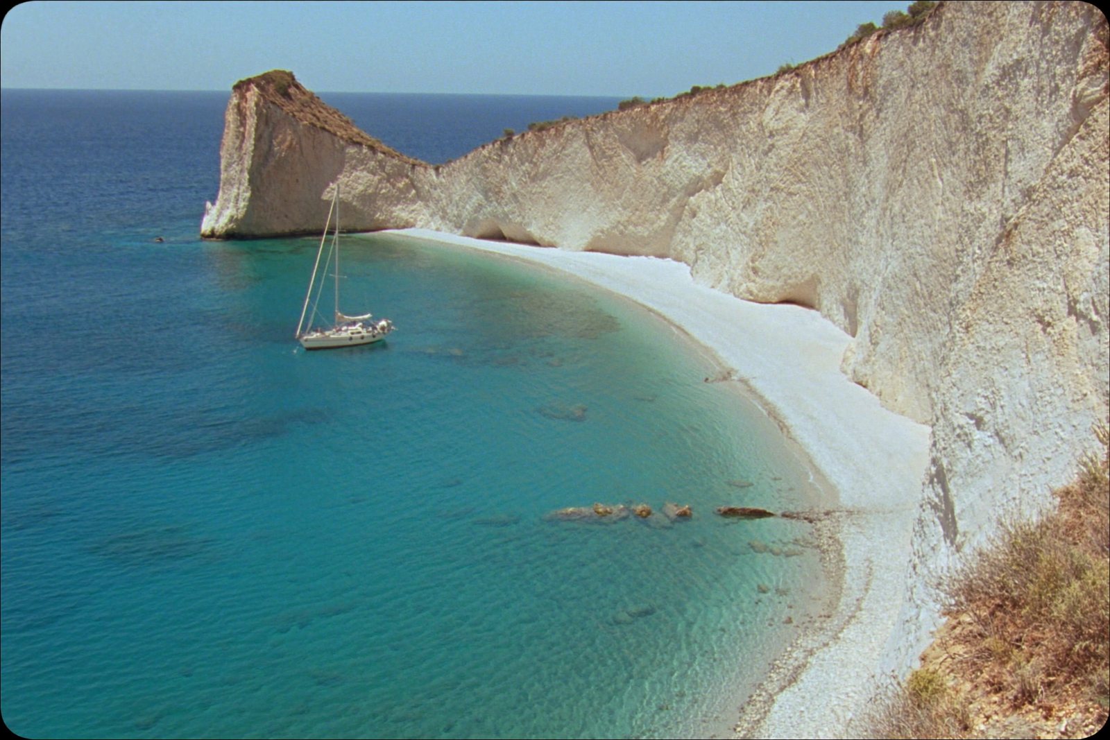
- Nearest town
- Orikum (by boat)
- Shore
- White pebble and limestone slabs
- Access
- Boat only, from Orikum, Vlorë or Dhërmi
- Main season
- June to September; water warmest in August
Sade bir dille
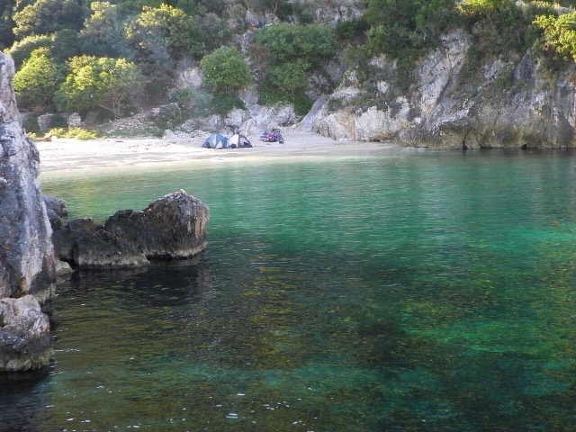
Grama Bay is on a wild peninsula with no roads. Sailors from ancient times carved their names into the rocks there, and you can still see the writing. You can only arrive by boat.
Basit açıklama
Grama Bay is on a wild peninsula with no roads. Sailors from ancient times carved their names into the rocks there, and you can still see the writing. You can only arrive by boat.
Bu sayfada
Location and setting
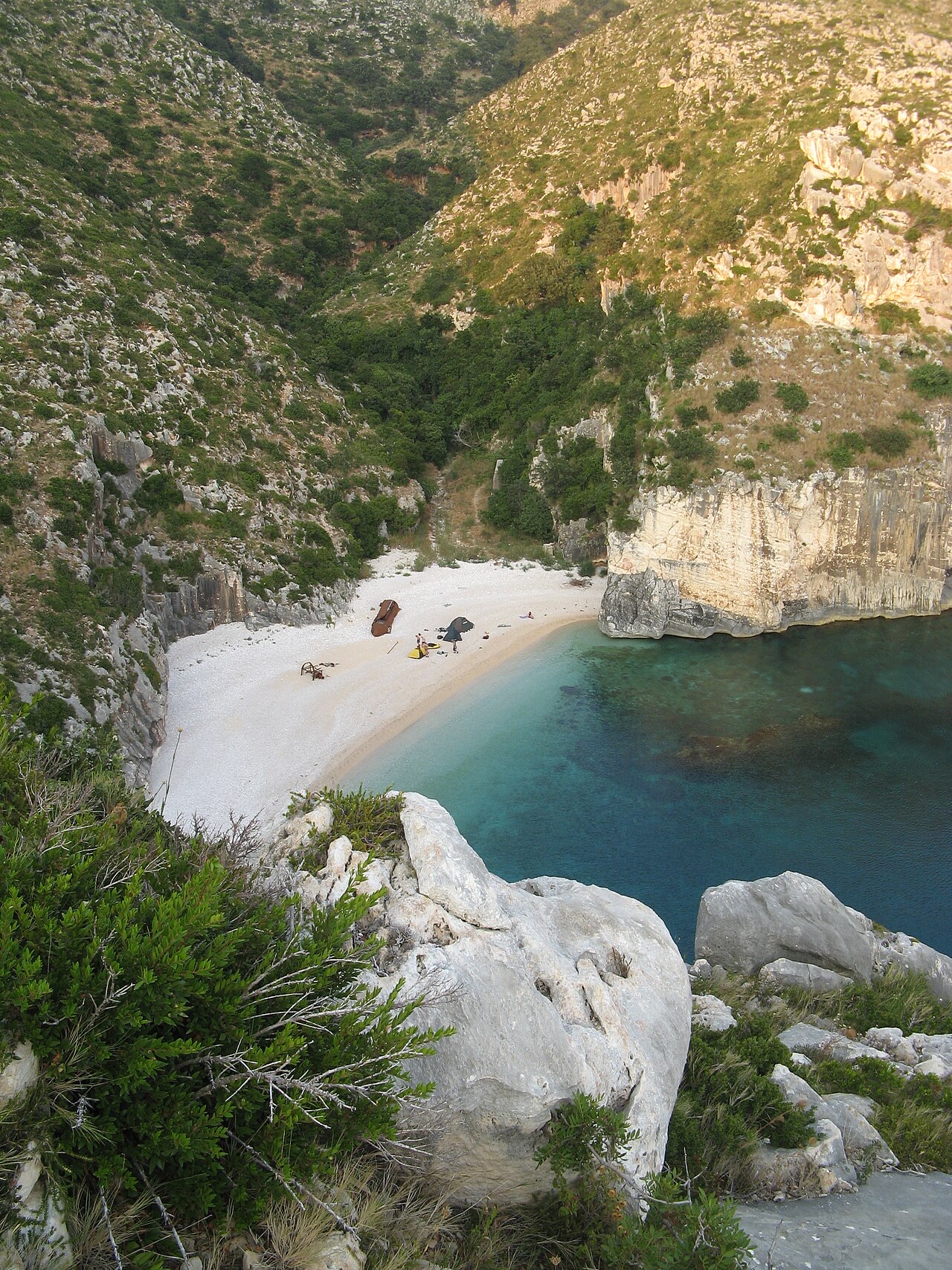
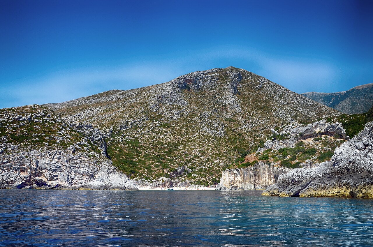
Grama Bay (Albanian: Gjiri i Gramës; pronounced [ˈɟiːɾi i ˈgraːməs]) lies on the Ionian Sea along the Albanian Riviera. It is one of several bays formed along the western face of the Ceraunian Mountains, a coastal range whose steep terrain shapes the character of the shoreline throughout this stretch of the Albanian coast.
The bay falls within the boundaries of the Karaburun-Sazan Marine Park. Its shore is dominated by coastal cliffs that slope vertically into the sea, alongside rocky and pebbled beaches. The site has been designated a natural monument on account of its landscape, which includes solutional caves and sea caves formed by coastal erosion.
The name and its origins
The name Grama derives from the Greek word for 'letter', a direct reference to the carved inscriptions that cover the surrounding cliffs. The bay is also referred to as Grammata (or Grammata), the plural of Gramma, reflecting the accumulated body of inscribed texts found there.
These inscriptions were left by Greek, Roman and medieval sailors as expressions of thanksgiving to the Dioscuri — Castor and Pollux — and to other patron figures. The naming of the bay is therefore inseparable from its role as a site of votive inscription over many centuries.
Ancient and medieval inscriptions
In antiquity, Grama Bay was a sheltered cove along the Chaonian coast, west of the Ceraunian Mountains. It served as a harbour and place of refuge for vessels sailing along this section of the coastline during classical antiquity.
On the vertical cliff faces and rocks, sailors carved inscriptions in Ancient Greek, Latin and Medieval Greek. This category of inscription was known in antiquity as euploia inscriptions (Greek: ευπλοϊα), a term associated with prayers or thanks for safe passage at sea. The presence of texts in three languages and across several historical periods indicates the bay was in continuous use as a waypoint over a long span of time.
A scholarly study of the inscriptions, authored by Arben Hajdari, Joany Reboton, Saïmir Shpuza and Pierre Cabanes, was published in the Revue des Études Grecques in 2007 under the title 'Les Inscriptions de Grammata (Albanie)'.
Use during the Second World War
During World War II, Grama Bay was used as a base by the Special Operations Executive (SOE). The article provides no further detail on the nature or duration of SOE operations conducted from the bay.
Sea caves and the Mediterranean monk seal
The sea caves of Grama Bay constitute a distinct ecosystem within the site. The article identifies them as providing important refuge for the Mediterranean monk seal, which it describes as the rarest seal species in the world.
The bay's landscapes are characterised in the article as being of global importance for their contribution to ecological balance and as habitat for species that are globally threatened or endangered. The sea caves are cited specifically in this context as an exceptional habitat type.
Protected status and conservation
Grama Bay's designation as a natural monument relates to its landscape qualities, including the presence of solutional and sea caves, rather than solely to its archaeological or historical significance. It sits within the Karaburun-Sazan Marine Park, which provides a broader protected area framework for the surrounding coastal and marine environment.
The bay is described in the article as contributing to Albania's ecological balance. Its dual significance — as a site of archaeological and epigraphic importance and as a habitat for threatened marine species — underlies its protected status.
Aylık iklim
En sıcak ay August (günlük azami sıcaklık ortalaması 31°C), en soğuk ay ise January (günlük asgari sıcaklık ortalaması 7°C), ve en yağışlı ay November (206 mm). Yıllık toplam yağış ortalaması 1,256 mm. Deniz suyu sıcaklığı Ağustos'ta yaklaşık 25°C.
| Ay | Azami | Asgari | Yağış | Yağışlı gün | Güneş/gün | Deniz |
|---|---|---|---|---|---|---|
| January | 12°C | 7°C | 146 mm | 13 | 7.4 h | 17°C |
| February | 13°C | 7°C | 126 mm | 12 | 8.3 h | 15°C |
| March | 15°C | 9°C | 118 mm | 12 | 9.9 h | 15°C |
| April | 18°C | 12°C | 86 mm | 12 | 11.0 h | 16°C |
| May | 23°C | 16°C | 61 mm | 9 | 12.3 h | 18°C |
| June | 28°C | 20°C | 33 mm | 6 | 13.7 h | 23°C |
| July | 31°C | 22°C | 17 mm | 4 | 13.8 h | 25°C |
| August | 31°C | 23°C | 27 mm | 4 | 12.9 h | 25°C |
| September | 26°C | 20°C | 103 mm | 9 | 10.8 h | 26°C |
| October | 22°C | 16°C | 143 mm | 10 | 9.3 h | 25°C |
| November | 18°C | 12°C | 206 mm | 14 | 7.4 h | 21°C |
| December | 14°C | 9°C | 190 mm | 14 | 6.8 h | 18°C |
Kaynak: ERA5 reanalysis via Open-Meteo, 1994–2023 · "Azami" ve "Asgari", günlük ortalama maksimum ve minimum hava sıcaklıklarıdır. "Yağışlı gün", en az 1 mm yağış düşen günlerin sayısını ifade eder.
Daha fazla görsel
İlgili konular
Yakınındakiler
Konu · Vlorë
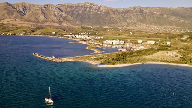
Karaburun Peninsula
Albania's largest uninhabited peninsula, closed to the public for most of the 20th century and now a marine park.
İlişkili konular

Koruma altındaki alan · Vlorë
Karaburun-Sazan Marine Park
Albania's only marine national park: sea caves, wrecks and the country's clearest water.
Rehber
Archaeological Albania
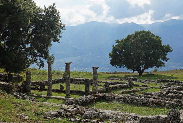
Butrint, Apollonia, Byllis, Antigonea and Amantia: five sites that cover 2,500 years between them.
Kaynaklar
- Wikipedia.
Grama Bay — English Wikipedia
· erişim tarihi 13 Oct 2026
Used to ground the deep-research section and as a discovery aid; not relied on alone for contested claims. - Wikidata.
Wikidata item Q20574906
· erişim tarihi 13 Oct 2026
Source of the population, area and elevation figures shown in Quick facts, each with its own observation year. - Open-Meteo / ECMWF.
Monthly climate normals, 1994–2023
· erişim tarihi 13 Oct 2026
Computed here from daily ERA5 reanalysis via Open-Meteo over 1994–2023. - Wikimedia Commons.
Photographs
· erişim tarihi 13 Oct 2026
Each photograph carries its own creator, licence and file link beneath it. Only public-domain, CC0, CC BY and CC BY-SA files are published.
Bu sayfada bir hata mı var? Düzeltmeler memnuniyetle karşılanır ve kaynak kayıtla karşılaştırılarak kontrol edilir. Neyin yanlış olduğunu ve mümkünse doğru rakamın kaynağını bize bildirin.