Site historique · Vlorë
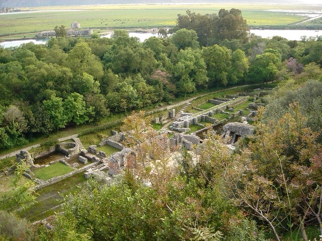
Butrint
A Greek, Roman, Byzantine, Venetian and Ottoman city layered on one wooded peninsula — Albania's first UNESCO site.
Chaque comté, chaque côte, chaque siècle
Vue guidée
Nouveau en Albanie ? Chaque page s'ouvre sur une explication en langage clair, accessible à un enfant de dix ans, avant d'entrer dans le détail.
Vue expert
Vous connaissez déjà les bases. Directement à l'essentiel, les explications simples étant masquées. Il s'agit du réglage par défaut.
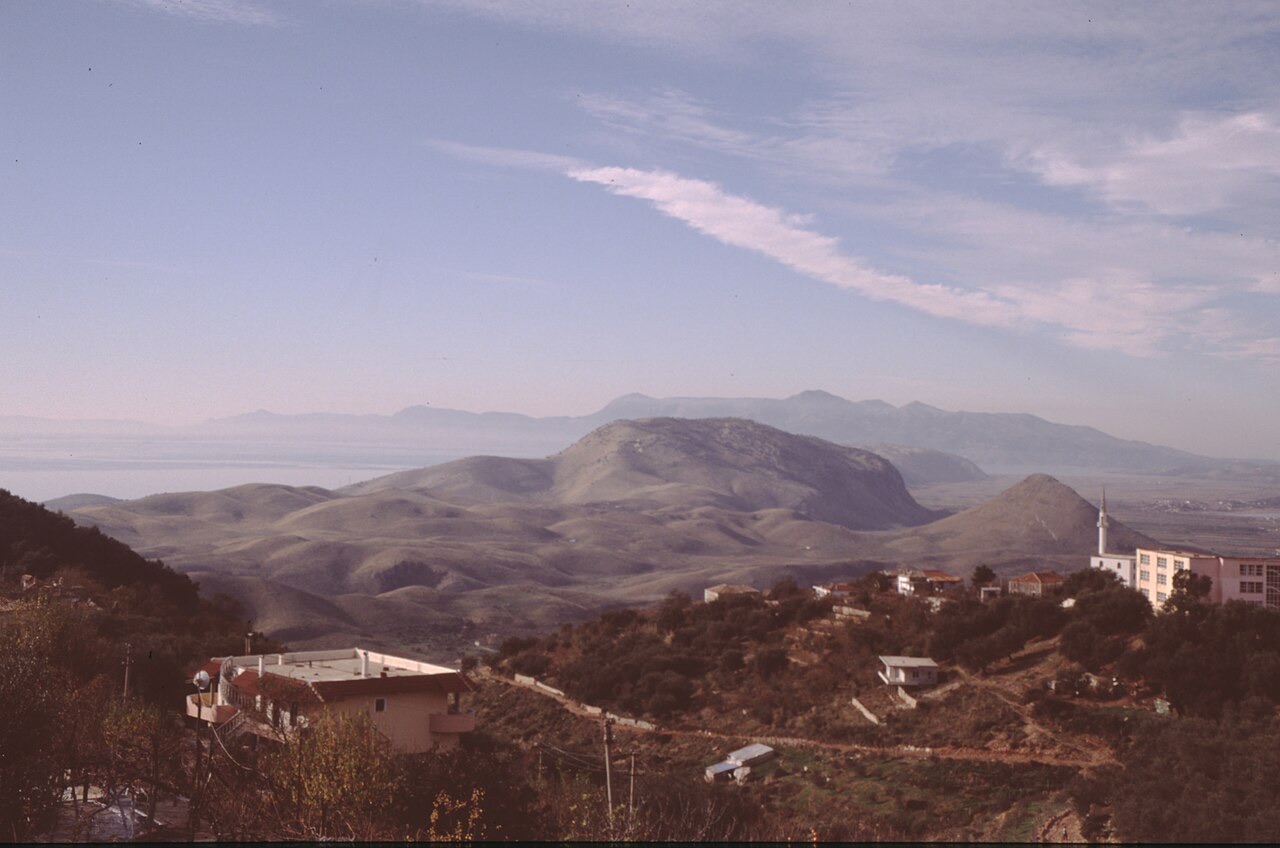
Bourg · Vlorë County
Albania's southernmost town, on the Greek border near the Butrint wetlands.
Enregistrer
Konispol is the town furthest south in Albania. A cave nearby holds some of the oldest signs of people living in the country.
Konispol is the town furthest south in Albania. A cave nearby holds some of the oldest signs of people living in the country.
Konispol (Albanian definite form: Konispoli) is the southernmost town in Albania, located one kilometre from the Albanian-Greek border and approximately four kilometres from Sagiada, Greece. By road and geography alike, it lies 301 kilometres from the capital Tirana. The town sits within the ancient region of Epirus.
The name Konispol derives from Slavic roots: коньць (konytsy), meaning 'end', and поля (polya), meaning 'field', together conveying the sense of 'end of a field'. The settlement is the modern centre of the Cham Albanian community in Albania, and agriculture and viticulture are the principal economic activities.
The Kreçmoi Cave near Konispol contains traces of human presence dating to the late Middle Paleolithic era, approximately 40,000 to 30,000 years ago. This makes the area one of the earlier documented sites of human occupation in the region.
In 1992, seven further caves were discovered just north of the town. Finds from these caves span from the Upper Paleolithic age to the Iron Age, indicating continuous or recurring human use of the area across a very long period.
In antiquity the area formed part of the region of Epirus and was inhabited by Chaonian Epirotes.
In 1943, Konispol was the site of a significant armed engagement between German units, Cham collaborators from the Thesprotia province of Greece fighting under the Nuri Dino battalion, and the communist Albanian resistance.
On 8 October 1943, representatives of the Albanian and Greek communist resistance groups met in the town. The meeting acknowledged that Albanian and Greek minorities existed on either side of the border. However, disagreements between the two movements prevented full coordination, and the meeting instead resulted in plans for a separate headquarters for the communist resistance units of the Greek minority within Albania.
Konispol is the seat of the Municipality of Konispol (Albanian: Bashkia Konispol), the southernmost administrative unit in Albania. The current municipality was created by the 2015 local government reform, which merged the formerly separate municipalities of Konispol, Markat, and Xarrë.
Before the 2015 reform, the Konispol municipal unit consisted of the town of Konispol and the village of Çiflik. The enlarged post-reform municipality covers a total area of 226.26 square kilometres. The total population recorded at the 2011 census was 8,245, while the population of the municipal unit alone, as recorded at the 2023 census, was 1,758.
The municipal seat of Konispol, together with the villages of Dishat, Vërvë, Shalës, Markat, Ninat, and Janjar, is populated by native Cham Albanians. The village of Xarrë has an Orthodox Albanian majority alongside approximately 200 Muslim Albanian Chams who arrived from northern Greece in the 1920s and 1940s, a combined Aromanian and Greek population of around 50, and a small number of Romani residents.
Mursi is predominantly Orthodox Albanian, with a small number of Muslim Albanians and Greeks. Çiflik is inhabited by Orthodox Albanians, Aromanians, Muslim Albanians, and a few Greeks. Shkallë has an Aromanian majority alongside small numbers of Muslim Albanians and Greeks; it also contains several families of Muslim Romani originally from Filiates, Greece, who were expelled in 1944–1945.
Vrinë is a village established during the communist period. Its population comprises approximately 400 Muslim Albanians, 318 Orthodox Albanians, and 300 Greeks. The broader municipality also includes Aromanians, Greeks, and Romani living in the Xarrë municipal unit.
Because of its proximity to the Greek border, Konispol is included in the European Union's Greece–Albania Neighbourhood Programme. The programme aims to improve the standard of living of the local population through promoting sustainable local development in the cross-border area between the two countries.
Teme Sejko (25 August 1922 – 31 May 1961) was an Albanian rear admiral and commander of the Albanian navy and the naval base of Durrës. Hasan Tahsini was an astronomer, mathematician, and philosopher who served as the first rector of Istanbul University and was a prominent Ottoman scholar of the 19th century.
Muhamet Kyçyku (also known as Çami) was a Cham poet who is also regarded as a poet of the Albanian National Renaissance. Bilal Xhaferri (born 10 May or 2 November 1935, died 1986) was an Albanian writer and political dissident who opposed the Albanian communist regime. Osman Taka is noted as a folk music dancer.
Konispol functions as the principal centre of the Cham Albanian community in Albania. Cham Albanians populate the town itself and several surrounding villages, reflecting the community's concentration in this southernmost part of the country.
The wider municipality encompasses a more varied population, including Orthodox Albanians, Muslim Albanians, Aromanians, Greeks, and Romani, distributed differently across individual settlements. The presence of Muslim Albanian Chams who arrived from northern Greece in the 1920s and 1940s reflects historical displacement movements affecting this community.
Site historique · Vlorë
A Greek, Roman, Byzantine, Venetian and Ottoman city layered on one wooded peninsula — Albania's first UNESCO site.
Ville · Vlorë
The Ionian resort town facing Corfu, and the arrival point for most visitors to southern Albania.
Bourg · Vlorë
Four small islands and very clear shallow water; the most photographed and most crowded stretch of the Albanian coast.
Bourg · Vlorë
A municipality of villages near Sarandë, containing the Blue Eye and the ancient site of Phoenice.
Période historique
Cave settlement at Konispol, and one of Europe's oldest lakeside pile villages under Lake Ohrid.
Une erreur sur cette page ? Les corrections sont les bienvenues et sont vérifiées par rapport au document source. Indiquer ce qui est erroné et, si possible, d'où provient le chiffre correct.