도시 · Durrës
Durrës
Albania's principal port and its oldest continuously inhabited city, founded as Epidamnos in 627 BC.
모든 주, 모든 해안, 모든 세기
안내 보기
알바니아가 처음이신가요? 모든 페이지는 세부 내용이 시작되기 전에, 열 살짜리 아이도 이해할 수 있는 평이한 설명으로 시작됩니다.
전문가 보기
기본 내용은 이미 알고 계신가요? 간단한 설명은 숨기고 핵심 내용만 바로 확인하세요. 이것이 기본 설정입니다.
소도시 · Tiranë County
A market town behind the Adriatic dunes, near the wide beaches of Golem and Spille.
저장
Kavajë is a town a little way back from the sea, between Durrës and the mouth of the Shkumbin river. Long sandy beaches are just a few kilometres away.
Kavajë is a town a little way back from the sea, between Durrës and the mouth of the Shkumbin river. Long sandy beaches are just a few kilometres away.
Kavajë is a city and municipality in the Western Lowlands region of Albania, within Tirana County. It lies 17 km north of Durrës, 27 km west of Tirana and 15 km north of Rrogozhinë. The Adriatic Sea forms its western boundary. The municipality covers 199.00 square kilometres.
The 2023 census recorded a municipal population of 30,012. The Civil Registry, however, inferred a total of 79,556 inhabitants — a figure that presumably includes citizens registered in Kavajë who live elsewhere. The discrepancy reflects the large-scale emigration the district has experienced since 1990, when more than 25 percent of the total district population left, primarily for Italy, Greece, the United Kingdom, France, Germany, the United States and Canada.
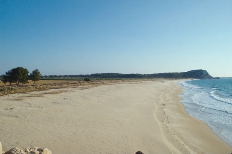
The municipality sits on the coastal plains of Albania's Western Lowlands, partially bounded by two small river streams: the Leshniqe to the west-northwest and the Darçi to the west-southwest. The coastline measures roughly 29.61 km and is described as mostly flat, with sandy and gravel beaches at locations including Golem, Karpen, Spille and Plazhi i Gjeneralit.
The name Kavajë appears in Ottoman archives from the Land Registry of the Sanjak of Albania for the years 1431–1432, in documents first published by Turkish researcher Halil İnalcık. On Latin maps of the period the settlement was recorded as Cavalli.
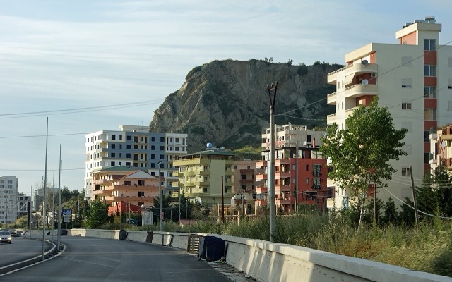
The Byzantine historian Anna Komnena, writing in the Alexiad, records the name of the area as Kabalion. Earlier still, the site near present-day Kavajë was known in antiquity as Petra — the location traditionally associated with events connected to the Battle of Pharsalus between Julius Caesar and Pompey, said to have taken place near what is now called Shkëmbi i Kavajës.
Researchers had until recently placed the beginning of settlement in the mid-16th century, but geological fragments and inscriptions suggest occupation dating to the first centuries BCE. The Illyrian tribe of the Taulantii is believed to have built a city called Arnisa in the area now known as Zik-Xhafaj.
Following the Roman conquest, the territory of Kavajë became a transit point on the Via Egnatia, the road built by Rome to link colonies from the Adriatic Sea to the Bosphorus. The Late Antique and early medieval periods left archaeological traces reflected in the Ethnographic Museum's collection, which includes items whose architectural typology has been traced back to the 'villa rustica' form common in the region.
From the second half of the 13th century until the early 15th century, central Albania was controlled by powerful feudal families. Two families dominated the Kavajë area: the Skuraj and the Matrangaj. The Skuraj, described as direct descendants of the dynasty that founded the Principality of Arbanon, held the eastern part of Kavajë. Their emblem — a lion standing on one foot reaching for a fleur-de-lis — is said to have later become the official emblem of the city of Tirana. The Zguraj neighbourhood of Kavajë takes its name from the Skuraj dynasty.
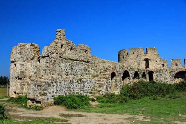
The Matrangaj family, described as the most powerful rulers of the region, established their administrative centre at Bashtovë. They controlled most of the Myzeqe plains and the coastal hills of Karpen. The Bashtovë Fortress, dated to the 15th century, remains a listed cultural monument.
The Ottoman traveller and writer Evliya Çelebi described Kavajë in his 1670 memoir as 'a well-protected and mighty town' situated on a broad, flat, fertile plain, surrounded by gardens and vineyards. He recorded 400 one- and two-storey stone houses with tiled roofs, four congregational mosques, four neighbourhood mosques, two medreses, three primary schools, two dervish tekkes, and 200 shops in the bazaar. The bazaar street was shaded by mulberry trees on both sides. The settlement was administered by an independent voyvoda under the jurisdiction of the Emin of Durrës, with the qadi of Durrës residing in Kavajë rather than at Durrës itself. The qadi's salary was recorded at 150 akçe, with authority over 73 villages.
The Scottish diplomat David Urquhart visited in 1831 and described a settlement of between two and three hundred Gheg families, ruled by Ibrahim Bey, whom he characterised as controlling 'an extent of country thirty miles in every direction'. Urquhart's account situates Kavajë within his tripartite division of Albanian regional groups, placing it in the Gheg zone, which he described as extending from Berat northward to Montenegro and Bosnia.
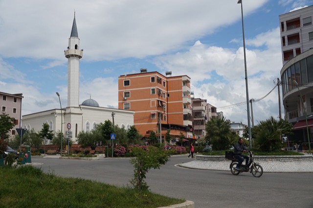
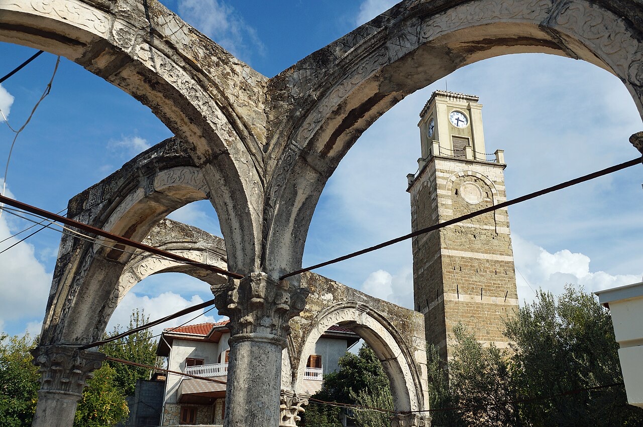
The Kubelie Mosque, the largest of the city's four mosques, takes its name from an earlier structure built by Kapllan Beu in 1736. That building was demolished by the communist regime in 1967; the existing mosque was rebuilt in 1994. The Clock Tower (Sahati) dates to 1817 and is a listed cultural monument.
A missionary identified in the article as Dr. Erickson, who had provided political advice to the Vatra delegation at the Paris Peace Conference of 1919, founded an agricultural school in Kavajë. A girls' school opened on 20 September and a boys' agricultural school on 10 October of that same year. Enrolment cost 50 gold franga per month; the standard course lasted three years, with two additional years available for students with excellent results. Teaching was conducted in both Albanian and English. The project was funded by the Near East Foundation, which commissioned the New York studio Thompson & Churchill for the architectural design.
Following the Italian fascist occupation of 1939, the school was briefly renamed the Italian Agrarian Institute 'Arnaldo Mussolini', after Benito Mussolini's younger brother.
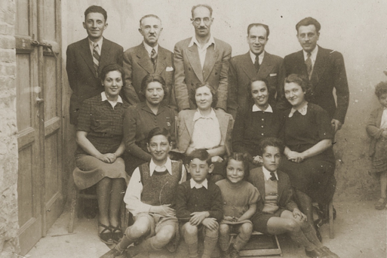
At the outbreak of the Second World War, approximately 600 Jews lived in Albania. Around 400 were German and Austrian refugees; the remainder came from Yugoslavia and Greece. The largest single group — some 200 individuals — was placed in a camp in Kavajë, where they subsequently found shelter with the local population. Three residents of Kavajë, Mihal Lekatari, Besim Kadiu and Shyqyri Myrto, are listed among the Righteous Among the Nations honoured by Yad Vashem for their role in protecting Jewish refugees during the war.
Kavajë had been primarily an agricultural area before the 1960s. Four major industrial plants were inaugurated under the communist government, all using Chinese technology. The Nails and Bolts Plant opened on 28 November 1963 and by 1990 employed 1,200 workers, producing nails, bolts, screws, metal chains, rail bolts and barbed wire. The Paper Factory opened on 28 November 1966 with a peak workforce of 750, initially producing stationery and typographic paper. The Glass Factory opened in late 1970 and, together with an associated ceramic facility, employed 2,500 workers, producing glass packaging, mirrors and later decorative items. The Carpet Production Plant employed 3,000 workers making tapestry carpets and artistic copper items for the domestic market. A Food Factory processing fresh and preserved fruit and vegetables employed 300 workers.
The first anti-communist revolt in Kavajë took place in the summer of 1988: a union strike organised by workers at the pottery, textile and glass factories, protesting job cuts and poor conditions. In subsequent months, anti-communist leaflets were distributed at shops, schools and nearby villages, and Enver Hoxha's portrait was torn down at the city's main high school and at the Cars and Tractors Station.
On 26 March 1990, the first active street demonstration in Albania took place in Kavajë. It was triggered by a football match between local club Besa and Tirana club Partizani. After the match, at which fans threw banners protesting the regime, police arrested numerous people. Citizens then burned the city's police building in what is recorded as the first major public act against the regime.
Kavajë's General Regulatory Masterplan was drafted and approved in 1994, covering a city area of 760 hectares divided into functional zones. A revised Functional Zoning Regulation and Map adopted in 2007 identified seven zones: Inhabited, City Centre, Economic, Green, Sports, Hospital and Cemetery. The new City Centre Masterplan, covering 40.5 hectares and produced by Tirana-based studio Atelier4, was approved in 2007 and included a new administrative centre, a cultural centre and a commercial centre.
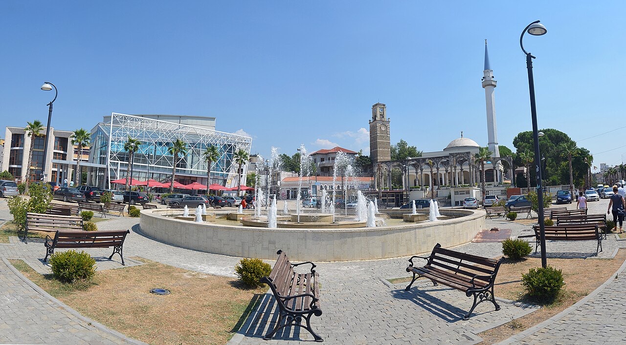
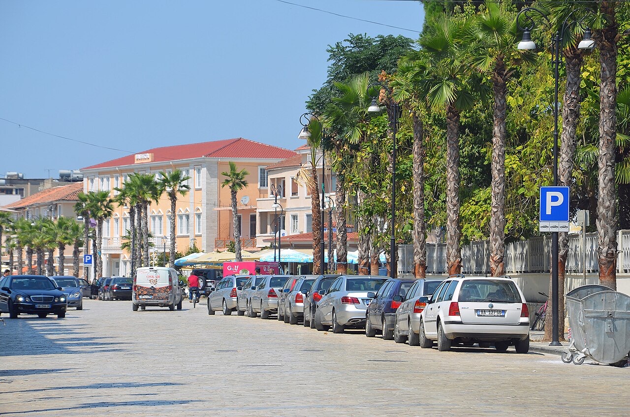
In 2014, under a Socialist Party administration, Kavajë was included in the national 'Rilindja Urbane e Qyteteve' (Urban Renaissance of Cities) initiative. Works included a new municipal building, a 2.5 km reconstructed entrance road and a 3,200 m² park. The programme drew criticism for replacing established trees with palm trees, which opponents said made the city centre less walkable in summer heat. The demolition of the 'Obelisk of Democracy' (known locally as the Two Fingers monument), which had commemorated the anti-communist struggle of the 1990s, was particularly contested. A fountain now occupies its original location.
Kavajë has been considered a stronghold of the Democratic Party, rooted in its anti-communist history. In 2013, Elvis Rroshi of the Socialist Party was elected mayor, marking a shift in the city's political alignment. Rroshi subsequently resigned under Albania's decriminalization law after acknowledging a conviction in Italy and criminal charges in Germany before 2002; a 2015 investigation by BIRN also reported a Swiss conviction for drug-related offences in the 1990s. In May 2023, Fisnik Qosja of the Democratic Party was elected mayor.
Besa Kavajë, founded in 1925, is the city's principal football club and one of the more historically significant clubs in Albanian football. In 1971 the club reached the final of the Balkans Cup, losing to Greek side Panionios 2–3 on aggregate, having won Group A against FK Crvenka and Veliko Tarnovo. In 1973, Besa became the first Albanian club to advance to the second round of the UEFA Cup Winners' Cup.
The club has won two Albanian Cup titles, appearing in the final eight times, and has finished as Superliga runners-up twice and in third place on eleven occasions. Notable results in the club's history include a 9–1 win over Flamurtari in 1937, a 12–0 win over Elbasani in 1945, an 11–0 win over Apolonia in 1965, and a 7–1 win over SK Tirana in 1992. Besa also won six different cup competitions between 1946 and 1965. The club's under-19 side has been Albanian champions twice, in 1992–93 and 2008–09, and the under-17 team won the national title most recently in 2018.
Three other professional football clubs operate in the broader former district of Kavajë: Egnatia Rrogozhinë, Golemi FC and Luzi United. The city has also produced numerous players for the Albanian national team across multiple generations, including goalkeeper Qemal Vogli (1947–1953) and forwards Altin Rraklli (1992–2005) and Sokol Cikalleshi.
도시 · Durrës
Albania's principal port and its oldest continuously inhabited city, founded as Epidamnos in 627 BC.
유적지 · Tiranë
A rare rectangular lowland fortress built by Venice to guard a river port on the Shkumbin.
소도시 · Tiranë
A junction town on the Shkumbin near the Bashtovë fortress and the Spille beaches.
해변 · Tiranë
A quieter sand beach south of Kavajë, backed by farmland rather than hotels.
이 페이지에 오류가 있습니까? 수정 제안을 환영하며, 출처 기록과 대조하여 검토합니다. 잘못된 내용과 가능하다면 올바른 수치의 출처를 알려 주십시오.