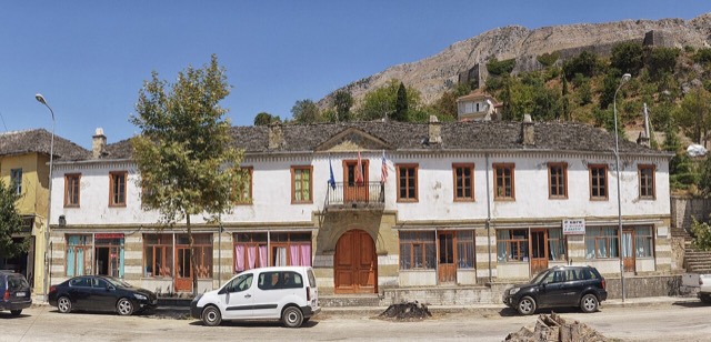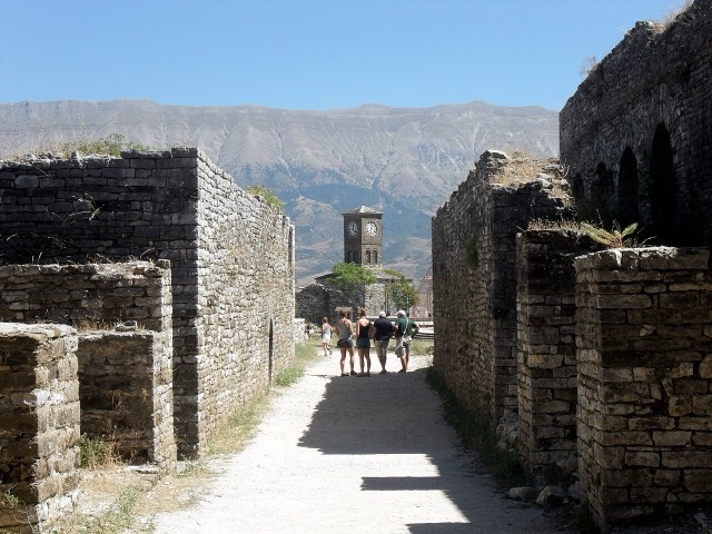
城市 · Gjirokastër
Gjirokastër
The 'stone city': slate-roofed tower houses on a steep slope beneath one of the Balkans' largest castles.
每个县、每段海岸、每个世纪
引导视图
初次了解阿尔巴尼亚?每个页面均以通俗易懂的说明开篇——即便是十岁的孩子也能读懂——随后再展开详细内容。
专业视图
您已掌握基础知识。直接进入正题,简明解释默认隐藏。此为默认模式。
城镇 · Gjirokastër County
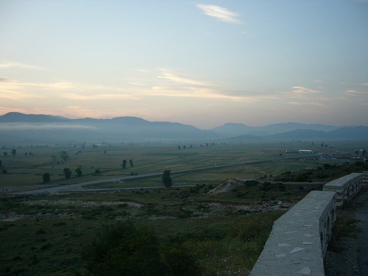
A valley of villages south of Gjirokastër with a large Greek-speaking population.
保存
Dropull is a wide valley of villages near the Greek border where many people speak Greek.
Dropull is a wide valley of villages near the Greek border where many people speak Greek.
Dropull is a municipality in Gjirokastër County, in southern Albania. The region runs south from the city of Gjirokastër to the Greek–Albanian border, along the valley of the Drino river. Its villages are part of the Greek minority zone officially recognised by the Albanian government, in which Greek-speaking majorities live.
The municipality was created in 2015 by the merger of three former municipalities: Dropull i Poshtëm, Dropull i Sipërm, and Pogon. Its administrative seat is the village of Sofratikë. The municipality covers 448.45 km² (173.15 sq mi). According to the 2011 census, the resident population was 3,503; the civil registry for the same year, which counts all citizens including those living abroad, recorded 23,247.
The Roman emperor Hadrian (r. 117–138) founded a city called Hadrianopolis in the region. The Synecdemus of Hierocles, a list of Byzantine administrative divisions dating to the reign of Theodosius II (r. 402–450), places Adrianoúpolis in the region of Dropull. A letter of Emperor Leo III (r. 717–741) mentions the bishop of Adrianoúpolis, and by a source from the late 12th century the title had become bishop of Drinoúpolis. The Arab traveller Muhammad al-Idrisi, also writing at the end of the 12th century, recorded the name as Adernoboli. The Chronicle of the Tocco, written around 1400, attests the form Dernópolin.
The etymology of the modern name is disputed. Çabej derived Dropull from Drinópolis/Dryinópolis, itself containing the name of the river Drino, proposing a reduction Drinópolis > Dropull. Kyriazis rejected this as ignoring the earlier form Adrianoúpolis, and instead traced the sequence: Adrianoúpoli > Adernoboli > Dernópoli > Derópoli/Drópoli, noting that the loss of -rn- to -r- is a recognised feature of Greek dialects in southern Albania. Demiraj regarded the derivation from Hadriano(u)polis as the most likely etymology, arguing that the evolution occurred within an Albanian-speaking population and that the form with the initial /D-/ is original; Greek speakers of the area later converted that initial stop /d/ to the fricative /dh/ and replaced the Albanian ending -pull with the Greek -polis, producing Dhropolis.
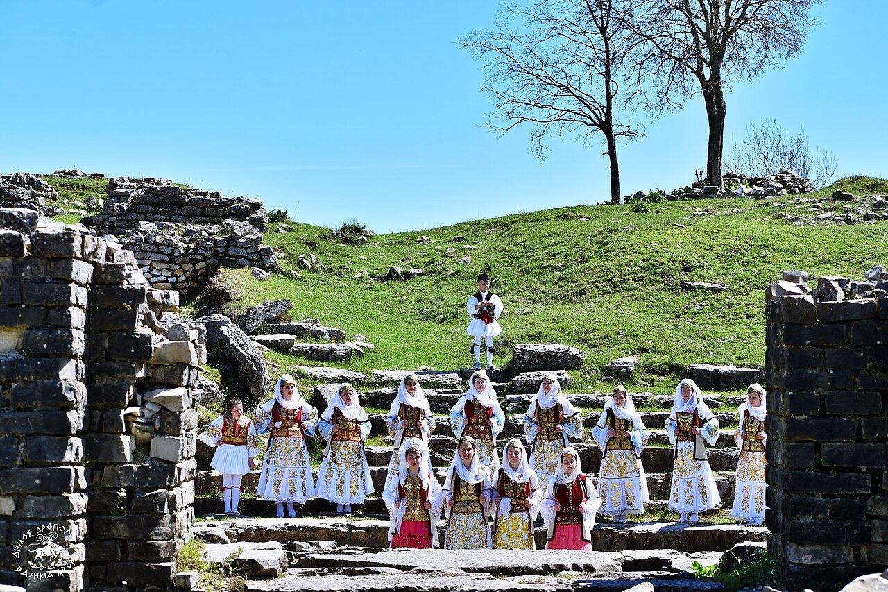
During the Middle Helladic period (2100–1550 BC), a double tumulus was excavated at Vodhinë showing strong similarities to the grave circles at Mycenae. In classical antiquity the area was inhabited by the Chaonians, a Greek tribal grouping. The Roman settlement of Hadrianopolis was built on a strategic position in the Drino valley, near the modern village of Sofratikë, approximately 11 kilometres south of Gjirokastër.
The foundations of Hadrianopolis were first noticed in 1984, when farmers observed upper sections of the amphitheatre. Subsequent excavations by Italian and Albanian archaeologists uncovered the full amphitheatre, Roman baths, and changing rooms. The site of the agora was detected by ground radar, with excavation planned from 2018. Evidence within the amphitheatre—post holes for iron railings in the first-row seats and former actors' changing rooms converted into animal pens—indicates the site was used to expose condemned persons to wild animals.
In the 6th century, the Byzantine emperor Justinian I relocated the settlement approximately 4 kilometres to the southeast, to the site of the modern village of Peshkëpi, as part of his fortification programme against barbarian invasions. Byzantine sources consequently refer to the city as Ioustinianoupolis (Justinianopolis). Ruins of those fortifications, an aqueduct, and a medieval Orthodox Christian church remain visible at the site.
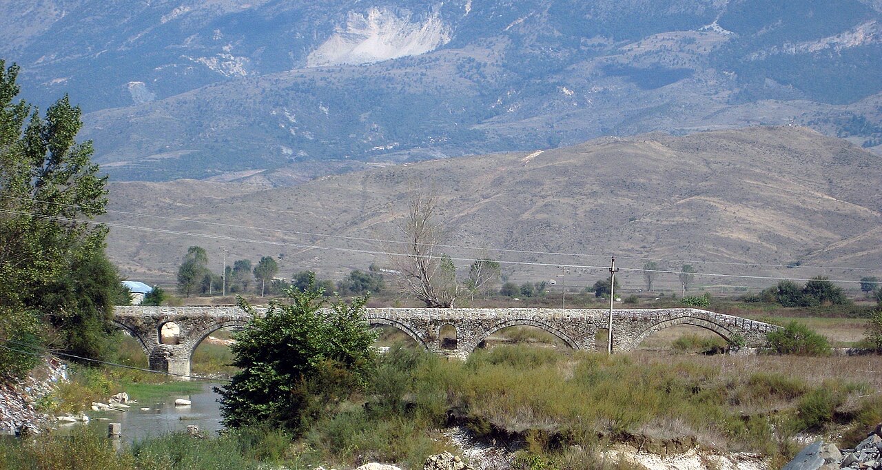
By the 5th century Dropull had become the see of a bishopric, initially within the Diocese of Nicopolis, later under Naupactus and then Ioannina. In the 11th century the city was named Dryinoupolis. In the last quarter of the 14th century, the Albanian Zenebisi clan held the provinces of Gjirokastër and Dropull, as recorded in the Chronicle of Ioannina.
In 1380 the Zenebisi and Mazaraqi clans were defeated at the battle of Politzes by the allied forces of the Epirote despot Thomas Preljubović and the Ottoman frontier chieftain Isayim. In 1382 Thomas, with Ottoman assistance, subdued the Zenebisi and Zulani clans north of Ioannina and retook Dropull, Vagenitia, and Vella. Dropull was then occupied by Isayim in 1384, before the Zenebisi regained control. A new Ottoman campaign under Evrenoz bey was launched against Gjin Zenebisi at the end of 1395 or beginning of 1396. In 1399 the despot of Ioannina, Esau de' Buondelmonti, marched against Gjin Zenebisi with forces drawn from the Albanian clans of Mazara and Malakash as well as from Zagori and Dropull, but was defeated outright at the battle of Mesopotamon and taken prisoner. Gjin Zenebisi extended his domain over the northern part of Vagenitia, and in 1400 the Venetians sought peace with him.
The Zenebisi clan dominated the region until the Ottomans captured the castle of Gjirokastër in 1418 and expelled the clan, marking the beginning of sustained Ottoman control.
Ottoman presence in Epirote and Albanian territories began in the 14th century. A brief rebellion under Emmanuel Mormoris in 1571 was suppressed the same year. During the 16th and 17th centuries, at least eleven Orthodox monasteries were erected in the region with the support of the local population—an increase in monastic foundations that led scholars to describe Dropull as 'little Mount Athos'. Iconographic traditions of the Cretan school are documented in the monastery of Driano (1583) and the Nativity of the Theotokos monastery at Dhuvjan (1594–1595).
When the Greek War of Independence broke out in 1821, several residents of Dropull joined the armed struggle. At the end of the 19th century significant emigration to the United States took place.
In 1927 Albanian state authorities closed all Greek-language schools in the region as part of measures against Greek-language education. The Greek population filed an official protest demanding the reopening of community schools. The Albanian government responded with mass arrests. On 1 October 1935 approximately 100 Albanian gendarmes were dispatched to Dropull, arresting and exiling several Greek teachers. The demonstrations spread to the adjacent communities of Permet and Delvine. The Albanian government subsequently attempted to negotiate with representatives of the Greek minority, and the episode contributed to a League of Nations decision in favour of the ethnic Greek minority.
During World War II, the region came under the control of the Greek army in 1940–1941 during the Greco-Italian War. The population of Lower Dropull welcomed the advancing Greek units and provided food and accommodation. During the People's Republic of Albania (1945–1991), the state recognised a Greek minority largely confined to the Dropull region, while official policy promoted a shift from Greek Orthodox to Albanian identity through population displacements and encouragement of mixed marriages.
The Peshkëpi incident took place on 10 April 1994. Eight men, subsequently identified as members of the Northern Epirus Liberation Front, a Greek nationalist paramilitary organisation, attacked an Albanian army barracks at Peshkëpi in Dropull. Two Albanian border soldiers were killed and three were wounded in the attack.
The Ottoman land survey (defter) of 1431–1432 for the Sanjak of Albania shows that most recorded toponyms in the Dropull area appear to have been Slavic rather than Greek or Albanian, though Slavic had ceased to be spoken in the region by that century. The recorded settlements were located differently from the modern villages, and a number are not attested in later periods. The precise date of abandonment and relocation is not known, but growth of peasant settlements at new and formerly deserted sites is documented in the 16th century.
The mufassal defter of 1520 for Dropull, within the Sanjak of Avlona, divides the region into two administrative units (nahiye): the core territory and the lands of the Iflaklar. The register, published in 1990 by the Albanian Ottomanist Ferit Duka, provides data for 21 settlements. In the core area the recorded personal names belong overwhelmingly to the Albanian onomastic sphere—names such as Bardh, Deda, Gjin, Gjon, Kola, and Leka—with a smaller Slavic presence. A number of clearly Greek surnames are also recorded, including Papdhopullo, Dhespoti, Konturaki, and Nikopullo. In the village of Derviçan the predominance of Greek anthroponyms is particularly evident.
The interpretation of the 1520 defter is contested among scholars. Duka argued that the absence of the Greek suffix -s indicates no Greek presence in much of the anthroponymy. Demiraj, Kyriazis, Liço, and Giakoumis each dispute this reading, arguing that in Greek practice—especially in Epirus—surnames were routinely given in the genitive or accusative case without the suffix -s, and that Ottoman registers recorded names in precisely those oblique cases. Schmitt concluded that the onomatological evidence across most villages is mixed and does not permit a clear ethnic-national division, and argued that the opposition between national communities emerged only in the late 19th century. Liço's study of 2,778 local place-names found 2,324 to be Greek, 184 Albanian, 57 Slavic, 90 Turkish, and 123 unidentified.
The Greek dialect spoken in Dropull forms a continuum between the dialects of Ioannina and those of Corfu and the Ionian Islands. It displays features of southern vocalism and the presence of syneresis types also found in neighbouring dialects of Delvine, Saranda, Pogon, Himara, and northern Thesprotia, while the uncontracted present tense prevails.
A bishopric was established at around 400 CE as the Diocese of Hadrianopolis in Epirus, a suffragan of the Metropolitan Archdiocese of Nicopolis. The diocese was suppressed by the Pope around 1000, but later received an Orthodox successor. The bishopric of Dryinoupolis covered modern southwest Albania, and from the early 16th century its centre was at Argyrokastro (modern Gjirokastër). A Catholic titular see was nominally restored in 1933 under the title Hadrianopolis in Epiro; it has been vacant for decades, its only incumbent at episcopal rank being Josef Freusberg, who served as Auxiliary Bishop of Fulda from 12 April 1953 until his death on 10 April 1964.
Among the monasteries in the region, the oldest with a recorded foundation date is the Monastery of Saints Quiricus and Julietta at Dhuvjan, founded in 1089. The Dormition of the Theotokos at Ravenia (Kalogoranxi) is dated to the 6th century. The Theotokos Monastery at Zervat dates to the 10th century and was abandoned during the 11th-century crusades. Other foundations range from the 16th to the 18th century; the Nativity of the Theotokos monastery at Lovinë, founded before 1761, was abandoned in the 20th century due to its proximity to the Greek–Albanian border. Dropull is twinned with Trikala, Greece.
最热月份为 August (日最高气温均值 31°C), 最冷月份为 January (日最低气温均值 3°C), 降水最多的月份为 November (233 mm). 年均降雨总量为 1,491 mm.
| 月份 | 最高气温 | 最低气温 | 降雨量 | 降雨天数 | 日照时长 |
|---|---|---|---|---|---|
| January | 11°C | 3°C | 182 mm | 12 | 6.8 h |
| February | 12°C | 3°C | 154 mm | 12 | 7.6 h |
| March | 14°C | 5°C | 146 mm | 12 | 9.2 h |
| April | 18°C | 8°C | 109 mm | 13 | 10.7 h |
| May | 23°C | 13°C | 87 mm | 11 | 11.9 h |
| June | 27°C | 17°C | 47 mm | 8 | 13.6 h |
| July | 31°C | 20°C | 22 mm | 4 | 13.8 h |
| August | 31°C | 20°C | 28 mm | 5 | 12.8 h |
| September | 26°C | 16°C | 116 mm | 9 | 10.6 h |
| October | 21°C | 12°C | 155 mm | 9 | 9.0 h |
| November | 16°C | 8°C | 233 mm | 13 | 6.9 h |
| December | 12°C | 4°C | 213 mm | 14 | 6.2 h |
数据来源: ERA5 reanalysis via Open-Meteo, 1994–2023 · "最高气温"与"最低气温"分别为日最高和日最低气温均值。"降雨天数"统计降水量不低于 1 毫米的天数。
城市 · Gjirokastër
The 'stone city': slate-roofed tower houses on a steep slope beneath one of the Balkans' largest castles.
城镇 · Gjirokastër
A hill town below a castle built by Ali Pasha for his sister, opposite Gjirokastër.
本页内容有误? 欢迎提交更正意见,所有意见均会与原始记录核对。请告知错误所在,如能提供正确数据的出处,请一并注明。