
City · Vlorë
Vlorë
Where the Adriatic meets the Ionian, and where Albanian independence was declared in 1912.
Every county, coast and century
Guided view
New to Albania? Every page opens with a plain-language explanation you could read to a ten-year-old, before the detail begins.
Expert view
You already know the basics. Straight to the substance, with the simple explanations hidden. This is the default.
Subject · Vlorë County
A cypress-covered island in the Narta lagoon holding a 13th–14th-century Orthodox monastery.
Save
Zvërnec is a small island in a lagoon near Vlorë, covered in cypress trees. A long wooden footbridge leads to it, and there is an old monastery among the trees.
Zvërnec is a small island in a lagoon near Vlorë, covered in cypress trees. A long wooden footbridge leads to it, and there is an old monastery among the trees.
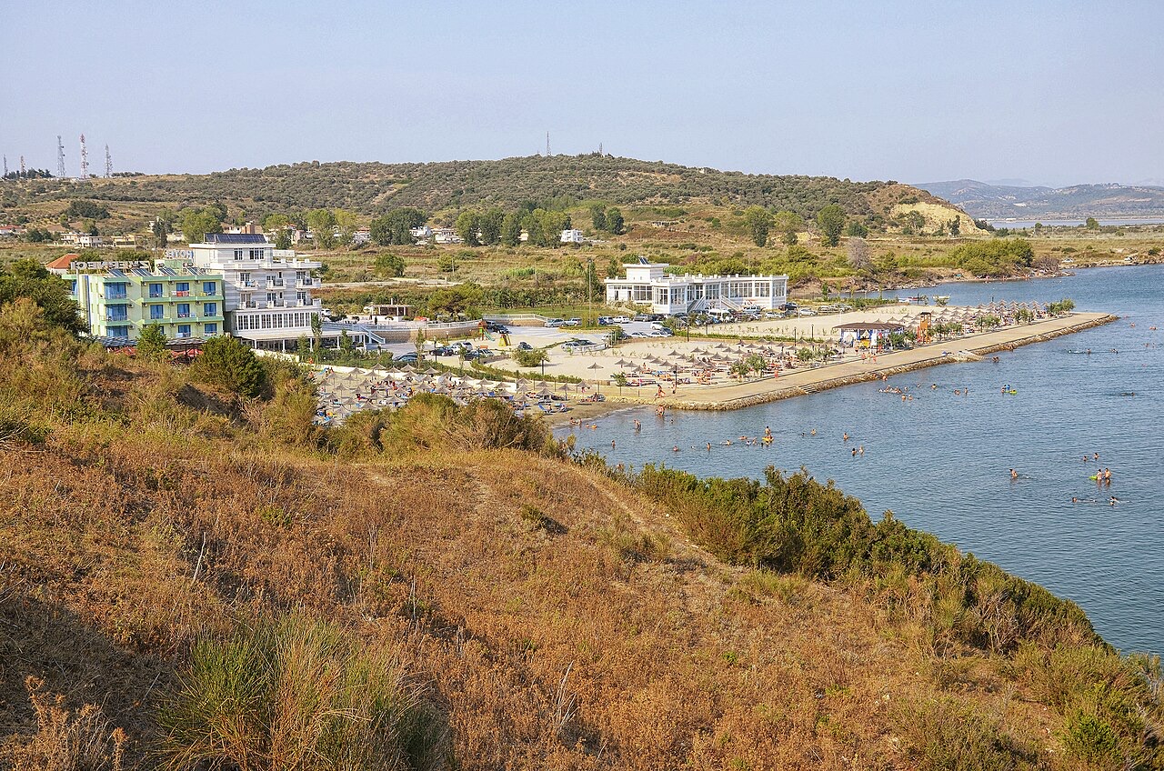
Zvërnec is a community in Vlorë County, in southwestern Albania. It lies northwest of the city of Vlorë, within a coastal zone characterised by extensive salt marshes. Following the 2015 local government reform, Zvërnec became part of the municipality of Vlorë.
The surrounding landscape includes the Narta Lagoon to the north, which hosts a distinctive ecosystem. A small island bearing the same name, Zvërnec Island, lies close to the settlement and houses a Byzantine monastery dedicated to the Dormition of the Mother of God. A lighthouse stands to the east of the settlement.
The toponym Zvërnec derives from the Slavic word zvěr, meaning 'wild beast', rendered in Bulgarian as звяр (zvjar) and in Old Church Slavonic as звѣрь (zvěrĭ). The suffix takes either an ец (ets) or ьн-ец (yn-ets) formation.
The name appears in different forms across languages spoken in or near the village. In Albanian, the definite form is Zvërneci. In Greek the settlement is known as Σβέρνιτσα (Svérnitsa), and in Aromanian as Zvârneț.
During classical antiquity, the coastal area of the Bay of Vlorë, where Zvërnec and the neighbouring village of Nartë are located, was inhabited by Illyrians and Ancient Greek colonists. Because these two villages today represent the northernmost pockets of Modern Greek speech in the region, the scholar Hatzopoulos (1997) raised the question of whether this is coincidental or whether the communities represent isolated linguistic relics of the ancient Balaiitai and Horikioi peoples.
The hypothesis of uninterrupted Greek-speaking presence from antiquity is disputed. Sh. Demiraj (2010) argues that the hypothesis lacks linguistic or historical evidence and proposes instead that the ancestors of the Greek-speaking population were relatively late arrivals from Greek-speaking regions around Arta. Demiraj draws on anthroponymic data from 16th-century Ottoman defters of 1520 and 1583, which record predominantly south Albanian Orthodox personal names in Nartë. Those names lack the Greek suffix -s and include consonants uncommon in Modern Greek, such as /b/, as in Bogdan and Tërbari. Some surnames point to immigration from neighbouring Albanian villages, including Bulku and Palasa. Demiraj concludes that the question of Greek-language use in the area remains open.
Kyriazis (2012) disputes this reading of the Ottoman registers, arguing that the same 16th-century documents also contain evidence supporting population continuity and internal differentiation. He notes that the absence of the suffix -s does not necessarily indicate a non-Greek presence, since this omission is documented in Ottoman records from regions that were unquestionably Greek-speaking. Kyriazis further suggests that if local Greek speech has historical depth reaching into antiquity, it is necessary to examine when and how northern vocalic features entered the dialect, a development he attributes either to later settlement by speakers of northern Greek varieties during the early Ottoman period or to internal linguistic evolution.
The historian Alain Ducellier identified the medieval city of Spinarica with Zvërnec. In 1297, the settlement of Spinaritza was governed by the dux Kalamanos, a member of the noble Greek Strategopoulos family. In 1301, Andronikos Palaiologos became governor of the Spinarica district.
According to local traditions among some village inhabitants, Zvërnec was originally settled during the Middle Ages by people from the Greek coast. Those settlers initially stayed on Sazan Island before moving to the hill above the current settlement to establish a permanent community.
The Ottoman traveller Evliya Çelebi, writing in the late 17th century, recorded that Zvërnec was inhabited by 150 Christian families who worked either as fishermen or in the salt marshes. This is one of the earliest detailed demographic references to the settlement.
By the early 19th century, five Aromanian families had also taken up residence in Zvërnec, representing the beginning of the second community group that would come to occupy a distinct neighbourhood in the village.
The village is composed of two distinct neighbourhoods. The older part, situated on the hill, is inhabited by Greeks. The second neighbourhood, established along the shoreline in the early 20th century, is populated by Aromanians. During the interwar period, both Greek and Aromanian speakers lived in Zvërnec.
Aromanians were historically regarded as an outsider group by the original hill-dwelling population, and relations between the two communities only began to form at a community and familial level in the modern period. In the early 21st century, all villagers speak Greek and Albanian, and the Aromanian residents additionally speak Aromanian. The inhabitants hold dual Albanian and Greek citizenship, while those on the hill identify as members of a Greek minority in Albania, a status not recognised by the Albanian government.
A dwindling student population led to the closure of the village school in 2007. A 2014 state report recorded 900 registered citizens belonging to the Greek minority in the surrounding area. By 2018, Zvërnec had 1,332 registered inhabitants, but approximately 85 percent of them were emigrants.
Of those registered residents, 1,101 had migrated mainly to Greece, while 24 had moved internally to Tiranë or Vlorë. The remaining 207 residents had an average age of 62 years. Nearly all emigrant families return to Zvërnec during summer, and a smaller influx of domestic migrants arrives during Orthodox Easter.
In 2026, Zvërnec became the focus of environmental protests and political controversy following the approval of a proposed luxury resort development backed by Affinity Partners, the investment firm founded by Jared Kushner. Environmental organisations and local activists alleged that construction activities within the nearby Pishë Poro–Narta protected area had damaged wetlands, dunes, and forested zones.
Albanian authorities maintained that the works complied with applicable permits and environmental regulations. The controversy intensified following confrontations between protesters, private security personnel, and police during demonstrations at the site. Albanian Prime Minister Edi Rama stated that opposition to the project was amplified by what he described as 'enemies of Israel and Albania', 'bots', and 'fake profiles', and asserted that the project would proceed in order to develop Albania's tourism sector.
Fatos Arapi, an Albanian writer and translator, is the notable person associated with Zvërnec recorded in reference sources.
The warmest month is August (mean daily high 32°C), the coldest is January (mean daily low 5°C), and the wettest is November (142 mm). Total annual rainfall averages 1,037 mm. Sea temperature peaks in August at about 25°C.
| Month | High | Low | Rain | Wet days | Sun/day | Sea |
|---|---|---|---|---|---|---|
| January | 12°C | 5°C | 103 mm | 12 | 7.4 h | 16°C |
| February | 13°C | 6°C | 98 mm | 11 | 8.3 h | 15°C |
| March | 16°C | 7°C | 97 mm | 11 | 9.8 h | 15°C |
| April | 19°C | 10°C | 82 mm | 11 | 11.0 h | 16°C |
| May | 24°C | 15°C | 63 mm | 8 | 12.2 h | 19°C |
| June | 28°C | 19°C | 41 mm | 6 | 13.6 h | 22°C |
| July | 32°C | 22°C | 26 mm | 5 | 13.8 h | 24°C |
| August | 32°C | 22°C | 30 mm | 5 | 12.9 h | 25°C |
| September | 27°C | 18°C | 101 mm | 9 | 10.8 h | 25°C |
| October | 22°C | 14°C | 123 mm | 9 | 9.3 h | 24°C |
| November | 18°C | 11°C | 142 mm | 12 | 7.4 h | 20°C |
| December | 14°C | 7°C | 131 mm | 13 | 6.8 h | 17°C |
Source: ERA5 reanalysis via Open-Meteo, 1994–2023 · “High” and “Low” are mean daily maximum and minimum air temperature. “Wet days” counts days with at least 1 mm of precipitation.
City · Vlorë
Where the Adriatic meets the Ionian, and where Albanian independence was declared in 1912.
Lake · Vlorë
Albania's second-largest lagoon, with working saltpans and the island monastery of Zvërnec.
Something wrong on this page? Corrections are welcome and are checked against the source record. Tell us what is wrong and, if you can, where the right figure comes from.