Kota besar · Gjirokastër
Gjirokastër
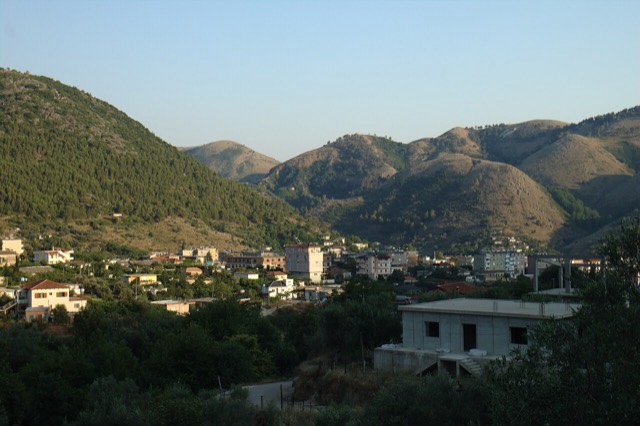
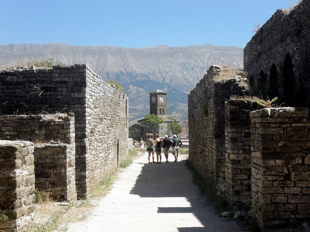
The 'stone city': slate-roofed tower houses on a steep slope beneath one of the Balkans' largest castles.
Setiap kabupaten, pantai, dan abad
Tampilan terpandu
Baru mengenal Albania? Setiap halaman dibuka dengan penjelasan dalam bahasa sederhana yang dapat dibaca oleh anak usia sepuluh tahun, sebelum detail lebih lanjut dimulai.
Tampilan ahli
Anda sudah mengetahui dasar-dasarnya. Langsung ke inti pembahasan, dengan penjelasan sederhana yang disembunyikan. Ini adalah tampilan default.
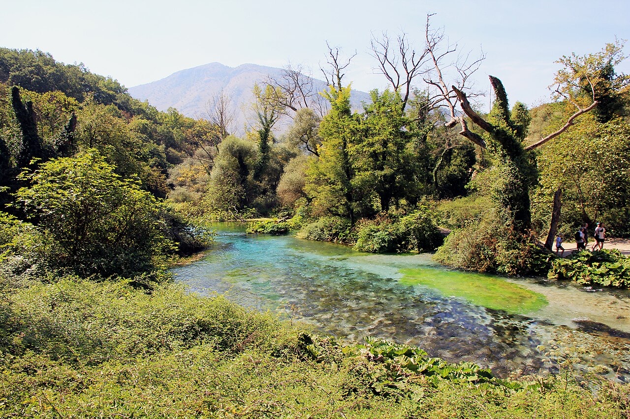
Mata air · Vlorë County
A karst spring of extraordinary clarity whose bottom has never been definitively reached.
Simpan
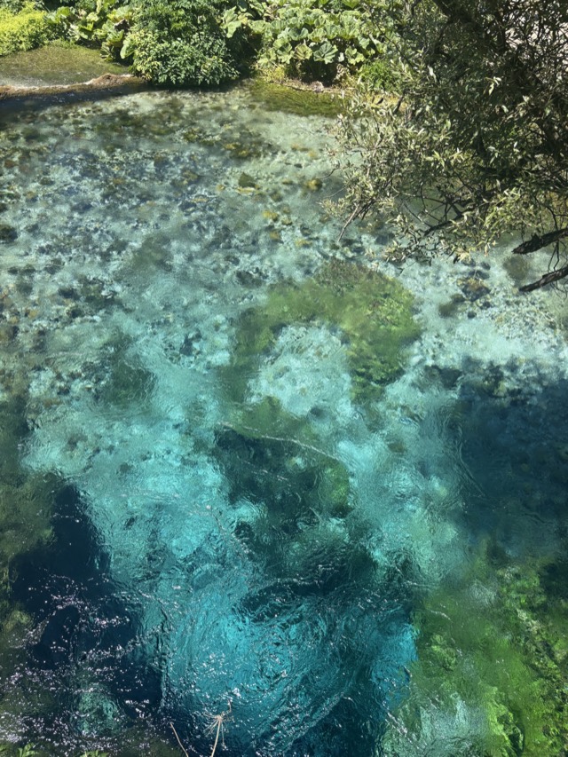
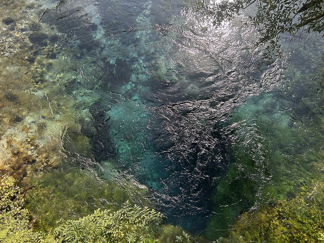
The Blue Eye is a spring where water comes up out of the ground so clear you can see deep into it. The middle is dark blue and the edges are pale — that is why it is called an eye. Divers have gone down more than 50 metres without finding the bottom.
The Blue Eye is a spring where water comes up out of the ground so clear you can see deep into it. The middle is dark blue and the edges are pale — that is why it is called an eye. Divers have gone down more than 50 metres without finding the bottom.
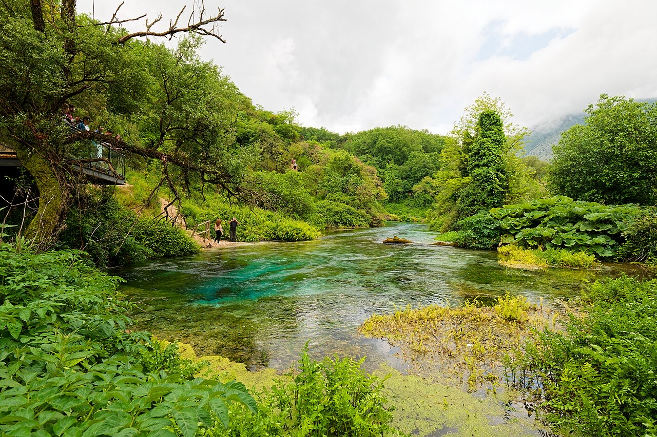
The Blue Eye (Albanian: Syri i Kaltër) is a water spring located slightly west of the village of Muzinë, in Finiq municipality, southern Albania. It is reached by car via the Sarandë–Gjirokastër road, joining from the village of Krongj. The spring sits at an altitude of 152 metres above sea level.
The spring is the initial water source of the Bistricë river, which runs for 25 kilometres before emptying into the Ionian Sea south of Sarandë. This connection has given the site an alternative name: the 'springs of Bistricë'.
The Blue Eye is a karst spring, meaning it issues from a hole dissolved through limestone bedrock over geological time. The clear blue water is visible from a depth of more than fifty metres. Divers have reached fifty metres, but the actual depth of the karst hole remains unknown.
The discharge rate of the spring is recorded at 18,400 litres per second, making it a substantial and consistent water source. The intense blue colouration of the water, visible from depth, is the defining visual characteristic that gives the spring its name in both Albanian and English.
The immediate area around the spring, covering 1.8 square kilometres (0.69 square miles), is designated a Nature Monument under Albanian protected-area legislation. The formally designated natural monument covers 180 hectares in total.
The vegetation of the protected zone is characterised by oak and sycamore trees. No further detail on the ecological composition of the area is provided in the available record.
In the summer of 2004, the Blue Eye spring temporarily dried up entirely. The article does not record the duration of the dry period, the cause, or whether flow returned naturally or as a result of intervention.
This event is notable given the spring's role as the sole recorded source of the Bistricë river. A cessation of flow at the source would have direct consequences for the full 25-kilometre length of the river downstream.
In the summer of 2017, part of the Blue Eye site was burned by wildfire. The article does not specify which portion of the protected area was affected, the extent of the damage, or whether recovery measures were undertaken following the fire.
The site's oak and sycamore tree cover would have been the primary vegetation at risk. Given that the protected zone covers 180 hectares, the scale of any loss is not quantified in the available record.
The Blue Eye is described as a popular tourist attraction. Its accessibility by road from the Sarandë–Gjirokastër route, combined with its position in the context of southern Albania's Ionian coast, places it within reach of the region's broader visitor infrastructure.
No visitor statistics, entry arrangements, or facilities are detailed in the available article. The site's status as a designated Nature Monument places it within Albania's system of protected areas, the framework for which is governed separately under national legislation.
Bulan terhangat adalah August (rata-rata suhu harian tertinggi 31°C), yang terdingin adalah January (rata-rata suhu harian terendah 3°C), dan yang terbasah adalah November (243 mm). Total curah hujan tahunan rata-rata 1,491 mm.
| Bulan | Tertinggi | Terendah | Hujan | Hari hujan | Matahari/hari |
|---|---|---|---|---|---|
| January | 11°C | 3°C | 177 mm | 13 | 6.9 h |
| February | 12°C | 3°C | 153 mm | 11 | 7.7 h |
| March | 15°C | 5°C | 144 mm | 12 | 9.3 h |
| April | 18°C | 8°C | 109 mm | 12 | 10.7 h |
| May | 23°C | 13°C | 79 mm | 10 | 11.9 h |
| June | 27°C | 17°C | 41 mm | 6 | 13.6 h |
| July | 31°C | 20°C | 20 mm | 4 | 13.8 h |
| August | 31°C | 20°C | 27 mm | 5 | 12.8 h |
| September | 26°C | 17°C | 115 mm | 9 | 10.6 h |
| October | 21°C | 12°C | 159 mm | 9 | 9.0 h |
| November | 16°C | 8°C | 243 mm | 13 | 6.9 h |
| December | 12°C | 4°C | 223 mm | 14 | 6.3 h |
Sumber: ERA5 reanalysis via Open-Meteo, 1994–2023 · "Tertinggi" dan "Terendah" adalah rata-rata suhu udara harian maksimum dan minimum. "Hari hujan" menghitung hari dengan curah hujan minimal 1 mm.
Kota besar · Gjirokastër
The 'stone city': slate-roofed tower houses on a steep slope beneath one of the Balkans' largest castles.
Kota besar · Vlorë
The Ionian resort town facing Corfu, and the arrival point for most visitors to southern Albania.
Kota · Vlorë
Four small islands and very clear shallow water; the most photographed and most crowded stretch of the Albanian coast.
Kota · Vlorë
A hill town above the Sarandë plain with a mixed Albanian and Greek population.
Kota · Vlorë
A municipality of villages near Sarandë, containing the Blue Eye and the ancient site of Phoenice.
Penjelasan
Twenty-eight thousand square kilometres, seventy per cent of it hills and mountains, and a coast that changes character halfway…
Ada yang salah di halaman ini? Koreksi sangat disambut dan akan diperiksa terhadap catatan sumber. Beri tahu kami apa yang salah dan, jika memungkinkan, dari mana angka yang benar berasal.