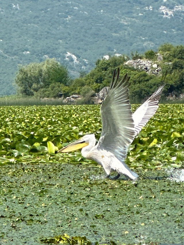
City · Shkodër
Shkodër
The cultural capital of the north: a lake, a fortress, a bicycle city and a Catholic heartland.
Every county, coast and century
Guided view
New to Albania? Every page opens with a plain-language explanation you could read to a ten-year-old, before the detail begins.
Expert view
You already know the basics. Straight to the substance, with the simple explanations hidden. This is the default.
Historic site · Shkodër County
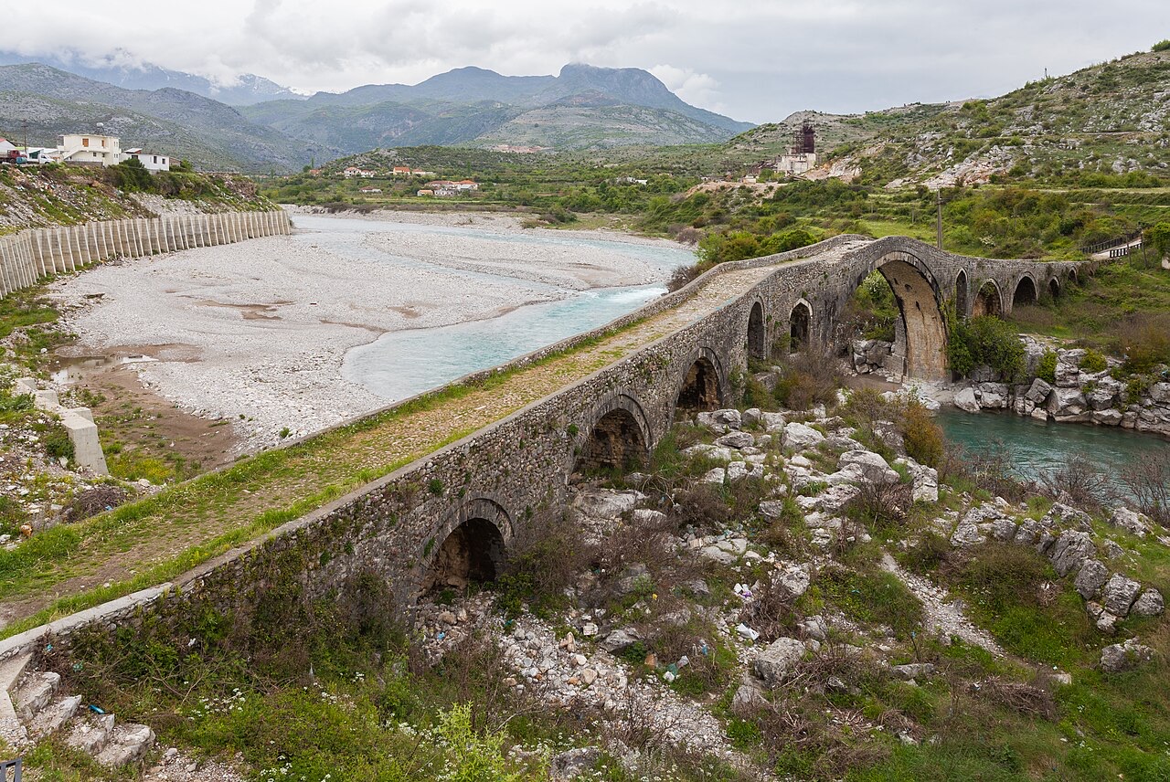
A 108 m, thirteen-arch packhorse bridge over the Kir north-east of Shkodër.
Save
The Mesi Bridge is a long stone bridge with thirteen arches, built about 250 years ago so mules and traders could cross the Kir river.
The Mesi Bridge is a long stone bridge with thirteen arches, built about 250 years ago so mules and traders could cross the Kir river.
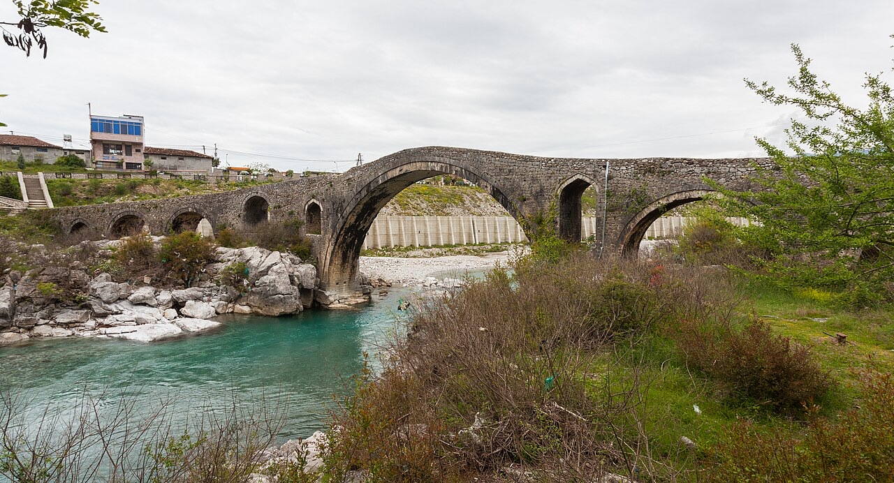
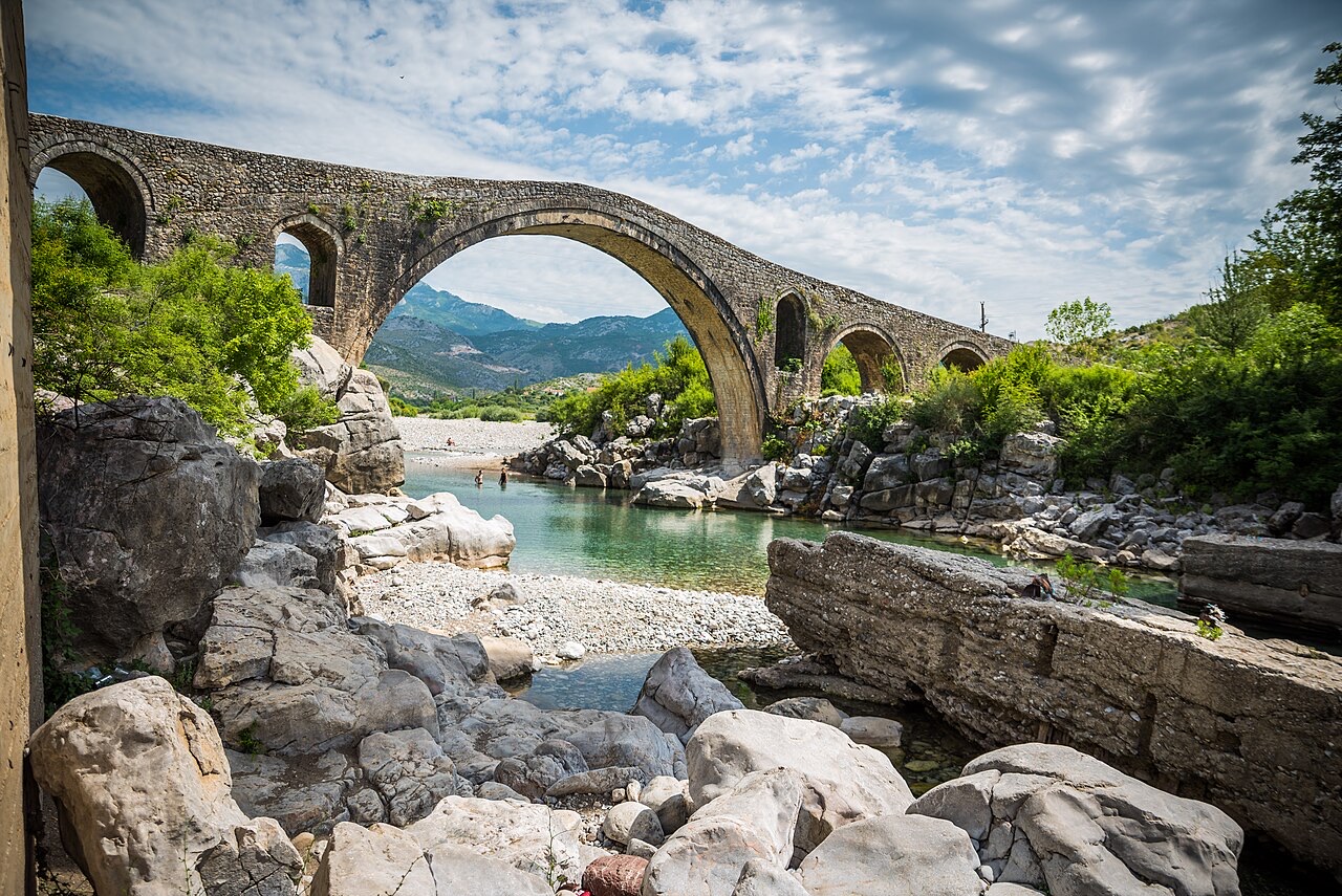
Mesi Bridge — Albanian: Ura e Mesit, literally 'The bridge in the middle' — stands in the village of Mes, approximately 5 km (3.1 miles) northeast of Shkodër in northwestern Albania. It crosses the Kir River, a watercourse subject to significant seasonal flooding that shaped the bridge's final design.
The surrounding area is associated with Postribë culture, and the site draws visitors on account of its architecture: round, smooth stones and stone plates form the visible fabric of the structure. The Albanian Development Fund invested 13 million ALL in access infrastructure so that visitors could approach and inspect the bridge directly, having previously had no formal entry route to it.
The bridge was built in the 18th century, around 1770, under the direction of Kara Mahmud Bushati, the local Ottoman Albanian pasha. Construction proceeded in two distinct phases rather than as a single continuous project.
The first phase began in 1768 and produced only the large central arch together with three smaller arches — one on the right side and two on the left. This initial structure was soon found to be inadequate: seasonal flooding on the Kir River made clear that a considerably longer crossing was required.
In 1770, the bridge was extended to its current length by adding the remaining arches to bring the total to thirteen. During this second phase, builders also introduced a 14-degree bend in the structure near the main arch.
That bend was not decorative but functional: it was designed to follow the natural rock formations in the riverbed, providing better stability for the foundations. The decision reflects an engineering response to the specific geology of the crossing point on the Kir River.
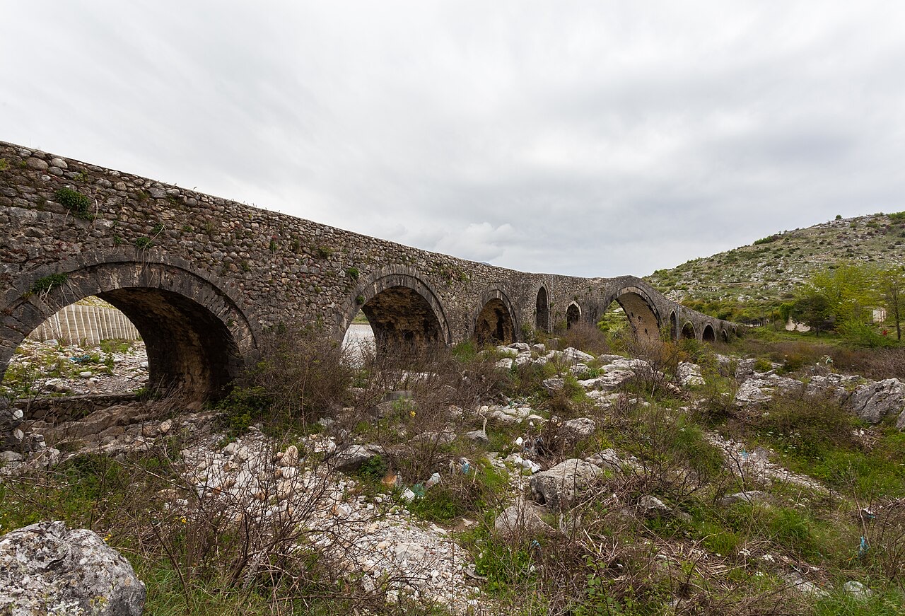
In its completed form, Mesi Bridge measures 108 m (354 ft) in length, 3.4 m (11 ft) in width, and 12.5 m (41 ft) in height. It carries thirteen arches in total, comprising one large central arch and twelve smaller ones.
These dimensions make it one of the longest surviving examples of an Ottoman bridge in the region. The combination of span, height above the river, and multi-arch configuration was suited to the demands of a watercourse that floods heavily at certain times of year.
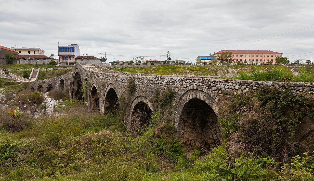
The bridge was constructed to connect Shkodër with the city of Drisht and other settlements on the northern side of the Kir River. It formed part of the road running up the Kir Valley, a route that extended eventually to Pristina.
This strategic function — linking a major urban centre with northern destinations along an established valley corridor — explains why Kara Mahmud Bushati, as pasha, commissioned a structure of such scale rather than a more modest crossing.
Mesi Bridge represents the Ottoman tradition of masonry arch bridge construction, characterised here by the use of local stone — round, smooth river stones and flat stone plates — and by the multi-arch form that distributes load and accommodates variable water levels.
The phased construction and the deliberate realignment to follow bedrock formations indicate that the builders adapted standard Ottoman bridge practice to the particular conditions of the Kir River site, rather than imposing a fixed template regardless of terrain.
The bridge is designated a monument of Postribë culture, giving it formal recognition within Albanian heritage categories. This status is reflected in the public investment — the 13 million ALL spent by the Albanian Development Fund — directed at enabling visitor access.
The site is described as a tourist attraction drawing visitors internationally. Foreign visitors are reported to find the stone construction — specifically the round smooth stones and flat stone plates — architecturally distinctive.
The bridge currently faces ongoing structural risk. Repeated flooding over time has eroded the arches on the right side of the structure, and cracking has resulted from this cumulative damage.
The vulnerability is directly connected to the same hydrological conditions that determined the bridge's design in the first place: the Kir River's seasonal flooding, which prompted the 1770 extension, continues to act on the masonry. No restoration programme is described in the available record.
The Kir River's behaviour runs through the entire history of Mesi Bridge. It drove the decision to extend the structure from its original four arches to thirteen after the 1768 first phase proved insufficient. It shaped the 14-degree bend introduced to align foundations with stable bedrock. And it remains today the primary agent of the deterioration threatening the structure.
The river's seasonal flooding pattern is thus the central environmental fact at the site: it determined the bridge's length, its alignment, and its current condition.
Situated 5 km northeast of Shkodër, Mesi Bridge sits within the gravitational reach of one of Albania's principal northern cities. Shkodër was the urban centre the bridge was built to serve, linking it northward to Drisht and beyond into the Kir Valley corridor toward Pristina.
The village of Mes, where the bridge stands, takes its place in the regional landscape as a point on what was an Ottoman-era road network rather than as an isolated monument. The bridge's scale — over 100 metres long — corresponds to its role as infrastructure for a significant inter-urban route rather than a local river crossing.
The warmest month is August (mean daily high 30°C), the coldest is January (mean daily low 1°C), and the wettest is November (257 mm). Total annual rainfall averages 1,799 mm.
| Month | High | Low | Rain | Wet days | Sun/day |
|---|---|---|---|---|---|
| January | 9°C | 1°C | 190 mm | 12 | 6.7 h |
| February | 11°C | 2°C | 171 mm | 12 | 7.6 h |
| March | 14°C | 5°C | 165 mm | 11 | 9.2 h |
| April | 18°C | 9°C | 144 mm | 12 | 10.5 h |
| May | 23°C | 14°C | 112 mm | 10 | 12.0 h |
| June | 27°C | 18°C | 60 mm | 6 | 13.5 h |
| July | 30°C | 20°C | 37 mm | 4 | 13.7 h |
| August | 30°C | 21°C | 54 mm | 4 | 12.8 h |
| September | 25°C | 16°C | 192 mm | 8 | 10.5 h |
| October | 20°C | 12°C | 188 mm | 10 | 8.9 h |
| November | 15°C | 7°C | 257 mm | 13 | 6.9 h |
| December | 10°C | 3°C | 229 mm | 13 | 6.2 h |
Source: ERA5 reanalysis via Open-Meteo, 1994–2023 · “High” and “Low” are mean daily maximum and minimum air temperature. “Wet days” counts days with at least 1 mm of precipitation.
City · Shkodër
The cultural capital of the north: a lake, a fortress, a bicycle city and a Catholic heartland.
Lake · Shkodër
The largest lake in southern Europe, shared with Montenegro and a major bird wintering ground.
Something wrong on this page? Corrections are welcome and are checked against the source record. Tell us what is wrong and, if you can, where the right figure comes from.