湖 · Korçë
Lake Ohrid
One of Europe's oldest and deepest lakes, UNESCO-listed and home to species found nowhere else.
すべての県、すべての海岸、すべての世紀
ガイドビュー
アルバニアを初めて知る方へ。各ページは、詳細に入る前に、10歳の子どもにも読み聞かせられる平易な説明から始まります。
エキスパートビュー
基本知識はすでにお持ちの方向け。平易な説明を非表示にし、内容を直接表示します。これがデフォルトです。
史跡 · Korçë County
Floor mosaics of birds and vines from a hilltop basilica above Lake Ohrid.
保存
On a hill above the village of Lin are the coloured floor mosaics of a church from the 500s, showing birds and plants. Below in the lake, archaeologists found a village built on wooden posts more than 8,000 years ago.
On a hill above the village of Lin are the coloured floor mosaics of a church from the 500s, showing birds and plants. Below in the lake, archaeologists found a village built on wooden posts more than 8,000 years ago.
Lin (Albanian definite form: Lini) is a village in the municipality of Pogradec, within Korçë County in southeastern Albania. It occupies a small peninsula on the western shore of Lake Ohrid, positioned just south of the Qafë Thanë mountain pass, which serves as a border-crossing point between Albania and North Macedonia.
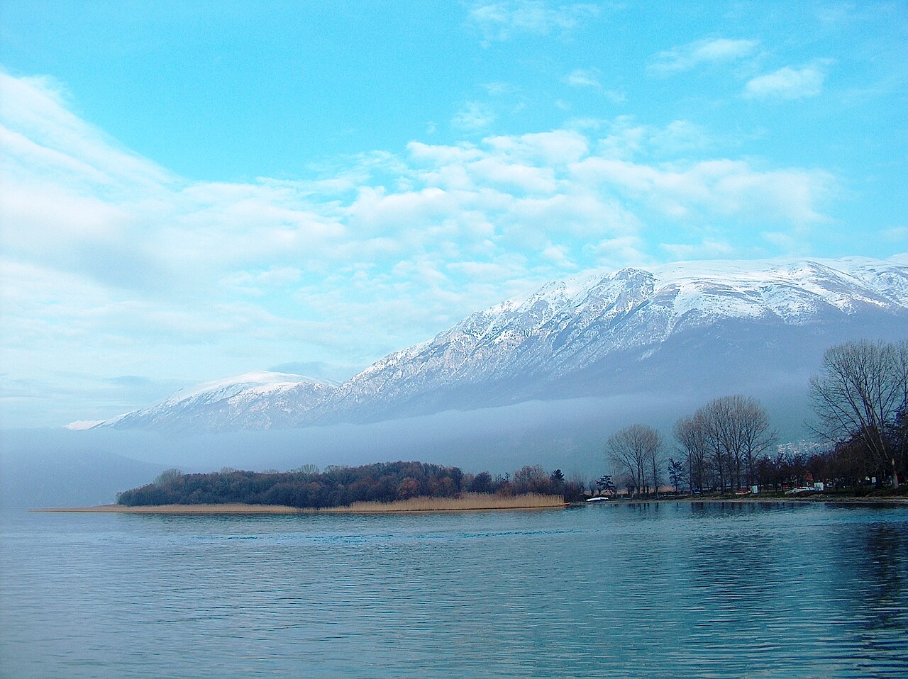
Pogradec lies approximately 22 km to the south of Lin along the lake. Struga, in North Macedonia, is about 10 km to the north along the shoreline. Directly across the border, the nearest settlement is Radožda. At the 2015 local government reform, Lin was formally incorporated into the municipality of Pogradec.
Archaeological evidence indicates that the Lin area has been inhabited since at least prehistoric times. Recent archaeological findings suggest the site dates back approximately 8,500 years, placing initial occupation at around 6000 BC or earlier. On the basis of these findings, Lin has been identified as the oldest known inhabited pile-dwelling settlement in Europe, though this claim rests on ongoing archaeological investigation.
The pile-dwelling context places Lin within a broader tradition of lake-edge settlement characteristic of the Ohrid region during the Neolithic and later periods. The longevity of occupation at the site reflects the geographic advantages of the peninsula's position on Lake Ohrid.
On the hilltop above the present-day village, archaeological excavations have uncovered the foundation walls and mosaics of an early Christian Byzantine church. The structure is dated to the 6th century AD, placing it within the broader late antique and early Byzantine period of ecclesiastical construction across the Balkans.
The church has been designated a Cultural Monument of Albania. It is also included within the proposed UNESCO heritage nomination covering the Natural and Cultural Heritage of the Ohrid Region on the Albanian side of the lake, a designation that would complement the existing UNESCO status held by the Ohrid region in North Macedonia.
The mosaics discovered at the hilltop church site are among the significant archaeological finds at Lin. They date from the 6th century and are associated with the Byzantine ecclesiastical complex whose foundation walls have also been excavated. Their presence confirms that the site functioned as a place of organized Christian worship during the early Byzantine period.
As part of a Cultural Monument of Albania and a candidate within the Ohrid Region UNESCO heritage framework, the mosaics carry formal heritage status. The article does not provide further technical detail on their composition, iconographic programme, or current state of preservation.
The earliest specific demographic record in the available sources dates to 1873, when Lin was recorded as containing 65 households. Of the male population counted at that time, 90 were identified as Bulgarian Orthodox Christians and 62 as Muslims.
In 1900, the traveller and ethnographer Vasil Kanchov visited the region and recorded Lin as a mixed village divided approximately equally between 300 Bulgarian Christians and 300 Albanian Muslims. These 19th-century records reflect a period in which the village's confessional and ethnic composition was explicitly documented by outside observers, though the reliability and framing of such classifications are subject to the methodological conventions of their time.
Under the terms of the Treaty of London of 1913, Lin was allocated to the Kingdom of Serbia. This arrangement reflected the post-Balkan Wars territorial settlements, in which Ottoman-held lands in the region were divided among the Balkan states.
The situation changed on 9 November 1921, when the Conference of Ambassadors assigned Lin to Albania instead. This decision placed the village within the borders of the Albanian state, where it has remained. The reversal illustrates the instability of boundary-drawing in the region during the post-World War I settlement process.
The Albanian Tosk dialect is the primary language of the area. Lin is, according to available sources, the only location in Albania where the Vevčani-Radožda dialect of Macedonian is spoken. This dialect is associated with Macedonian-speaking inhabitants, who refer to the village as Лин.
Fieldwork conducted during the 2000s by linguists Klaus Steinke and Xhelal Ylli, undertaken to verify villages cited in prior literature as Slavic-speaking, confirmed Lin's status as a linguistically mixed settlement. Local residents reported that Macedonian use had declined substantially: only a small number of families still spoke the language, typically in cases where women had married into Lin from the neighbouring village of Radožda across the border in North Macedonia. Macedonian was reported as not being used by the third generation of residents.
The fieldwork carried out by Steinke and Ylli in the 2000s recorded Lin as a mixed village of Orthodox Christians and Muslims. At the time of their research, the village had approximately 1,680 inhabitants organised into 296 families.
The coexistence of Orthodox Christian and Muslim communities in Lin reflects a pattern documented in the village since at least the 19th century, when both confessional groups were recorded in the 1873 and 1900 surveys. The linguistic fieldwork of the 2000s provides the most recent population figure available in the supplied sources.
Lin's early Christian Byzantine church and its associated mosaics are included within the proposed UNESCO nomination for the Natural and Cultural Heritage of the Ohrid Region on the Albanian side of the border. This nomination process applies to the Albanian portion of the Ohrid heritage zone, which already holds UNESCO status on the North Macedonian side.
The inclusion of the Lin church site in this framework places it alongside other cultural and natural assets of the Albanian Ohrid shoreline being put forward for international heritage recognition. The article does not indicate whether the nomination had been formalised or approved as of the date of the source material.
Prior to 2015, Lin had a separate administrative standing within Korçë County. The 2015 local government reform in Albania reorganised municipal boundaries across the country, and as a result of that reform, Lin was incorporated into the enlarged municipality of Pogradec.
Pogradec municipality, of which Lin is now a part, sits in Korçë County in southeastern Albania. The village's position on the Lake Ohrid peninsula, close to the North Macedonian border, gives it a geographic character distinct from the inland settlements of the broader Pogradec municipal area.
最も暖かい月は August (日中の平均最高気温 27°C), 最も寒い月は January (夜間の平均最低気温 -2°C), 最も雨が多い月は December (102 mm). 年間総降水量の平均は 860 mm.
| 月 | 最高気温 | 最低気温 | 降水量 | 降水日数 | 日照時間/日 |
|---|---|---|---|---|---|
| January | 5°C | -2°C | 94 mm | 11 | 6.5 h |
| February | 7°C | -1°C | 77 mm | 10 | 7.7 h |
| March | 10°C | 2°C | 87 mm | 12 | 9.1 h |
| April | 15°C | 6°C | 82 mm | 13 | 10.4 h |
| May | 20°C | 10°C | 69 mm | 12 | 11.6 h |
| June | 24°C | 15°C | 42 mm | 8 | 13.4 h |
| July | 27°C | 18°C | 34 mm | 6 | 13.6 h |
| August | 27°C | 18°C | 30 mm | 6 | 12.6 h |
| September | 22°C | 14°C | 63 mm | 8 | 10.4 h |
| October | 17°C | 10°C | 79 mm | 9 | 8.7 h |
| November | 12°C | 5°C | 101 mm | 11 | 6.7 h |
| December | 6°C | 0°C | 102 mm | 12 | 6.1 h |
出典: ERA5 reanalysis via Open-Meteo, 1994–2023 · 「最高気温」および「最低気温」は日平均最高・最低気温です。「降水日数」は降水量が1mm以上の日数を計上しています。
湖 · Korçë
One of Europe's oldest and deepest lakes, UNESCO-listed and home to species found nowhere else.
町 · Korçë
A lakeside town on Ohrid, a UNESCO natural and cultural site shared with North Macedonia.
村 · Korçë
A peninsula village on Lake Ohrid with a 6th-century basilica floor mosaic and a prehistoric pile settlement.
歴史的時代
Cave settlement at Konispol, and one of Europe's oldest lakeside pile villages under Lake Ohrid.
このページに誤りがありますか? 修正は歓迎しており、原典記録と照合して確認します。何が誤っているか、また可能であれば正しい数値の出典をお知らせください。