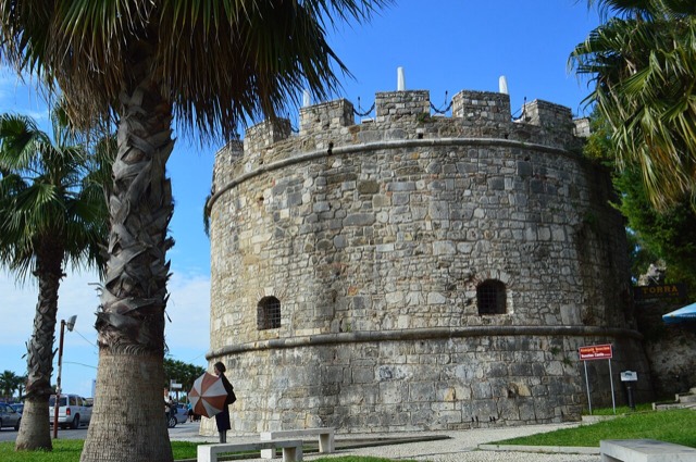
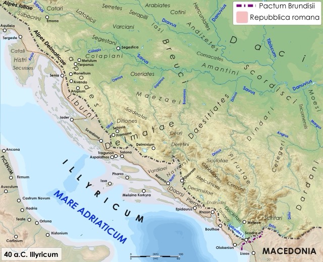
Città · Durrës
Durrës
Albania's principal port and its oldest continuously inhabited city, founded as Epidamnos in 627 BC.
Ogni contea, ogni costa, ogni secolo
Vista guidata
Non conosci l'Albania? Ogni pagina si apre con una spiegazione in linguaggio semplice, comprensibile anche a un bambino di dieci anni, prima di entrare nei dettagli.
Vista per esperti
Conosci già le basi. Direttamente alla sostanza, con le spiegazioni elementari nascoste. Questa è l'impostazione predefinita.
Sito storico · Durrës County
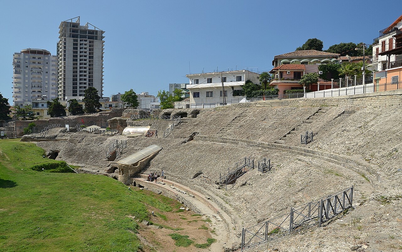
The largest Roman amphitheatre in the Balkans, found by accident in 1966 under the modern city.
Salva
Under the streets of Durrës is a huge Roman amphitheatre where thousands of people once watched games. It was only found in 1966 when someone was digging a garden. Later, Christians built a small chapel inside it with a wall mosaic.
Under the streets of Durrës is a huge Roman amphitheatre where thousands of people once watched games. It was only found in 1966 when someone was digging a garden. Later, Christians built a small chapel inside it with a wall mosaic.
The Amphitheatre of Durrës (Albanian: Amfiteatri i Durrësit; Latin: Amphitheatrum Dyrrhachinum) was built at the beginning of the 2nd century AD under the emperor Trajan. It is the largest Roman amphitheatre ever constructed in the Balkan Peninsula, with a recorded capacity of 20,000 people.
The structure was used for performances, including gladiatorial contests, until the 4th century AD. The earthquake of 345 or 346 AD is thought to have damaged the monument and brought an end to the 'ludii gladiatorii' held there, though the precise sequence of events is not fully established.
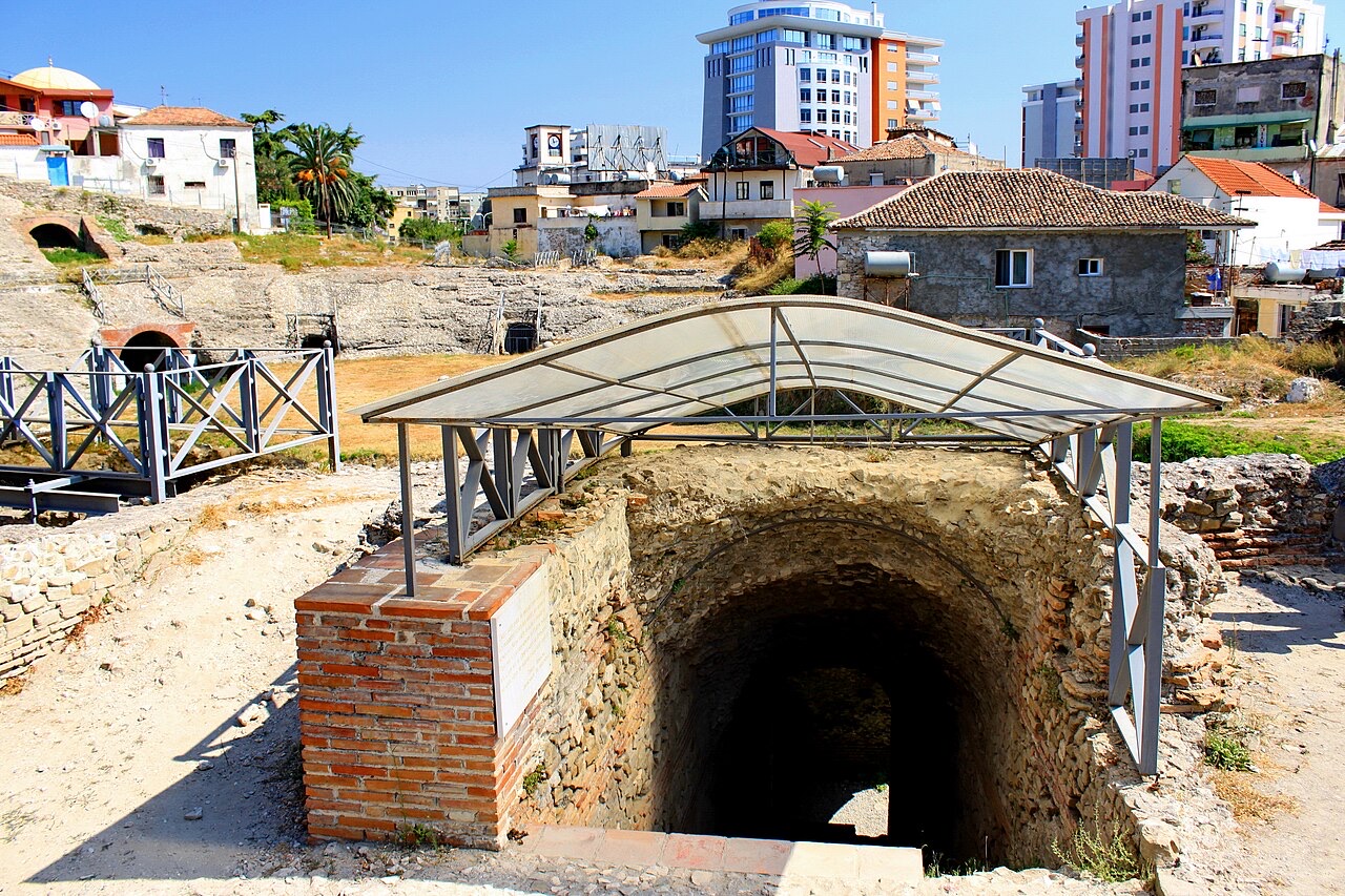
The amphitheatre has an elliptical plan with major and minor axes measuring 132.4 metres (434 ft) and 113.2 metres (371 ft) respectively. The arena floor measures 61.4 metres (201 ft) by 42.2 metres (138 ft), and the structure stands 20 metres (66 ft) high.
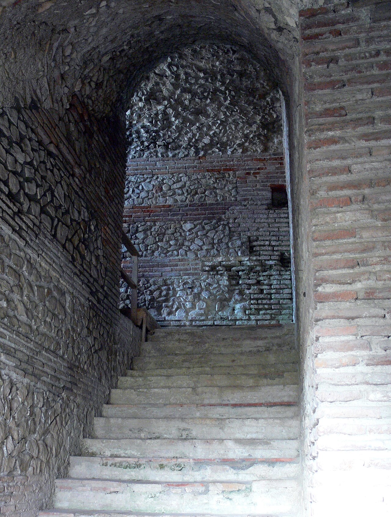
The building was constructed on a sloping hillside, which determined its internal arrangement. Inside, staircases and galleries are distributed across different levels to accommodate the tiered seating and circulation of a large crowd.
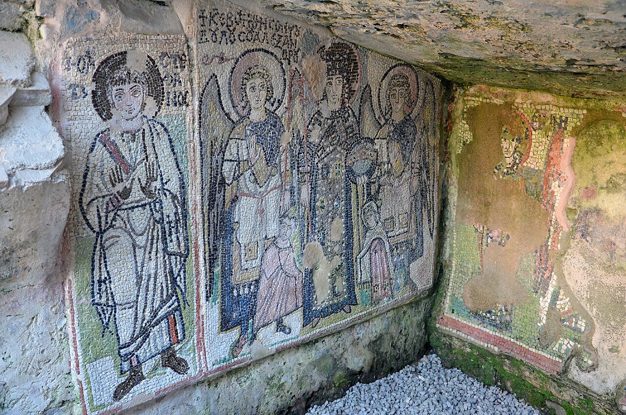
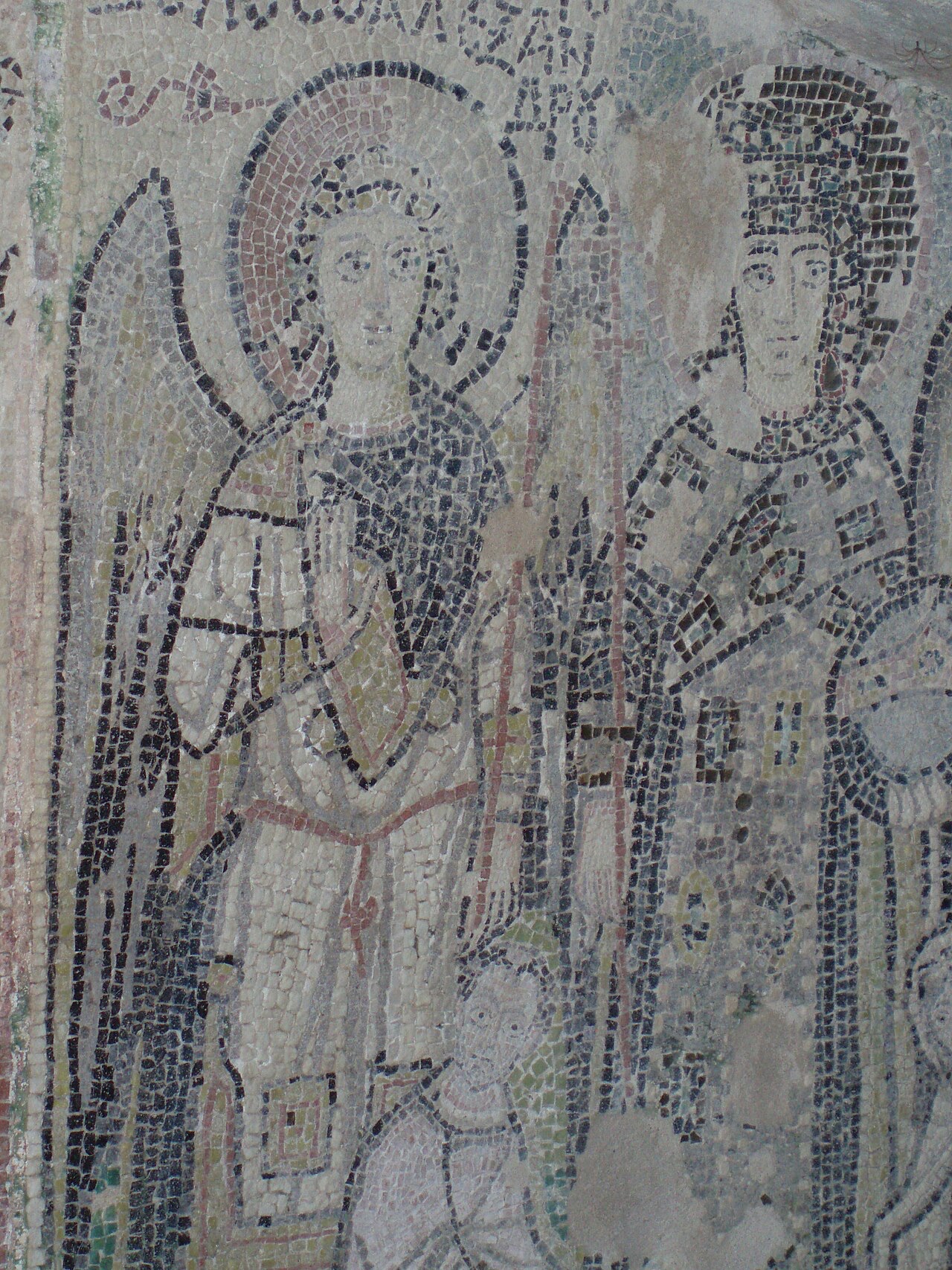
In the second half of the 4th century AD, an early Christian chapel was constructed within the amphitheatre. It was initially decorated with frescoes. During the 6th century, mosaics were added to the chapel, and that mosaic decoration is among the elements that survive to the present day.
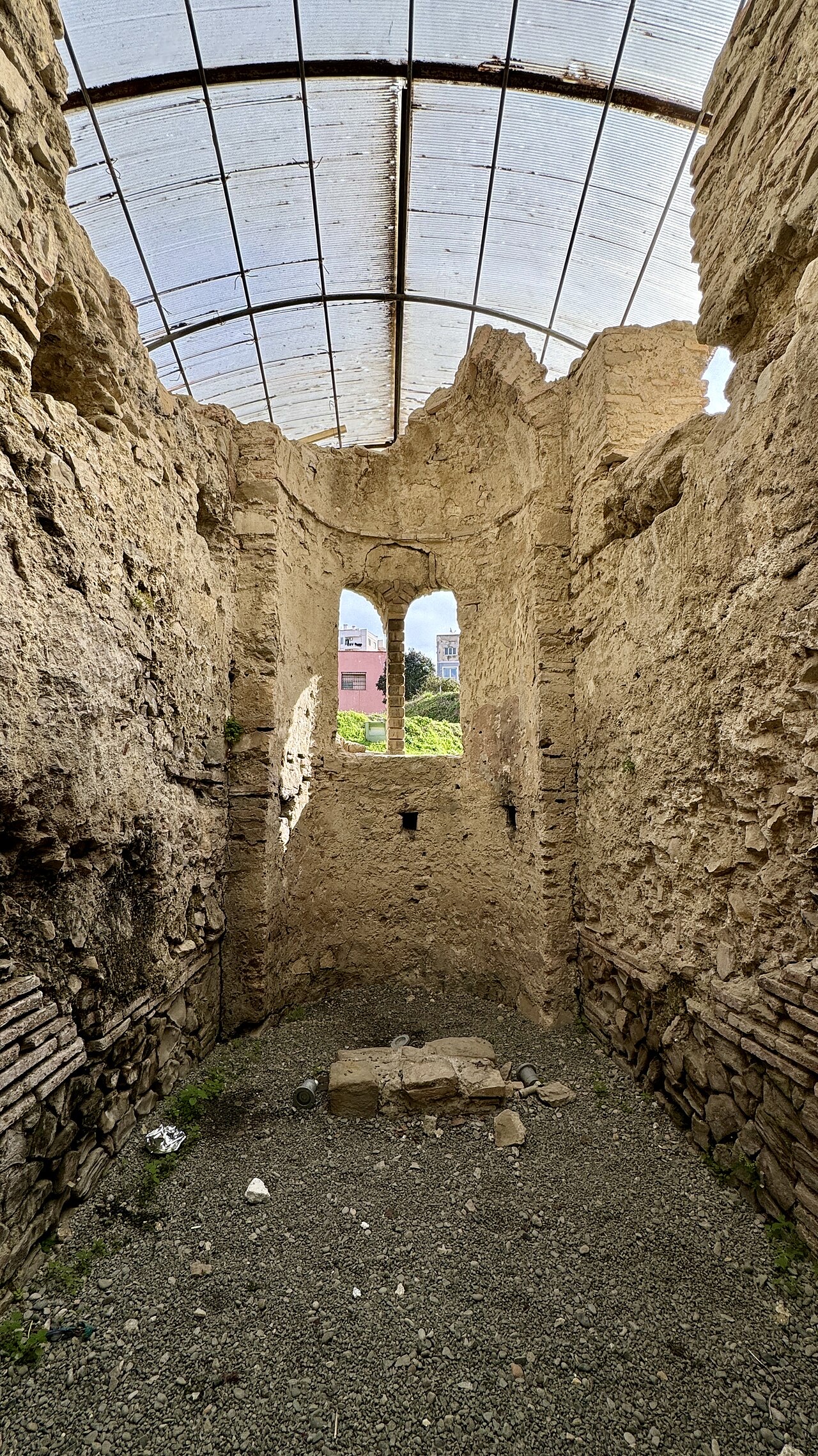
A second, medieval chapel was built within the site in the 13th century, also decorated with frescoes. The survival of religious architecture within the amphitheatre structure illustrates successive phases of reuse spanning several centuries.
The amphitheatre was damaged twice by earthquakes, in the 6th century and again in the 10th century. These seismic events contributed significantly to the monument's deterioration and eventual abandonment as a functioning structure.
Following the Ottoman occupation, the amphitheatre was covered over in the 16th century when a wall was constructed in the vicinity. The chronicler Marin Barleti, writing around this period, described the monument as 'well constructed', indicating that its form was still legible or remembered before it was fully buried.
The amphitheatre was rediscovered in late 1966. Approximately one third of the site was excavated in the 1960s by archaeologist Vangjel Toci. The remaining two thirds were excavated in the 1980s by Lida Miraj.
No conservation work was undertaken in the period immediately following excavation. As a result, the amphitheatre deteriorated progressively after it was uncovered. Construction continued to take place around and on the site during this period, compounding the structural risks.
In 2004, the University of Parma began restoration work on the amphitheatre with the aim of arresting the monument's deterioration. This represented the first organised conservation effort at the site since its excavation decades earlier.
The restoration programme was initiated against a backdrop of serious structural deficiencies throughout the fabric of the building. The mosaics and paintings within the site were also recorded as slowly decaying at the time conservation work began.
The amphitheatre is surrounded on all sides by the urban fabric of Durrës. A section of the arena itself has been built upon with modern housing, meaning residential development sits directly within the ancient structure. This situation poses a direct and ongoing threat to the long-term preservation of the monument.
The municipality of Durrës has announced plans to remove the houses occupying the arena, though the article does not record whether or when this has been carried out. Development pressure from the surrounding city continues to be identified as one of the principal risks to the site.
In 2013, Europa Nostra shortlisted the Durrës amphitheatre among fourteen sites across Europe identified as the most endangered cultural heritage sites on the continent. The listing drew international attention to the combined threats of structural decay, unchecked urban development and the slow deterioration of the site's mosaics and painted surfaces.
The Europa Nostra designation placed the amphitheatre alongside thirteen other European sites judged to be at serious risk, underlining that the preservation challenges at Durrës were considered comparable in urgency to those facing heritage sites elsewhere in Europe.
The site currently operates as a museum open to visitors. It also functions as the stage for the International Film Summerfest of Durrës, giving the ancient structure a role in contemporary cultural programming.
The chapel containing the 6th-century mosaics is preserved within the site. The coexistence of active public use with ongoing structural and conservation problems reflects the difficult balance the site presents to its managers.
The Amphitheatre of Durrës is included on Albania's tentative list of UNESCO World Heritage Sites. Inclusion on a tentative list indicates that a state party considers a site to have potential outstanding universal value and intends to nominate it, but does not confer full World Heritage status.
The article does not record the date on which the amphitheatre was added to the tentative list or the current stage of any formal nomination process.
Il mese più caldo è August (massima giornaliera media 28°C), il più freddo è January (minima giornaliera media 6°C), e il più piovoso è November (171 mm). La precipitazione annua totale è in media 1,235 mm.
| Mese | Massima | Minima | Pioggia | Giorni piovosi | Sole/giorno |
|---|---|---|---|---|---|
| January | 11°C | 6°C | 134 mm | 12 | 7.2 h |
| February | 12°C | 7°C | 118 mm | 11 | 8.2 h |
| March | 14°C | 8°C | 116 mm | 11 | 9.7 h |
| April | 17°C | 11°C | 99 mm | 11 | 10.8 h |
| May | 21°C | 15°C | 74 mm | 9 | 12.2 h |
| June | 25°C | 19°C | 45 mm | 6 | 13.6 h |
| July | 28°C | 22°C | 29 mm | 4 | 13.8 h |
| August | 28°C | 22°C | 36 mm | 4 | 12.9 h |
| September | 24°C | 19°C | 116 mm | 9 | 10.7 h |
| October | 21°C | 15°C | 135 mm | 10 | 9.2 h |
| November | 17°C | 12°C | 171 mm | 13 | 7.4 h |
| December | 13°C | 8°C | 162 mm | 13 | 6.7 h |
Fonte: ERA5 reanalysis via Open-Meteo, 1994–2023 · «Massima» e «Minima» sono la temperatura dell'aria massima e minima giornaliera media. «Giorni piovosi» conta i giorni con almeno 1 mm di precipitazione.
Città · Durrës
Albania's principal port and its oldest continuously inhabited city, founded as Epidamnos in 627 BC.
Sito storico · Durrës
Byzantine sea walls raised under Anastasius I, later strengthened by Venice and the Ottomans.
Periodo storico
The Via Egnatia crossed here, making the coast Rome's gateway to Greece and the East.
Hai notato un errore in questa pagina? Le correzioni sono benvenute e vengono verificate rispetto al record di fonte. Indica cosa è sbagliato e, se possibile, da dove proviene il dato corretto.