Stadt · Vlorë
Sarandë
The Ionian resort town facing Corfu, and the arrival point for most visitors to southern Albania.
Jeder Kreis, jede Küste, jedes Jahrhundert
Geführte Ansicht
Neu in Albanien? Jede Seite beginnt mit einer einfachen Erklärung, die auch ein Zehnjähriger verstehen würde – bevor es ins Detail geht.
Expertenansicht
Sie kennen die Grundlagen bereits. Direkt zur Substanz, ohne die vereinfachten Erklärungen. Dies ist die Standardeinstellung.
Historische Stätte · Vlorë County
A Greek, Roman, Byzantine, Venetian and Ottoman city layered on one wooded peninsula — Albania's first UNESCO site.
Speichern
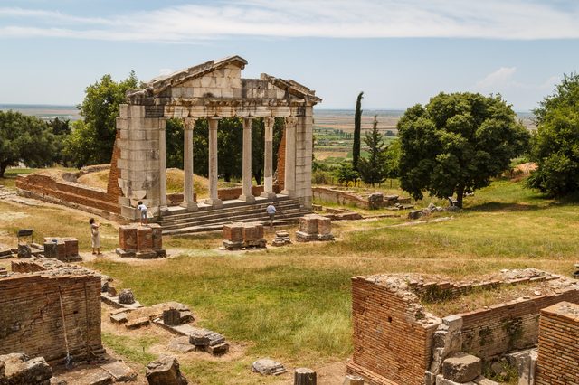
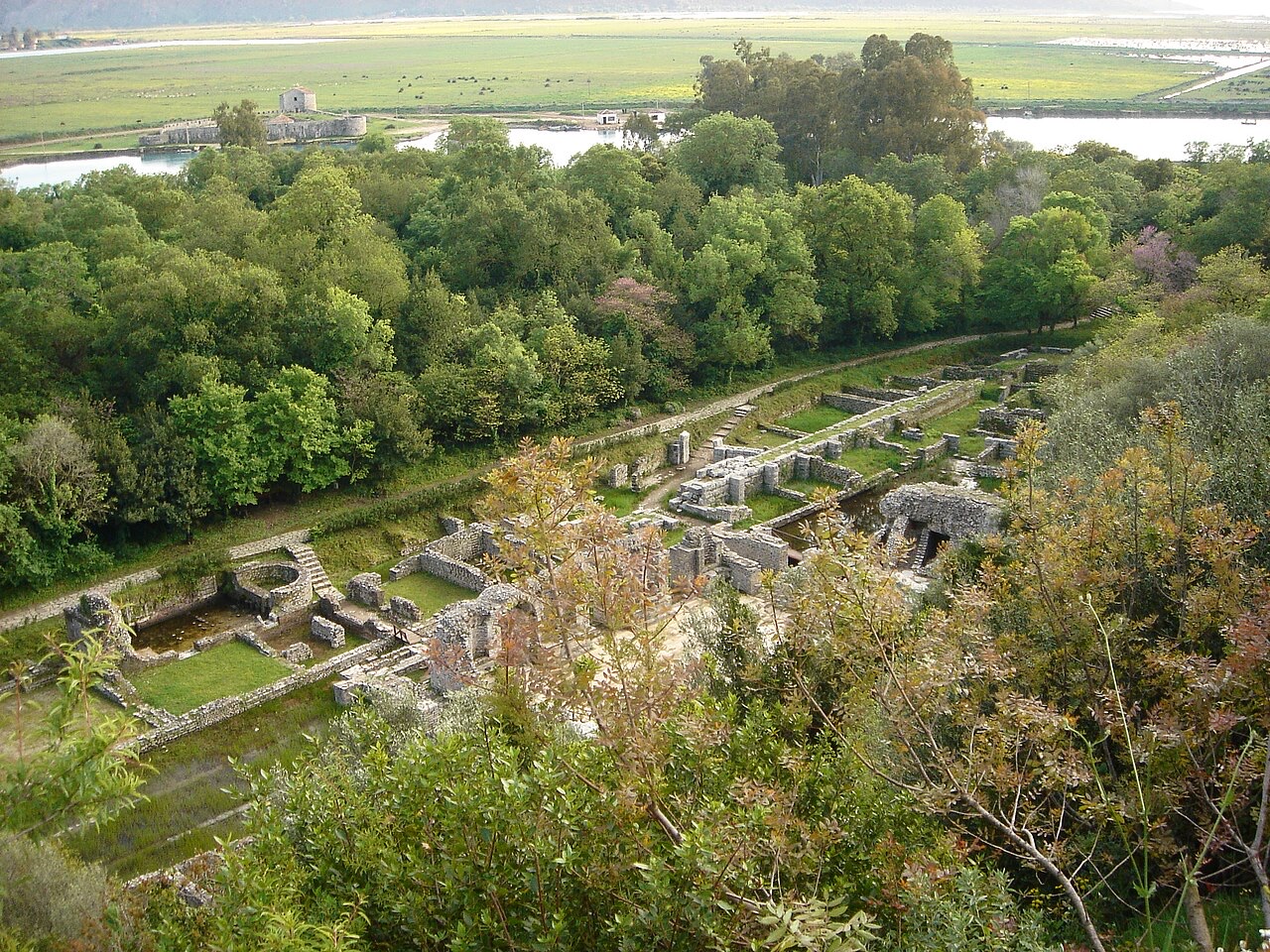
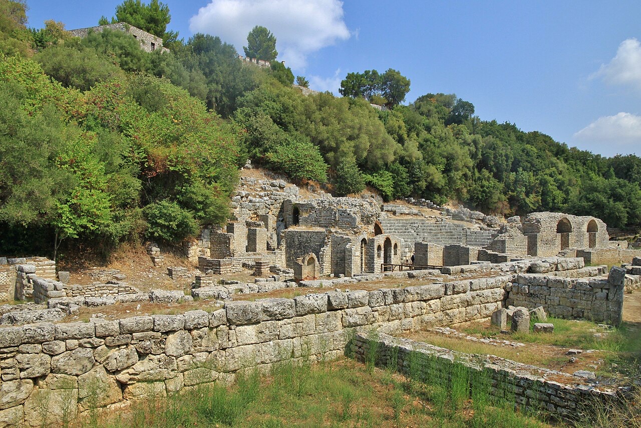
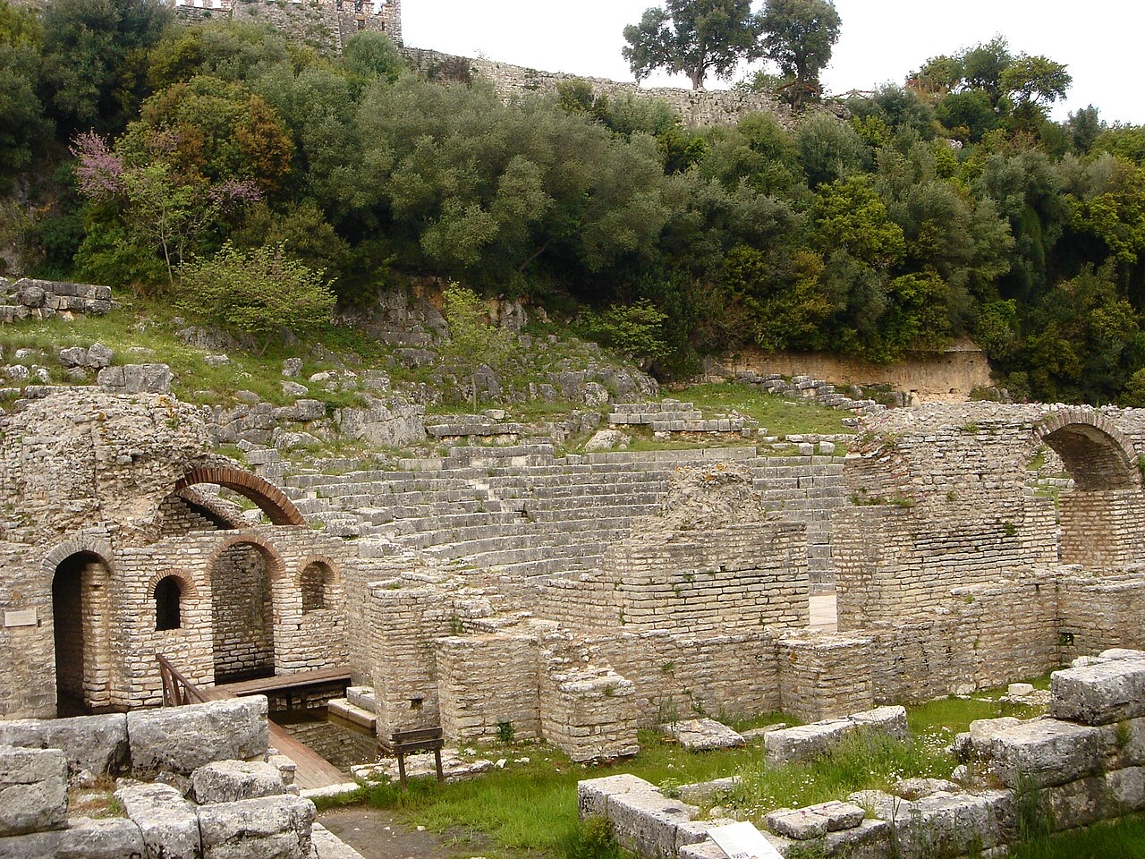
Butrint is a ruined city on a small peninsula surrounded by water and trees. People lived there for more than 2,500 years, so you can walk past a Greek theatre, Roman baths, a Christian baptistery with a mosaic floor, and a Venetian castle, all in one visit.
Butrint is a ruined city on a small peninsula surrounded by water and trees. People lived there for more than 2,500 years, so you can walk past a Greek theatre, Roman baths, a Christian baptistery with a mosaic floor, and a Venetian castle, all in one visit.
Butrint began as a settlement of the Chaonians, one of the northwestern Greek tribal groupings of Epirus. The earliest archaeological evidence of settled occupation dates to between the 10th and 8th centuries BC, though some researchers claim evidence of habitation as early as the 12th century BC. Excavations have yielded Proto-Corinthian pottery of the 7th century BC and Corinthian and Attic pottery of the 6th century BC, but no indications of a prehistoric settlement proper have been found.
The site's strategic value derived from its position controlling access to the Straits of Corfu and its location at the crossroads of mainland Greece and Magna Graecia. It became one of two ancient ports in lower Chaonia, the other being Onchesmos, the settlement now known as Sarandë. The Chaonians maintained close contacts with the Corinthian colony of Corcyra, modern Corfu.
According to the Roman poet Virgil, the city's legendary founder was Helenus, a son of King Priam of Troy, who moved westward after the fall of Troy together with Neoptolemus and Andromache. Both Virgil and the Greek historian Dionysius of Halicarnassus recorded that Aeneas visited Bouthroton after his escape from the destruction of Troy. These are literary traditions, not historical attestations.
The acropolis was erected on a hill on the bank of Lake Butrint. Its first extension, dating to the 5th century BC, expanded the original 7th-century BC structure. During the early years of the second Peloponnesian War (413–404 BC), the Corcyreans built fortifications stretching from Ksamil to Buthrotum, at which point Buthrotum, previously an independent city, became subject to nearby Corfu.
By the 4th century BC, the city had grown to include a theatre, a sanctuary dedicated to Asclepius, and an agora. The acropolis was protected by three circuit walls; the outermost was erected around 380 BC, enclosing an area of 4 hectares. This wall measured 870 metres in length and included bastions and five gates, of which the Scaean Gate and the Lion Gate were among the most significant. The agora, stoas, residential zone, and theatre occupied a separate walled area.
Several inscriptions from the early 3rd century BC describe the Chaonians' political organisation, including an annual leader with the title Prostates, meaning protector. The Greek calendar of Bouthroton appears in the Antikythera Mechanism, the oldest known analog computer, dated to approximately 150–100 BC. The theatre is notable for the large number of inscriptions carved into its stones, the majority dealing with manumissions. The names recorded are almost exclusively Greek, with a few Latin names that nevertheless carry Greek family names.
In 228 BC, Buthrotum became a Roman protectorate alongside Corfu. By the mid-2nd century BC it was the centre of an independent state, possibly the 'Koinon of the Prasaiboi', as listed among the theorodokoi at the Oracle of Delphi. In the following century it became part of the province of Macedonia.
In 44 BC, Julius Caesar designated Buthrotum as a colony intended to reward soldiers who had fought on his side against Pompey. The local landholder Titus Pomponius Atticus objected and his correspondent Cicero lobbied against the plan in the Senate, with the result that only small numbers of colonists were actually settled.
In 31 BC, following his victory over Mark Antony and Cleopatra at the Battle of Actium, Emperor Augustus renewed the plan to establish a veterans' colony at Buthrotum. New residents expanded the city considerably, adding an aqueduct, a Roman bath, houses, a forum complex, and a nymphaeum. The size of the town doubled during this era, with new structures built around the theatre and the temple of Asklepeios in particular.
In the 3rd century AD, an earthquake destroyed a large part of the town, levelling buildings in the suburbs on the Vrina Plain and in the forum of the city centre. Excavations have confirmed that the city had already been in decline by this point. Nevertheless, the settlement survived into Late Antiquity, functioning as a major port in the province of Old Epirus. The most notable late antique structure is the Triconch Palace, a grand residence built around 425 AD for a major local notable.
The city walls were extensively rebuilt, most probably at the end of the 5th century, an effort attributed by scholars to Byzantine Emperor Anastasius. The Ostrogoths under Indulf raided the Ionian coast in 550 and may have attacked Buthrotum. Groups of Slavs possibly arrived at Buthrotum toward the end of the 6th century, though the sources are ambiguous.
Importation of wine and oil from the Eastern Mediterranean continued into the early 7th century, when the early Byzantine Empire lost these provinces. Because of the scarcity of written sources, it is difficult to determine whether Buthrotos was controlled by Slavs or Byzantines between the 7th and 10th centuries. Byzantine sources record that Saint Elias of Enna was detained as a spy in Bouthrotos, while Arsenios of Corfu (876–953) noted the marine wealth of the town.
Butrint was one of the few cities in Epirus that survived the period of Slavic invasions and population movements while retaining its status as a bishopric without interruption. Colonisation by Byzantine authorities appears to coincide with the reign of Leo VI (886–912). Imperial administrators of that time may have governed from a residence on the Vrina Plain rather than from the citadel. Archaeological records become substantially stronger from the 10th century onward. Arab traveller Muhammad al-Idrisi noted in the 12th century that Buthrotum was a densely populated city with a number of markets.
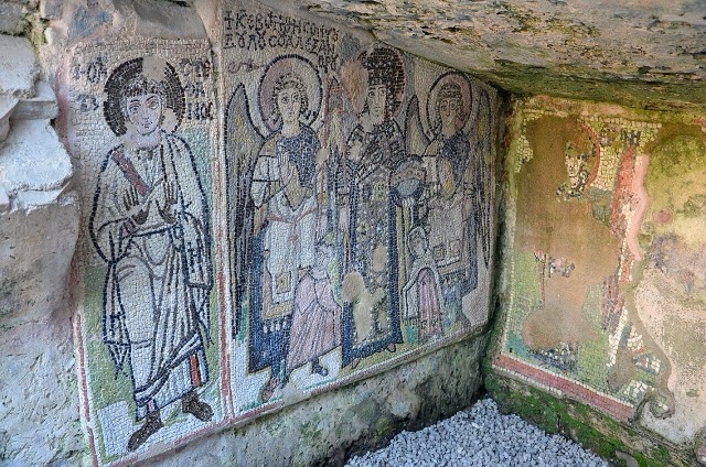
The major ecclesiastical monuments of the Byzantine era include the Grand Basilica, built in the first half of the 6th century on the northeast side of the settlement; the Acropolic Basilica (4th century); the Triconch Palace (6th century); the Baptistery with a large complex mosaic (6th century); the Lake Gate church (9th century); and the Baptistery church (9th century). From the 10th to 12th centuries, records of episcopal inventories identify the bishop of Butrint as subject to the metropolitan bishopric of Nafpaktos, the ecclesiastical province that inherited the name of the old provincial capital of Nicopolis.
Butrint remained an outpost of the Byzantine Empire against Norman assaults until 1204, when the Fourth Crusade fragmented the empire and Buthrotum fell to the breakaway Despotate of Epirus. In the following centuries it became a point of contest between the Byzantines, the Angevins of southern Italy, and the Venetians. The fortifications were probably strengthened by Byzantine Emperor Michael VIII Palaiologos.
In 1267, Charles of Anjou took control of both Butrint and Corfu, leading to further restoration of the walls and the Grand Basilica. In 1274, Byzantine forces re-entered Butrint, provoking conflict with Despot Nikephoros of Epirus, who regarded the site as his domain. Despite the deep religious difference between the Catholic Charles of Anjou and the Orthodox Nikephoros, the two allied against Emperor Michael and together drove the Byzantines from the area in 1278.
Under Angevin pressure, Nikephoros ultimately recognised Charles' rights to the towns that Michael II had awarded to Manfred of Hohenstaufen as part of his wife Helen's dowry. This cession included Butrint and the entire Acroceraunian Coast from Vlora to Butrint. From 1284, Byzantine Emperor Andronikos II controlled most of present-day Albania, and Angevin authority on the Balkan mainland was reduced essentially to Butrinto, which then formed a single administrative unit with nearby Corfu.
Butrint remained under Angevin rule until 1386, with two brief interruptions: in 1306, when it was controlled by the Despot of Epirus, Thomas I Komnenos Doukas, and again in 1313–1331. The site became Catholic following Angevin conquest and remained so throughout the 14th century. The Orthodox Bishopric was transferred to nearby Glyki in 1337 or 1338. Toward the end of the 14th century the town contracted in size owing to the turbulent conditions in the region.
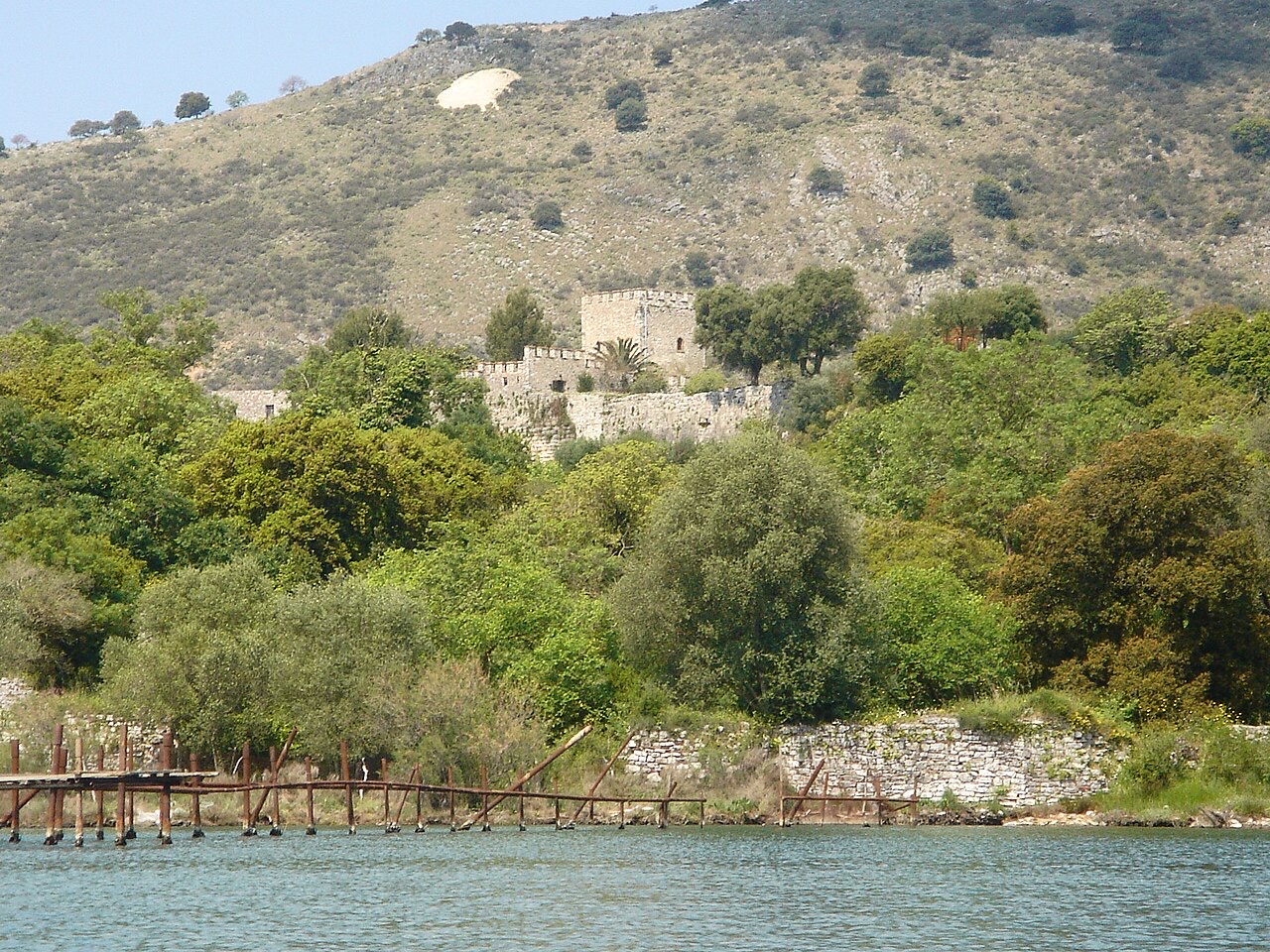
The Republic of Venice purchased the area, including Corfu, from the Angevins in 1386. Venetian merchants were principally interested in Corfu, and Butrinto declined again. By 1572, the wars between Venice and the Ottoman Empire had left Butrinto in ruins and the acropolis was abandoned. On the orders of Domenico Foscarini, the Venetian commander of Corfu, the administration of Butrinto and its environs was transferred to a small triangular fortress associated with extensive fish weirs.
The area was lightly settled thereafter, being seized by the Ottoman Turks on two occasions—in 1655 and 1718—before being recaptured by Venice each time. Its fisheries were a vital contributor to the supply of Corfu, and olive growing together with cattle and timber were the principal economic activities. The Treaty of Campo Formio of 1797, which divided the former Venetian territories between France and Austria, brought Butrinto and the other former Venetian enclaves in Albania under French sovereignty under article 5 of the treaty.
In October 1798 the city was conquered by the Ottoman Albanian ruler Ali Pasha Tepelena. After his death, it officially became part of the Ottoman Empire until Albania gained its independence in 1912. By that time the site of the original city had been unoccupied for centuries and was surrounded by malarial marshes. During Ottoman rule in Epirus, the inhabitants of Butrint displayed continuous support for Greek revolutionary activities.
In 1913, following the end of the First Balkan War, Butrint was initially ceded to Greece. Italy challenged the decision, and in the Treaty of London the region was assigned to the newly created Principality of Albania. The site therefore found itself near the southern border of the new Albanian state, in a largely Greek-speaking territory.
The local Greek population rejected this outcome and declared an Autonomous Republic of Northern Epirus, which lasted for six months before being reluctantly ceded to Albania, with an Italian peacekeeping force maintaining order until 1919. Italy opposed Greek control partly because it did not want Greece to command both sides of the Straits of Corfu.
In the early 6th century, Buthrotum became the seat of a bishopric. Its most notable early Christian monuments are the Buthrotum Baptistery, described as one of the largest such Early Christian structures of its type, and a basilica. The diocese was initially a suffragan of the Metropolis of Nicopolis, the metropolitan capital of Epirus Vetus and within papal jurisdiction. By the 9th and 10th centuries it was listed among the suffragans of Naupaktos, which had succeeded the ruined Nicopolis as provincial capital, placing it within the Byzantine Patriarchate of Constantinople. After the 14th century it fell under the jurisdiction of the Metropolis of Ioannina.
Two pre-Schism bishops are attested in surviving documents. A bishop named Stephanus signed the joint letter of the bishops of Epirus Vetus to Emperor Leo I the Thracian in 458, in the aftermath of the killing of Patriarch Proterius of Alexandria. A bishop named Matthaeus signed the synodal letter to Pope Hormisdas in 516 concerning the ordination of Metropolitan John of Nicopolis. A Latin see was established around 1250 under the Italian name Butrinto, operating under Angevin and then Venetian rule, before being suppressed around 1400.
The diocese was nominally restored in 1933 as a Latin Catholic titular see under the name Buthrotum. Among those subsequently nominated as titular bishops were Louis-Bertrand Tirilly (1953–1966), who served simultaneously as the last Apostolic Vicar of the Marquesas Islands, and George Frendo (2006–2016), who served as Auxiliary Bishop of the Archdiocese of Tiranë–Durrës and as Secretary General of the Episcopal Conference of Albania. Zdeněk Wasserbauer, born 16 June 1965, has held the title since 19 May 2018 as Auxiliary Bishop of the Roman Catholic Archdiocese of Prague.
The first modern archaeological excavations began in 1928, when the Fascist government of Benito Mussolini's Italy dispatched an expedition to Butrint. The stated aim was geopolitical—to extend Italian influence in the area—rather than scientific. The expedition was led by Italian archaeologist Luigi Maria Ugolini, who is described as a competent archaeologist despite the political context of his mission. Ugolini died in 1936, but excavations continued until 1943, when the Second World War brought them to a halt. The Italian excavations uncovered the Hellenistic and Roman portions of the city, including the Lion Gate and the Scaean Gate, the latter named by Ugolini after the famous gate at Troy mentioned in Homer's Iliad.
After the communist government of Enver Hoxha took power in 1944, foreign archaeological missions were banned. Albanian archaeologists, including Hasan Ceka, continued the work. Nikita Khrushchev visited the ruins in 1959 and proposed that the area be converted into a submarine base. The Albanian Institute of Archaeology began larger-scale excavations in the 1970s. Following the collapse of the communist regime in 1992, the Butrint Foundation began further major excavations in collaboration with the Albanian Institute of Archaeology from 1993. These revealed further Roman villas and an early Christian church.
Butrint was inscribed on the UNESCO World Heritage List in 1992. A major political and economic crisis in 1997 led UNESCO to place it on the List of World Heritage in Danger, citing looting, inadequate protection, management failures, and conservation deficiencies. In 2004, excavations continued under principal investigator David R. Hernandez. Climate change has created a new management challenge: the area of the ancient theatre and Roman forum can sometimes be covered with water, prompting a new management plan for both the cultural and natural assets of the site.
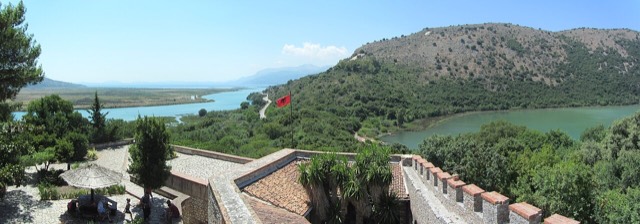
Butrint is located in Vlorë County, in southern Albania, approximately 14 kilometres south of Sarandë and close to the Greek border. The site sits on a hill overlooking the Vivari Channel and forms part of the Butrint National Park, which was established in 2000 under the leadership of Auron Tare, its first director. The Ali Pasha Castle is also present at the site.
The road connecting Sarandë to Butrint was first built in 1959 for Khrushchev's visit and was upgraded during the summer of 2010. The construction of that upgrade was described as something of an environmental disaster and was considered a potential threat to the site's World Heritage status. Hydrofoils taking approximately 30 minutes and ferries taking approximately 90 minutes operate daily between Corfu and Sarandë, making day visits from Corfu feasible.
Der wärmste Monat ist August (mittleres tägliches Maximum 31°C), der kälteste ist January (mittleres tägliches Minimum 6°C), und der regenreichste ist November (205 mm). Der mittlere jährliche Gesamtniederschlag beträgt 1,204 mm.
| Monat | Maximum | Minimum | Niederschlag | Regentage | Sonne/Tag |
|---|---|---|---|---|---|
| January | 12°C | 6°C | 139 mm | 12 | 7.2 h |
| February | 13°C | 6°C | 120 mm | 11 | 8.0 h |
| March | 15°C | 7°C | 109 mm | 11 | 9.6 h |
| April | 18°C | 10°C | 75 mm | 10 | 10.9 h |
| May | 23°C | 15°C | 51 mm | 7 | 12.1 h |
| June | 27°C | 19°C | 27 mm | 4 | 13.6 h |
| July | 30°C | 22°C | 13 mm | 2 | 13.8 h |
| August | 31°C | 22°C | 21 mm | 3 | 12.9 h |
| September | 26°C | 19°C | 110 mm | 8 | 10.6 h |
| October | 22°C | 15°C | 146 mm | 10 | 9.1 h |
| November | 17°C | 11°C | 205 mm | 13 | 7.1 h |
| December | 13°C | 7°C | 187 mm | 13 | 6.5 h |
Quelle: ERA5 reanalysis via Open-Meteo, 1994–2023 · „Maximum" und „Minimum" sind das mittlere tägliche Temperaturmaximum bzw. -minimum. „Regentage" zählt Tage mit mindestens 1 mm Niederschlag.
Stadt · Vlorë
The Ionian resort town facing Corfu, and the arrival point for most visitors to southern Albania.
Kleinstadt · Vlorë
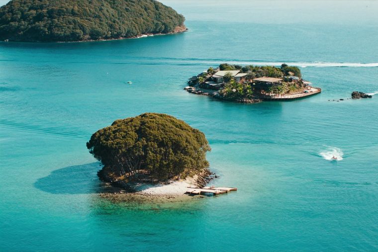
Four small islands and very clear shallow water; the most photographed and most crowded stretch of the Albanian coast.
Schutzgebiet · Vlorë
A wetland and forest park wrapped around the archaeological city, on the Vivari channel.
Kleinstadt · Vlorë
Albania's southernmost town, on the Greek border near the Butrint wetlands.
Fährverbindung · Vlorë
The busiest sea crossing into southern Albania, and the usual day-trip link with Greece.
Historische Epoche
The Via Egnatia crossed here, making the coast Rome's gateway to Greece and the East.
Historische Epoche
Corinthian and Corcyraean foundations at Epidamnos, Apollonia and Orikum along the coast.
Historische Epoche
Nine centuries of eastern Roman rule, interrupted by Bulgarians, Normans, Serbs and Angevins.
Erläuterung
Illyrians, Greek colonists and Rome, layered on the same coastline for a thousand years.
Erläuterung
Four inscriptions: Butrint, the historic centres of Berat and Gjirokastra, the Ohrid region, and the primeval beech forests.
Leitfaden
Two stone cities, the country's best archaeology, a wild river, and the Riviera behind it.
Leitfaden
Butrint, Apollonia, Byllis, Antigonea and Amantia: five sites that cover 2,500 years between them.
Etwas falsch auf dieser Seite? Korrekturen sind willkommen und werden gegen den Quelldatensatz geprüft. Bitte mitteilen, was falsch ist und, wenn möglich, woher die richtige Angabe stammt.