城镇 · Tiranë
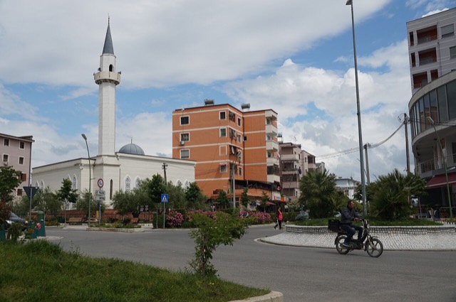
Kavajë
A market town behind the Adriatic dunes, near the wide beaches of Golem and Spille.
每个县、每段海岸、每个世纪
引导视图
初次了解阿尔巴尼亚?每个页面均以通俗易懂的说明开篇——即便是十岁的孩子也能读懂——随后再展开详细内容。
专业视图
您已掌握基础知识。直接进入正题,简明解释默认隐藏。此为默认模式。
历史遗址 · Tiranë County
A rare rectangular lowland fortress built by Venice to guard a river port on the Shkumbin.
保存
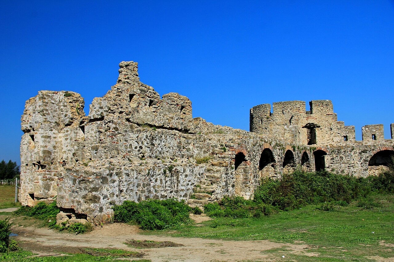
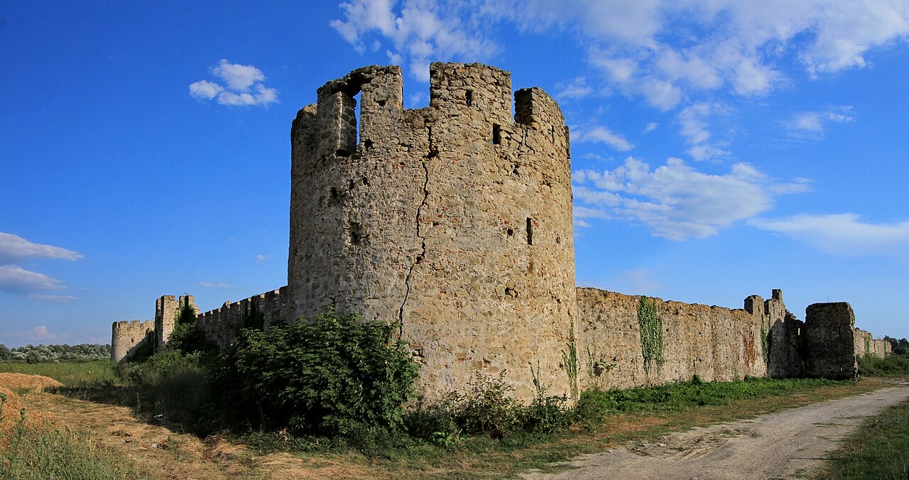
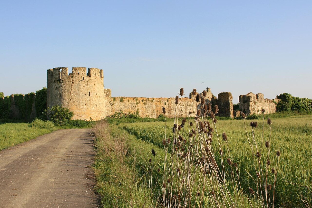
Bashtovë is an unusual square fortress standing alone on flat farmland. The Venetians built it to protect a river harbour where grain was shipped out.
Bashtovë is an unusual square fortress standing alone on flat farmland. The Venetians built it to protect a river harbour where grain was shipped out.
The Fortress of Bashtovë is a medieval quadrangular fortress situated close to the outflow of the Shkumbin River into the Adriatic Sea, in central Albania. In medieval sources it appears under the variant names Breg, Briego, and Vrego. The ruins stand on fertile flat ground east of the river mouth, approximately 2 kilometres from the village of Vilë-Ballaj in Tirana County.
By straight-line distance the site lies 15 kilometres south of Kavajë, 20 kilometres northwest of Lushnjë, 36 kilometres north of Fier, and 40 kilometres southwest of Tirana. Its position near the Shkumbin estuary placed it at a strategic point between the Adriatic coast and the Albanian interior.
Before and during the Middle Ages, the region of Bashtovë functioned as a trade harbour and a centre for the export of grain. This economic role reflects the agricultural productivity of the Shkumbin plain and the accessibility of the site by sea, making it a point of commercial significance in the central Albanian littoral.
The name Bashtovë and its medieval variants appear in historical records in connection with this trading activity, suggesting that the settlement predated or accompanied the construction of the defensive structure that now dominates the site.
The origins of the Fortress of Bashtovë have been a matter of dispute among historians. According to Gjerak Karaiskaj, the initial fortress was constructed during the period when the region formed part of the Venetian Empire. On this reading, Venetian administration is responsible for the founding of the fortification.
Alain Ducellier has offered a different interpretation, asserting that the Venetians built over an already existing structure. Ducellier dates that earlier structure to the 6th century, when the area was under the Byzantine Empire during the Justinian dynasty. The question of whether the Venetians were founders or adaptors of the site therefore remains unresolved in the scholarly literature.
The fortress is rectangular in plan and oriented along a north–south axis. Its interior measures approximately 60 by 90 metres. The perimeter walls stand 9 metres high.
There are three entrances, with well-preserved archaeological traces indicating that they were positioned in the northern, western, and eastern walls respectively. No entrance is recorded in the southern wall.
Round towers stand at the northern and eastern corners of the fortress. Each tower reaches a height of 12 metres, standing some 3 metres taller than the surrounding curtain walls. Their placement at the north and east provided flanking coverage of the walls most exposed to approach from land.
The towers are among the most substantial surviving elements of the structure and are consistent with defensive architectural practice associated with both late Byzantine and Venetian military building traditions in the Adriatic region.
The fortress survives as a ruin. The walls and towers retain much of their height, and the three entrances retain sufficient archaeological traces to confirm their original positions. The interior has not been described in the source material as containing standing buildings.
In recent years, interventions have been proposed for the rehabilitation of the fortress, though the article does not specify the nature, funding, or current status of those proposals.
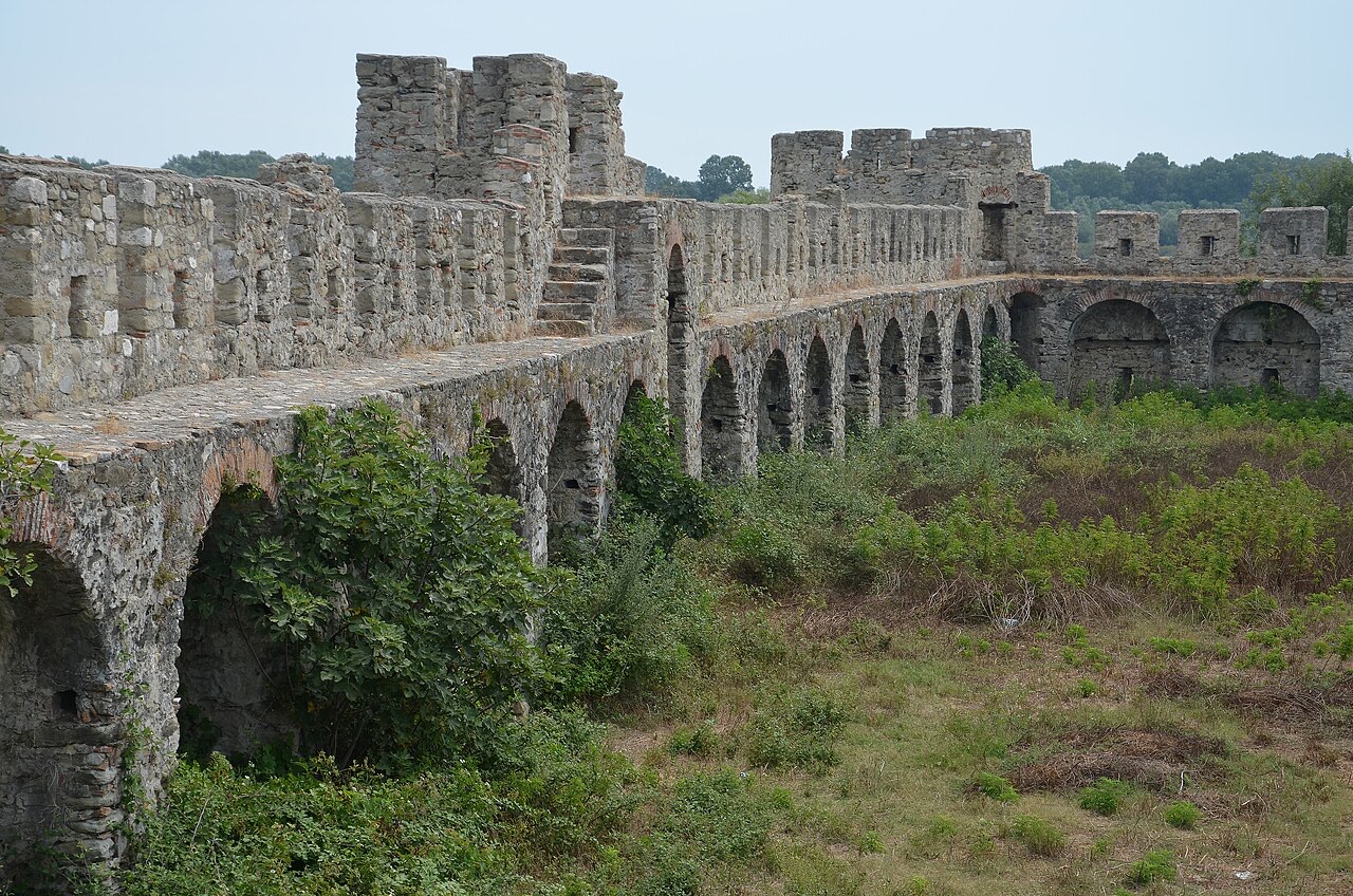
The Fortress of Bashtovë is included on Albania's tentative list for UNESCO World Heritage Site status. Placement on a tentative list is a prerequisite for formal nomination, though it does not itself confer World Heritage designation.
The site's candidacy reflects its significance as a medieval military structure linked to both Byzantine and Venetian layers of Albanian history, as well as its position as one of the more intact fortress ruins on the central Albanian coast.
The Shkumbin River, at whose mouth the fortress stands, has historically served as a rough geographical boundary between the Gheg-speaking north and the Tosk-speaking south of Albania. Control of its estuary therefore carried both economic and strategic implications throughout the medieval period.
The fortress's placement directly east of the river mouth allowed it to monitor and potentially tax or control maritime traffic entering or leaving the river, reinforcing the region's documented role as a grain-export harbour.
The Republic of Venice held significant territorial interests along the Albanian Adriatic coast during the medieval and early modern periods, a zone sometimes referred to in historical literature as Venetian Albania. The Fortress of Bashtovë, whether constructed or adapted by Venetian administration, fits within this broader pattern of Venetian coastal fortification and commercial management.
The precise dates of Venetian construction or modification at Bashtovë are not given in the available sources, and the disputed origin question means that the relative contributions of the Byzantine and Venetian phases to the surviving fabric cannot be stated with certainty.
The fortress is located near the village of Vilë-Ballaj, which falls within Tirana County despite being geographically remote from the capital. The 2-kilometre distance from the village to the ruins places the site in an agricultural landscape close to the Adriatic shoreline.
No road, visitor infrastructure, or formal site management arrangements are described in the source material beyond the general note that rehabilitation interventions have been proposed.
最热月份为 August (日最高气温均值 30°C), 最冷月份为 January (日最低气温均值 5°C), 降水最多的月份为 November (135 mm). 年均降雨总量为 990 mm.
| 月份 | 最高气温 | 最低气温 | 降雨量 | 降雨天数 | 日照时长 |
|---|---|---|---|---|---|
| January | 12°C | 5°C | 107 mm | 11 | 7.3 h |
| February | 13°C | 6°C | 94 mm | 11 | 8.3 h |
| March | 15°C | 7°C | 97 mm | 10 | 9.8 h |
| April | 18°C | 10°C | 77 mm | 10 | 10.9 h |
| May | 22°C | 14°C | 58 mm | 8 | 12.2 h |
| June | 27°C | 19°C | 37 mm | 5 | 13.6 h |
| July | 30°C | 21°C | 22 mm | 4 | 13.8 h |
| August | 30°C | 22°C | 31 mm | 4 | 12.9 h |
| September | 26°C | 18°C | 92 mm | 9 | 10.8 h |
| October | 22°C | 14°C | 113 mm | 9 | 9.3 h |
| November | 17°C | 10°C | 135 mm | 12 | 7.4 h |
| December | 13°C | 7°C | 129 mm | 12 | 6.7 h |
数据来源: ERA5 reanalysis via Open-Meteo, 1994–2023 · "最高气温"与"最低气温"分别为日最高和日最低气温均值。"降雨天数"统计降水量不低于 1 毫米的天数。
城镇 · Tiranë
A market town behind the Adriatic dunes, near the wide beaches of Golem and Spille.
城镇 · Tiranë
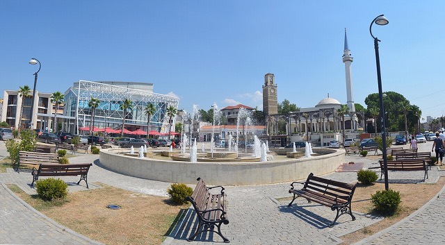
A junction town on the Shkumbin near the Bashtovë fortress and the Spille beaches.
海滩 · Tiranë
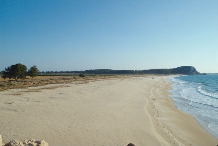
A quieter sand beach south of Kavajë, backed by farmland rather than hotels.
本页内容有误? 欢迎提交更正意见,所有意见均会与原始记录核对。请告知错误所在,如能提供正确数据的出处,请一并注明。