都市 · Gjirokastër
Gjirokastër
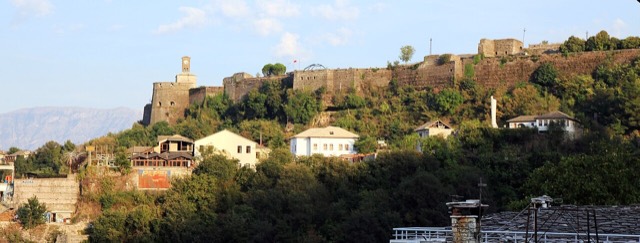
The 'stone city': slate-roofed tower houses on a steep slope beneath one of the Balkans' largest castles.
すべての県、すべての海岸、すべての世紀
ガイドビュー
アルバニアを初めて知る方へ。各ページは、詳細に入る前に、10歳の子どもにも読み聞かせられる平易な説明から始まります。
エキスパートビュー
基本知識はすでにお持ちの方向け。平易な説明を非表示にし、内容を直接表示します。これがデフォルトです。
史跡 · Gjirokastër County
A short-lived Epirote city founded by King Pyrrhus and burned by Rome in 167 BC.
保存
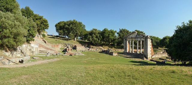
Antigonea was a city built about 2,300 years ago by King Pyrrhus, who named it after his wife. Roman soldiers destroyed it in 167 BC and it was never rebuilt, so what is left is one clear moment in time.
Antigonea was a city built about 2,300 years ago by King Pyrrhus, who named it after his wife. Roman soldiers destroyed it in 167 BC and it was never rebuilt, so what is left is one clear moment in time.
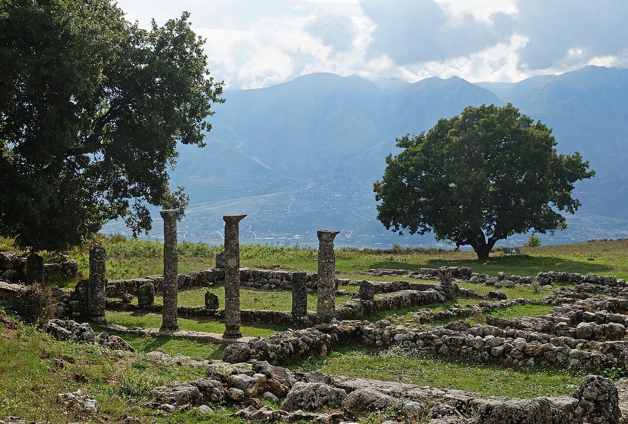
Antigonea (Ancient Greek: Ἀντιγόνεια; also transliterated as Antigonia or Antigoneia) was an ancient Greek city in the region of Chaonia, within Epirus. It functioned as the chief inland city of the ancient Chaonians. The site lies just south of the modern village of Saraqinisht in Gjirokastër County, Albania, and has been designated a National Archaeological Park.
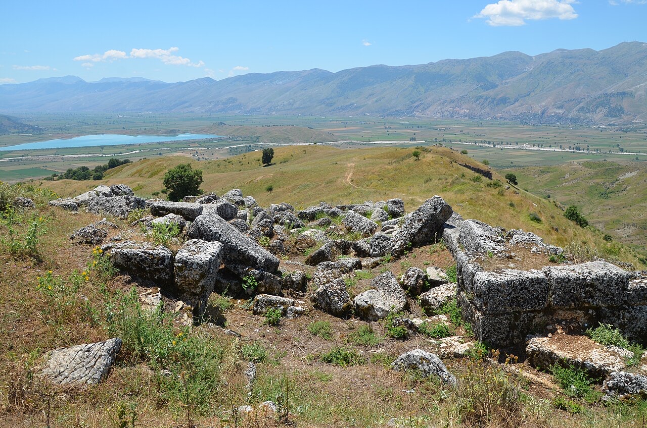
The city was positioned at approximately 600 metres above sea level on an almost impregnable hill overlooking the settlements of the Drino valley below. This elevated position gave it command over access routes through the surrounding mountains and towards the sea, making it a strategically important centre for the region.
Antigonea was founded in the 3rd century BC. Two founders have been proposed, and the matter remains uncertain. It may have been founded by Antigonus II Gonatas, but scholarly opinion leans more toward Pyrrhus of Epirus as the more probable founder.
If Pyrrhus founded the city, the name would derive from one of his wives, Antigone, who was the daughter of Berenice I and the step-daughter of Ptolemy I of Egypt. The personal connection to the Ptolemaic dynasty through his wife would thus account for the city's name under this interpretation.
The city appears in the historical record as early as 230 BC, when the straits near Antigonea were the passage used by a force of Illyrians under the command of Scerdilaidas, who passed the city on their way to join an invading army further to the south.
In 198 BC, during the Second Macedonian War, Roman forces marched against the Macedonian armies of Philip V. A Macedonian general named Athenagoras occupied one of the nearby passes and temporarily held the Romans back. Peace negotiations were initially considered, but several shepherds acting as traitors guided the Romans around the Macedonian position. The Romans subsequently surrounded and destroyed a Macedonian force of 2,000 men.
Antigonea had aligned itself with the Macedonian side in this conflict. As a consequence, when Roman forces under Consul Aemilius Paullus achieved final victory over the Macedonians in 167 BC, he ordered 70 towns in Epirus to be set on fire. Antigonea was among those destroyed and was never rebuilt.
Antigonea is recorded in the works of several ancient authors. These include the historian Polybius, the Roman historian Livy, the encyclopaedist Pliny the Elder, and the geographer Ptolemy. Their references collectively establish the city's significance within the ancient world and provide the principal textual basis for its historical reconstruction alongside archaeological evidence.
A church discovered at the site provides evidence that the city, though destroyed by Rome in 167 BC, retained some form of occupation or renewed use into the early Christian period. The church is of triconch form and features a mosaic floor. The mosaic contains a depiction described as a strange illustration of a human figure with an animal head, interpreted as resembling either the Egyptian god Anubis or Saint Christopher. A Greek emblem is also present in the floor decoration.
The church appears to represent the last structure built at ancient Antigonea. It was destroyed during Slavic assaults in the 6th century AD, which marks the effective end of identifiable activity at the site.
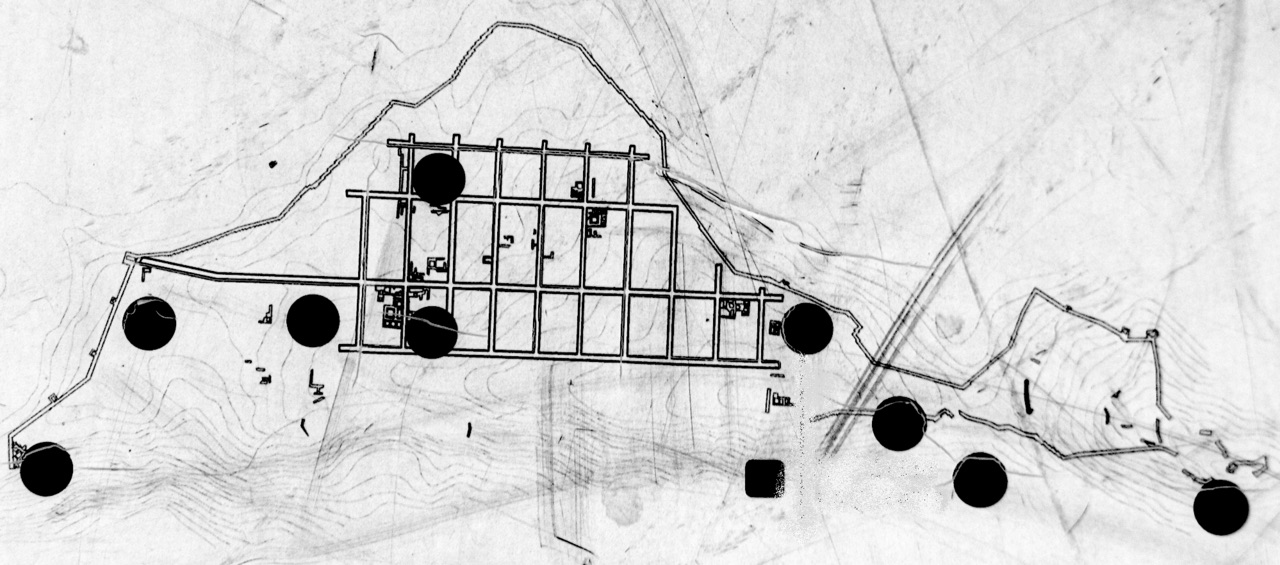
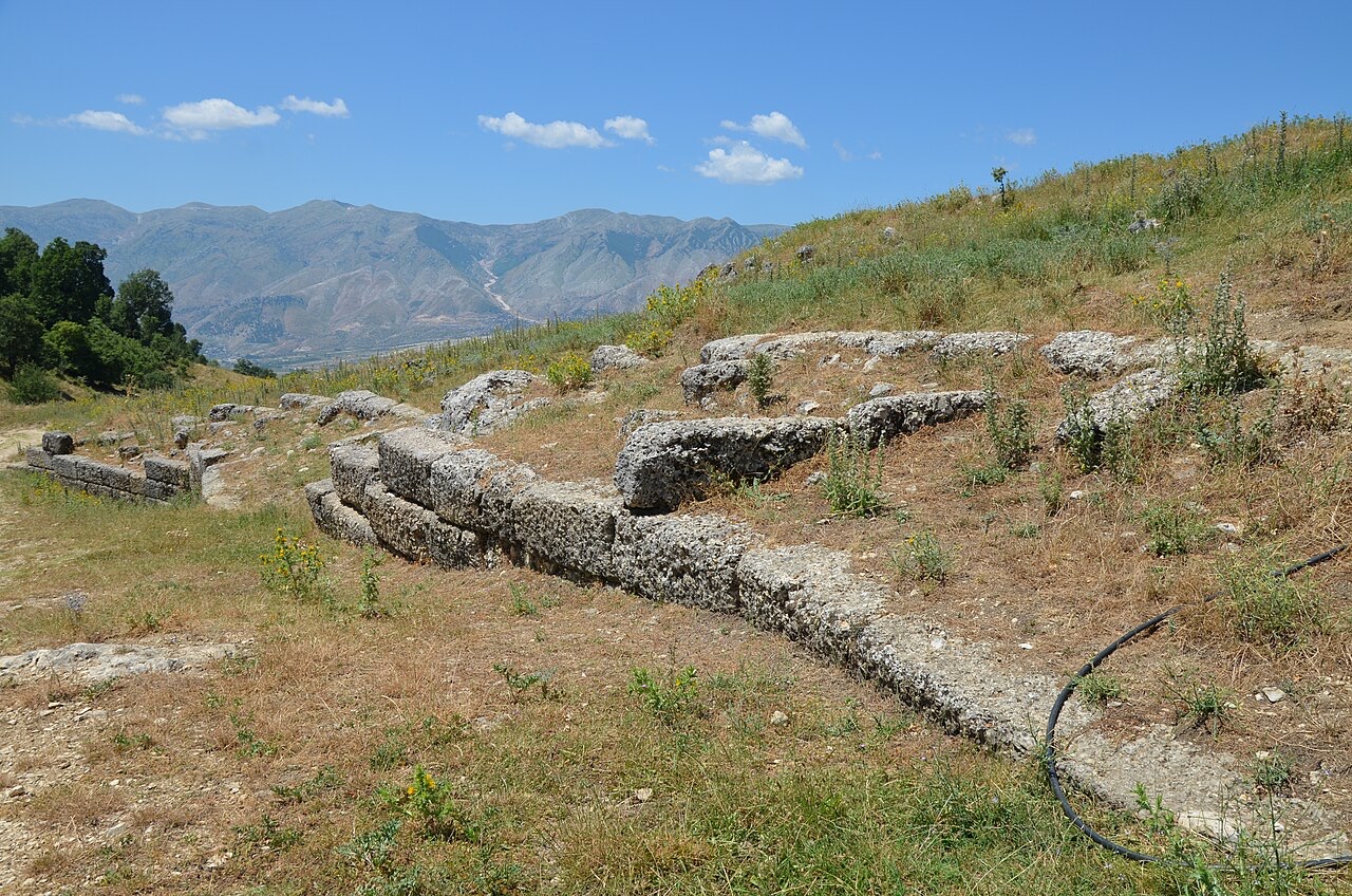
The most prominent surviving physical feature of Antigonea is its circuit of walls, which originally encircled the entire hill. The Romans demolished these walls following their destruction of the city in 167 BC. Despite this, significant sections remain identifiable.
The most clearly visible gate in the wall circuit is located at the south-western portion of the city. The southern end of the city retains the best-preserved section of the walls. This wall section terminates at the small early Christian church of triconch form described separately. The wall line as it survives allows the overall extent of the ancient city's fortified perimeter to be traced.
The city centre of Antigonea was constructed according to an orthogonal layout, also known as the Hippodamian plan, on the central hill. An entire ancient street from this grid has been exposed through excavation, giving a direct indication of the planned character of the urban core.
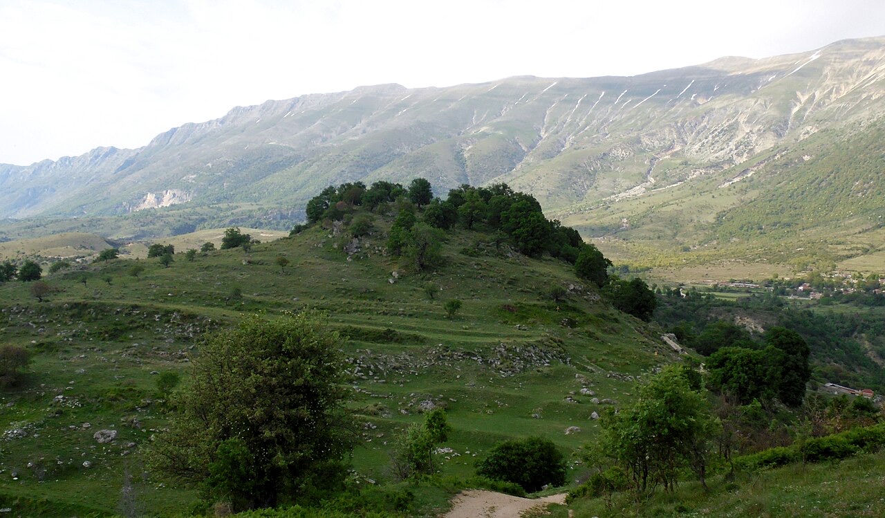
The acropolis of Antigonea was situated on the northern hill, separate from the central hill on which the main urban grid was laid out. This division between the civic centre and the elevated acropolis is consistent with the planning conventions of ancient Greek city foundations.
Excavation of the site has yielded a range of significant artefacts. Among the most notable are a bronze sphinx and a statue of Poseidon, both of which are currently exhibited in Tirana. Evidence of pottery has also been found across the city, and this distribution is taken as an indicator of the city's size at its peak.
The presence of the mosaic floor in the early Christian church, with its figurative imagery, constitutes a further category of material evidence. Taken together, these finds span the city's history from its foundation through to its use in the early Christian period before final destruction in the 6th century AD.
The ancient town was identified and first excavated by the Albanian archaeologist Dhimosten Budina. His work established the site's identity and initiated systematic study of its remains.
More recently, an Albanian-Greek team of archaeologists has continued work at the site. This collaborative effort represents the current phase of scholarly investigation into Antigonea's layout, material culture, and historical development.
As the chief inland city of the ancient Chaonians, Antigonea occupied a central role within the sub-region of Chaonia in Epirus. Its position controlling the Drino valley and mountain passes gave it economic and military significance beyond its immediate hinterland. The city's alignment with Macedon during the Second Macedonian War reflects the political entanglements of Epirote communities in the wider conflicts of the Hellenistic world.
The city's destruction by Aemilius Paullus in 167 BC, as one of 70 Epirote towns burned on his orders, was part of a deliberate Roman policy of punishment directed at communities that had supported Macedon. The fact that Antigonea was never rebuilt distinguishes its fate from settlements that recovered after Roman intervention elsewhere in the Greek world.
最も暖かい月は August (日中の平均最高気温 28°C), 最も寒い月は January (夜間の平均最低気温 0°C), 最も雨が多い月は November (246 mm). 年間総降水量の平均は 1,528 mm.
| 月 | 最高気温 | 最低気温 | 降水量 | 降水日数 | 日照時間/日 |
|---|---|---|---|---|---|
| January | 8°C | 0°C | 192 mm | 13 | 6.8 h |
| February | 9°C | 1°C | 156 mm | 12 | 7.6 h |
| March | 12°C | 3°C | 146 mm | 12 | 9.2 h |
| April | 16°C | 6°C | 110 mm | 13 | 10.6 h |
| May | 20°C | 11°C | 85 mm | 11 | 11.9 h |
| June | 25°C | 15°C | 45 mm | 7 | 13.6 h |
| July | 28°C | 17°C | 22 mm | 4 | 13.8 h |
| August | 28°C | 18°C | 28 mm | 5 | 12.8 h |
| September | 23°C | 14°C | 117 mm | 9 | 10.6 h |
| October | 19°C | 10°C | 154 mm | 9 | 9.0 h |
| November | 14°C | 6°C | 246 mm | 13 | 6.8 h |
| December | 9°C | 2°C | 227 mm | 14 | 6.2 h |
出典: ERA5 reanalysis via Open-Meteo, 1994–2023 · 「最高気温」および「最低気温」は日平均最高・最低気温です。「降水日数」は降水量が1mm以上の日数を計上しています。
都市 · Gjirokastër
The 'stone city': slate-roofed tower houses on a steep slope beneath one of the Balkans' largest castles.
史跡 · Gjirokastër
One of the largest castles in the Balkans, holding an artillery gallery and a captured US aircraft.
町 · Gjirokastër
A hill town below a castle built by Ali Pasha for his sister, opposite Gjirokastër.
ガイド
Butrint, Apollonia, Byllis, Antigonea and Amantia: five sites that cover 2,500 years between them.
このページに誤りがありますか? 修正は歓迎しており、原典記録と照合して確認します。何が誤っているか、また可能であれば正しい数値の出典をお知らせください。