
Stadt · Durrës
Durrës
Albania's principal port and its oldest continuously inhabited city, founded as Epidamnos in 627 BC.
Jeder Kreis, jede Küste, jedes Jahrhundert
Geführte Ansicht
Neu in Albanien? Jede Seite beginnt mit einer einfachen Erklärung, die auch ein Zehnjähriger verstehen würde – bevor es ins Detail geht.
Expertenansicht
Sie kennen die Grundlagen bereits. Direkt zur Substanz, ohne die vereinfachten Erklärungen. Dies ist die Standardeinstellung.
Hafen · Durrës County
The country's main commercial and passenger port, handling the large majority of Albanian seaborne trade.
Speichern
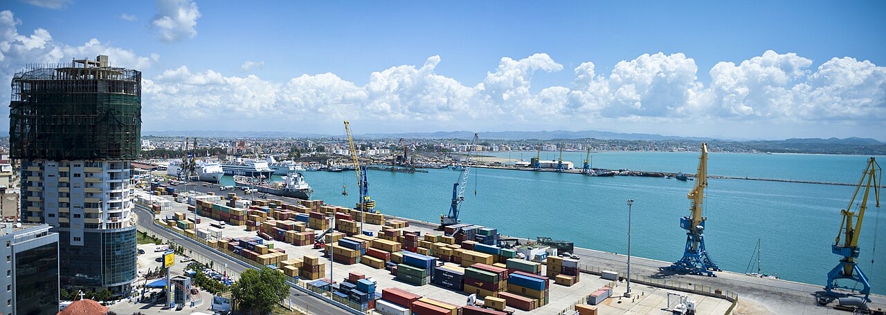
The Port of Durrës is Albania's busiest port. Cargo ships bring in goods and ferries carry people and cars to and from Italy. There are plans to move the cargo part to Porto Romano and turn the old docks into a marina.
The Port of Durrës is Albania's busiest port. Cargo ships bring in goods and ferries carry people and cars to and from Italy. There are plans to move the cargo part to Porto Romano and turn the old docks into a marina.
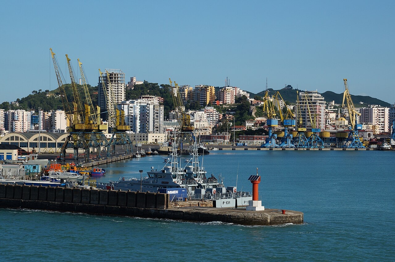
The Port of Durrës is an artificial basin formed between two moles, with a west-northwesterly oriented entrance approximately 183 metres (600 ft) wide between the ends of those moles. The port sits at the north end of the Bay of Durrës, a substantial body of water bounded by Kalaja e Turrës and Cape Durrës. Cape Durrës lies approximately 1.6 kilometres west of the port itself.
The West Mole provides approximately 763 metres (2,503 ft) of alongside pier space. A fishing harbour occupies the north end of the East Mole; a small harbour for fishing boats was built on the west mole and opened in 2013, protected by a small new pier. Several wrecks are located near the entrance channel, and the use of tugboats is compulsory within the port.
The city at the site of the modern port was originally called Epidamnos. It was seized by Glaukias, king of Illyria, in 312 BC. Following a war with the Roman Republic that ended in Illyrian defeat in 229 BC, the city passed to Roman control and was developed as a major military and naval base. The Romans renamed it Dyrrachium—a Greek term meaning roughly 'bad spine' or 'difficult ridge', possibly a reference to cliffs near the city. They avoided the original name Epidamnos because of its resemblance to the Latin word damnum, meaning 'loss' or 'harm'.
Under Roman rule, Dyrrachium became the western terminus of the Via Egnatia, the main road linking the Adriatic coast to Byzantium. The emperor Caesar Augustus established it as a colony for veterans of his legions after the Battle of Actium and proclaimed it a civitas libera ('free city'). Julius Caesar's rival Pompey made a stand at Dyrrachium in 48 BC before withdrawing south to Greece.
In the 4th century AD, Dyrrachium was designated the capital of the Roman province of Epirus nova. The emperor Anastasius I was born there around 430 AD. Later in the same century a powerful earthquake destroyed the city's defences; Anastasius I subsequently rebuilt and strengthened the walls. The Byzantine historian Anna Komnene recorded that the rebuilt walls stood 12 metres (36 ft) high and were wide enough for four horsemen to ride abreast. Significant portions of these ancient defences survive.
Like much of the Balkans, Dyrrachium and its surrounding province suffered repeated barbarian incursions during the Migration Period. Theodoric the Great, king of the Ostrogoths, besieged it in 481 AD. In later centuries it faced repeated Bulgarian attacks. Despite the fall of the Western Roman Empire, the city continued under Byzantine authority as an important port and a key link between the empire and Western Europe.
During the communist period in Albania, the Port of Durrës was named after Enver Hoxha, the country's communist leader. The article does not specify the precise dates of this naming or its subsequent removal, but the designation reflects the broader pattern of institutional renaming common under the Hoxha government.
As of 2011, the port underwent major renovation and expansion works. A new ferry terminal opened in 2013, alongside the fishing harbour constructed in the same year.
As of 2014, the Port of Durrës ranked as the largest passenger port in Albania and one of the largest passenger ports on the Adriatic Sea, with an annual passenger volume of approximately 1.5 million. The port is regularly served by ferries, the majority of which connect Durrës with Bari and Ancona; some routes also run to Trieste, and connections to Brindisi are described as rare.
In 2019, 878,687 passengers and 259,175 vehicles were carried on 1,052 ferry sailings. In the same year, 19 cruise ships called at the port, carrying over 4,500 passengers in total. Since early 2019, a customs office of the Republic of Kosovo has operated within the port, with the stated purpose of simplifying the import of goods to Kosovo and relieving pressure on the Vërmica/Morina border crossing.
The port contains several terminals handling different cargo and passenger categories. Container operations are managed by the Durrës Container Terminal (DCT). The East Terminal is operated by EMS Albanian Port Operator (EMS APO), which handles bulk cargo, breakbulk cargo, project cargo, and associated logistics. Additional facilities cover passenger ferries, general cargo, and liquid cargo.
The Albanian government has announced plans to relocate the existing port northward to the Porto Romano area. The current port grounds would then be redeveloped as a luxury marina under the Durrës Yachts & Marina project, to be built by the Dubai-based company Emaar. The planned development is described as comprising residential construction, recreational areas, and a marina for super yachts. No completion date is specified in the available information.
Stadt · Durrës
Albania's principal port and its oldest continuously inhabited city, founded as Epidamnos in 627 BC.
Fährverbindung · Durrës
The main overnight vehicle link between Albania and Italy.
Fährverbindung · Durrës
The longer northern Italian crossing, used heavily by lorries and by the diaspora in summer.
Betreff
An upper-middle-income economy of roughly $30 billion, led by services and tourism, with remittances and construction close…
Industrie
Italy is by a wide margin the largest partner; exports are led by textiles, minerals, oil and agri-food.
Etwas falsch auf dieser Seite? Korrekturen sind willkommen und werden gegen den Quelldatensatz geprüft. Bitte mitteilen, was falsch ist und, wenn möglich, woher die richtige Angabe stammt.