- Established
- 2008
- UNESCO
- Parts inscribed 2017 within the transboundary 'Ancient and Primeval Beech Forests' site
- Wildlife
- Includes the critically endangered Balkan lynx
- Area
- 339 km²
بلغة مبسّطة
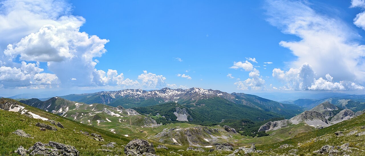
This park on the eastern border protects very old beech forests, glacial lakes and some of the few remaining Balkan lynx.
شرح مبسّط
This park on the eastern border protects very old beech forests, glacial lakes and some of the few remaining Balkan lynx.
في هذه الصفحة
Location and administrative context
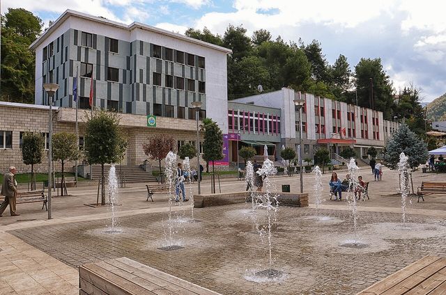
Shebenik-Jabllanicë National Park lies in eastern Albania, along the border with North Macedonia, north of Lake Ohrid. It falls mostly between latitudes 41° and 10° N and longitudes 20° and 30° E, entirely within Elbasan County. The closest significant towns are Librazhd and Prrenjas, and the park's managing directorate is based in both of those towns, subordinated to the Ministry of Environment.
The park is among the newest national parks in Albania and is the country's second largest. The International Union for Conservation of Nature (IUCN) classifies it as Category II. It also incorporates the Rajca Nature Reserve within its boundaries.
The park forms part of the European Green Belt, a transboundary conservation corridor recognised for its value as a refuge for endangered animal and plant species. The mountains of Shebenik and Jabllanica, along with the Rrajcë region, have been designated as Important Plant Areas of international importance by Plantlife.
Area and boundary history
The park covers 34,507.9 hectares (345.079 km²). In January 2022, its boundary was extended from a previous area of 33,894.25 hectares (338.9425 km²) to its current extent. The park covers 339.277 km² (130.996 sq mi) of Elbasan County according to administrative measurements.
Roughly 212,945 hectares (2,129.45 km²) of the park's territory are included within the Ancient and Primeval Beech Forests of the Carpathians and Other Regions of Europe, a UNESCO World Heritage Site. The name of the park reflects the two principal mountain massifs it encompasses: Shebenik and Jabllanicë.
Geology and landform origins
The park's geologic record spans from the middle Triassic and Jurassic periods. The mountains were formed during the Variscan orogeny and are predominantly composed of ultramafic and metamorphic rocks. Calcareous rocks are among the most common rock types, found particularly in the south and southeastern sections of Shebenik.
The bedrock, primarily carbon and karst in character, stretches above the forest belt and dates from the formation of the mountain chain. The landscape was subsequently shaped by the glaciers of the last ice age, which produced the u-shaped valleys and cirques visible across the park today. Since the end of the ice ages, sediments have deposited on the bedrock, contributing to what the article describes as extraordinary fertility in the region.
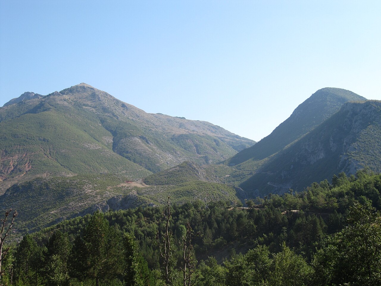
Elevations across the park range from 300 metres to over 2,200 metres above the Adriatic Sea level, with the highest points at the peaks of Shebenik and Jabllanica. This vertical range drives considerable variation in climate, vegetation, and fauna within the park's boundaries.
Climate
Under the Köppen classification, the park experiences a moderately warm and rainy continental climate with strong Mediterranean influence. Altitude is the principal factor modifying local conditions, with lower temperatures generally recorded at higher elevations.
Mean annual precipitation ranges between 1,300 mm (51 in) and 1,800 mm (71 in), varying by geographic subregion and prevailing climate type within the park.
Glacial lakes, rivers, and water features
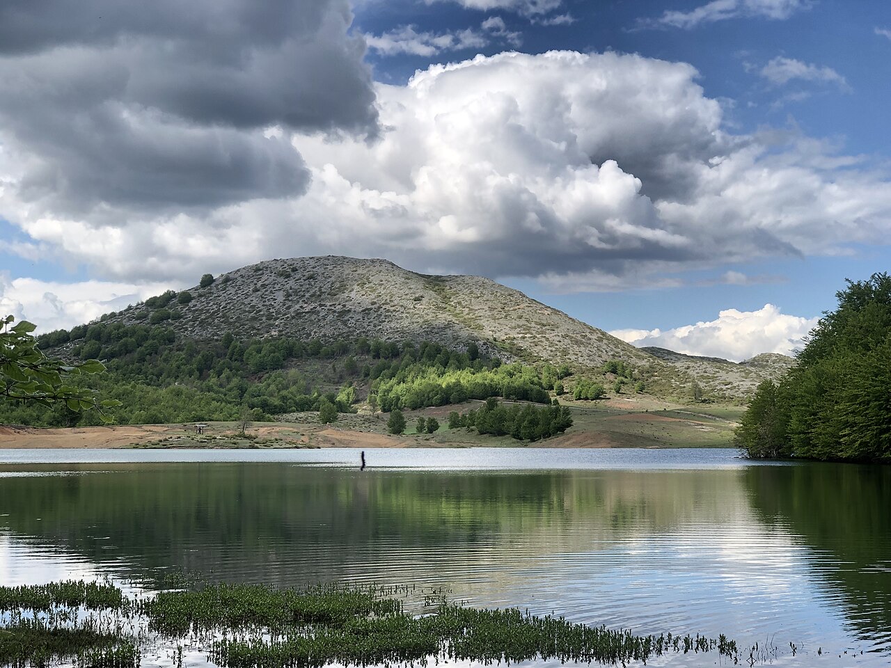
The park contains 14 glacial lakes, the highest situated at elevations between 1,500 and 1,900 metres above the Adriatic. Small cirque glaciers are distributed across the mountain ranges, typically occupying depressions on the sides of mountains. The lakes vary considerably in size, shape, and depth.
Two rivers of note flow through the park: the Qarrishte and the Bushtrice, both of which are 22 km long. Multiple smaller water sources also flow through the park's area. The river valleys extend the forested ecosystem to higher elevations and provide habitat for bird and animal species.
Forest ecosystems and plant communities
The park falls within the Dinaric Mountains mixed forests and Balkan mixed forests terrestrial ecoregions of the Palearctic temperate broadleaf and mixed forest biome. Deciduous forest dominated by European beech is present across the full territory of the national park. Conifers including European silver fir, Bosnian pine, and Macedonian pine also occur within these forests, though beech is generally more abundant.
The northern slopes of the mountains carry species such as purple willow, Norway maple, silver birch, and silver fir. The understory of the forest floor is characterised by a variety of shrubs, frequently dominated by manna ash, common hazel, and cade juniper. Oak species are also present alongside beech and pines.
Dense forest often clings to steep valley sides and mountain slopes. Some sections of the forest are described as quite ancient, a condition attributed to their inaccessibility. The park's flora is noted for the presence of many endemic species across a range of habitats including forests, shrubs, meadows, and pastures.
The mountains of Shebenik and Jabllanica and the Rrajcë region are recognised as Important Plant Areas of international importance by Plantlife, reflecting the significance of the park's flora at a global level.
Mammal and bird fauna
Approximately 30 mammal species have been recorded within the park. The Balkan lynx, a subspecies of the Eurasian lynx classified as critically endangered, is considered the most notable. On 21 April 2011, a research team from the Protection and Preservation of Natural Environment of Albania obtained the first photograph of a live Balkan lynx within the park's boundaries. The park is regarded as one of the primary remaining ranges of this subspecies.
The red fox and gray wolf are observed relatively frequently. Brown bears are present but less commonly encountered. Red deer and roe deer, described as very rare mammals in Albania, have also been recorded. The park supports populations of the least weasel, beech marten, stoat, and European badger. Bats are represented by 18 species, though they are rarely seen; the greater horseshoe bat, lesser horseshoe bat, and Mediterranean horseshoe bat use the pastures, woodlands, and scrublands as sanctuary.
More than 88 bird species have been recorded, associated with both European and Mediterranean faunal communities. The golden eagle occupies areas of rocky terrain and mountains. The short-toed snake eagle is found near large bodies of water. The western capercaillie, hazel grouse, and peregrine falcon are also recorded; the peregrine falcon is both a resident and a visitor, nesting on cliffs and rocks.
The article notes that the status of most species in the park is unknown due to incomplete or unavailable information.
Amphibians, reptiles, and conservation significance
The park contains 10 species of amphibians and 15 species of reptiles. Rare and endemic species recorded include Hermann's tortoise, the blue-throated keeled lizard, smooth snake, black whipsnake, and dice snake.
The park's ecological value is partly explained by the variety of vegetation types and its remote location, which together sustain species that are fast becoming rare in Southern Europe, including the brown bear and gray wolf alongside the Balkan lynx. The park functions as an important ecological corridor for numerous species considered endangered across both Albania and the broader Balkan Peninsula.
The park's inclusion within the UNESCO World Heritage Site designation for Ancient and Primeval Beech Forests of the Carpathians and Other Regions of Europe, alongside its IUCN Category II status and role within the European Green Belt, reflects its recognition across several international conservation frameworks.
المناخ شهراً بشهر
أكثر الأشهر دفئاً هو August (متوسط أعلى درجة حرارة يومية 20°C), وأبردها هو January (متوسط أدنى درجة حرارة يومية -8°C), وأكثرها مطراً هو December (128 mm). يبلغ متوسط هطول الأمطار السنوي الإجمالي 1,101 mm.
| الشهر | الأعلى | الأدنى | الأمطار | أيام المطر | ساعات الشمس/اليوم |
|---|---|---|---|---|---|
| January | -2°C | -8°C | 120 mm | 12 | 6.4 h |
| February | -0°C | -8°C | 100 mm | 11 | 7.6 h |
| March | 3°C | -5°C | 106 mm | 12 | 9.0 h |
| April | 7°C | -2°C | 106 mm | 15 | 10.2 h |
| May | 12°C | 3°C | 93 mm | 14 | 11.5 h |
| June | 17°C | 7°C | 67 mm | 12 | 13.3 h |
| July | 20°C | 10°C | 47 mm | 8 | 13.5 h |
| August | 20°C | 10°C | 43 mm | 8 | 12.6 h |
| September | 15°C | 6°C | 80 mm | 10 | 10.3 h |
| October | 10°C | 2°C | 91 mm | 10 | 8.7 h |
| November | 5°C | -2°C | 121 mm | 12 | 6.8 h |
| December | -0°C | -6°C | 128 mm | 12 | 6.1 h |
المصدر: ERA5 reanalysis via Open-Meteo, 1994–2023 · "الأعلى" و"الأدنى" هما متوسط أقصى وأدنى درجة حرارة يومية للهواء. تحسب "أيام المطر" الأيام التي يبلغ فيها الهطول مليمتراً واحداً على الأقل.
مزيد من الصور
موضوعات مرتبطة
قريب منه
موضوعات ذات صلة

شرح وافٍ
Albania's UNESCO Sites
Four inscriptions: Butrint, the historic centres of Berat and Gjirokastra, the Ohrid region, and the primeval beech forests.
المصادر
- Wikipedia.
Shebenik National Park — English Wikipedia
· تاريخ الاسترجاع 13 Oct 2026
Used to ground the deep-research section and as a discovery aid; not relied on alone for contested claims. - Wikidata.
Wikidata item Q1969017
· تاريخ الاسترجاع 13 Oct 2026
Source of the population, area and elevation figures shown in Quick facts, each with its own observation year. - Open-Meteo / ECMWF.
Monthly climate normals, 1994–2023
· تاريخ الاسترجاع 13 Oct 2026
Computed here from daily ERA5 reanalysis via Open-Meteo over 1994–2023. - Wikimedia Commons.
Photographs
· تاريخ الاسترجاع 13 Oct 2026
Each photograph carries its own creator, licence and file link beneath it. Only public-domain, CC0, CC BY and CC BY-SA files are published.
ثمة خطأ في هذه الصفحة؟ نرحب بالتصويبات وتُراجَع في مواجهة سجل المصدر. أخبرنا بما هو خاطئ، وإن أمكن، بالمكان الذي يأتي منه الرقم الصحيح.