- Established
- 1966; expanded and merged as Lurë-Dejë Mountain in 2018
- Feature
- The Lurë lakes — a chain of small glacial lakes
- Condition
- Significant historic logging damage
- Area
- 13 km²
わかりやすく説明すると
Lurë is a mountain park known for a group of small lakes among pine trees. Illegal logging damaged it badly in the 1990s and 2000s, and it is still recovering.
簡易説明
Lurë is a mountain park known for a group of small lakes among pine trees. Illegal logging damaged it badly in the 1990s and 2000s, and it is still recovering.
このページの内容
Establishment and legal status
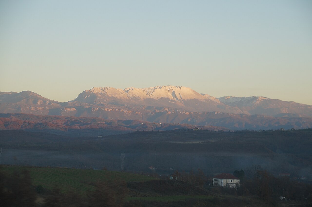
Lurë-Dejë Mountain National Park, known in Albanian as Parku Kombëtar 'Lurë-Mali i Dejës', is located in northeastern Albania within Dibër County. It was originally established in 1966 under the name Lura National Park, with the explicit purpose of protecting the area's ecosystems and biodiversity.
The International Union for Conservation of Nature (IUCN) classifies the park under Category II, which corresponds to national park status. The park is additionally recognised as an important Bird and Plant Area on account of the significant bird and plant species it supports.
In 2018, the park was substantially expanded and renamed Lurë-Dejë Mountain National Park. The expansion incorporated the entire section of Kunora e Lurës, the former Zall-Gjocaj National Park, and Dejë Mountain, bringing the total protected area to 202.42 km² (78.15 sq mi), or 20,242 hectares.
Terrain, elevation and geological character
The park's altitude ranges from 1,500 to 2,300 metres (4,921 to 7,546 ft). This considerable variation in elevation accounts for the density and diversity of vegetation found throughout the protected area.
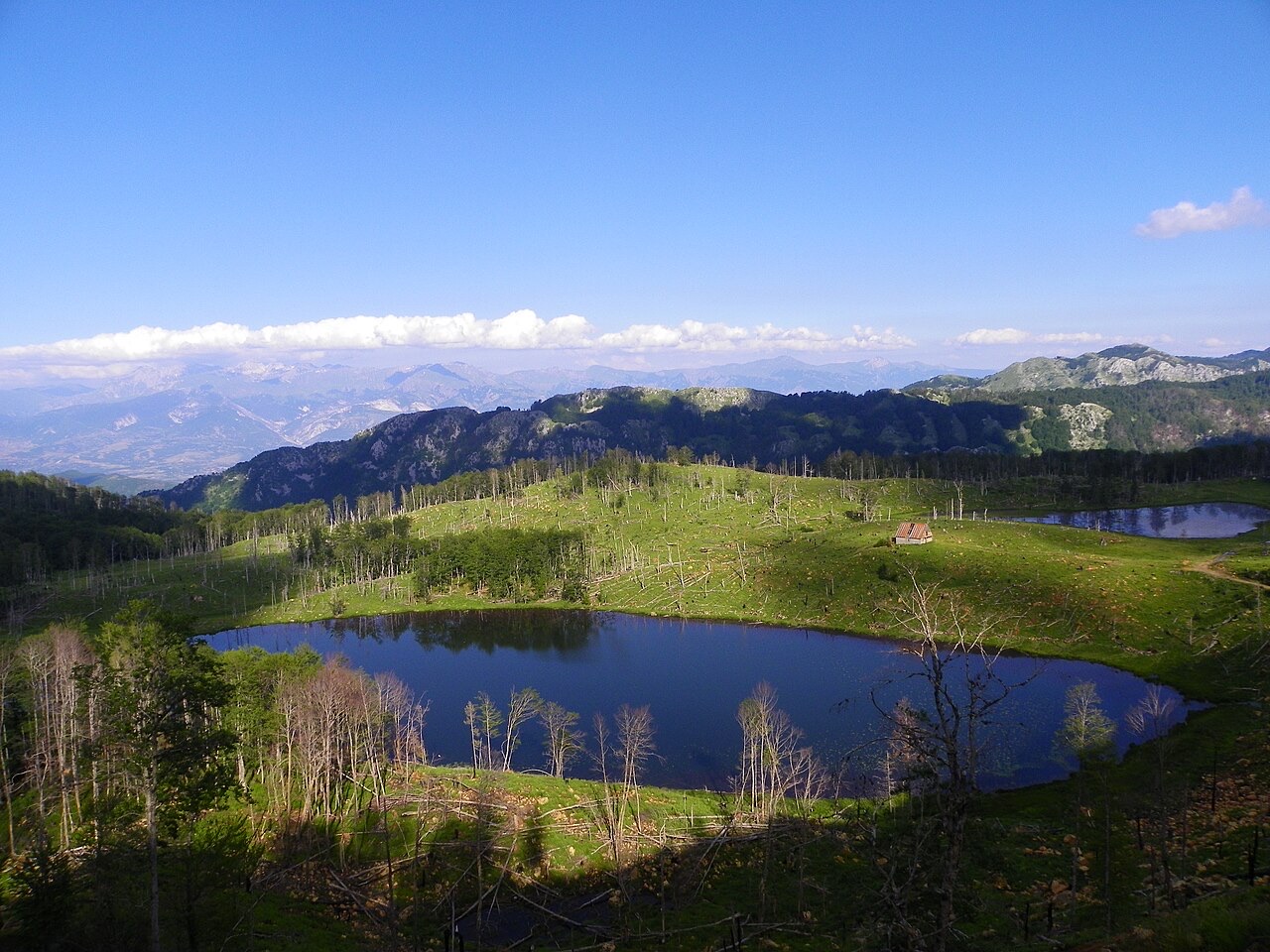
The Zall-Gjocaj section of the expanded park is described as an intensively fissured and mountainous landscape. Elevations in that zone vary from 600 metres to over 2,000 metres above the Adriatic. The geomorphological conditions of the region reflect a dynamic geological history shaped by tectonic movements and the erosive activity of rivers flowing through the park.
Much of the substrate consists of limestone and dolomite, on which a mixed forest of beech, fir, pine, ash and maple grows. The park falls within the Pindus Mountains mixed forests terrestrial ecoregion, which belongs to the Palearctic Mediterranean forests, woodlands, and scrub biome.
The twelve glacial lakes
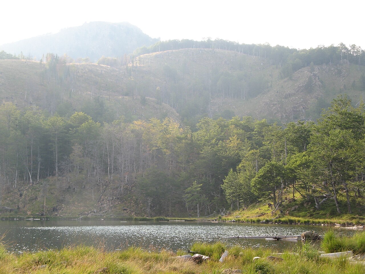
Twelve glacial lakes lie within the national park, all formed during the ice age. They are situated in the northeastern part of Albania, within Dibër County, at elevations between 1,200 and 1,500 metres (3,937 and 4,921 ft).
Each lake carries a name associated with its most characteristic feature. The lakes are located in the northeastern section of the park. Some of the lakes are reportedly drying up, a process that local non-governmental organisations have been working to address.
Native tree species and the Field of Mares
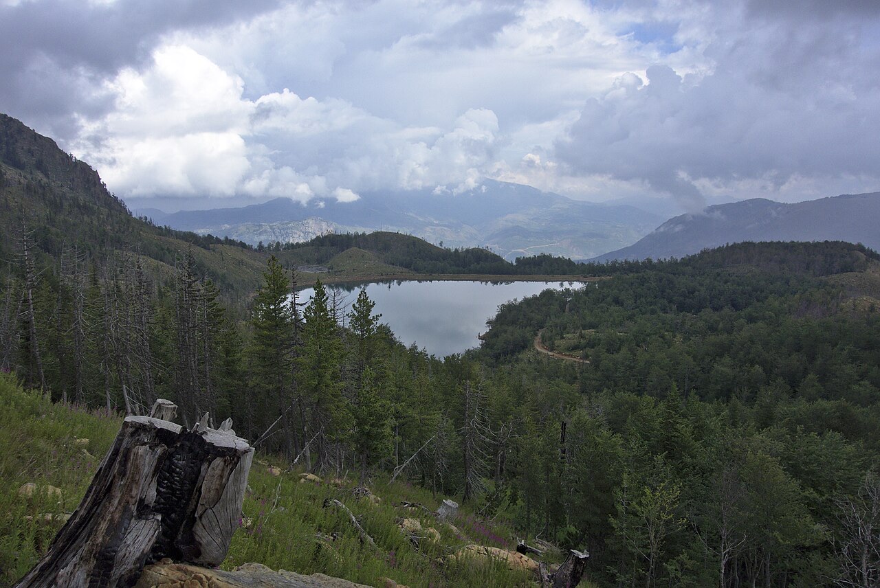
The most common tree native to the Lurë area is the European beech. Other significant species include silver fir, black pine, red pine and Bosnian pine. The park gives particular protection to the Balkan pine, which is threatened with extinction and is found only in the western part of the Balkan Peninsula.
The Zall-Gjocaj portion of the park supports a mixture of beech, fir, pine, ash and maple growing on limestone and dolomite substrates, with dense forest cover and, according to the article, no human intervention.
The southern section of the park contains an area known as the Field of Mares, characterised by a meadow of multicolour flowers and several coniferous trees.
Wildlife
The park shelters a range of mammal species. Large fauna include the European brown bear, Eurasian lynx, Eurasian wolf, European pine marten, and roe deer. Among birds, the western capercaillie is specifically noted.
Smaller mammals recorded in the park include the red squirrel and the edible dormouse. The park's recognition as an important Bird and Plant Area reflects the breadth of species it supports across multiple taxonomic groups.
Deforestation and damage following the fall of communism
After the fall of communism in Albania in the 1990s, the park suffered extensive damage from illegal logging and forest fires. It is estimated — though the figure should be treated as an approximation — that as much as 50 percent of the original Lura National Park was destroyed during this period.
In 2014, the Albanian government launched a rehabilitation campaign involving reforestation, roadwork and new signage. The campaign was described as controversial, and local stakeholders criticised it as superficial rather than substantive.
In May 2002, Joseph Limprecht, who was serving as United States Ambassador to Albania, died of a heart attack at the age of 55 while visiting Lura National Park.
Reforestation efforts from 2019 onwards
In 2019, local NGOs including Co-Plan and the North Green Association, working with local stakeholders, planted 1,000 new trees within the protected area. The following year, GIZ Albania undertook the planting of 7,000 trees in Lurë.
From 2021, a project called Trees for Lurë planted 22,793 trees within the national park, restoring 15.22 hectares of forest. In 2022, the same project established a tree nursery in Fushë-Lurë to grow saplings locally. During the 2023 planting season, 1,081 locally grown trees were planted from that nursery.
Natural regeneration is also under way, with seeds spreading organically and new trees establishing themselves in various parts of the park. Local NGOs such as Ecovolis have also been removing debris around the lakes.
The 2018 expansion and current threats
The 2018 expansion incorporated the former Zall-Gjocaj National Park into the new Lurë-Dejë Mountain National Park, increasing the total area to 20,242 hectares. The Albanian government has also outlined plans to develop the area as an agritourism destination under the 100 Villages Initiative. That plan includes the renovation of traditional tower houses and the reconstruction of the road connecting the park with Rreshen and the A1 motorway. Construction work on the road began in late 2021 with the widening and stabilisation of the existing road structure.
The future of the expanded park is described as threatened by the construction of hydroelectric power plants in the Zall-Gjocaj area, which, according to the article, would further damage an already fragile ecosystem. Accommodation in the vicinity currently consists of several family-run hotels and guesthouses near the park in Fushë-Lurë.
月別気候
最も暖かい月は August (日中の平均最高気温 24°C), 最も寒い月は January (夜間の平均最低気温 -6°C), 最も雨が多い月は December (164 mm). 年間総降水量の平均は 1,374 mm.
| 月 | 最高気温 | 最低気温 | 降水量 | 降水日数 | 日照時間/日 |
|---|---|---|---|---|---|
| January | 2°C | -6°C | 143 mm | 12 | 6.7 h |
| February | 3°C | -5°C | 124 mm | 12 | 7.7 h |
| March | 7°C | -2°C | 129 mm | 13 | 9.1 h |
| April | 11°C | 2°C | 130 mm | 16 | 10.2 h |
| May | 16°C | 7°C | 119 mm | 16 | 11.6 h |
| June | 21°C | 11°C | 82 mm | 12 | 13.4 h |
| July | 24°C | 13°C | 58 mm | 9 | 13.6 h |
| August | 24°C | 13°C | 54 mm | 8 | 12.7 h |
| September | 19°C | 10°C | 106 mm | 11 | 10.4 h |
| October | 14°C | 5°C | 112 mm | 10 | 8.8 h |
| November | 9°C | 1°C | 153 mm | 12 | 6.9 h |
| December | 4°C | -4°C | 164 mm | 13 | 6.2 h |
出典: ERA5 reanalysis via Open-Meteo, 1994–2023 · 「最高気温」および「最低気温」は日平均最高・最低気温です。「降水日数」は降水量が1mm以上の日数を計上しています。
その他の画像
関連項目
周辺
出典
- Wikipedia.
Lurë-Dejë Mountain National Park — English Wikipedia
· 取得日 13 Oct 2026
Used to ground the deep-research section and as a discovery aid; not relied on alone for contested claims. - Wikidata.
Wikidata item Q1521938
· 取得日 13 Oct 2026
Source of the population, area and elevation figures shown in Quick facts, each with its own observation year. - Open-Meteo / ECMWF.
Monthly climate normals, 1994–2023
· 取得日 13 Oct 2026
Computed here from daily ERA5 reanalysis via Open-Meteo over 1994–2023. - Wikimedia Commons.
Photographs
· 取得日 13 Oct 2026
Each photograph carries its own creator, licence and file link beneath it. Only public-domain, CC0, CC BY and CC BY-SA files are published.
このページに誤りがありますか? 修正は歓迎しており、原典記録と照合して確認します。何が誤っているか、また可能であれば正しい数値の出典をお知らせください。