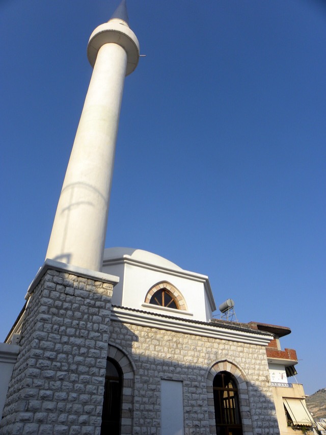
史跡
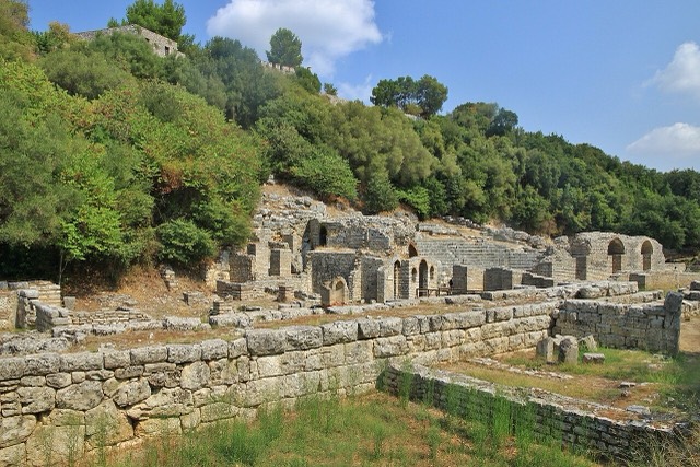
Butrint
A Greek, Roman, Byzantine, Venetian and Ottoman city layered on one wooded peninsula — Albania's first UNESCO site.
🧭 ガイドビュー
アルバニアを初めて知る方へ。各ページは、詳細に入る前に、10歳の子どもにも読み聞かせられる平易な説明から始まります。
⚡ エキスパートビュー
基本知識はすでにお持ちの方向け。平易な説明を非表示にし、内容を直接表示します。これがデフォルトです。
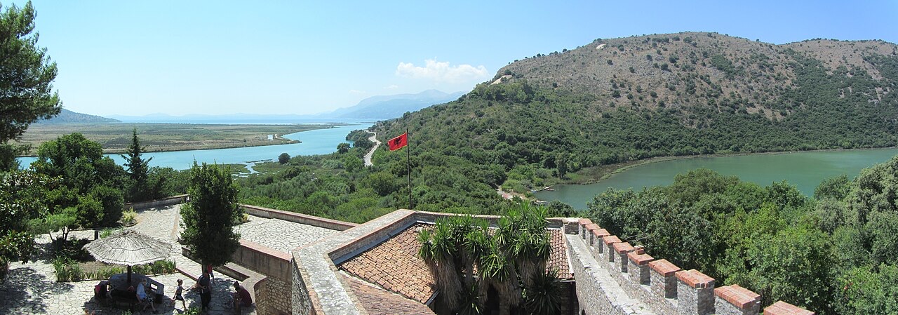
Butrint National Park protects the land and water around the ancient ruins of Butrint — a lake, a channel to the sea, marshes and woods full of birds and turtles.
Butrint National Park protects the land and water around the ancient ruins of Butrint — a lake, a channel to the sea, marshes and woods full of birds and turtles.
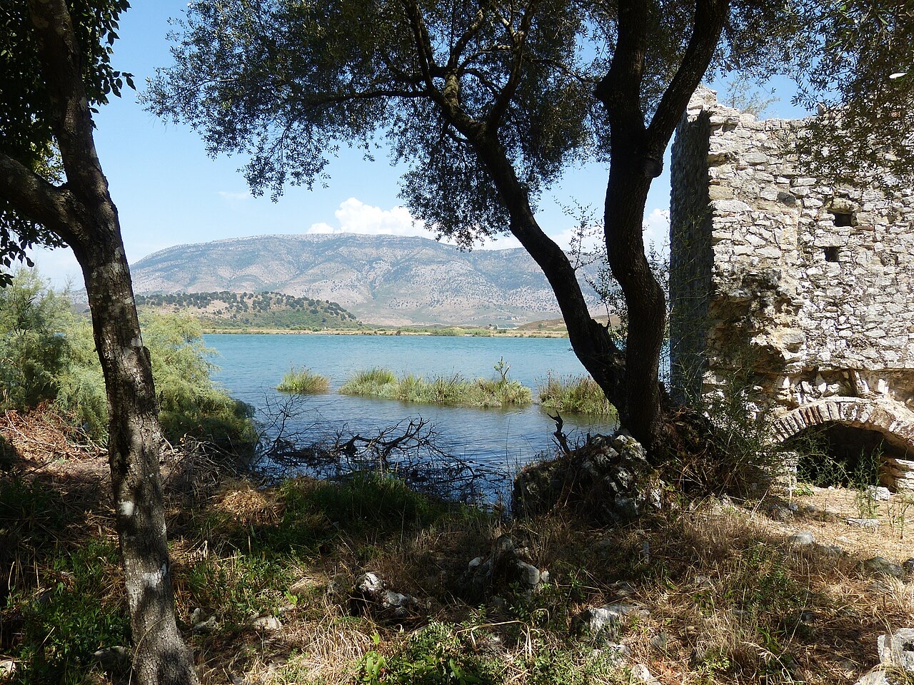
Butrint National Park (Albanian: Parku Kombëtar i Butrintit) lies in Vlorë County, in the extreme south of Albania, 18 kilometres south of Sarandë and a short distance north of the land border with Greece. It occupies the eastern part of the Strait of Corfu, spreading across a peninsula surrounded by Lake Butrint and the Vivari Channel. That channel connects the lake to the Ionian Sea through a narrow sandy bar.
The park covers 9,424.4 hectares of terrain that combines hilly ground, freshwater lakes, wetlands, salt marshes, open plains, reed beds, and islands. Its mandate formally extends to the protection of Lake Butrint, the lagoon of Butrint, the natural channel of Vivari, and the Ksamil Islands, as well as the archaeological site within its boundaries. The park is classified by the International Union for Conservation of Nature as Category II.
The park was established by ordinance number 82 on 2 March 2000, with the stated purpose of preserving natural ecosystems, landscapes, plant and animal communities, habitats, and cultural heritage. Its territory was expanded several times after that date, reaching its current area in 2005. Day-to-day management falls to a directorate subordinated to Albania's Ministry of Environment, based in Sarandë.
The park was founded by the Ministry of Culture in partnership with UNESCO, ICCROM, and ICOMOS, with the explicit intention of creating a sustainable cultural heritage resource involving local communities and national institutions as a model for other parks in the country. With support from Albanian institutions, the Butrint Foundation, the World Bank, and UNESCO, the archaeological site was removed from the UNESCO World Heritage in Danger list in 2005.
The park now serves as a centre for archaeology and conservation training organised by the Butrint Foundation in partnership with Albania's Institutes of Archaeology and Monuments, foreign universities, and international specialists. It also runs an active programme of events in the theatre and outreach programmes for local schools and colleges. In 2010, national authorities demolished more than 200 illegal structures in Ksamil that were judged to violate the town's master plan and the integrity of the park; the remains of those demolished buildings had not been fully removed by authorities as of the time of reporting.
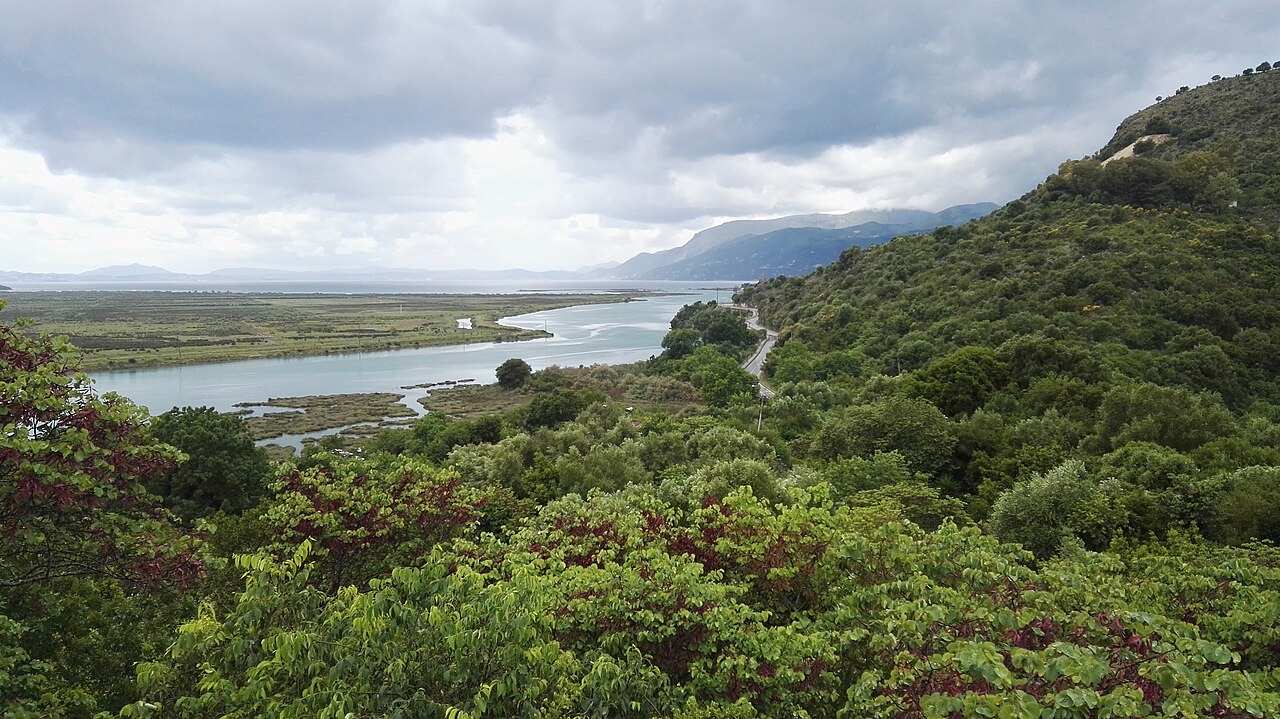
According to the Köppen classification, the park experiences a Mediterranean climate (Csa and Csb), with rainy winters and dry, warm to hot summers. Annual precipitation is recorded at approximately 1,500 millimetres. Its coastal position on the Albanian Ionian Sea Coast moderates temperatures, producing mild winters and hot, dry summers.
The hydrographical network within the park includes several short, steep rivers of high water volume. The principal features are Lake Butrint in the northwest, Lake Bufi in the southeast, the Bistrica River to the north, Mile Mountain to the west, and the Pavllo River to the south. Lake Butrint is the largest body of water: it measures 7.1 kilometres in length and 3.3 kilometres in width, with a surface area of 16.3 square kilometres. Its water regime is typical of a coastal lagoon, with mesotrophic waters showing eutrophic tendencies and a limnology divided into two distinct layers.
Lake Bufi lies approximately 2 metres above the Adriatic, in the southeast of Lake Butrint, and covers a total surface area of 83 hectares. Its excess waters are discharged into the southern part of Lake Butrint through a former channel. The Vivari Channel serves as the critical link connecting Lake Butrint with the Ionian Sea.
The park falls phytogeographically within the Illyrian deciduous forests terrestrial ecoregion of the Palearctic Mediterranean forests, woodlands, and scrub. The vertebrate flora comprises more than 800 to 900 species, estimated to represent 27 percent of the total number of plant species recorded in Albania. The diversity of geological and hydrological conditions, and the mosaic distribution of habitat types, are considered the main drivers of this variety.
Evergreen forests, found within the archaeological site and on the southern and eastern slopes of Sotira, are vertically divided into three distinct zones. The upper tree level is dominated by holly oak and bay laurel, with field elm, narrow-leafed ash, and valonia oak also present. The scrub level includes elmleaf blackberry, common hawthorn, evergreen rose, common ivy, and Italian leather flower. The herbaceous level contains wild asparagus, hedge bedstraw, lesser celandine, and purple loosestrife.
The shallow coastal lagoons are characterised by dense beds of phragmites and typha latifolia, with underwater meadows dominated by zostera noltei and ruppia cirrhosa. Posidonia oceanica is distributed along the sea bottom from Stillo Cap to Cuka Channel, while cymodocea nodosa and zostera noltei are found near the mouth of the Pavllo River. Along coastal cliffs, salinity and rocky conditions reduce floristic diversity to species such as crithmum, elymus pycnanthus, and golden samphire.
The park supports at least 39 species of mammals, of which 14 are classified as globally endangered. The beech marten occupies the woodland edges and open hillsides. The golden jackal and red fox are recorded in the grasslands, where they feed primarily on small rodents. The grey wolf is present only during winter. The otter, found in the park's streams and lakes, is protected under international conventions.
Coastal waters around the park are frequented by the common bottlenose dolphin and short-beaked common dolphin, with occasional sightings of the striped dolphin. The park is described as one of the last remaining nesting habitats for the Mediterranean monk seal, which uses the rocks and caverns within its boundaries. Two species of sea turtles — the loggerhead sea turtle and the leatherback sea turtle — have been recorded in the shallow coastal waters and are listed as endangered or threatened by state authorities.
Ten species of amphibians are documented, including the fire salamander, northern crested newt, common toad, and Greek stream frog. Reptile diversity is described as higher than in any other protected area in the region, with 25 species inventoried, among them the Balkan green lizard, slowworm, and Aesculapian snake.
The park records 246 species of birds across its habitats. Residents share the territory with migratory species passing through the Adriatic flyway. Raptors recorded include the golden eagle, peregrine falcon, and common buzzard; other notable species include the rock partridge and golden oriole. The bays and estuaries along the Ionian Sea Coast serve as a wintering destination for significant bird populations.
The wetlands function as feeding and resting areas for species including the common pochard, great cormorant, great crested grebe, Eurasian coot, and black-headed gull. Reed beds are used by the common moorhen, water rail, hen harrier, western marsh harrier, moustached warbler, and remiz pendulinus. The marshes provide feeding sites for the little egret, grey plover, European golden plover, and dunlin, while the coastal marshes concentrate species such as the Eurasian curlew, common redshank, and sandwich tern. Lake Butrint is designated an Important Bird and Plant Area.
The park's bodies of water support 105 species of fish. The most abundant include the flathead grey mullet, thinlip mullet, thicklip grey mullet, European eel, European hake, and crucian carp.
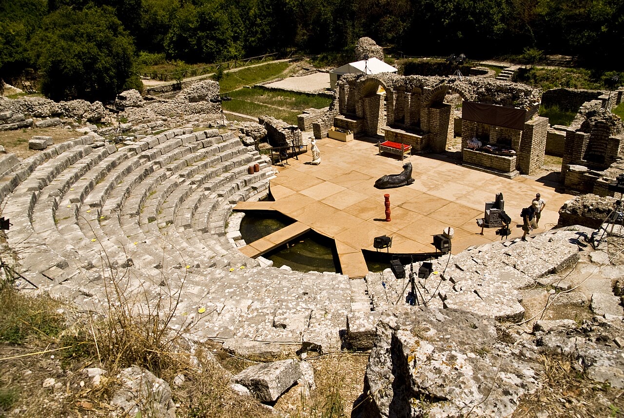
The archaeological heritage of Butrint spans from the Iron Age to the Middle Ages and is considered one of the most important sites in Albania. Extant monuments include city walls, a late-antique baptistery, a great basilica, a Roman theatre, and two castles. In 1992, the site was inscribed on the UNESCO World Heritage List. The lagoon is additionally recognised under the Ramsar Convention as a wetland of international importance.
The Roman theatre is among the best preserved structures at Butrint. It is situated below the Acropolis and faces the Vivari Channel. Construction is dated to the 3rd century BC, possibly incorporating the walls of an earlier, smaller theatre. During the Roman period, the building was enlarged and renovated: boxes for upper-class spectators were added above the two entrances, and the auditorium was expanded to accommodate a growing population.
The Lion Gate dates to the 4th century BC and is one of six former entrances to the city. Its inscribed decoration shows a lion in the act of devouring a bull; the lion is identified as representing the city's inhabitants and the bull as their enemies. The passage through the gate was made deliberately narrow to restrict the number of people who could enter simultaneously. The Castle of Ali Pasha Tepelena stands on a small island at the mouth of the Vivari Channel. It is named after Ali Pasha of Ioannina, the Albanian ruler who controlled the Pashalik of Yanina. The structure is rectangular with battered walls, two battered round towers with cannons on the seaward side, and two irregularly sized battered square towers with firing loops.
The Ksamil Islands lie in the western part of the park and are described as rocky. They are accessible only by boat, although two of the islands are connected to each other by a narrow strip of sand. The waters around the islands are frequented by the short-beaked common dolphin and common bottlenose dolphin.
The islands fall within the park's protected mandate. In 2010, national authorities demolished more than 200 illegal structures in the adjacent settlement of Ksamil that were judged to compromise the integrity of the park; at the time of reporting, the debris from those demolitions had not been fully cleared.
30年平均値: Butrint National Park, 1994〜2023年の日次ERA5再解析データからこのアトラス用に算出。これらは長期平均値であり、予測ではありません。個々の年は大幅に異なる場合があります。
最も暖かい月は August (日中の平均最高気温 31°C), 最も寒い月は January (夜間の平均最低気温 6°C), 最も雨が多い月は November (205 mm). 年間総降水量の平均は 1,204 mm.
| 月 | 最高気温 | 最低気温 | 降水量 | 降水日数 | 日照時間/日 |
|---|---|---|---|---|---|
| January | 12°C | 6°C | 139 mm | 12 | 7.2 h |
| February | 13°C | 6°C | 120 mm | 11 | 8.0 h |
| March | 15°C | 7°C | 109 mm | 11 | 9.6 h |
| April | 18°C | 10°C | 75 mm | 10 | 10.9 h |
| May | 23°C | 15°C | 51 mm | 7 | 12.1 h |
| June | 27°C | 19°C | 27 mm | 4 | 13.6 h |
| July | 30°C | 22°C | 13 mm | 2 | 13.8 h |
| August | 31°C | 22°C | 21 mm | 3 | 12.9 h |
| September | 26°C | 19°C | 110 mm | 8 | 10.6 h |
| October | 22°C | 15°C | 146 mm | 10 | 9.1 h |
| November | 17°C | 11°C | 205 mm | 13 | 7.1 h |
| December | 14°C | 7°C | 187 mm | 13 | 6.5 h |
出典: ERA5 reanalysis via Open-Meteo, 1994–2023 · 「最高気温」および「最低気温」は日平均最高・最低気温です。「降水日数」は降水量が1mm以上の日数を計上しています。 JSONで取得
これらはアトラス内の実際の関係性です——この場所に近い地点と、実際に関連する項目です。汎用的な推薦は含まれていません。
A Greek, Roman, Byzantine, Venetian and Ottoman city layered on one wooded peninsula — Albania's first UNESCO site.
The Ionian resort town facing Corfu, and the arrival point for most visitors to southern Albania.
Four small islands and very clear shallow water; the most photographed and most crowded stretch of the Albanian coast.
A Greek, Roman, Byzantine, Venetian and Ottoman city layered on one wooded peninsula — Albania's first UNESCO site.
Four small islands and very clear shallow water; the most photographed and most crowded stretch of the Albanian coast.
上記の「詳細解説」のセクションは、以下に示す出典記事を全文精読したうえで、このアトラスのために執筆されました (12,791 文字). これらは当該文書に基づくAI支援による調査であり、このページの精選された事実と照合済みです。重要な事項については必ず一次情報源で確認してください。
このページに誤りがありますか? 修正は歓迎しており、原典記録と照合して確認します。何が誤っているか、また可能であれば正しい数値の出典をお知らせください。