도시 · Berat
Berat
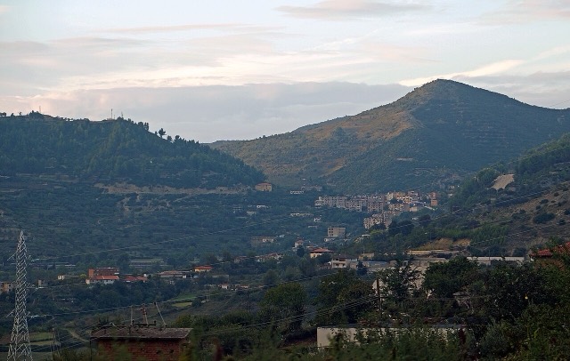
The 'city of a thousand windows': an Ottoman hill town under a still-inhabited castle, UNESCO-listed since 2008.
모든 주, 모든 해안, 모든 세기
안내 보기
알바니아가 처음이신가요? 모든 페이지는 세부 내용이 시작되기 전에, 열 살짜리 아이도 이해할 수 있는 평이한 설명으로 시작됩니다.
전문가 보기
기본 내용은 이미 알고 계신가요? 간단한 설명은 숨기고 핵심 내용만 바로 확인하세요. 이것이 기본 설정입니다.
산 · Berat County
A 2,416 m massif above Berat, and the site of an annual Bektashi pilgrimage each August.
저장
Tomorr is a big mountain above Berat. Every August thousands of Bektashi Muslims walk up it for a pilgrimage to a shrine near the top. It is also a national park.
Tomorr is a big mountain above Berat. Every August thousands of Bektashi Muslims walk up it for a pilgrimage to a shrine near the top. It is also a national park.
Mount Tomorr is a mountain chain situated in the regions of Berat and Skrapar in central Albania. Its highest point, the Çuka e Partizanit, reaches 2,416 metres (7,927 ft) above sea level, making it the highest peak in central Albania.
The mountain is one of Albania's largest water-collecting areas. It lies entirely within Tomorr National Park, which supports diverse deciduous and coniferous tree species and a wide variety of flora. Endangered fauna recorded in the park include brown bear (Ursus arctos), wolf (Canis lupus), and several birds of prey.
The mountain overlooks the town of Berat to the west. Across the valley stands Mount Shpirag, whose slopes carry furrow-like water channels. The Osum river is associated in local oral tradition with the landscape between the two massifs.
The Albanian name Tomor(r) derives from the Illyrian Tómaros, itself traced to the Proto-Indo-European root *tómhxes-, meaning 'dark'. The Illyrians regarded the mountain as the most prominent peak in southern Illyria.
Modern scholars have proposed a connection between Mount Tomorr and the Mount Amyron (Greek: Άμυρον) recorded by Stephanus of Byzantium in the 6th century AD, who cited the much earlier Hecataeus of Miletus (6th century BC). That passage states that the Dexaroi, a Chaonian tribe, lived beneath this mountain, which was probably located in the region known in Roman times as Dassaretis. The article notes that all these hypothetical connections remain uncertain.
Vibius Sequester, writing in the 4th or 5th century AD, records the mountain under the Latin name Tomarus and places it in the Roman province of Macedonia, near Apollonia. Byzantine authors knew the mountain as Tmoros (Greek: Τμόρος) or Timoros (Greek: Τίμορος).
During the reign of Byzantine Emperor Basil II, sons of Bulgarian Tsar Ivad Vladislav retreated to Tomorr after the collapse of the First Bulgarian Empire in 1018 to continue resistance against Byzantine forces. They soon surrendered after reaching an agreement that granted them substantial privileges. The last Bulgarian governor of Berat recorded at this time was a figure named Elimagos.
The 13th century brought repeated changes of overlordship. Manfred of Sicily held the area before it passed to Angevine Albania after 1271–72. By the early 14th century the fortress of Tomorr, attested under the form Timoro(n), was under Byzantine control.
In 1337, Albanian tribes in the region of Belegrita — the area of Mount Tomorr — and Kanina rose in rebellion and seized the fortress of Tomorr. Primary sources provide little detail on the uprising. John VI Kantakouzenos records that the rebels acted despite privileges previously granted to them by Andronikos III Palaiologos. Andronikos responded with an army composed largely of Turkish mercenaries, defeated the Albanians, killed many, and took prisoners. These events are noted as the first recorded movement of those Albanian tribes into Epirus.
During the Albanian-Ottoman Wars of the 15th century, the region of Mount Tomorr became a theatre of significant military activity. All local chieftains on both sides of the Tomorr mountain range were loyal to Skanderbeg. By 1457 the Ottomans had occupied a number of Albanian valleys, and an Ottoman army under Firuz Bey and Mihaloglu Ali Bey was dispatched westward with the objective of taking Kruje, Svetigrad, and Berat.
On 2 September 1457, Skanderbeg attacked the resting army of Isa Bey at Tomorr, catching the Ottomans entirely by surprise. The engagement is described as Skanderbeg's bloodiest but also his most brilliant victory. Sources record the deaths of 15,000 Ottoman soldiers, with some figures — characterised in the article as exaggerated — reaching 30,000. The Albanians also took 15,000 prisoners, captured 24 horsetails of Ottoman commanders, and seized the entire enemy camp with its contents.
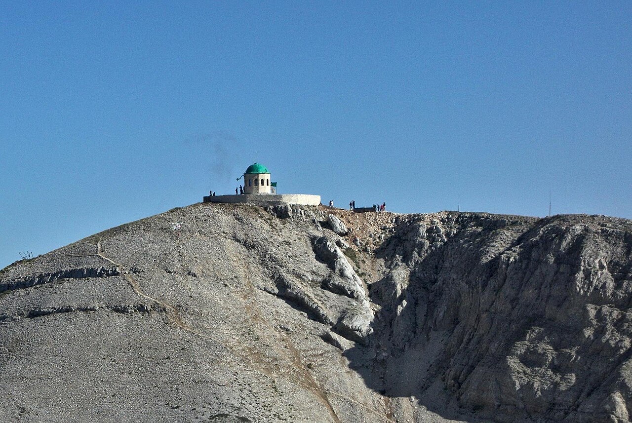
The sacredness of Mount Tomorr has been documented since the 17th century. The small round twelve-sided shrine (tyrbe) at the top of the southern peak, encircled by a stone wall, is said by Bektashis to have been built or rebuilt in the early 1880s, when the Bektashi Order was growing and taking on an Albanian nationalist character. Bektashis associated the shrine with a second tomb of Abbas ibn Ali (Albanian: Abaz Ali). Unverified sources claim the mausoleum had existed on the mountain since the 17th century; the türbe is described in the pilgrimage traditions as originally constructed in 1620.
In 1908–09 a two-room stone dervishia was built approximately 100 metres (330 ft) below the tyrbe. According to British journalist Joseph Swire, who visited in 1930, it was burned by Greek armed groups in spring 1914. A new tekke was founded and built in 1916 on the Kulmaku Mountain by Dervish Iljaz Vërzhezha, on the southeastern part of the Tomorr range, just below the old dervishia. The first recorded head of the tekke was Baba Haxhi; between 1921 and 1925 it was headed by Baba Ali Tomorri. Around 1930 approximately five dervishes were living there.
After the communist government abolished religion in Albania in 1967, pilgrimages ceased. Under the stated pretext that the peak was needed as a strategic military location, both the tyrbe and the tekke were destroyed in 1967. Following the fall of communism, the tekke was reconstructed in 1992 and the tyrbe in 2008. The tekke is currently headed by Baba Shaban.
Mount Tomorr is considered the most frequented sacred site in Albania alongside St. Anthony's Catholic Church in Laç. Both Christians and Bektashis hold annual pilgrimages on the mountain. Christians climb on Assumption Day, 15 August, to honour the Virgin Mary. The Bektashi pilgrimage runs from 20 to 25 August and honours Abbas ibn Ali.
According to Bektashi tradition, Abbas ibn Ali travelled to Albania on a white horse to save it from invaders, and returns to Mount Tomorr for five days each year — the period of the August pilgrimage — during which animal sacrifices are made and homage is paid. During this period pilgrims visit the Abbas Ali Türbe on the southern peak, believed to house his remains.
A separate Bektashi legend attributes the sanctification of the site to Haji Bektash, who, seeing Christian pilgrims ascend the mountain on 15 August, journeyed to the holy city of Karbala, exhumed an arm bone of Abbas ibn Ali, and threw it onto the peak of Mount Tomorr, thereby establishing it as the second sacred grave of Abbas ibn Ali. Folk belief also associates the mountain with Baba Tomor and Zojz in Albanian tradition, with Abbas Ali among Bektashis, and with the Virgin Mary among Christians.
The cult of Mount Tomorr features in the Rilindja period of Albanian literature. Authors including Konstantin Kristoforidhi, Naim bey Frashëri, Andon Zako Çajupi, Asdreni, Hilë Mosi, and Ndre Mjeda composed prose and poetry devoted to Father Tomor. Naim Frashëri's 1890 poetry collection Luletë e verësë ('Summer Flowers') contains a poem directly addressing Abbas Ali's presence on Tomorr.
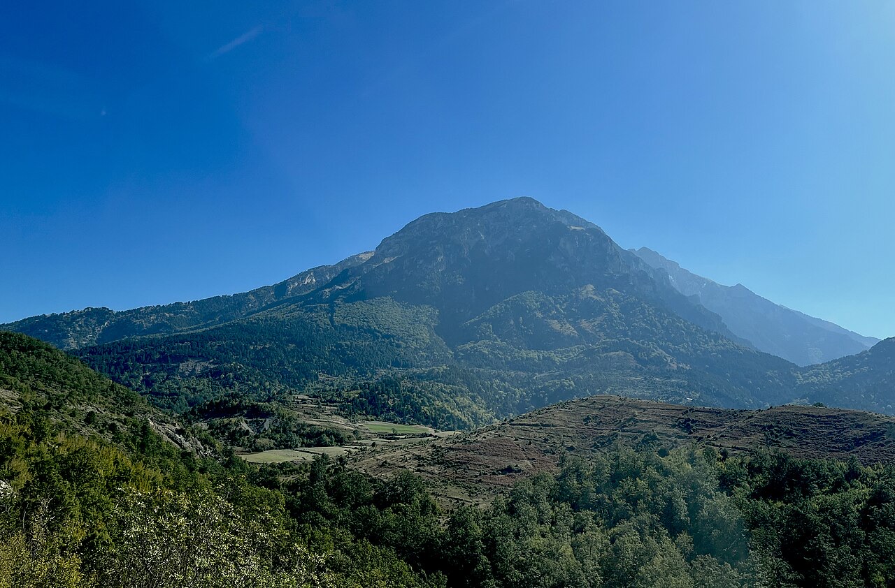
In Albanian folklore, Mount Tomorr is understood as the home of deities and is itself anthropomorphised as a deity. The legendary figure Baba Tomor is envisioned as an old giant with a long flowing white beard, with four female eagles hovering above him and perching on his snow-covered slopes. According to German folklorist Maximilian Lambertz, Baba Tomor is the remnant of an Illyrian deity.
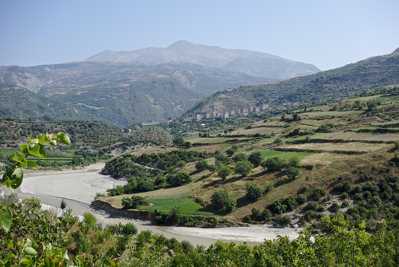
The oral tradition attached to Baba Tomor includes a detailed narrative involving his bride, the Earthly Beauty, who spends her days with her sister the Sea Beauty but is returned each evening to Tomorr by the wind. The story centres on a conflict with the neighbouring Mount Shpirag, which attempted to take over Berat while Baba Tomor was distracted. Alerted by his four guardian eagles, Baba Tomor rode out on his mule and wounded Shpirag with his scythe — the wounds said to be visible as the furrows on Shpirag's slopes. The two giants killed one another, and the maiden's tears became the Osum river. A mark said to be the hoof-print of Baba Tomor's mule is reportedly visible near the village of Sinja.
The pre-Islamic and pre-Christian dimensions of the cult are noted in the article. Local inhabitants, both Christians and Muslims, are recorded as swearing solemn oaths 'By Him of Tomorr' and 'By the Holy One of Tomorr' and practising ritual animal sacrifices, apparently long before the shrine of Abbas Ali was connected to the site. There is also an oral tradition concerning a Church of Saint Marie on the mountain, though the article notes the site lacks concrete evidence of any ancient pre-Muslim shrine.
가장 더운 달은 August (일 최고 기온 평균 22°C), 가장 추운 달은 January (일 최저 기온 평균 -7°C), 가장 강수량이 많은 달은 December (119 mm). 연평균 강수량은 1,066 mm.
| 월 | 최고 | 최저 | 강수량 | 강수일 | 일조 시간 |
|---|---|---|---|---|---|
| January | 2°C | -7°C | 101 mm | 11 | 6.8 h |
| February | 3°C | -6°C | 93 mm | 10 | 7.8 h |
| March | 6°C | -4°C | 104 mm | 12 | 9.2 h |
| April | 10°C | -1°C | 104 mm | 15 | 10.4 h |
| May | 14°C | 3°C | 94 mm | 14 | 11.7 h |
| June | 18°C | 7°C | 66 mm | 10 | 13.4 h |
| July | 22°C | 10°C | 40 mm | 7 | 13.7 h |
| August | 22°C | 10°C | 40 mm | 7 | 12.7 h |
| September | 17°C | 6°C | 88 mm | 10 | 10.5 h |
| October | 12°C | 2°C | 100 mm | 9 | 9.0 h |
| November | 7°C | -2°C | 116 mm | 11 | 7.0 h |
| December | 3°C | -6°C | 119 mm | 12 | 6.3 h |
출처: ERA5 reanalysis via Open-Meteo, 1994–2023 · "최고" 및 "최저"는 일 최고·최저 기온의 평균값입니다. "강수일"은 강수량이 1mm 이상인 날의 수입니다.
도시 · Berat
The 'city of a thousand windows': an Ottoman hill town under a still-inhabited castle, UNESCO-listed since 2008.
협곡 · Berat
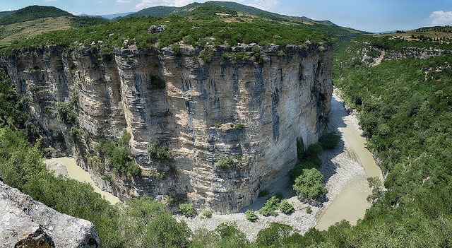
A 26 km limestone gorge up to 80 m deep, run by raft in spring and walked in late summer.
제목
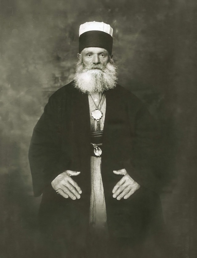
A Sufi order whose world headquarters has been in Tirana since 1925, with a major shrine on Mount Tomorr.
이 페이지에 오류가 있습니까? 수정 제안을 환영하며, 출처 기록과 대조하여 검토합니다. 잘못된 내용과 가능하다면 올바른 수치의 출처를 알려 주십시오.