Stad · Korçë
Korçë
The highland city of serenades, the first Albanian-language school, and the country's oldest brewery.
Elke provincie, elke kust, elke eeuw
Begeleidende weergave
Nieuw in Albanië? Elke pagina begint met een uitleg in eenvoudige taal die u aan een tienjarige zou kunnen voorlezen, voordat de details beginnen.
Expertweergave
U kent de basis al. Meteen naar de kern, met de eenvoudige uitleg verborgen. Dit is de standaardinstelling.
Meer · Korçë County
A high tectonic lake where Albania, Greece and North Macedonia meet, draining underground into Ohrid.
Opslaan
Prespa is a high lake shared by three countries. Its water leaks out through the limestone underground and comes up again in Lake Ohrid, about 150 metres below.
Prespa is a high lake shared by three countries. Its water leaks out through the limestone underground and comes up again in Lake Ohrid, about 150 metres below.
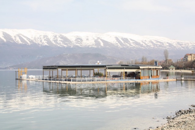
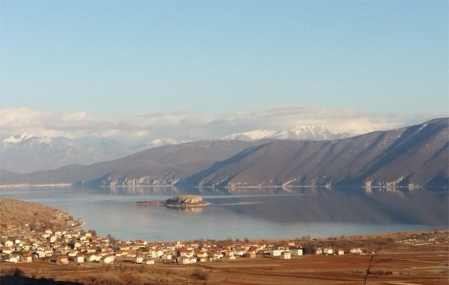
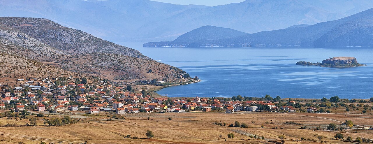
Lake Prespa sits at the meeting point of three countries: North Macedonia, Albania, and Greece. It is not a single body of water but a system of two lakes — Great Prespa Lake and Little Prespa Lake — connected by a short canal and separated by an isthmus on Greek territory. At an elevation of 853 metres (2,799 ft), they are the highest tectonic lakes in the Balkans.
The largest town in the broader Prespa region is Resen, located in North Macedonia. Three national parks cover parts of the surrounding land: Galičica National Park in North Macedonia, Prespa National Park in Albania, and Prespa National Park in Greece. In 2014, the Ohrid-Prespa Transboundary Biosphere Reserve, covering the Albanian and North Macedonian portions, was added to UNESCO's World Network of Biosphere Reserves.
Great Prespa Lake has a total surface area of 259 km² (100 sq mi). Of this, 176.3 km² (68.07 sq mi) falls within North Macedonia, 46.3 km² (17.88 sq mi) within Albania, and 36.4 km² (14.05 sq mi) within Greece. It is thus predominantly a North Macedonian lake by area, with Albania holding the second-largest share.
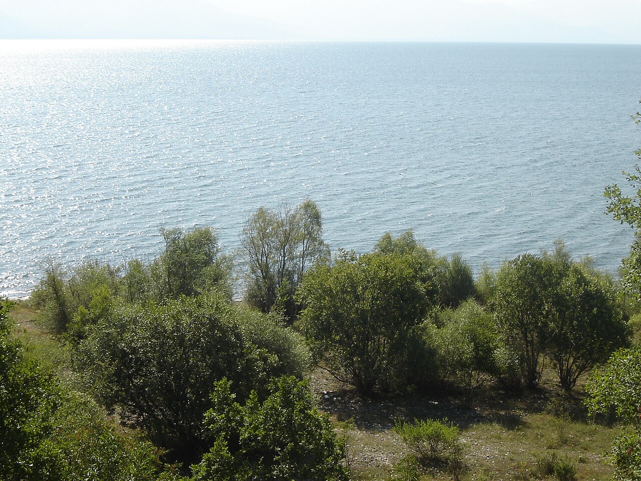
Little Prespa Lake lies to the south and has a total surface area of 46.8 km² (18.07 sq mi), the great majority of which lies within Greece. Only the westernmost tip, measuring 4.3 km² (1.66 sq mi), falls within Albania. The two lakes are separated by an isthmus approximately 4 kilometres long and 500 metres wide, located on Greek territory, which carries an embankment road connecting the village of Psarades. A short canal on the western side of the isthmus links the two lakes.
Great Prespa Lake sits in limestone country at approximately 150 metres above the level of Lake Ohrid, which lies roughly 10 kilometres to the west. Because of this elevated position in karst terrain, Great Prespa has no surface outlets. Its waters drain exclusively through underground channels in the limestone, emerging from springs that feed streams running into Lake Ohrid.
This subterranean drainage system is a defining hydrological characteristic of the lake and distinguishes it from most Balkan lakes of comparable size. The karst geology also helps explain why changes in water volume — whether from climate, abstraction, or river diversion — have measurable consequences for the lake level and surface area.
In Classical antiquity, the Prespa region formed part of ancient Lynkestis, and the two lakes were known as Little and Great Brygeis. The area's recorded medieval history includes a significant monument: in the 10th century, Tsar Samuel built a fortress and church dedicated to St. Achillius on an island named Agios Achillios in the Small Prespa Lake, on the Greek side of the border.
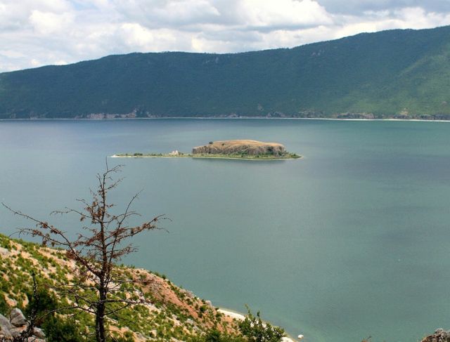
Great Prespa Lake contains two islands. The larger, within North Macedonia, is called Golem Grad (meaning 'Large Town') and also Snake Island (Zmiski Ostrov). The smaller, Mal Grad ('Small Town'), lies within Albania and is the site of a ruined 14th-century monastery dedicated to St. Peter. Both islands are uninhabited today.
The Greek portion of the Prespa Lakes region spent much of the 20th century as a militarily sensitive zone, requiring special permission for outsiders to enter. The area saw fierce fighting during the Greek Civil War, after which much of the local population emigrated due to poverty and political instability. The region saw little development until the 1970s, when it began to be promoted as a tourist destination.
In the 1970s, Albania's communist government diverted the Devoll River, which had fed Little Prespa Lake, to irrigate agricultural land in the Korçë area. The consequences for Little Prespa were severe: its surface area contracted from 450 hectares to no more than 20 hectares by 2024, with the lost area either drying out or converting to swampland. Great Prespa Lake was also affected by broader environmental pressures: between 1984 and 2020, its surface area decreased by seven percent and its volume reduced by half.
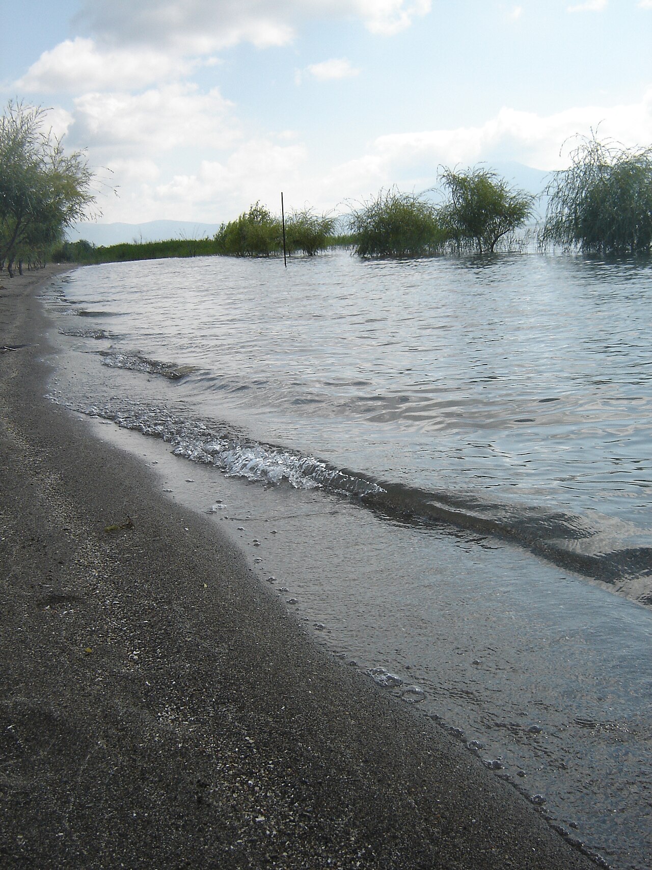
The abundance of rare fauna and flora in the Prespa region led to its declaration as a Transnational Park in 2000. Conservation activity in the area had already attracted international recognition: in 1999 the Society for the Protection of Prespa received the Ramsar Wetland Conservation Award for its work on the Lake Prespa Ramsar site. The site was formally included on the Ramsar List on 3 July 2013.
The North Macedonian portion of the lake has been designated an Important Bird Area (IBA) by BirdLife International, supporting populations of ferruginous ducks, tufted ducks, Dalmatian pelicans, and pygmy cormorants. The Albanian section of the lake is a separate but corresponding IBA, designated for the same species. The Greek southern section of the lake holds a third corresponding IBA designation.
On 17 June 2018, the shore of Great Prespa Lake became the site of the signing of the Prespa Agreement, a diplomatic accord intended to resolve the long-running Macedonia naming dispute by renaming the Republic of Macedonia to North Macedonia. The signing ceremony was held at the Greek border village of Psarades. The agreement was signed by the two foreign ministers, Nikola Dimitrov of the Republic of Macedonia and Nikos Kotzias of Greece, in the presence of their respective prime ministers, Zoran Zaev and Alexis Tsipras.
Following the ceremony, Prime Ministers Tsipras and Zaev crossed the border to the North Macedonian side of the lake to have lunch at the village of Oteševo. The move was widely described as highly symbolic: it marked the first time a Greek prime minister had set foot in the Republic of Macedonia since the country declared independence in 1991.
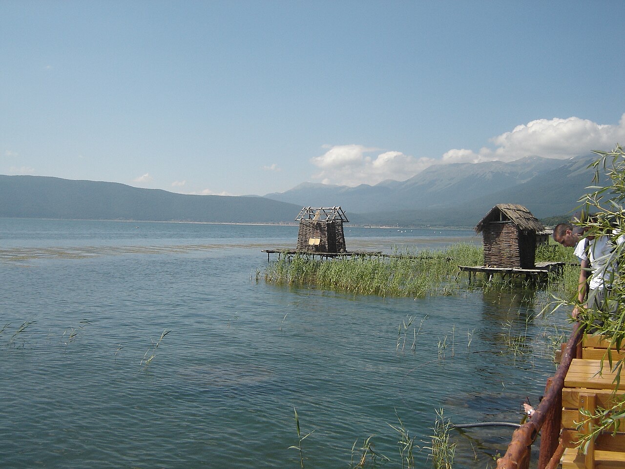
The Lake Prespa system supports only 11 known native fish species, of which 9 are endemic: Alburnoides prespensis, Alburnus belvica, Barbus prespensis, Chondrostoma prespense, Cobitis meridionalis, Pelasgus prespensis, Rutilus prespensis, Salmo peristericus, and Squalius prespensis. The remaining two species — the European eel (Anguilla anguilla) and European carp (Cyprinus carpio) — are not endemic to the lake. The lake also supports the freshwater sponge Spongilla prespensis.
The high proportion of endemic fish species relative to total species count reflects the lake's long geological isolation. The basin's protected status across all three countries is in part a response to the ecological significance of this endemism, alongside the bird populations — including Dalmatian pelicans and pygmy cormorants — that have made each national section of the lake an IBA.
De warmste maand is August (gemiddeld dagelijks maximum 26°C), de koudste is January (gemiddeld dagelijks minimum -0°C), en de natste is December (79 mm). De gemiddelde jaarlijkse neerslag bedraagt 713 mm.
| Maand | Maximum | Minimum | Neerslag | Natte dagen | Zon/dag |
|---|---|---|---|---|---|
| January | 4°C | -0°C | 72 mm | 10 | 6.3 h |
| February | 6°C | 0°C | 60 mm | 9 | 7.6 h |
| March | 9°C | 2°C | 70 mm | 11 | 8.9 h |
| April | 14°C | 6°C | 68 mm | 12 | 10.4 h |
| May | 19°C | 11°C | 65 mm | 11 | 11.5 h |
| June | 23°C | 15°C | 42 mm | 8 | 13.4 h |
| July | 26°C | 18°C | 33 mm | 6 | 13.5 h |
| August | 26°C | 19°C | 31 mm | 7 | 12.6 h |
| September | 21°C | 14°C | 53 mm | 8 | 10.3 h |
| October | 16°C | 10°C | 68 mm | 8 | 8.4 h |
| November | 11°C | 5°C | 73 mm | 9 | 6.5 h |
| December | 6°C | 1°C | 79 mm | 11 | 5.7 h |
Bron: ERA5 reanalysis via Open-Meteo, 1994–2023 · "Maximum" en "Minimum" zijn het gemiddelde dagelijkse maximum en minimum van de luchttemperatuur. "Natte dagen" telt dagen met ten minste 1 mm neerslag.
Stad · Korçë
The highland city of serenades, the first Albanian-language school, and the country's oldest brewery.
Meer · Korçë
One of Europe's oldest and deepest lakes, UNESCO-listed and home to species found nowhere else.
Beschermd gebied · Korçë
The Albanian share of a three-country park around the Great and Small Prespa lakes.
Iets onjuist op deze pagina? Correcties zijn welkom en worden gecontroleerd aan de hand van de bronregistratie. Laat ons weten wat onjuist is en, indien mogelijk, waar het juiste cijfer vandaan komt.