Ville · Tiranë
Tirana
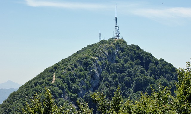
The capital: a fast-changing city of painted blocks, Ottoman survivals and new towers, under Mount Dajti.
Chaque comté, chaque côte, chaque siècle
Vue guidée
Nouveau en Albanie ? Chaque page s'ouvre sur une explication en langage clair, accessible à un enfant de dix ans, avant d'entrer dans le détail.
Vue expert
Vous connaissez déjà les bases. Directement à l'essentiel, les explications simples étant masquées. Il s'agit du réglage par défaut.
Lac · Tiranë County
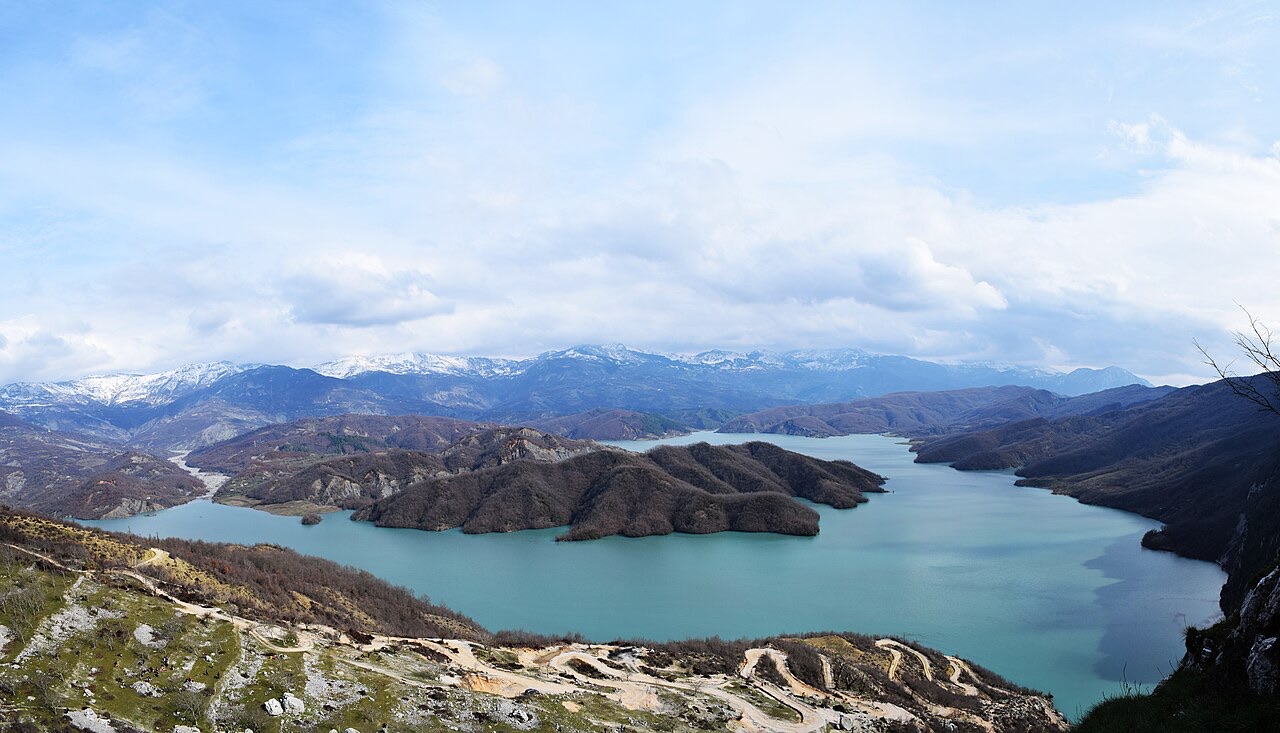
Tirana's drinking-water reservoir, ringed by limestone cliffs half an hour from the capital.
Enregistrer
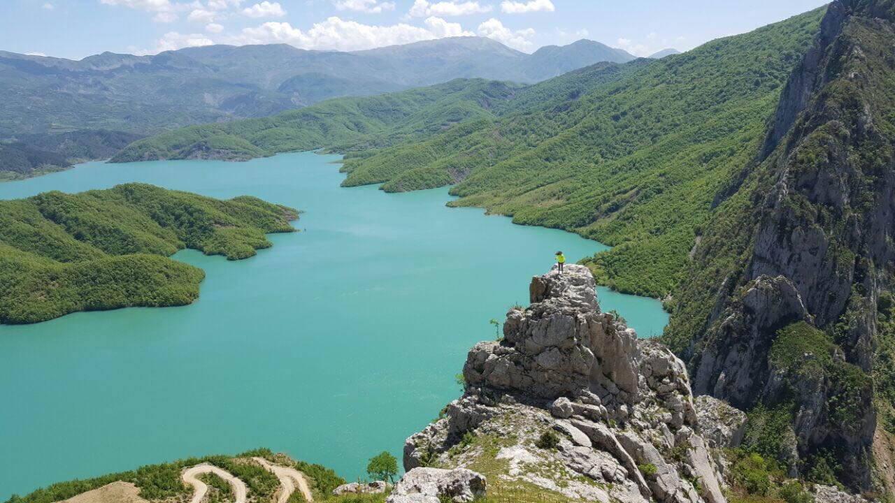
Bovilla is a reservoir north-east of Tirana that supplies much of the capital's drinking water. A short steep path leads to a rock viewpoint above it.
Bovilla is a reservoir north-east of Tirana that supplies much of the capital's drinking water. A short steep path leads to a rock viewpoint above it.
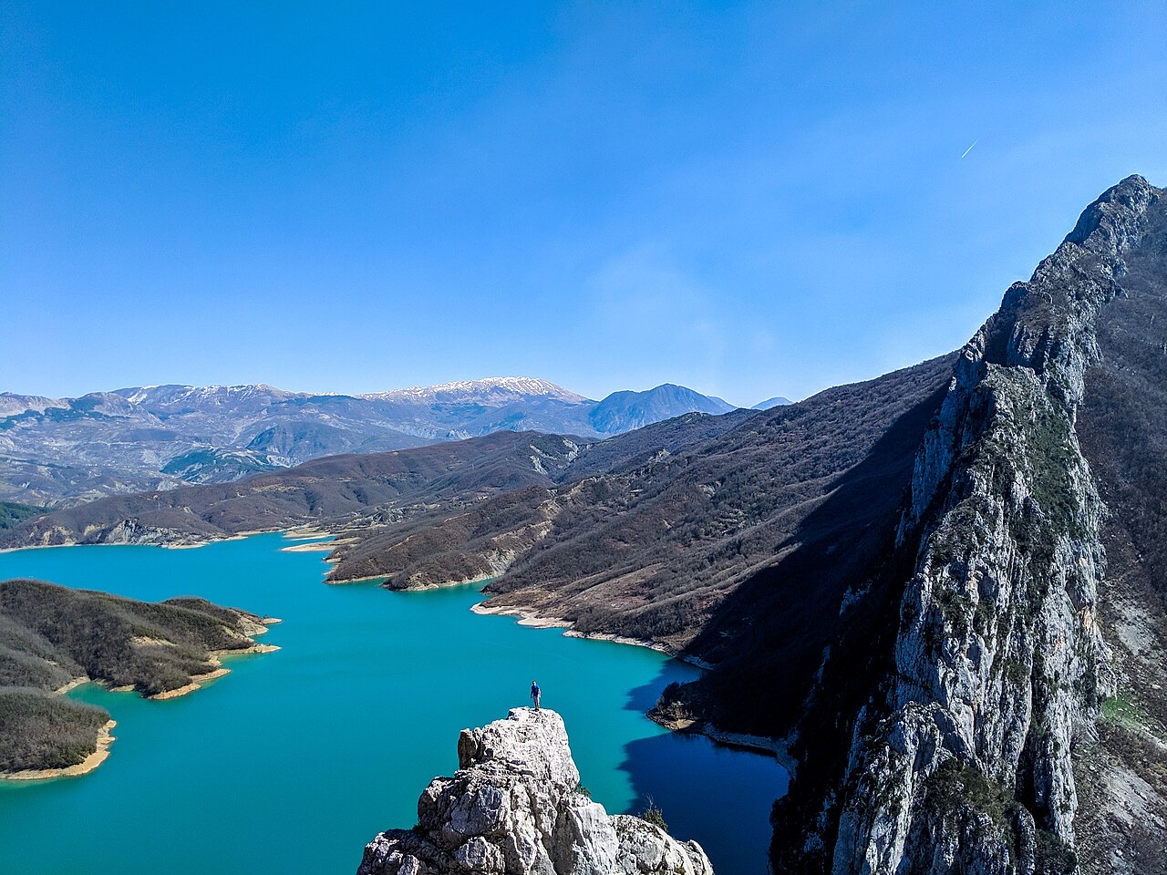
The Bovilla Reservoir (Albanian: Ujëmbledhësi i Bovillës) covers 4.6 square kilometres (1.8 sq mi) and lies approximately 14 kilometres (9 miles) northeast of Tirana and southeast of Kruja, within Dajti Mountain National Park. It sits within the Shkallë e Bovillës canyon, a deep gorge cut between Mount Maja e Gomtitit, which rises to 1,268 metres, and Mount Mali i Bjeshit, which reaches 1,239 metres.
The reservoir is formed by damming the river Tërkuzë, a tributary of the Ishëm. The Tërkuzë rises to the east of the outer chain of the coastal mountain range and drains a catchment area of roughly 98 square kilometres (38 sq mi). The dam stands at the entrance to the Shkallë e Bovillës canyon.
The dam is constructed from local conglomerate, gravel and sand — materials sourced from the immediate area. It stands 91 metres high and 130 metres long, positioned at the point where the Tërkuzë enters the canyon.
Measurements taken between 2006 and 2008 recorded the greatest depth of the reservoir at around 45 metres. The article notes this is shallower than the original design depth of 53 metres, and attributes the difference to sediment deposited by the river from upstream — though the precise volume of accumulated sediment is not quantified in the available sources.
Construction of the dam began in 1988, but work halted with the collapse of communism in Albania. The project remained suspended until October 1993, when it resumed with financial and technical support from the Italian state.
Construction was completed in 1996. The reservoir then took a further two years to fill, reaching operational capacity in 1998, at which point it began supplying drinking water to Tirana. The total elapsed time from first construction to full service was therefore a decade.
The Tërkuzë delivers approximately 105,000,000 cubic metres of water per year into the reservoir. Annual water consumption drawn from the reservoir is around 78,000,000 cubic metres — described as roughly equivalent to the total volume of the reservoir itself. Approximately 1,800 litres per second are piped from the reservoir to the water processing plant, equivalent to roughly 50 to 57 million cubic metres per year.
The steel pipeline connecting the reservoir to the processing plant at Kodra Kuqe, north of Tirana, is approximately 90 centimetres in diameter. Beyond this surface water supply, Tirana's drinking water is also supplemented by natural underground wells and artesian wells. Total required supply was estimated in 2009 at 2.8 cubic metres per second. Some water from the reservoir is additionally used for irrigation.
The water level in the reservoir varies by 7 to 10 metres across the course of a year, with the highest level reached during the rainy winter months.
The construction and flooding of the reservoir required the resettlement of approximately 400 families. These families received compensation for their land, but the article records that the resettlement was still violently opposed.
Nine remote villages, with a combined population of over 5,000 inhabitants, remain scattered in the hills surrounding the reservoir. The residents of these communities derive their livelihoods primarily from agriculture.
The reservoir supports a limited number of fish species. The Schneider (Alburnoides bipunctatus) and Barbus carp were recorded as the most common. Large numbers of grass carp have also been caught by fishermen. The silver carp (Hypophthalmichthys molitrix) has been introduced to the reservoir on multiple occasions with the specific aim of improving water quality.
In September 2001, a noticeable bad odour and taste were first detected in water drawn from the reservoir. A subsequent investigation concluded that the water quality was fundamentally sound. The source of the odour was suggested — though not definitively confirmed — to be oxygen-dependent actinobacteria and streptomyces.
Experts proposed several measures to address water quality and reduce turbidity: reforestation of the surrounding slopes to limit erosion, establishing a protected buffer zone along the reservoir's shoreline, and treating wastewater from the settlements and agricultural operations in the area. Swimming in the reservoir is prohibited.
The reservoir lies within Mount Dajti National Park, positioned a short distance south of Shtamë Pass National Park. The cliff faces around the canyon and the dam structure itself are noted as offering good climbing prospects.
The canyon through which the Tërkuzë flows — the Shkallë e Bovillës — is described as deep, with the steep terrain characteristic of the outer coastal mountain range of Albania. The surrounding landscape is primarily agricultural, as reflected in the livelihoods of the local village populations.
The Bovilla Reservoir provides most of the drinking water for Tirana, the Albanian capital, located approximately 14 kilometres to the southwest. The processing plant receiving the reservoir's water is situated at Kodra Kuqe, to the north of the city.
The reservoir does not supply all of Tirana's water needs independently. Underground wells and artesian wells supplement the surface water to meet the city's total estimated requirement of 2.8 cubic metres per second, based on a 2009 estimate. The balance between these sources is not fixed and reflects seasonal variation in reservoir levels as well as demand.
Le mois le plus chaud est August (maximum quotidien moyen 29°C), le plus froid est January (minimum quotidien moyen 1°C), et le plus pluvieux est November (169 mm). La pluviométrie annuelle totale est en moyenne de 1,393 mm.
| Mois | Max. | Min. | Pluie | Jours de pluie | Ensoleil./jour |
|---|---|---|---|---|---|
| January | 9°C | 1°C | 142 mm | 12 | 7.1 h |
| February | 11°C | 1°C | 126 mm | 11 | 8.0 h |
| March | 14°C | 4°C | 133 mm | 12 | 9.5 h |
| April | 17°C | 7°C | 128 mm | 14 | 10.7 h |
| May | 22°C | 12°C | 110 mm | 12 | 12.1 h |
| June | 26°C | 16°C | 66 mm | 8 | 13.6 h |
| July | 29°C | 18°C | 42 mm | 6 | 13.8 h |
| August | 29°C | 18°C | 46 mm | 6 | 12.9 h |
| September | 24°C | 15°C | 129 mm | 10 | 10.7 h |
| October | 20°C | 11°C | 136 mm | 10 | 9.1 h |
| November | 15°C | 6°C | 169 mm | 12 | 7.3 h |
| December | 11°C | 2°C | 166 mm | 13 | 6.6 h |
Source: ERA5 reanalysis via Open-Meteo, 1994–2023 · « Max. » et « Min. » sont les températures de l'air maximale et minimale quotidiennes moyennes. « Jours de pluie » comptabilise les jours avec au moins 1 mm de précipitations.
Ville · Tiranë
The capital: a fast-changing city of painted blocks, Ottoman survivals and new towers, under Mount Dajti.
Montagne · Tiranë
Tirana's own mountain: 1,613 m, a national park, and a 4.2 km cable car from the city edge.
Une erreur sur cette page ? Les corrections sont les bienvenues et sont vérifiées par rapport au document source. Indiquer ce qui est erroné et, si possible, d'où provient le chiffre correct.