Stadt · Shkodër
Shkodër
The cultural capital of the north: a lake, a fortress, a bicycle city and a Catholic heartland.
Jeder Kreis, jede Küste, jedes Jahrhundert
Geführte Ansicht
Neu in Albanien? Jede Seite beginnt mit einer einfachen Erklärung, die auch ein Zehnjähriger verstehen würde – bevor es ins Detail geht.
Expertenansicht
Sie kennen die Grundlagen bereits. Direkt zur Substanz, ohne die vereinfachten Erklärungen. Dies ist die Standardeinstellung.
Energiestandort · Shkodër County
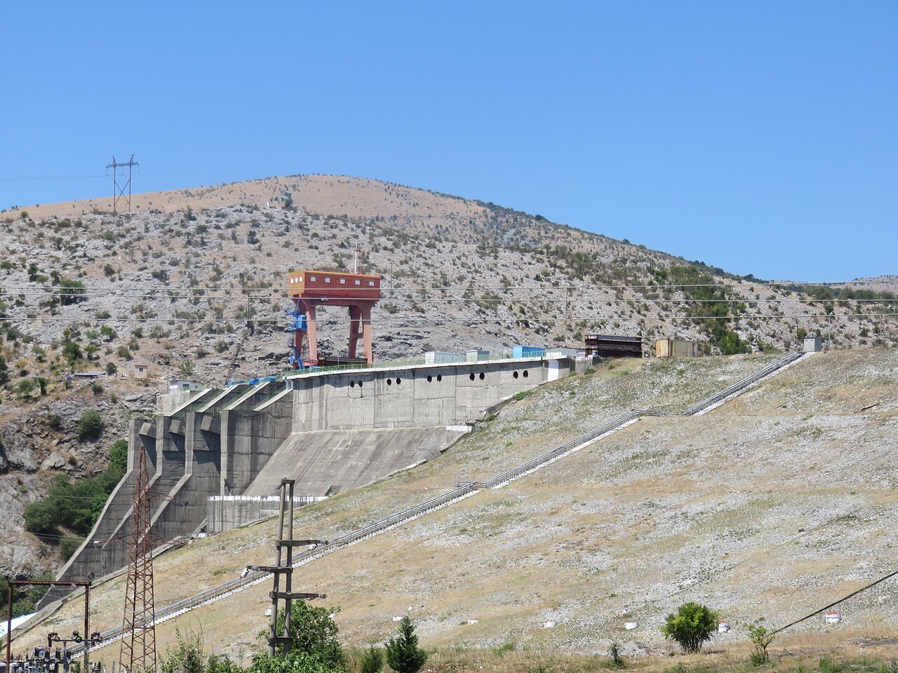
The lowest station of the Drin cascade, just upstream of Shkodër.
Speichern
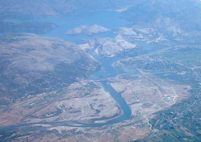
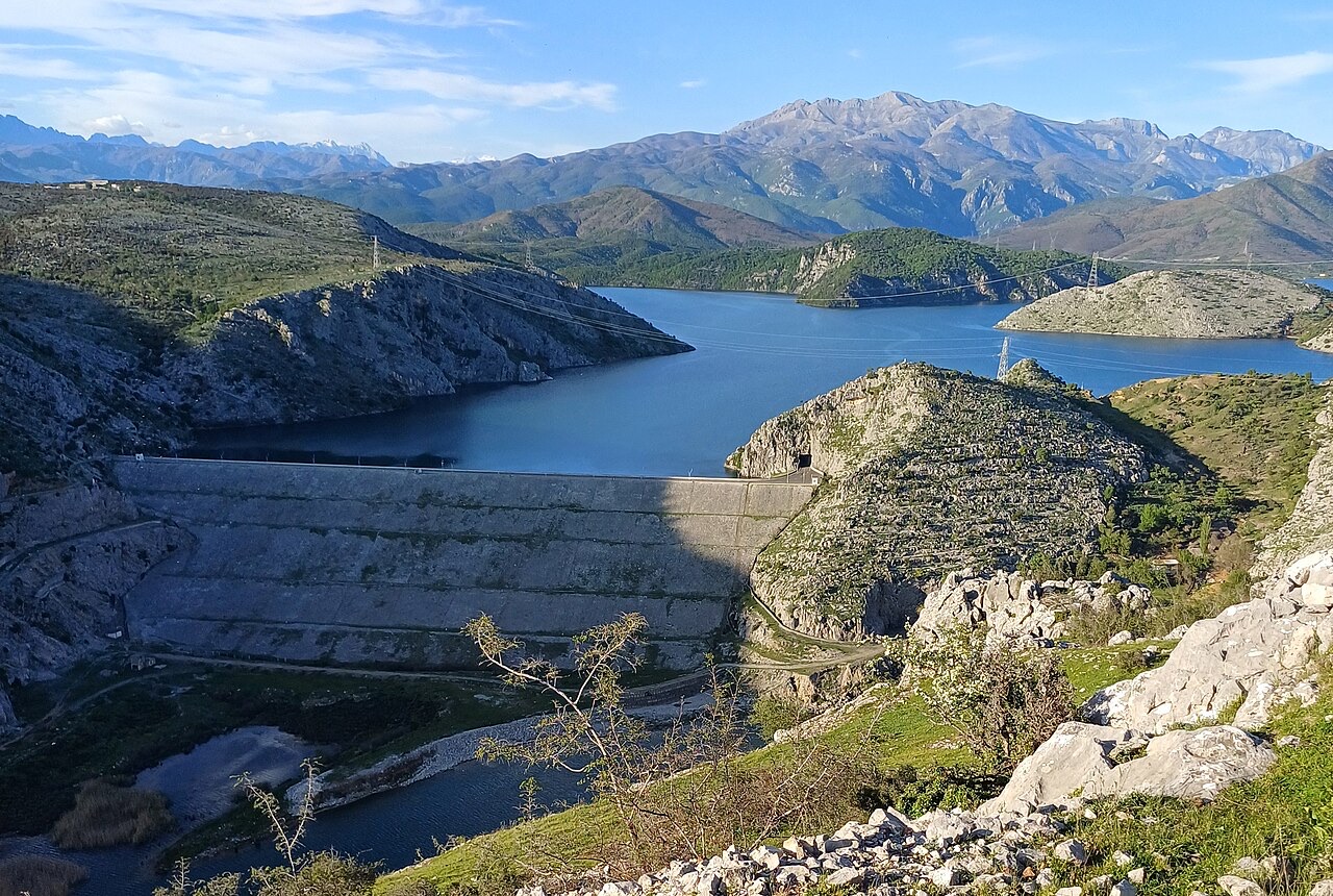
Vau i Dejës is the last of the three big dams on the Drin before the river reaches the plain.
Vau i Dejës is the last of the three big dams on the Drin before the river reaches the plain.
The Vau i Dejës Hydroelectric Power Station was built on the Drin River in northern Albania, near the settlement of Vau i Dejës, approximately 18 km from Shkodër. China agreed to provide funding for the project in September 1967, at a time when the Albanian–Soviet split had led Beijing to step in as Albania's principal external partner for major industrial development. Construction began in the autumn of 1971, during Albania's fifth five-year plan.
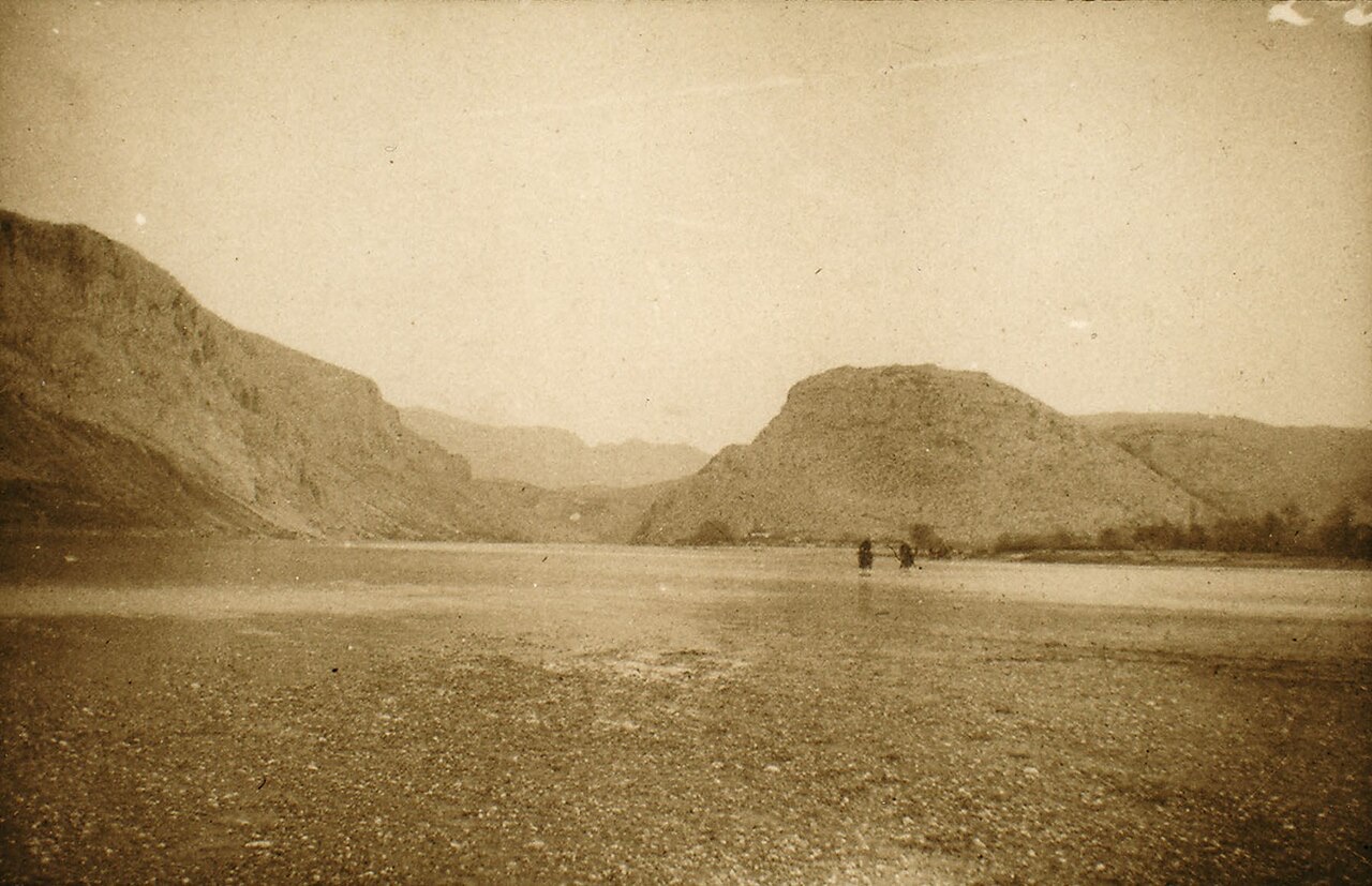
The station was completed in 1973 and was, at the time, the first dam on the Drin River and the largest hydroelectric project in Albania. Soon after completion it provided more than half of Albania's electricity. The dam was originally named the Mao Zedong Hydropower Plant, reflecting the Chinese partnership, and it was equipped throughout with Chinese technology and machinery. Its construction created Lake Vau i Dejës, expanded Albania's electricity-generating capacity, supported industrial development, and contributed to electricity exports. According to Time magazine, the plant 'brought electricity to every rural district.'
Vau i Dejës is the most downstream of three dams forming the Drin River cascade. The other two stations — Fierza and Koman — lie upstream. Together, the three plants have been described as Albania's three main hydropower units and are characterised as 'communist legacies' of the country's mid-twentieth-century industrial programme. By January 1994, the three dams collectively generated 1.5 gigawatts (GW) of electricity. Their reservoirs have also served functions beyond power generation, including tourism and transportation.
The dam sits within the Vau i Dejës gorge and reaches a maximum height of 75 m. Its reservoir, Lake Vau i Dejës, has a maximum volume of 580,000,000 m³, though its active volume is recorded at 263,000,000 m³ or, by another estimate, 0.68 km³. The lake's surface area is given as either 26 km² or 25 km², depending on the source. Privately owned hydropower units, Ashta 1 and 2, are located immediately downstream of Vau i Dejës.
The station operates five vertical Francis turbines, each rated at 50 MW, giving a total installed capacity of 250 MW. The turbines are of French origin. The plant connects to a substation through synchronous generators using three-phase electric power and transformers, alongside auxiliary devices and control systems. Average annual output is recorded at either 1,000 GWh or 870 GWh, depending on the source.
The original Chinese technology and equipment were replaced between 2003 and 2007. Mechanical equipment came from Andritz AG, while electrical and control installations were supplied by Alstom. The station's safe maximum flow for a 1-in-10,000-year event — a standard risk-assessment benchmark — is 10,000 m³/s, and its total discharge capacity is either 7,500 m³/s or 7,740 m³/s, depending on the source.
A technical report published by the Albanian Power Corporation in 2023 found that the equipment was outdated and that some of it was in extremely poor condition. While no failures had yet occurred, the report warned that interruptions to electricity generation were a future risk. This assessment led to the undertaking of the CONNECTA2 project in 2025, aimed at producing a rehabilitation plan. A completed rehabilitation is projected to generate 74 GWh more per year and bring in an additional 5.4 million euros in annual revenue.
Vau i Dejës has experienced repeated flooding that has affected the area around Shkodër. The most severe episode on record occurred in January and December 2010, when water loads in the Buna River reached 3,600 m³/s and 4,000 m³/s respectively. In 2018, heavy rainfall, a sudden rise in temperatures, and increased water flow brought the reservoir close to capacity again, forcing the dam to release water; payments were subsequently made to Shkodër for flood damage. As of 2026, the dam continues to cause floods and soil erosion in Lake Koman.
Flood releases through the station's floodgates, combined with non-use of the drainage system and the influence of upstream dams, have prevented the deposition of sediments and solid materials carried by the river, resulting in coastal erosion. Wastewater and flooding caused by heavy year-round rainfall are identified as the station's main environmental problems; solid waste pollution is considered more prevalent at upstream locations. Road deterioration in the area has led to companies disposing of waste into Lake Vau i Dejës and local rivers. The area around the plant is described as sparsely populated as of 2026.
In 2010, the fish species Styzostedion lucioperca, classified as invasive in Albania, was found in Lake Vau i Dejës. It subsequently spread into the Drin River. The suspected cause was flooding events that led dam management to open the spillways, providing the fish with a passage into the lake.
In 2018, the Albanian Power Corporation submitted a proposal to the Ministry of Transport and Infrastructure to construct a 12.9 MW floating photovoltaic plant on the station's reservoir. In April 2021, the European Bank for Reconstruction and Development approved a loan of €9.1 million for the project — described as the first loan of its kind from an international financial institution for a floating solar installation. Earlier reporting had cited the proposed loan amount as either €9.5 million or €9.75 million. The bank stated that the floating solar addition would reduce Albania's reliance on hydroelectric revenue.
The floating panels would cover 11.8 ha of the reservoir, and at the time of approval an Environmental and Social Due Diligence process was ongoing to assess potential impacts. The photovoltaics were expected to prevent algae growth, reduce water evaporation, and improve water quality. The completed solar installation at Qyrsaq, one of the station's three dams, has a capacity of 5.1 MW and an annual output of 7 GWh, occupying 2.5 ha of the 3.2 ha available on that dam.
Plans also existed as of 2023 for a further installation at Zadeja dam, rated at 8.25 MW and spanning 40 ha of the 48.6 ha available, using a combination of ground-mounted and floating panels. A procurement bid covering design, engineering, construction, commissioning, and two years of maintenance closed on 3 July 2023. The Albanian Power Corporation valued the investment at €7.6 million excluding value-added tax. In 2024, Masdar was selected as contractor, establishing a joint venture with the Albanian Power Corporation. In total, the floating solar project was described as the largest of its kind in Europe as of 2023, with 12.9 MW of peak capacity, 17.6 GWh of projected average annual output, and coverage of approximately 0.45% (11 ha) of Lake Vau i Dejës.
In 2022, Albania's Minister of Infrastructure and Energy, Belinda Balluku, announced plans to develop a wind power plant within the Vau i Dejës site alongside the solar projects already under development. By 2023 the combined scheme was described as a potential first sufficiently large-scale hybrid plant integrating solar, hydro, and wind generation for utility-scale use, though its completion was still pending. Hybrid power plants were noted at the time to be relatively new but growing in prevalence, with most existing examples combining fossil fuels rather than multiple renewable sources.
The rationale cited for combining wind and solar at Vau i Dejës was that wind turbines generate power at night and in winter, periods when solar output is lower, thereby reducing the overall intermittency of generation. Hybrid plants of this type are also noted to provide a more stable energy supply, which can reduce grid and storage costs for investors. The development of the floating and ground-mounted photovoltaics was characterised as part of a broader Albanian trend of energy diversification, driven by the country's vulnerability to droughts that reduce hydroelectric output.
In 2025, the Agence Française de Développement and the Albanian Power Corporation signed a memorandum on the development of the Drin River's dams, covering Koman, Fierza, and Vau i Dejës. France's focus was on modernising existing energy infrastructure through technical assistance, with the goals of developing storage capacity, mitigating flooding, and optimising electricity generation. The agreement reflected France's increasing involvement in Albania's energy sector over the preceding five years.
Der wärmste Monat ist August (mittleres tägliches Maximum 31°C), der kälteste ist January (mittleres tägliches Minimum 2°C), und der regenreichste ist December (227 mm). Der mittlere jährliche Gesamtniederschlag beträgt 1,741 mm.
| Monat | Maximum | Minimum | Niederschlag | Regentage | Sonne/Tag |
|---|---|---|---|---|---|
| January | 10°C | 2°C | 191 mm | 13 | 6.6 h |
| February | 11°C | 3°C | 168 mm | 12 | 7.5 h |
| March | 14°C | 5°C | 169 mm | 12 | 9.1 h |
| April | 18°C | 9°C | 157 mm | 13 | 10.3 h |
| May | 23°C | 14°C | 117 mm | 12 | 11.8 h |
| June | 27°C | 18°C | 63 mm | 7 | 13.4 h |
| July | 30°C | 21°C | 43 mm | 5 | 13.6 h |
| August | 31°C | 21°C | 48 mm | 5 | 12.7 h |
| September | 25°C | 17°C | 160 mm | 9 | 10.4 h |
| October | 20°C | 12°C | 173 mm | 10 | 8.8 h |
| November | 16°C | 8°C | 227 mm | 13 | 6.9 h |
| December | 11°C | 4°C | 227 mm | 14 | 6.1 h |
Quelle: ERA5 reanalysis via Open-Meteo, 1994–2023 · „Maximum" und „Minimum" sind das mittlere tägliche Temperaturmaximum bzw. -minimum. „Regentage" zählt Tage mit mindestens 1 mm Niederschlag.
Stadt · Shkodër
The cultural capital of the north: a lake, a fortress, a bicycle city and a Catholic heartland.
See · Shkodër
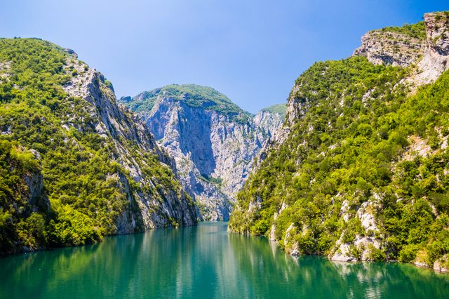
A 34 km reservoir in a gorge so narrow the ferry crossing is treated as a scenic journey in its own right.
Industrie
Electricity almost entirely from hydropower — which makes supply depend on rainfall.
Fluss · Shkodër
Albania's longest river and the backbone of its electricity system, dammed three times in the north.
Kleinstadt · Shkodër
The town beside the lowest dam of the Drin cascade, east of Shkodër.
Etwas falsch auf dieser Seite? Korrekturen sind willkommen und werden gegen den Quelldatensatz geprüft. Bitte mitteilen, was falsch ist und, wenn möglich, woher die richtige Angabe stammt.