ビーチ · Vlorë
Gjipe Beach
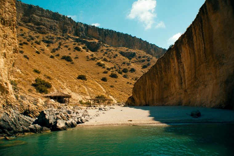
A pebble beach at the mouth of a limestone canyon, reachable only on foot or by boat.
すべての県、すべての海岸、すべての世紀
ガイドビュー
アルバニアを初めて知る方へ。各ページは、詳細に入る前に、10歳の子どもにも読み聞かせられる平易な説明から始まります。
エキスパートビュー
基本知識はすでにお持ちの方向け。平易な説明を非表示にし、内容を直接表示します。これがデフォルトです。
峡谷 · Vlorë County
A narrow limestone slot that meets the sea at Gjipe beach — the Riviera's one true canyon.
保存
Gjipe Canyon is a narrow crack in the rock that runs down to the sea. Walkers follow it to reach the beach at the bottom.
Gjipe Canyon is a narrow crack in the rock that runs down to the sea. Walkers follow it to reach the beach at the bottom.
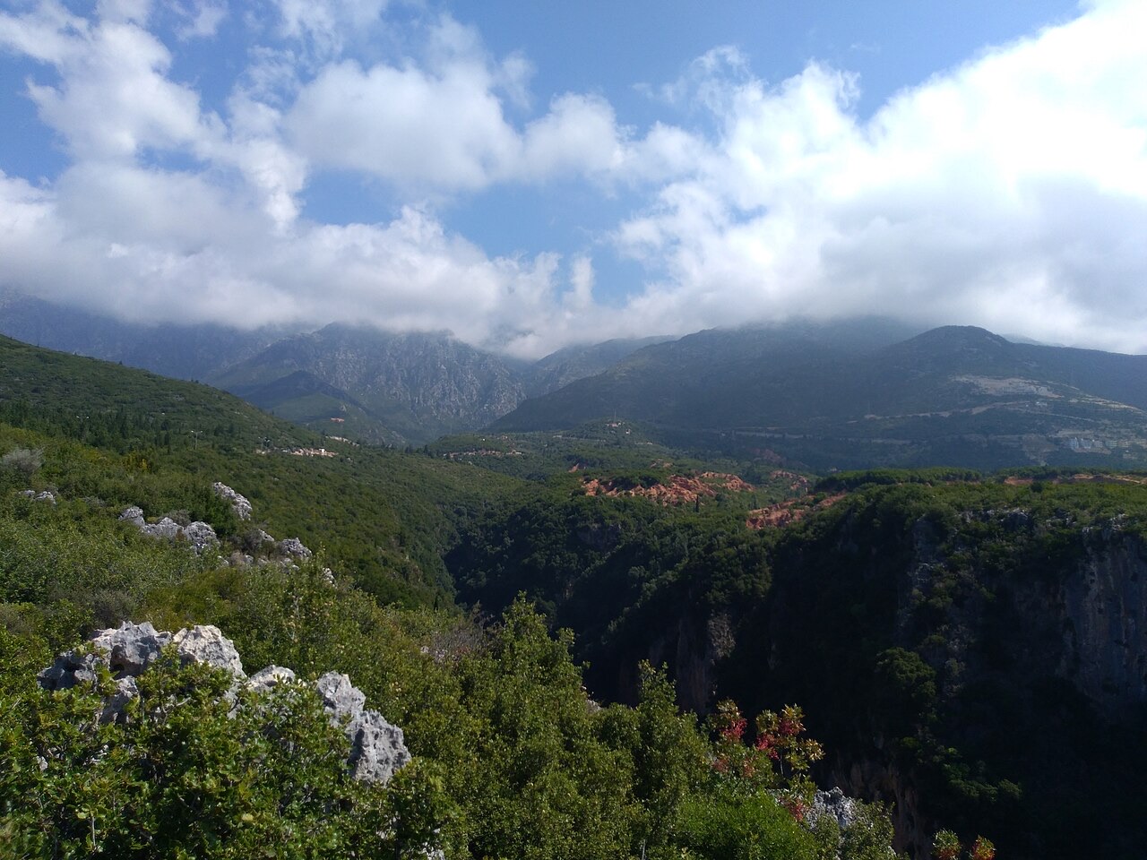
Gjipe Canyon (Albanian: Kanioni i Gjipesë) is a calcareous canyon and bay situated between the coastal settlements of Dhërmi and Vuno in Vlorë County, southern Albania. It lies at the transition zone between the Adriatic Sea and the Ionian Sea, placing it within the broader coastal stretch known as the Albanian Riviera.
The canyon extends 800 metres (2,600 ft) in length and varies in width between 10 metres (33 ft) and 20 metres (66 ft). This narrow passage was formed by the erosive action of a brook flowing through the gorge, which cut through the calcareous rock over time. Rock formations, including a number of caves, line the canyon walls along its course.
The canyon represents a narrow strait carved primarily by the activity of a brook running through its confined pass, with the Ionian Sea also contributing to its formation. The rock is calcareous in character, consistent with the limestone geology widespread across the Albanian coastal ranges.
The canyon's narrow profile — at points only 10 metres wide — reflects sustained erosion through a geologically resistant but soluble rock type. The resulting cave formations along its walls are a direct product of this long-term chemical and mechanical weathering process.
In phytogeographic terms, Gjipe Canyon belongs to the Illyrian province of the circumboreal region within the boreal Kingdom. It falls entirely within the Illyrian deciduous forests terrestrial ecoregion, which is itself part of the broader Palearctic Mediterranean forests, woodlands, and scrub biome.
Among the vegetation present, the carob and olive are described as particularly significant elements. Both species have been cultivated or harvested in Albania since antiquity, and their presence in the canyon reflects the continuity of a Mediterranean plant community suited to the local climate and proximity to the sea.
Gjipe Canyon has been recognised as an Important Plant Area (IPA) of international importance by Plantlife, the international conservation organisation. This designation reflects the canyon's support for a number of rare and endemic plant species.
The IPA status places Gjipe Canyon within a framework of internationally significant botanical sites. The combination of its specific coastal landscape and local climatic conditions is identified as a primary factor enabling the diversity and rarity of its plant life.
The canyon contains shallow coastal waters that provide habitat for the loggerhead sea turtle (Caretta caretta), described in the article as the most familiar turtle species in the Mediterranean Sea. The particular climate and seascape of the site are cited as factors favouring the development of a broad range of faunal species.
Three cetacean species have been identified in the waters of the canyon: the Cuvier's beaked whale, the common bottlenose dolphin, and the short-beaked common dolphin. The article notes that dolphin sightings in the region are not uncommon.
The canyon is described as among the most visited natural attractions along the Albanian Riviera, a status attributed to its position at the transition zone between the Adriatic and Ionian seas and the character of its coastal scenery.
Despite visitor interest, the site carries formal conservation significance through its IPA designation, which reflects ecological and botanical values independent of its popularity. No specific visitor infrastructure, access routes, or management arrangements are described in the available source material.
最も暖かい月は August (日中の平均最高気温 28°C), 最も寒い月は January (夜間の平均最低気温 5°C), 最も雨が多い月は November (255 mm). 年間総降水量の平均は 1,652 mm. 海水温は8月にピークを迎え、約 26°C.
| 月 | 最高気温 | 最低気温 | 降水量 | 降水日数 | 日照時間/日 | 海水温 |
|---|---|---|---|---|---|---|
| January | 10°C | 5°C | 190 mm | 13 | 7.1 h | 17°C |
| February | 11°C | 5°C | 163 mm | 12 | 8.0 h | 15°C |
| March | 13°C | 6°C | 156 mm | 13 | 9.5 h | 15°C |
| April | 16°C | 9°C | 117 mm | 14 | 10.8 h | 16°C |
| May | 21°C | 14°C | 93 mm | 12 | 12.1 h | 19°C |
| June | 25°C | 18°C | 59 mm | 8 | 13.6 h | 24°C |
| July | 28°C | 20°C | 30 mm | 6 | 13.8 h | 26°C |
| August | 28°C | 21°C | 39 mm | 6 | 12.9 h | 26°C |
| September | 24°C | 17°C | 138 mm | 11 | 10.7 h | 26°C |
| October | 20°C | 14°C | 173 mm | 11 | 9.2 h | 25°C |
| November | 16°C | 10°C | 255 mm | 14 | 7.1 h | 21°C |
| December | 12°C | 6°C | 238 mm | 14 | 6.5 h | 18°C |
出典: ERA5 reanalysis via Open-Meteo, 1994–2023 · 「最高気温」および「最低気温」は日平均最高・最低気温です。「降水日数」は降水量が1mm以上の日数を計上しています。
ビーチ · Vlorë
A pebble beach at the mouth of a limestone canyon, reachable only on foot or by boat.
村 · Vlorë
An old white village on the slope above one of the Riviera's longest pebble beaches.
このページに誤りがありますか? 修正は歓迎しており、原典記録と照合して確認します。何が誤っているか、また可能であれば正しい数値の出典をお知らせください。