Lake · Shkodër
Lake Shkodër
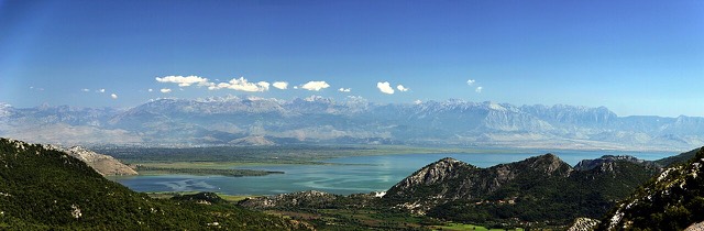
The largest lake in southern Europe, shared with Montenegro and a major bird wintering ground.
Every county, coast and century
Guided view
New to Albania? Every page opens with a plain-language explanation you could read to a ten-year-old, before the detail begins.
Expert view
You already know the basics. Straight to the substance, with the simple explanations hidden. This is the default.
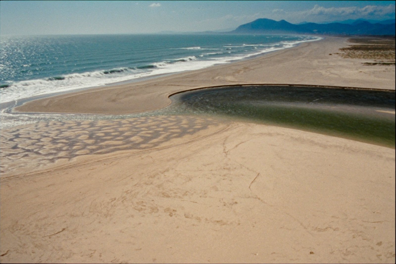
Beach · Shkodër County
A very shallow, wide sand beach at the Buna delta, beside a protected lagoon.
Save
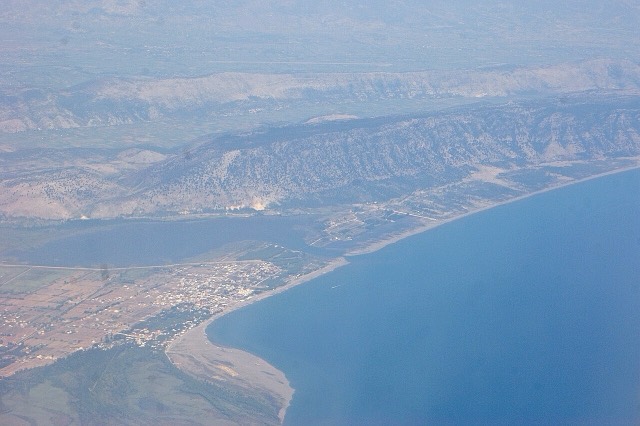
Velipojë is a wide sandy beach in the far north where the Buna river meets the sea. The water stays shallow a long way out.
Velipojë is a wide sandy beach in the far north where the Buna river meets the sea. The water stays shallow a long way out.
Velipojë sits at the mouth of the Buna River, the only navigable river in Albania, where it empties into the Adriatic Sea. The estuary simultaneously forms Albania's natural border with Montenegro, giving the settlement a position at the junction of river, sea, and international boundary.
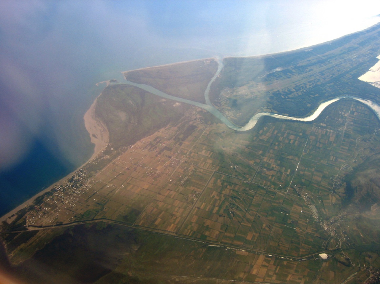
The administrative unit of Velipojë has a population of around 10,000, distributed across several small settlements, with the town of Velipojë itself being the largest. The chief city of northern Albania, Shkodër, lies approximately 30 km (19 mi) inland and has historically been the primary urban centre whose inhabitants frequent the area.
Since 2005, Velipojë has fallen within the boundaries of the Buna River–Velipoja Protected Landscape, a designation that formally recognises the ecological significance of the surrounding territory, which combines seacoast, river estuary, heathland, pine woods, farmland, and mountain scenery.
The name Velipojë derives from the Slavic word Velikopoje, which translates into English as 'Great Plain'. According to the article, the name is thought to have been applied during one of the multiple periods in which Slavic peoples invaded the territory of present-day Albania.
The Albanian definite form of the name is Velipoja, and both forms appear in common usage in references to the village, the beach, and the protected landscape that bears its name.
Velipojë was formerly a municipality in its own right within Shkodër County in northwestern Albania. As a result of the 2015 local government reform, it lost that status and became a subdivision of the enlarged municipality of Shkodër.
The population recorded at the 2011 census was 5,031. The broader administrative unit, encompassing the town and surrounding smaller settlements, had a population of around 10,000 at the time of writing. The article notes that the area has historically been poor and has experienced significant emigration, consistent with broader patterns across Albania.
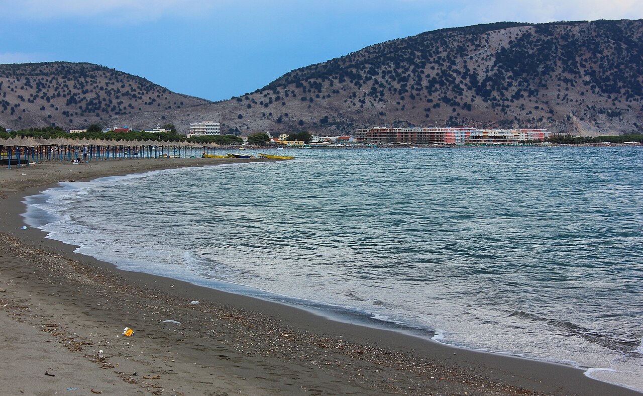
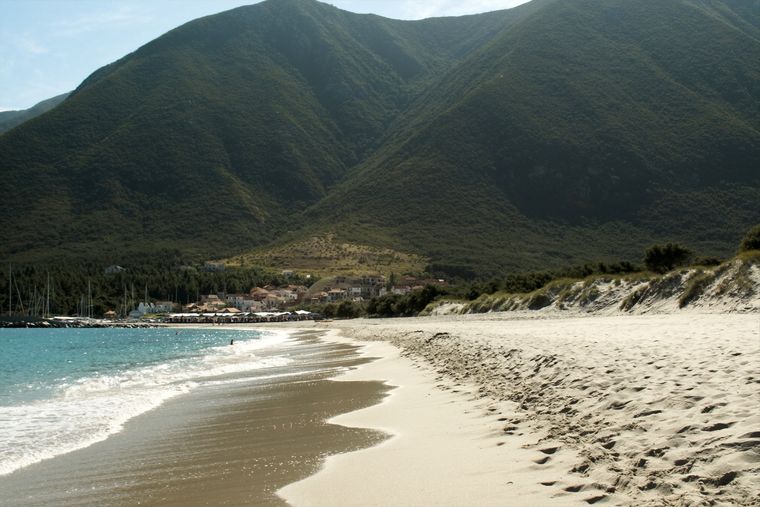
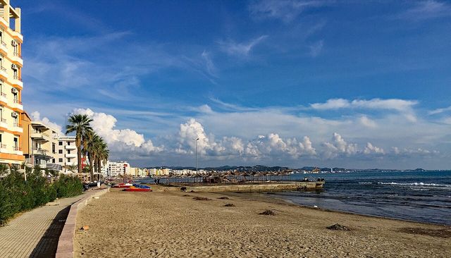
The beach at Velipojë is described as long and sandy, with a seaside promenade. The article characterises it as 'curative,' though no further clinical or scientific detail is given to support that description. It draws visitors primarily during summer and is particularly popular among residents of Shkodër.
The village hosts the Land and Sand Art Festival, an event focused on carving sand sculptures along the beach. No founding date or frequency is given in the source article beyond its existence as a recurring local cultural event.
In recent years, several conservation projects have been introduced with the dual aim of protecting the environment, including the marine life of the Buna River, and promoting ecological tourism. The area is noted as a significant site for birdwatching, fishing, and game shooting.
The local economy rests on three main activities: agriculture, tourism, and fishing. The article also records recent efforts to establish fish farming as an additional economic activity, though the scale and progress of those efforts are not quantified.
A highway linking Shëngjin with Velipojë was under construction from 2021. The article states that this road connection is expected to further develop both tourism and the broader local economy, though no completion date or projected outcomes are specified in the source text.
Tourism has grown in recent decades after a long period in which Velipojë remained a comparatively poor and underdeveloped settlement. The expansion of the resort has been driven primarily by visitors from Shkodër rather than international tourism, though the protected landscape designation and ecological projects aim at a wider audience.
Educational provision in the commune includes a church-sponsored kindergarten, several primary schools, two secondary schools, and one gymnasium. No further detail on enrolment figures or the administering church body is given in the source article.
Cultural infrastructure includes a small theatre. The village also supports a local football club, KS Ada Velipojë, which represents the settlement in organised competition, though the article provides no further information about the club's history or league standing.
The warmest month is August (mean daily high 29°C), the coldest is January (mean daily low 4°C), and the wettest is November (258 mm). Total annual rainfall averages 1,798 mm. Sea temperature peaks in August at about 26°C.
| Month | High | Low | Rain | Wet days | Sun/day | Sea |
|---|---|---|---|---|---|---|
| January | 10°C | 4°C | 188 mm | 12 | 6.7 h | 13°C |
| February | 12°C | 5°C | 167 mm | 12 | 7.7 h | 12°C |
| March | 14°C | 7°C | 161 mm | 11 | 9.3 h | 14°C |
| April | 17°C | 11°C | 141 mm | 12 | 10.5 h | 15°C |
| May | 22°C | 15°C | 110 mm | 10 | 12.0 h | 19°C |
| June | 26°C | 19°C | 60 mm | 6 | 13.5 h | 24°C |
| July | 29°C | 22°C | 38 mm | 4 | 13.7 h | 26°C |
| August | 29°C | 22°C | 56 mm | 4 | 12.8 h | 26°C |
| September | 25°C | 18°C | 193 mm | 8 | 10.6 h | 24°C |
| October | 20°C | 14°C | 199 mm | 10 | 8.9 h | 22°C |
| November | 16°C | 10°C | 258 mm | 13 | 6.9 h | 19°C |
| December | 12°C | 6°C | 228 mm | 14 | 6.3 h | 15°C |
Source: ERA5 reanalysis via Open-Meteo, 1994–2023 · “High” and “Low” are mean daily maximum and minimum air temperature. “Wet days” counts days with at least 1 mm of precipitation.
Lake · Shkodër
The largest lake in southern Europe, shared with Montenegro and a major bird wintering ground.
Village · Shkodër
A wide, shallow sand beach at the Buna river mouth, with a protected lagoon reserve.
Beach · Lezhë
The main northern resort beach, with the Kune-Vain pine and lagoon reserve alongside.
Guide
Sand beaches in the centre and north, short drives, and a culture that is genuinely welcoming to children.
Something wrong on this page? Corrections are welcome and are checked against the source record. Tell us what is wrong and, if you can, where the right figure comes from.