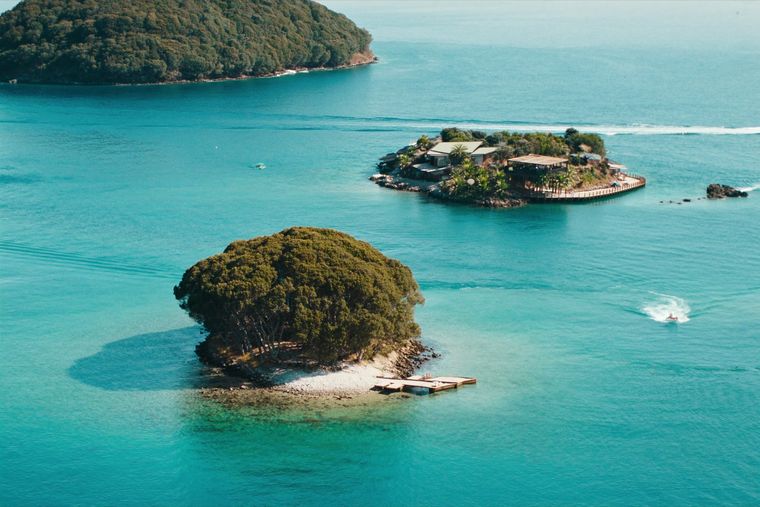
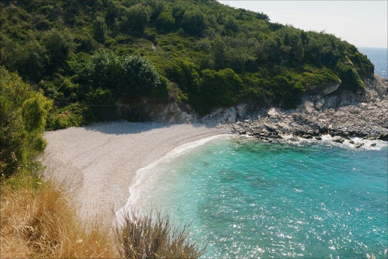
City · Vlorë
Sarandë
The Ionian resort town facing Corfu, and the arrival point for most visitors to southern Albania.
Every county, coast and century
Guided view
New to Albania? Every page opens with a plain-language explanation you could read to a ten-year-old, before the detail begins.
Expert view
You already know the basics. Straight to the substance, with the simple explanations hidden. This is the default.
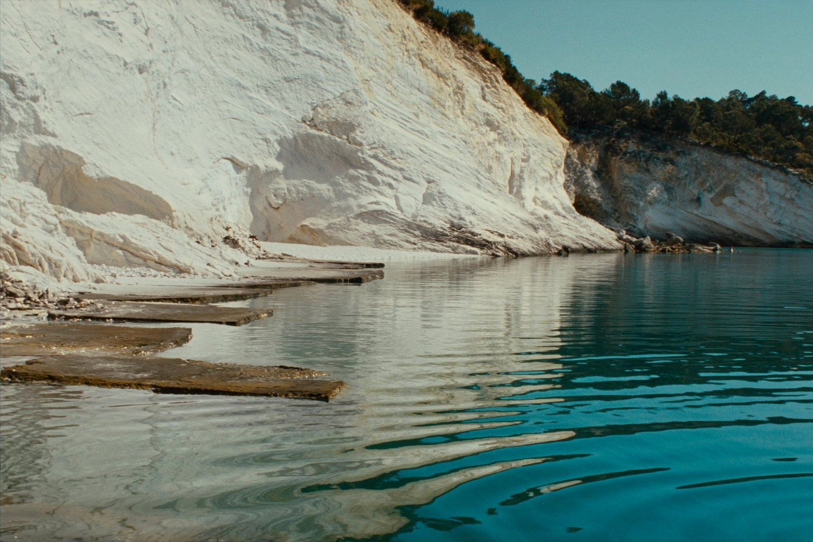
Beach · Vlorë County
Rock shelves and a small pebble strip where the water is unusually still.
Save
Mirror Beach is a small rocky beach between Sarandë and Ksamil. The water is often very calm, which is how it got its name.
Mirror Beach is a small rocky beach between Sarandë and Ksamil. The water is often very calm, which is how it got its name.
Mirror Beach, known in Albanian as Pasqyrat, is located in the Sarandë area on the Albanian Ionian Sea Coast in southwestern Albania. The broader area sits on an arch-shaped bay between the Gormarti and Berdeneshi Hills, facing the open Ionian Sea within the Mediterranean. The city of Sarandë, the nearest urban centre, is situated within Sarandë Municipality, which forms part of Vlorë County and the Southern Region of Albania.
The coastline here belongs to the Albanian Riviera. The municipality has a total area of 58.96 km², encompassing the administrative units of Ksamil and Sarandë. The Ionian waters in this part of Albania are characteristically described as deep blue Mediterranean waters.
The Sarandë area, including the coast where Mirror Beach is found, has a hot-summer Mediterranean climate, classified as Csa under the Köppen climate classification system. The region records more than 300 sunny days per year, a figure that defines the seasonal character of beach use in the area.
This climate has been central to the development of tourism along the Albanian Riviera since the fall of communism in Albania after 1991, with Sarandë becoming the principal coastal resort city of southern Albania.
Sarandë is regarded as the unofficial capital of the Albanian Riviera and serves as the main base for visitors exploring the surrounding coastline and beaches, including those in the Ksamil administrative unit, which is specifically noted for its beaches and islets.
A 2026 report by the travel publication Travel Off Path ranked Sarandë as Europe's most affordable beach destination for the summer season, placing it ahead of comparable coastal locations in terms of value across accommodation, dining, and cultural attractions. The report noted that visitor numbers were approaching levels seen in established Mediterranean destinations in Italy and Croatia, while pricing remained relatively low by comparison.
As of 2026, recorded average costs in the area include budget guesthouses and hotels at approximately $20 per night, upscale beachfront properties at approximately $120 per night, mid-range three-course meals for two at $40–$55, casual dining at around $5 per meal, and daily beach set rental — one umbrella and two sun loungers — at Ksamil averaging around $10.
The area around Mirror Beach and Sarandë contains several significant sites. The ancient city of Butrint, a UNESCO World Heritage Site, lies near Sarandë and features an ancient Greco-Roman amphitheatre among its remains. Entry to the Butrint archaeological complex was approximately $11 as of 2026. Sarandë functions as the primary access point for Butrint National Park.
The Blue Eye Spring is another notable natural attraction in the region. Ksamil, south of Sarandë, is separately distinguished for its beaches and offshore islets.
The coast around Sarandë has been settled since antiquity. Bronze Age tools typical of Mycenaean Greece, dated to approximately 1400–1100 BC, have been found at Sarandë. In ancient times the site was a port-town called Onchesmos or Onchesmus, serving the Chaonian capital Phoenice (modern Finiq) and used as a departure point for voyages from Epirus to Italy.
During the 20th century, Italian forces occupied the town and its port between 1916 and 1920, and again from 1939. Between 1926 and 1939, Italy financed extensive improvements to the harbour at Sarandë. During the Italian occupation in World War II, Benito Mussolini renamed the city Porto Edda in honour of his eldest daughter. Since 2012, the Port of Saranda has been undergoing expansion to accommodate cruise ships.
During the communist period (People's Republic of Albania, 1945–1991), the city saw significant demographic change through state-directed resettlement policies, and the church of Saint Spyridon in the harbour was demolished as part of the state's atheistic campaign. After the restoration of democracy in 1991, a small shrine was erected on the site of the demolished church.
The United States Department of State classifies Albania as a Level 2 destination, a classification it places alongside Western European countries such as France and Italy. Albania holds a score of 83 out of 100 on the global Traveler Safety Index, as recorded in international travel indices cited in relation to the Sarandë area.
The unemployment rate in Sarandë, according to the population census of 2008, was 8.32%. Family tourism and seasonal summer employment are noted as factors that may affect the real unemployment rate. Uncontrolled construction growth in the town has been identified as a potential risk to future tourism capacity.
The warmest month is August (mean daily high 31°C), the coldest is January (mean daily low 4°C), and the wettest is November (255 mm). Total annual rainfall averages 1,497 mm. Sea temperature peaks in August at about 26°C.
| Month | High | Low | Rain | Wet days | Sun/day | Sea |
|---|---|---|---|---|---|---|
| January | 12°C | 4°C | 185 mm | 13 | 7.1 h | 16°C |
| February | 13°C | 5°C | 158 mm | 11 | 7.9 h | 15°C |
| March | 15°C | 6°C | 142 mm | 12 | 9.5 h | 16°C |
| April | 18°C | 10°C | 99 mm | 12 | 10.9 h | 16°C |
| May | 23°C | 14°C | 66 mm | 9 | 12.1 h | 19°C |
| June | 28°C | 18°C | 35 mm | 5 | 13.7 h | 24°C |
| July | 31°C | 21°C | 15 mm | 3 | 13.8 h | 26°C |
| August | 31°C | 22°C | 23 mm | 4 | 12.9 h | 26°C |
| September | 26°C | 18°C | 118 mm | 9 | 10.6 h | 26°C |
| October | 22°C | 14°C | 167 mm | 10 | 9.1 h | 25°C |
| November | 17°C | 10°C | 255 mm | 14 | 7.1 h | 21°C |
| December | 13°C | 6°C | 233 mm | 14 | 6.5 h | 18°C |
Source: ERA5 reanalysis via Open-Meteo, 1994–2023 · “High” and “Low” are mean daily maximum and minimum air temperature. “Wet days” counts days with at least 1 mm of precipitation.
City · Vlorë
The Ionian resort town facing Corfu, and the arrival point for most visitors to southern Albania.
Something wrong on this page? Corrections are welcome and are checked against the source record. Tell us what is wrong and, if you can, where the right figure comes from.